Historic El Niño nears its peak, months of impacts yet to come

Water temperatures in the eastern Pacific Ocean are running a fever, and we’ll continue to feel El Niño’s effects into this winter
The historic El Niño raging in the eastern Pacific Ocean may be close to its peak intensity, forecasters announced on Thursday.
This exceptional pattern of warmer-than-normal water temperatures has already influenced weather patterns around the world.
North America will experience further impacts from this high-end event in the weeks and months ahead.
DON’T MISS: The polar vortex just made a historic reversal. What now, Canada?
Historically warm waters in the Pacific
A very strong El Niño continued into November, with record-high sea surface temperature anomalies throughout the eastern equatorial Pacific Ocean.
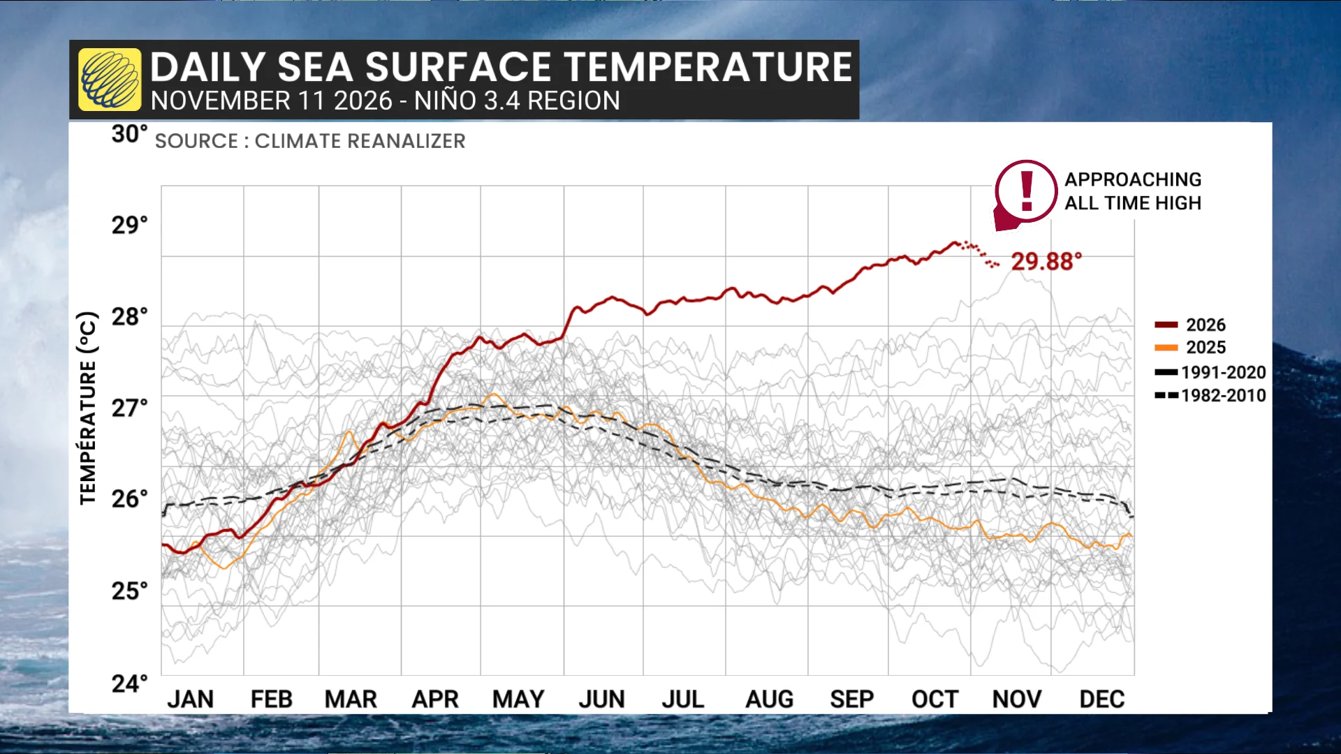
Experts monitor a swath of the Pacific known as the Niño 3.4 region to officially rank the intensity of an El Niño. Average three-month temperatures here are running warmer than 2.0°C, solidly ranking this event as a strong (or “super”) El Niño.
The latest forecast from NOAA still calls for a 60 per cent chance that El Niño's intensity peaks at an all-time high over the next few weeks.
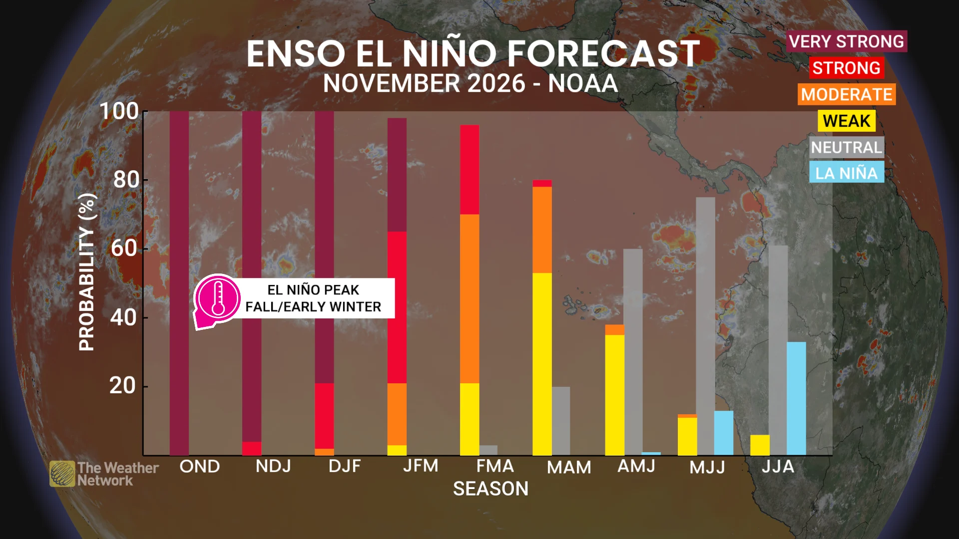
Why the uncertainty? Even though water temperatures are running historically warm, the greatest anomalies are just missing that Niño 3.4 region to the east, so they're not showing up in the official metric.
Some additional strengthening, or a steady plateau, is possible before the event gradually weakens heading into the opening months of next year. Neutral conditions are favoured by the spring.
Significant impacts expected through winter
The impacts of this high-end El Niño are baked in for the winter months. El Niño will play a major role in Canada’s winter forecast, which comes out on Wed., Nov. 25.
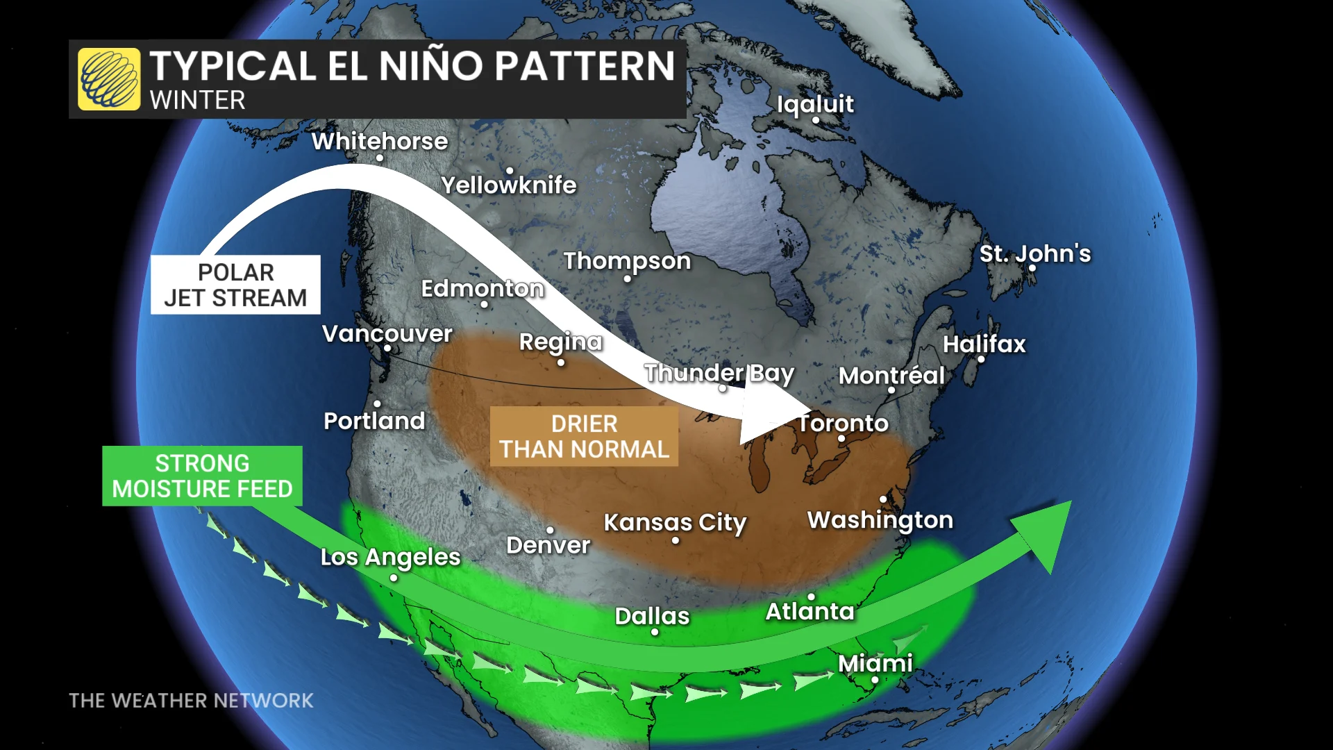
These warmer-than-normal waters significantly alter upper-level winds as they blow across North America. Jet streams are strongest during the cooler months; as a result, we feel El Niño’s strongest influence on temperatures and precipitation in the winter.
RELATED: How will a strong El Niño impact lake-effect snow season?
Previous winters featuring strong El Niño conditions saw generally above-seasonal temperatures across much of Canada.
An active storm track over the southern U.S. could bring repeated rounds of foul weather to snowbirds, as well as opportunities for unsettled weather on the East Coast.
But don’t count the winter out just yet. As we saw with the recent reversal in the polar vortex, El Niño isn’t the only player on the field, and winter always has a few tricks up its sleeve for Canada.