Warmest El Niño on record confirmed—and it's still intensifying

El Niño has officially reached its warmest point this year, tying the previous record set in 2015. This significant weather system is expected to persist and continue influencing global and regional weather patterns in the months ahead
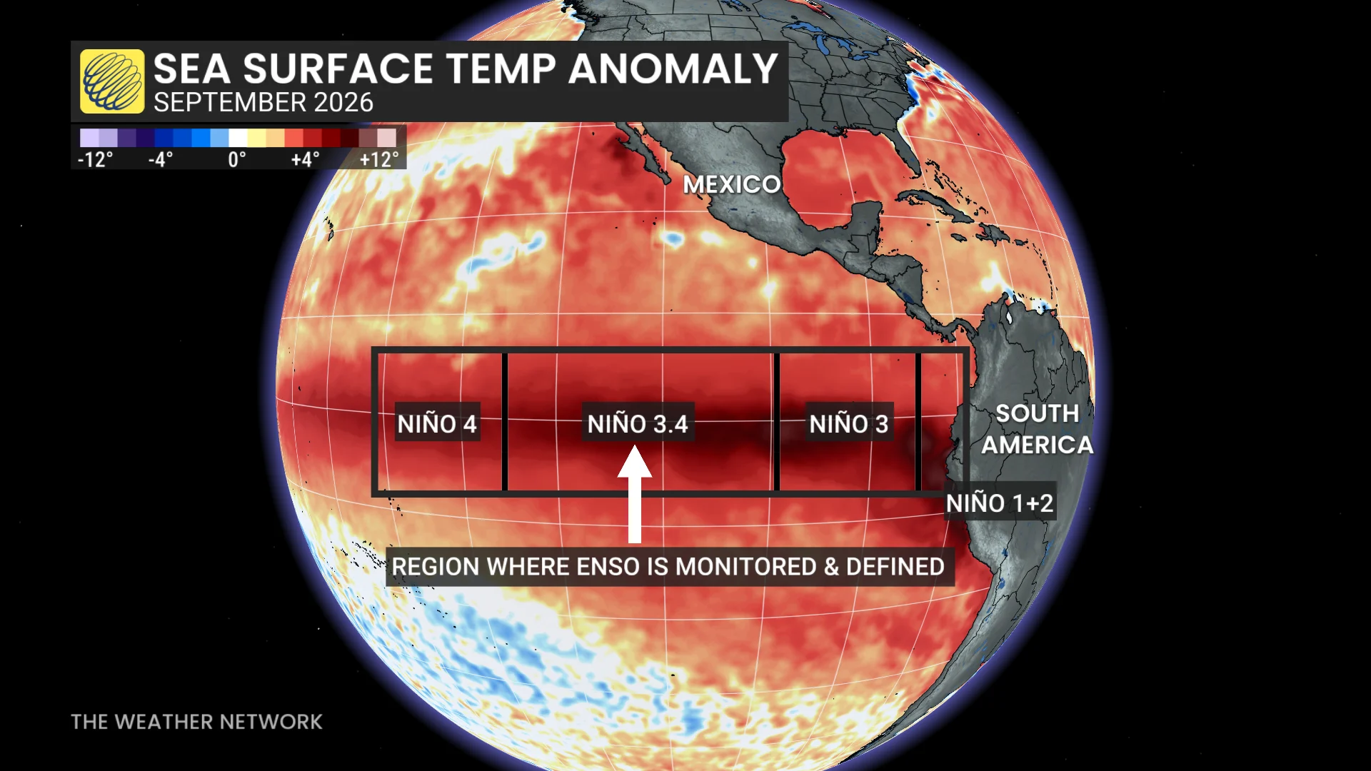
The current El Niño has now been confirmed as the strongest ever observed, with sea surface temperatures in the critical Niño 3.4 region of the equatorial Pacific surpassing all previous records.
This area, where NOAA officially monitors ENSO patterns, registered a record-breaking temperature of +29.822°C on September 25, edging out the previous high of +29.82°C set on November 17, 2015.
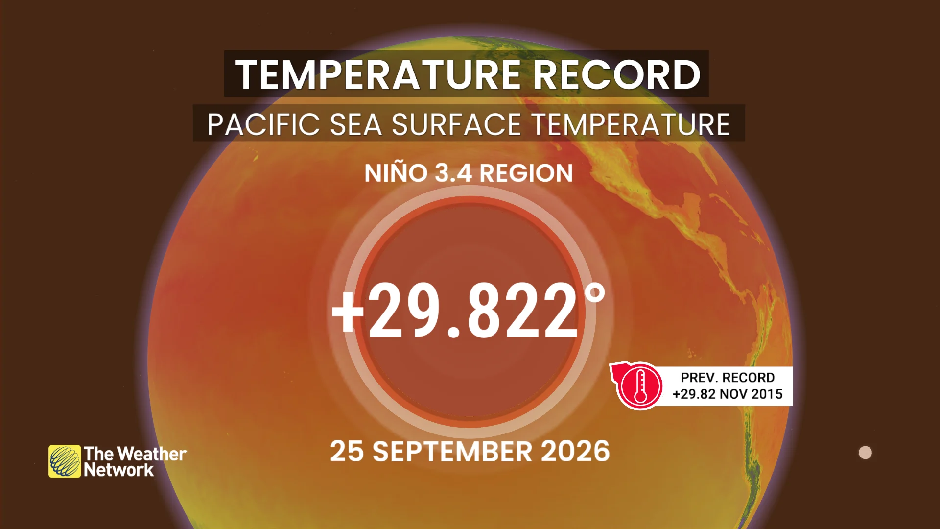
Remarkably, this milestone has been reached nearly two months ahead of the typical peak of El Niño events — a phenomenon that is continuing to intensify.
DON'T MISS: Latest forecast calls for a historic El Niño to peak this winter
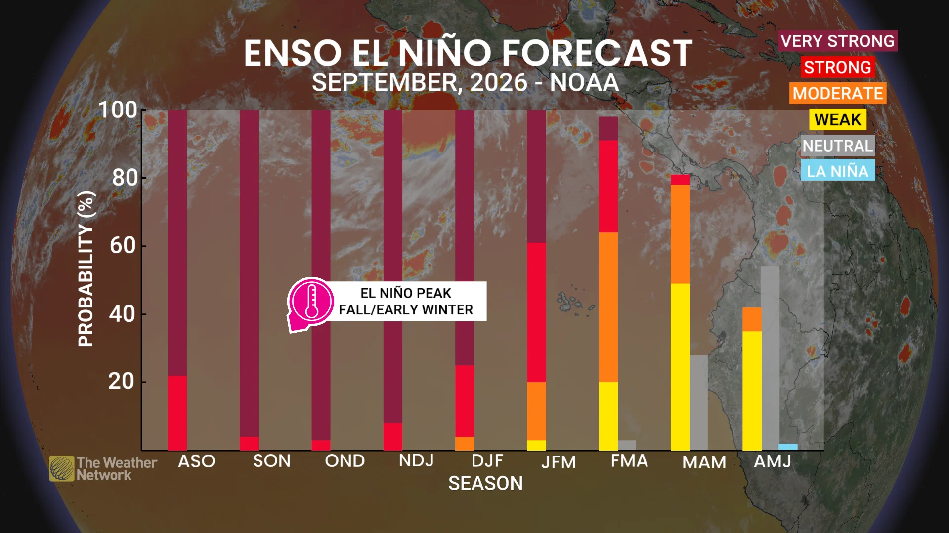
Current forecasts suggest this El Niño will reach its peak between late fall and early winter, potentially adding further strength to its already significant impacts.
Why does this matter? The unprecedented marine heatwave created by this event is expected to fuel Pacific hurricanes and could contribute to heat, flooding, and drought patterns worldwide.
El Niño’s widespread influence underscores the importance of closely monitoring its progression.
WATCH: A strengthening El Nino impacts fall & winter across Canada
With files from MétéoMédia