Polar vortex is on the brink of a historic reversal. What now, Canada?

A complete reversal of the polar vortex winds has occurred, a historical first for November. Learn about the unprecedented polar vortex event that just made history
Over the past several weeks, we’ve identified our winter wild card, tracked a remarkable, early-season weakening, and explained the battle between the Pacific jet stream and the polar vortex.
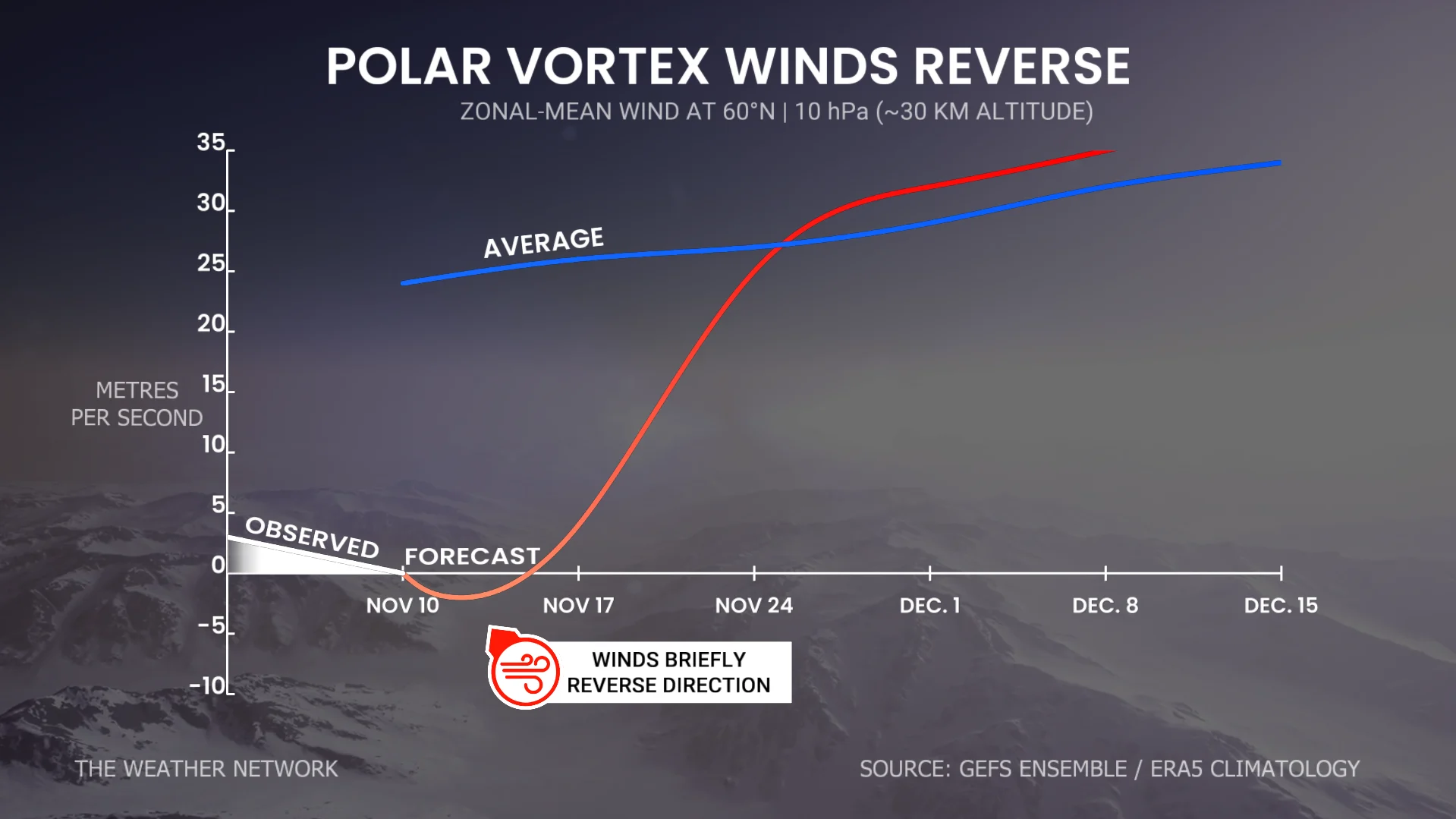
This week, the polar vortex is entering the history books with an unprecedented, early-November wind reversal, at a time when it should be strengthening!
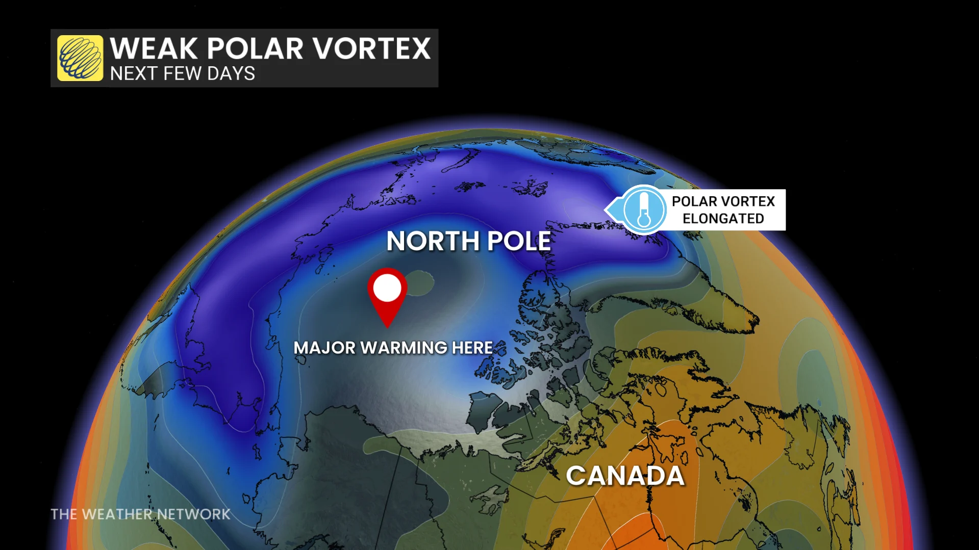
It’s a reversal almost nobody saw coming. The atmosphere is doing something pretty ridiculous, roughly 30 km above the Arctic for this time of year.
What makes this breakdown so unprecedented is that powerful El Niño events typically bolster the polar vortex, making this sudden reversal the exact opposite of what history would suggest.
The current metrics are staggering. The polar vortex has ground to a halt and has actually reversed direction as of Nov. 10.
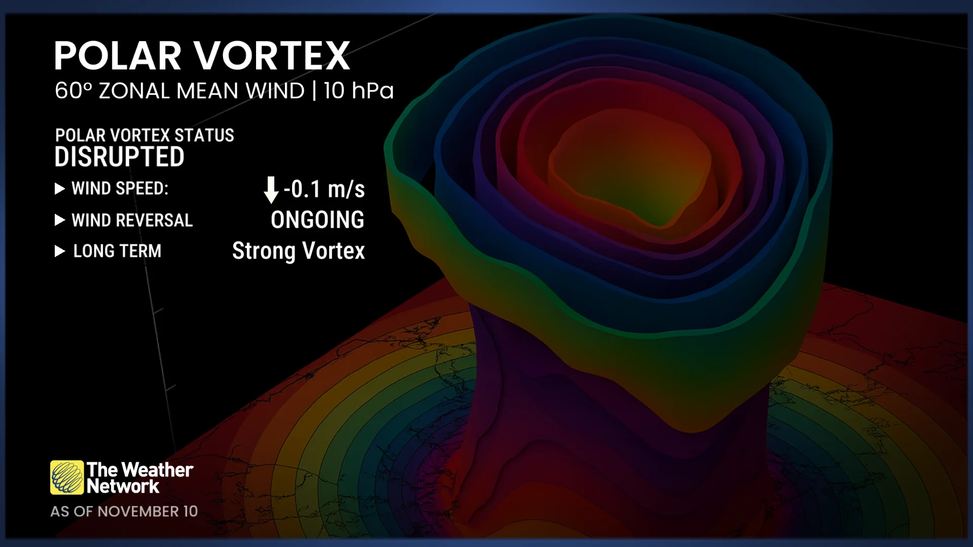
Current polar vortex wind speed: -0.1 m/s (walking speed)
Four per cent of normal values
Typical speed: 25 m/s (highway speed)
When such a major disruption occurs, its influence can work downward through the layers of the atmosphere, shifting the jet stream, enhancing blocking patterns, and allowing Arctic air to surge farther south.
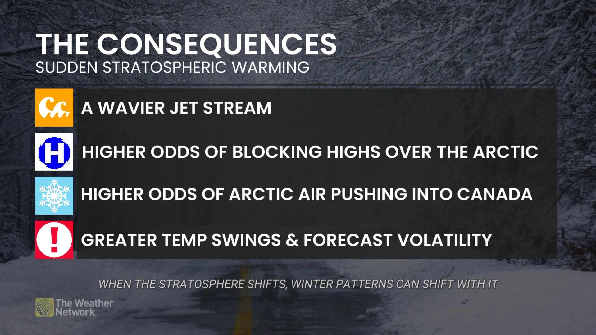
For those fans of winter weather, this process can be painstakingly slow to materialize at the surface.
And if you’re curious about what triggers these disruptions, take a look at this article for a more in-depth analysis.
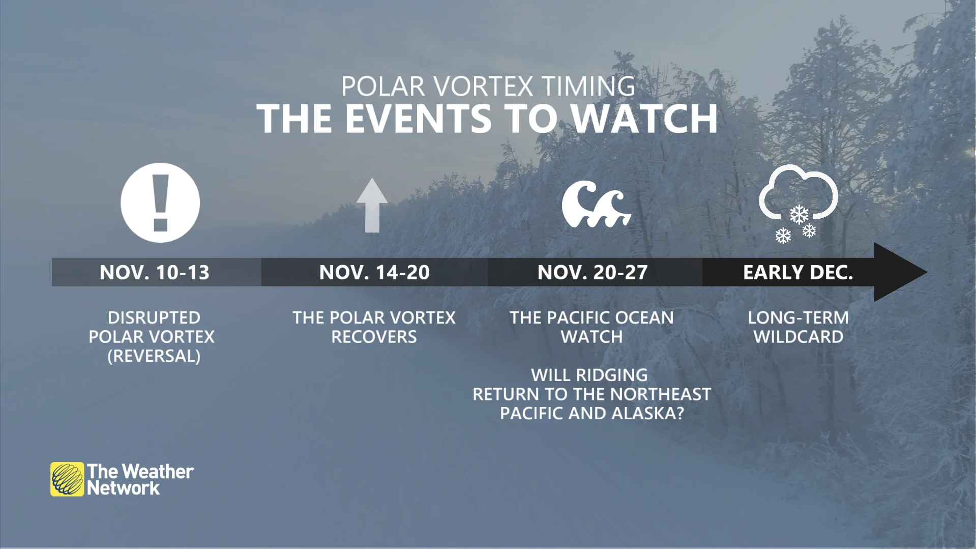
Polar vortex timeline
Nov. 10-13: Historic disruption (reversal)
Nov. 14-20: Vortex recovery
Nov. 20-27: Pacific Ocean watch: Will ridging return to the northeast Pacific and Alaska?
Early December: The longer-term wild card, blocking pattern continues?
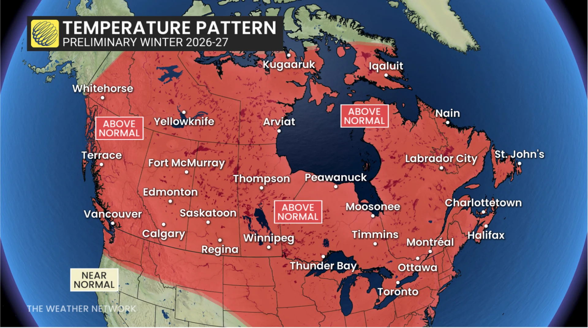
And while this polar vortex faces an unprecedented disruption high above the Arctic, our record-breaking El Niño and energized Pacific jet stream are delivering widespread, above-seasonal temperatures across the heart of Canada.
It’s a true juxtaposition and fascinating, atmospheric contradiction that highlights the consequences may still be several weeks away.
The next test: Late-November into December
A couple of signals in the atmosphere suggest that North America’s current weather pattern could begin changing during the final 10 days of November.
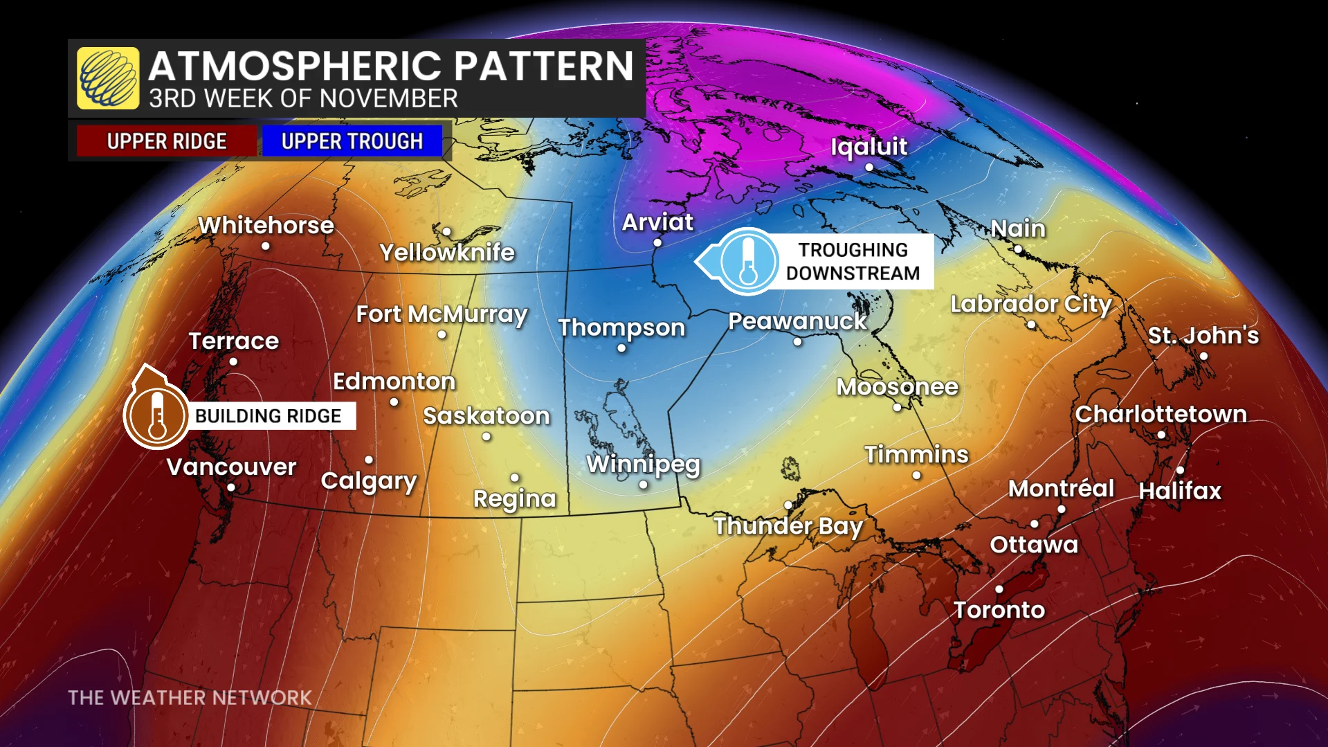
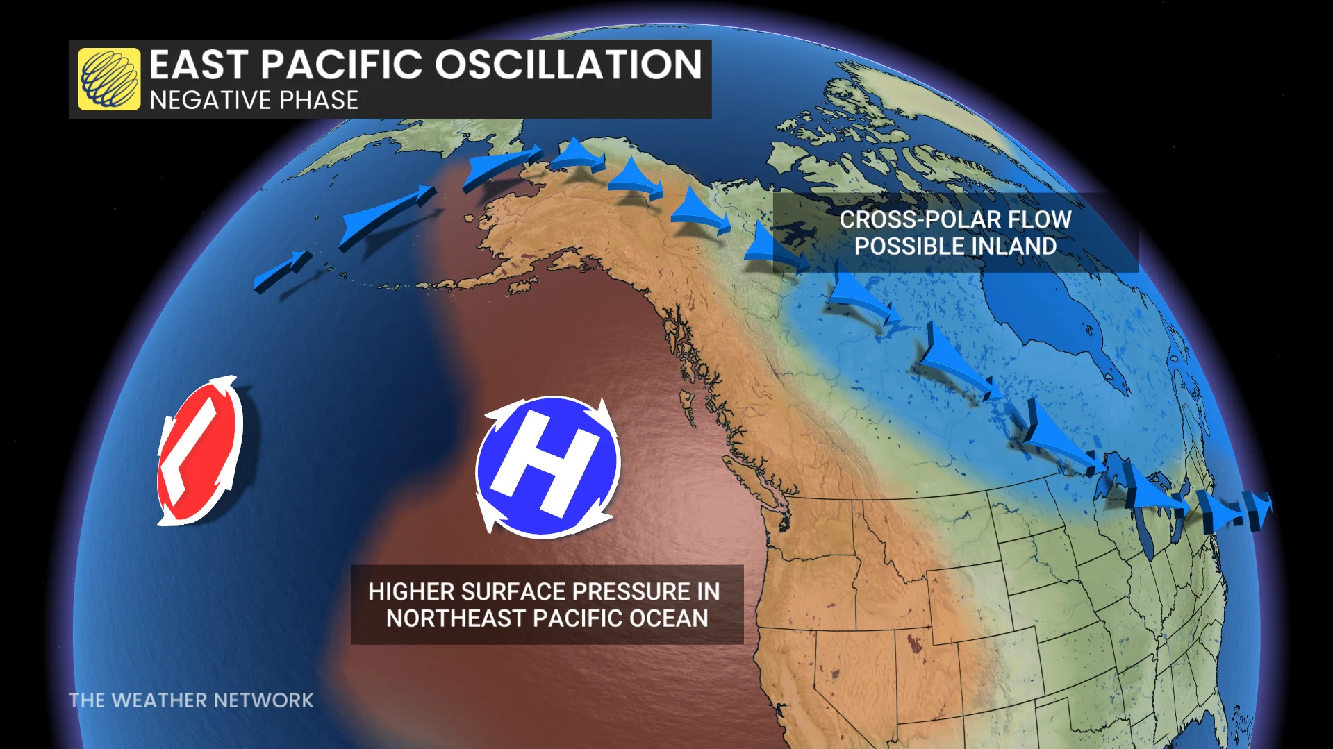
European ensemble guidance highlights a potential transition of the eastern Pacific oscillation (EPO) into negative territory, meaning a sizable shift in atmospheric circulation across the northeast Pacific Ocean.
Could ridging return to Alaska and the northeastern Pacific?
This favours ridging towards Alaska, and often allows a downstream trough to develop, helping Arctic air slide farther south across portions of North America.
It would also help pump the brakes on the storm parade and reshape the storm track that has been ravaging the coast of British Columbia.
Another problem: Canada’s Arctic is unusually toasty
So, let’s say the jet stream creates the most favourable path across Canada to deliver cold air south in a few weeks.
What happens if there’s no frigid air on this side of the pole?
The current pattern highlights the blowtorch pattern across Northern Canada, with exceptionally mild temperatures extending deep into the Arctic.
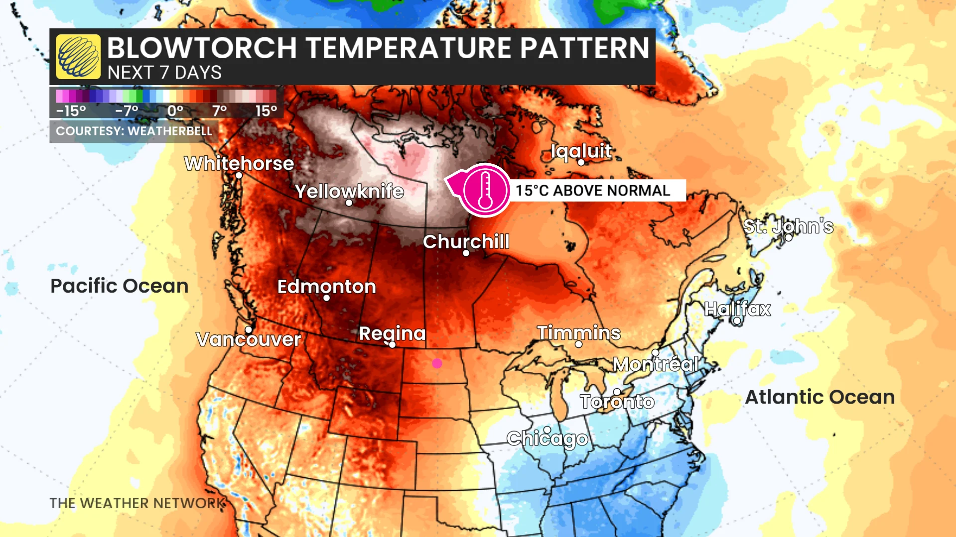
Since there’s no deep reservoir of Arctic air, it creates another forecasting wrinkle if the upper-level pattern becomes more favourable.
The coldest air is residing on the other side of the pole in Siberia, so it would take a little longer to make the journey to North America.
A quick polar vortex bounceback
Although we’re witnessing polar vortex history this week, the reversal itself will be short-lived.
Forecast models show the stratospheric winds rapidly increasing back to normal by the third week of November, eventually reaching over 25 m/s.
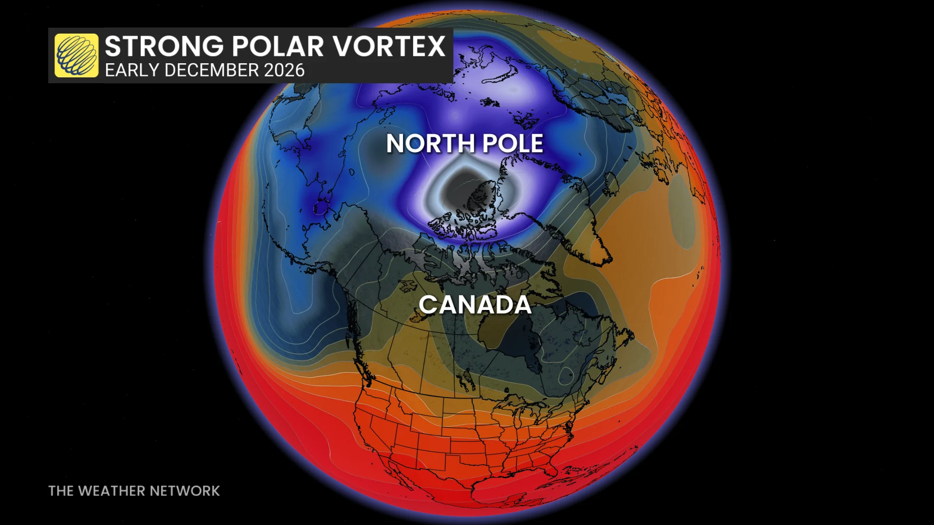
But this doesn’t mean the disruption around the globe is over – far from it, actually.
The changes to the polar vortex will likely create a ripple effect around the Northern Hemisphere, unfolding for weeks after a major warming, even as the polar vortex bounces back.
This is precisely why the final days of November and December will be fascinating to watch.
Signs continue to point towards the changing pattern, but it remains unclear whether this will be a sustained major pattern change, or just a blip to the overall dominant mild pattern.
As you’re reading this, El Niño and the Pacific jet stream have the upper hand, but the polar vortex has made the forecast much less straightforward than it was just a few weeks ago.
Come back on Nov. 25 for the Winter Forecast release.
Q-and-A
Q: Can a polar vortex that reverses for only a few days still have consequences lasting weeks?
A: Yes. The duration alone doesn’t determine possible surface impacts. The development of blocking patterns and regional weather conditions all matter, as well.
Q: Do we have to rewrite our winter forecast?
A: Not fundamentally. A powerful El Niño is still the dominant driver of the forecast and an important influence, and it remains a compelling reason to forecast above-normal temperatures. But, seasonal forecasts describe the broad pattern, not every cold snap or winter storm. The polar vortex disruption just added another layer of complexity to the forecast.
Q: Could Canada still experience an Arctic outbreak this December?
A: Absolutely. A disrupted polar vortex can increase opportunities for Arctic air sliding south, especially if a blocking pattern develops. But there’s little certainty on where the Arctic air will go, and the current El Niño regime favours a mild, overall pattern.
Q: Why did the polar vortex weaken so early this year?
A: Powerful, atmospheric waves travelling upward from the lower atmosphere disrupted the polar vortex, weakening its dominant, westerly winds, and triggering rapid warming in the stratosphere. The record-breaking El Niño may have contributed by increasing wave activity reaching the stratosphere, although its role in this event remains highly uncertain.
Q: Could the polar vortex weaken again this winter?
A: Yes, and historically, mid-to-late winter is a more common time for a polar vortex to weaken.