Cold snap looms for the holiday season
Meteorologist
Tuesday, December 16, 2014, 2:10 PM - The holiday season is in full swing (you may have noticed that Christmas Day is already in our 14-day trend).
It’s one of the busiest times of year for travel and weather always plays a major role in our holiday plans. Many Canadians in Eastern Canada think back to last Christmas and remember the terrible ice storm that had families without power right through the holidays. So what do we have to prepare for this year? We aren’t expecting an ice storm repeat by any means, but there are some storm systems on the horizon that could have an impact on our travel and plans next week.
Long range weather models are showing a change in the weather pattern across Canada to occur at a point during the holidays. Essentially, it looks as though Canada will be moving from this above seasonal pattern we’ve been in into a below seasonal temperature pattern and remaining below seasonal through the New Year. For the first half of December, all major Canadian cities were at or above normal for temperatures. This has led to lower snowfall totals but greater rainfall totals for many Canadians.
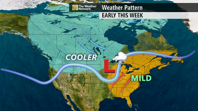
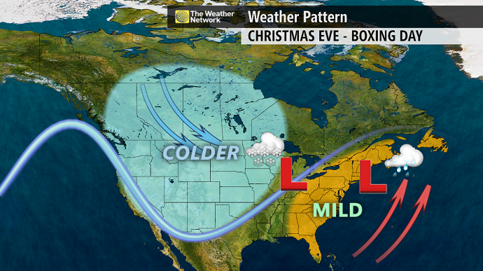
There is still quite a bit of uncertainty with how the holiday period from Christmas Eve through to Boxing Day will pan out weather-wise but the majority of long range weather models are showing main weather impacts to be from Ontario through to Atlantic Canada. Models are indicating a large trough in the Jetstream will swing into the area forming surface low pressure systems that will be our main weather-makers. A clipper-type system will emerge from the Prairie provinces into Ontario and Quebec.
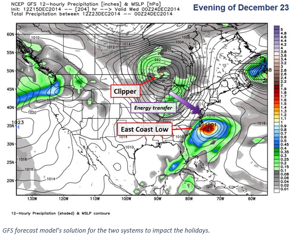
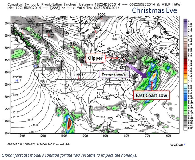
Once that system slides in, energy transfer and the trough pushing east will trigger the development of a low pressure system along the east coast of the United States that could impact Atlantic Canada. When that energy transfer occurs and how quickly will be the key to determining how impacted Christmas travel will be, who will be impacted the most and who will see a white Christmas. As we can see from the two images above, there are timing and placement difference between the weather models which is fairly typical when looking at forecasts more than a week out.
![]() RELATED: What's a weather clipper: Winter weather terms explained
RELATED: What's a weather clipper: Winter weather terms explained
At the moment, models are not indicating much in the way of high impact weather for western Canada from Christmas Eve through to Boxing Day. The majority of the active weather will be focused on eastern Canada.
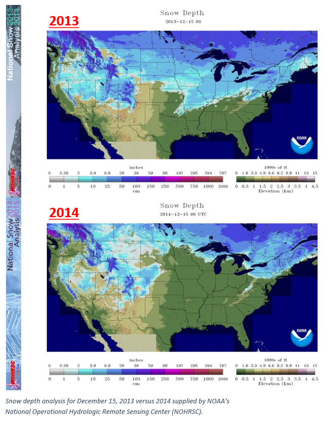
Throughout the remainder of the week, we will also be monitoring who across Canada has the best chance at seeing a white Christmas and whose forecast could bring them a white or green Christmas. Keep checking back as we follow the storm systems that could impact our white Christmas forecast. Below images show the comparison of our snow depth across Canada and the United States on December 15, 2013 versus this year, 2014. We can see we are dealing with quite a bit less snow right now for many of the major population centres across Canada this year as we were at this time last year.