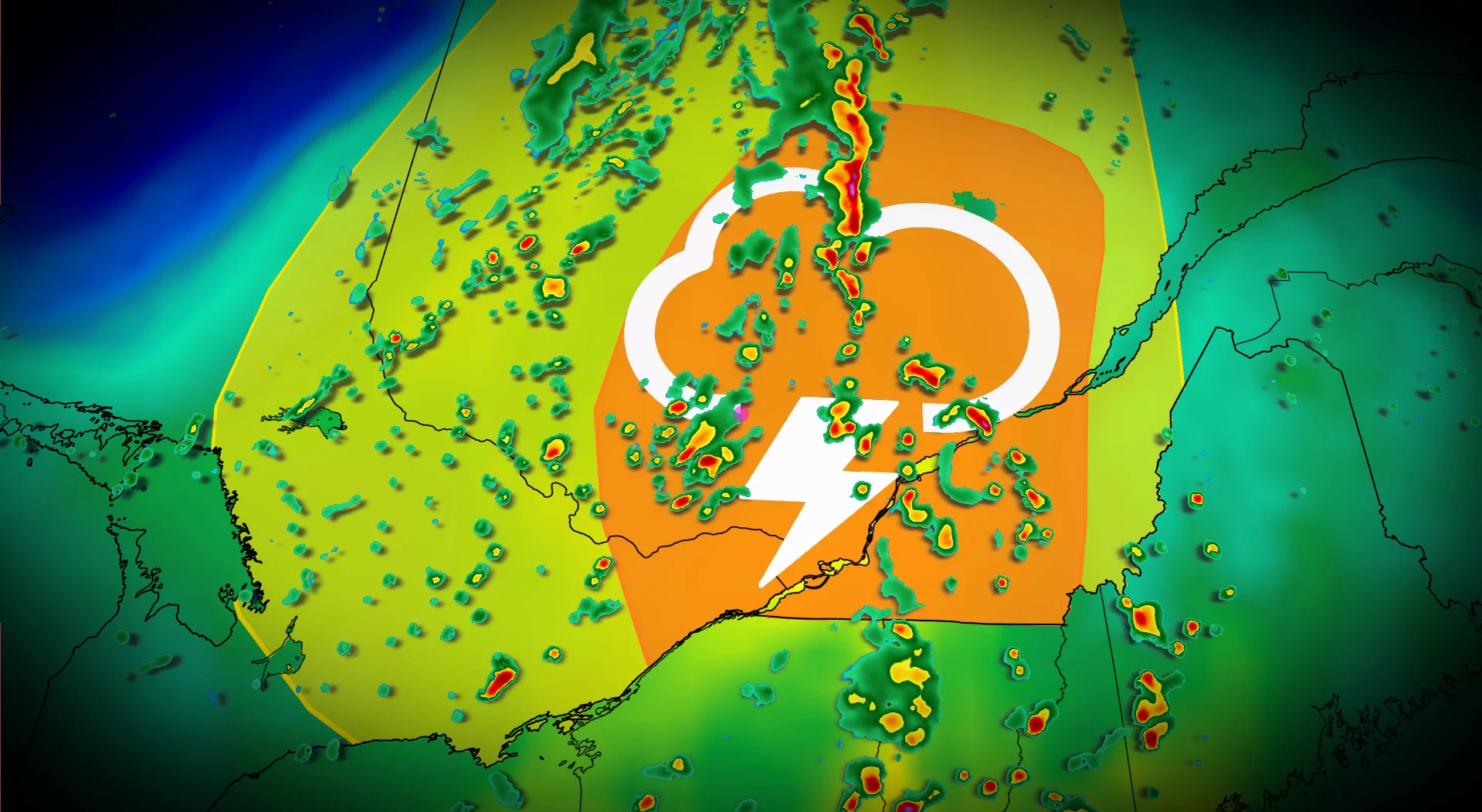
Severe storm risk for parts of Ontario, Quebec Thursday, tornadoes possible

Severe thunderstorms expected Thursday in Ontario and Quebec, with heavy rain, strong winds, hail, and a tornado risk
A cold front is set to move across Ontario and Quebec on Thursday, bringing the potential for severe thunderstorms.
Ample moisture from a lifting warm front in the morning will combine with a cold front by early afternoon to trigger storm development.
SEE ALSO: This week's Full Moon will produce a 'nearly-total' lunar eclipse in the sky
Keep an eye out for weather alerts or warnings throughout the day, as the severe weather environment will build with daytime heating.
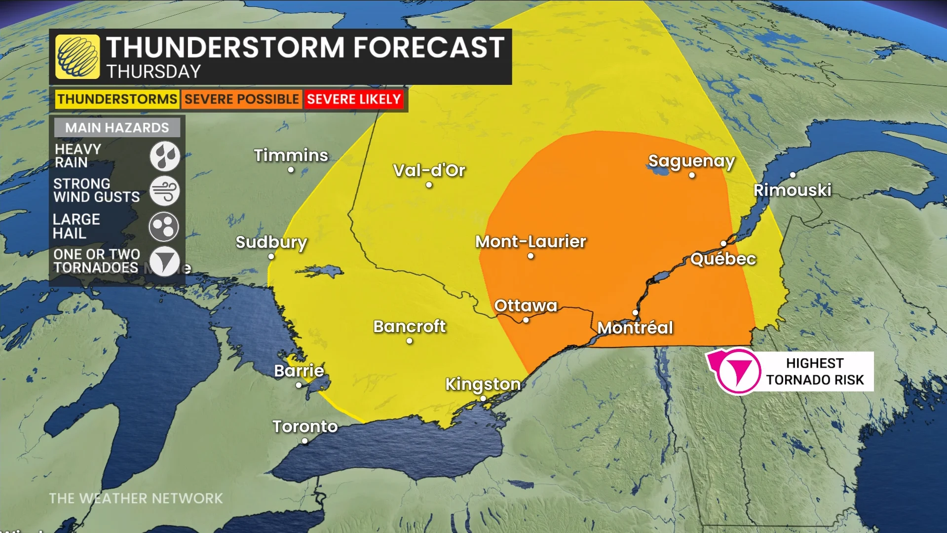
Severe thunderstorm threat builds through Thursday
The most significant activity is expected to occur east of the St. Lawrence River, particularly in the Eastern Townships. Conditions with high instability and wind shear could produce hazards such as strong winds and hail, potentially up to the size of quarters.
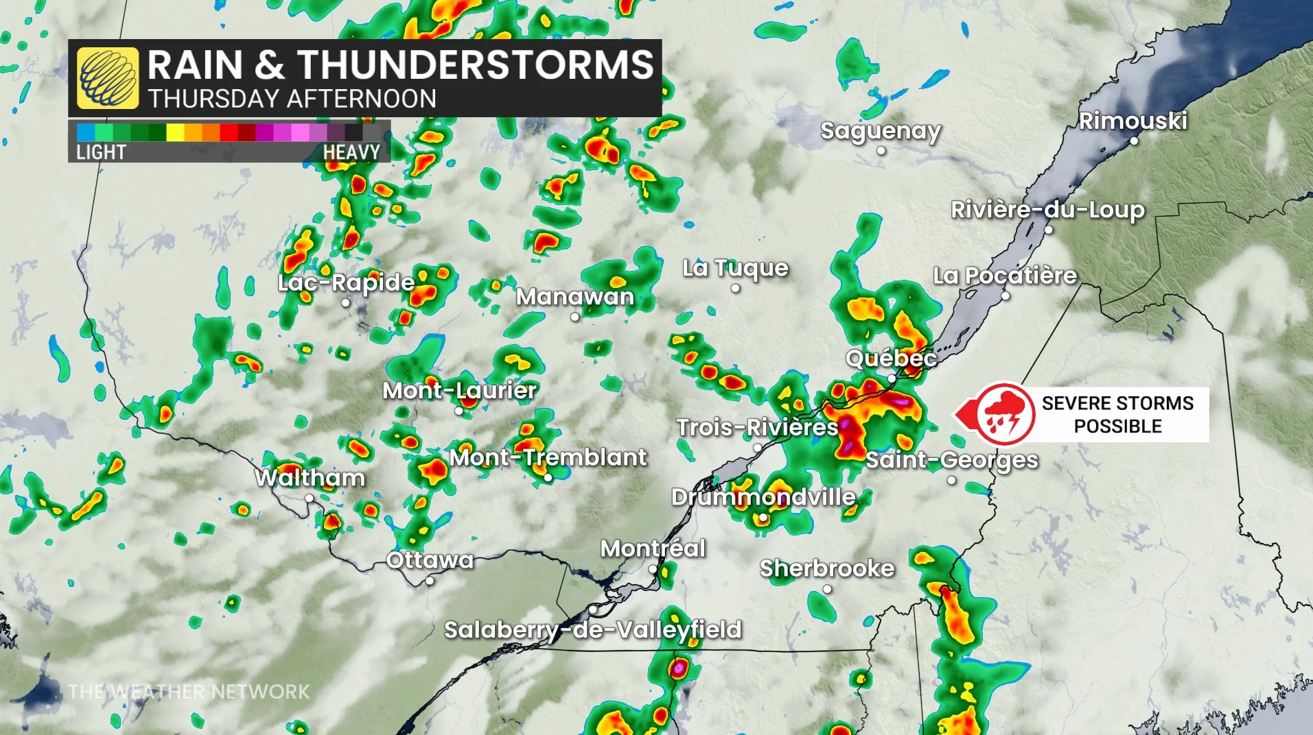
There is also a risk of rotating storms, especially near the international border and stretching toward Quebec City, where shear and instability remain elevated.
Key threats include heavy rainfall, large hail, and strong wind gusts. The risk of one or two tornadoes cannot be ruled out, particularly in the areas near the border and the Eastern Townships.
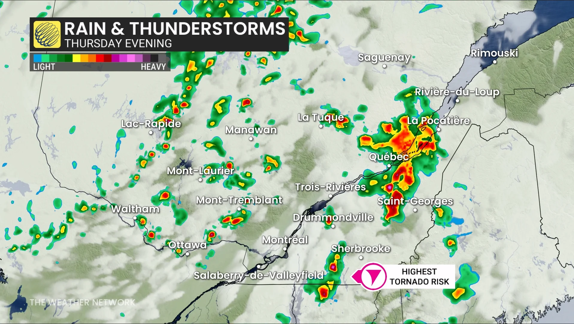
Residents in these areas should stay alert for weather warnings or updates throughout the day. Keep an eye on rapidly changing skies.
Warm and humid weather ahead for southern Ontario this weekend
Southern Ontario will see warmer weather this weekend, offering a notable shift from last weekend's wet and stormy conditions.
Saturday will feature partly sunny skies with daytime highs in the low to mid 20s, climbing to the upper 20s near Windsor and Sarnia. By Sunday, temperatures will rise into the mid to upper 20s, with parts of the region such as Windsor and Sarnia likely exceeding 30°C. Humidity will also increase throughout the day, adding to the summer-like feel.
Late Sunday into Sunday night, showers and thunderstorms are expected to move through, some of which may be strong. Localized heavy rainfall is possible with these storms.
DON'T MISS: Mississauga’s Culham Trail secures $5.2M for flood-resilient upgrades
Looking into next week, southern Ontario will remain warm and very humid, with humidex values potentially reaching or exceeding 40 in parts of the southwest. Multiple rounds of rain and thunderstorms are likely, with significant rainfall possible in some areas. This weather pattern is linked to hot and humid air dominating the U.S. Midwest.
Forecast models are monitoring the approach of a potential cold front around the Labour Day weekend, which could bring cooler conditions. However, warmer weather may return during the back-to-school week.
Stay with The Weather Network for the latest updates and information on your forecast in Ontario and Quebec.