
Overland flood warning issued for southern Manitoba
An overland flood warning has been issued for a vast swath of southern Manitoba as the province braces for another storm, which is expected to bring strong winds, heavy snow and rain from Friday through to Monday.
The areas under the warning could receive anywhere from 30-60 millimetres of precipitation — with some small areas possibly seeing up to 80 mm — by midday Monday.
SEE ALSO: Eastern Prairies braces for mighty storm with heavy snow, flood risk
Some ditches and waterways are still ice-covered or contain snow, which could cause the water to back up as high amounts of rainfall will occur in a short period of time, the province said in a news release.
"The frozen ground has a reduced ability to absorb this rainfall," Environment Canada said in its weather alert.
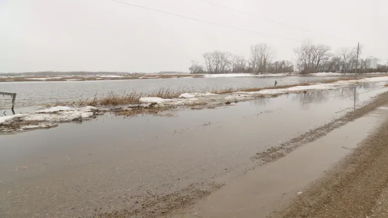
Overland flooding is likely in southern Manitoba as heavy rain and snow are on the way, with some ditches and waterways still frozen. (Riley Laychuk/CBC)
The heaviest rain will fall on Saturday, with embedded thunderstorms possible.
There's potential for a sudden rise in water levels in an area stretching from the Saskatchewan border east to Highway 12 and from the United States border north to the Trans-Canada Highway.
The warning could extend north of the Trans-Canada between highways 5 and 16, and between Portage la Prairie and Winnipeg, but that has not yet occurred, the province said.
"Weather models do not fully agree on the exact location, amount and timing of the precipitation system. However, confidence is high that most central and southern Manitoba basins, including the United States' portions of the Red, Souris, Pembina and Roseau river basins, could receive 40-50 mm of precipitation, with localized areas receiving up to 80 mm," the release says.
The system, a Colorado low, is expected to be accompanied by strong winds gusting up to 90 kilometres per hour at times.
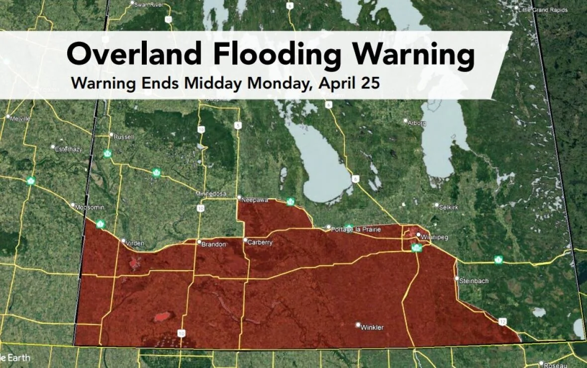
A map shows the vast swath under an overland flooding warning from the province. (Government of Manitoba)
Several weather alerts are in place across the south, with rainfall warnings, freezing rain warnings and winter storm watches.
Areas under the winter storm watch — which covers a band from Virden through Brandon and northeast through the Interlake and into Berens River and Little Grand Rapids — will likely face light snow in Friday that transitions to rain.
The rain will persist until Saturday afternoon before shifting back to heavy wet snow Saturday afternoon and evening. Accumulations of 20-50 cm are expected by Monday afternoon.
The rainfall warning pretty much covers the rest of the south, including Winnipeg. Early snow should quickly change to rain that lingers through Sunday.
HOW ICE JAMS CAUSE SEVERE FLOODING: SCIENCE BEHIND THE WEATHER:
There will be 30-60 mm of rain before it turns to snow on Saturday evening, the rainfall warning says. Reduced visibility in blowing snow is expected on Sunday as wind gusts hit 60-90 km/h.
The freezing rain warnings cover a small area around the Turtle Mountain region, including Killarney and Boissevain.
Daily average temperatures are expected to remain above zero until early next week for most parts of southern and central Manitoba, before dipping down for a day or two then rebounding again, far below the normal high of 13 C for this time of year.
Runoff from snowmelt in areas that see flurries will lead to peak flows on the Red and Assiniboine rivers and their tributaries sometime in late April or early May, the province says.
The story was originally published by CBC News on April 22, 2022.


