High-impact weekend storm to bring disruptions to eastern Prairies

A far-reaching storm will bring heavy snow, blizzard conditions, and flooding rains to the eastern Prairies over the next few days.
Folks on the eastern Prairies are on the cusp of a rough weekend as a high-impact storm approaches the region. The Colorado low will feature a spread of conditions, including heavy rain and thunderstorms to the east and heavy snow and gusty winds to the west. Communities that see rain and storms could deal with flooding, while those that see heavy snow could contend with blizzard conditions. More on the timing and impacts of the impending storm, below.
PREPARE NOW: Everyone needs a home emergency kit. Here's what to stock yours with
THIS WEEKEND: STORM ARRIVES WITH HEAVY SNOW TO THE WEST, HEAVY RAIN TO THE EAST
This weekend’s Colorado low is getting its act together stateside. The system’s effects will begin to push across the border late Friday into early Saturday.
Heavy precipitation and high winds will spread over Saskatchewan, Manitoba, and northwestern Ontario through the day on Saturday and lingering into Sunday. Conditions won’t improve over parts of northwestern Ontario until Monday.

Colorado lows are notoriously difficult to predict, so the details of the weather forecast and potential impacts will change over time, Environment and Climate Change Canada (ECCC) says. The dynamics involved with this system are impressive. A few hundred kilometres will separate 30°C temperatures and 30+ cm of snowfall.
SNOWFALL
We’ll see a wide spread in conditions across the storm as a result of the vibrant temperature gradient between the system’s western and eastern edges. Cold air will keep precipitation mostly snow to the storm’s north and west, while warmer air wrapping in to the east will make this a heavy rain and thunderstorm threat to the east of the storm’s track.
A mix of rain and snow overnight Friday will change over to heavy snow by Saturday morning. There is also a likelihood of freezing rain in parts of southeastern Saskatchewan and southern Manitoba early Saturday morning.

The low-pressure system looks to track a little farther west than last week’s blizzard, meaning most of the snow will avoid Winnipeg.
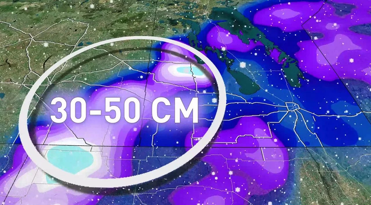
A hefty swath of 30-50 cm of snow could fall locally, with some isolated areas forecast to see near 70 cm. The swath of snow will be much narrower than we saw with last week’s storm, with the greatest impacts confined to southeastern Saskatchewan, southwestern Manitoba, south of Dauphin, and portions of the Manitoba Lakes. A swath of 15-20 cm is also anticipated for parts of northwestern Ontario.
WINDS
Also similar to the mid-April storm, blustery winds will be an issue. The threat for low visibility from blowing snow will make travelling quite treacherous in some areas.

Dangerous travel is likely, especially in areas that receive the brunt of the snow. Low to zero visibility will result from wind gusts reaching 70-90 km/h at times.
Intense winds along the Saskatchewan and Manitoba border will create blizzard-like conditions at times on Saturday and Sunday, and travel along the Trans-Canada Highway between Brandon and Regina will not be recommended. Winds won't begin to subside until Sunday evening.
FLOODING RAINS
Milder air on the eastern side of the system will bring a period of heavy, drenching rain to portions of southeastern Manitoba and northwestern Ontario, including Winnipeg and Thunder Bay.
Snow will quickly change over to rain Friday morning. This rainfall will persist through Saturday with some areas receiving more rain Saturday overnight and Sunday. The heaviest rain will fall on Saturday with embedded thunderstorms possible. The frozen ground has a reduced ability to absorb this rainfall.

Forecasters are watching the potential for flooding in some areas. With 30-60 mm of rain and thunderstorms forecast to target the Red River Basin, and precipitation in the region 150-200 percent of normal over the last 30 days, concerns are rising for areas along the Red River to experience minor to moderate flooding from the U.S. into southern Manitoba.
Rain will change over to snow beginning on Saturday evening through Sunday morning, from west to east, in behind the storm. Snowfall warnings may follow, including for Winnipeg, ECCC warns.
Temperatures following the system are also forecast to be above the freezing mark for the majority of next week.
MUST SEE: Impending storm could create moderate to major flooding in Red River Valley
Looking ahead, calmer conditions should prevail heading into next week. Temperatures will remain significantly below seasonal next week, with the potential for a warming trend as we head toward the end of the month.
However, while conditions will improve next week, the flooding threat will still remain as the Red River is forecast to crest towards the end of April through North Dakota and into southern Manitoba.
Check back frequently for the latest details on this major storm headed for the eastern Prairies.


