Impending Manitoba snowstorm could raise Red River flood threat

A potent snowstorm that is expected to track through southern Manitoba this week could elevate the risk of flooding along the Red River.
A significant and possibly disruptive spring snowstorm is expected to deliver heavy snow to southern Manitoba later this week, so the potential of Red River flooding could exponentially rise.
SEE ALSO: Red River crest expected in Manitoba between April 8 and 15
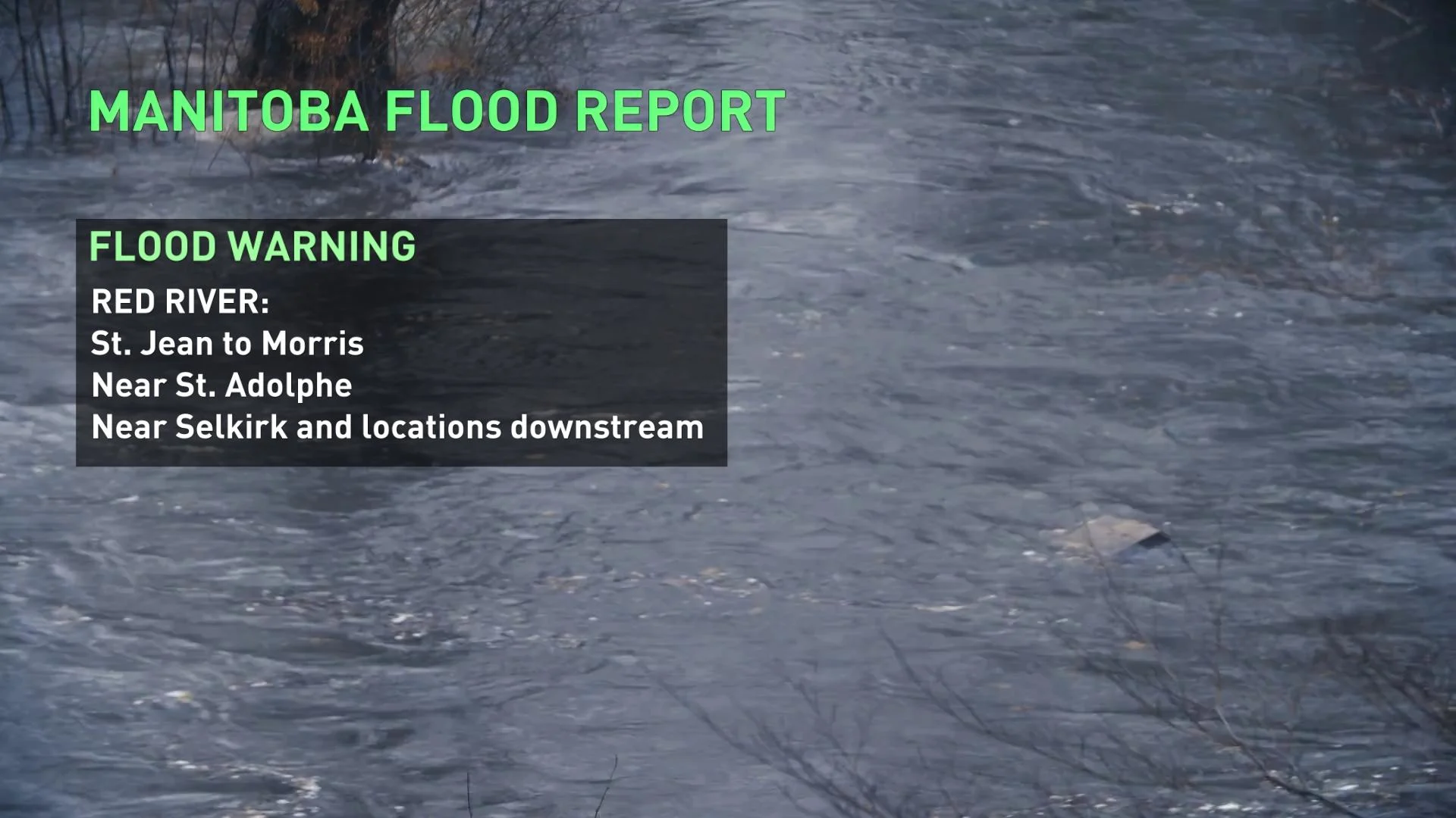
At the moment, a flood warning is in place for a few locales along the Red River: Donwstream of PR204 at Selkirk due to ice jamming, St. Jean to Morris and near St. Adolphe. A flood watch has been downgraded to a high water advisory for the Red River from Emerson to the Floodway Inlet, except areas under a warning, according to Manitoba's hydrologic forecast centre.
Runoff from the forecasted precipitation is not expected to start before Wednesday, April 20.
"Flood forecasters will continue to monitor the system, and its impact on flows and river levels as the system develops and progresses throughout the week," the centre said in the April 9 report, noting that localized flooding is occurring in some areas, often due to ice jams on streams and blockages in drains.
PEAKS HAPPENING NOW
According to the hydrologic forecast centre, the peak on the Red River has passed St Agathe and is approaching the Floodway Inlet. The river levels are above-channel capacities in several locales: From St. Jean to Morris, near St. Adolphe and downstream of PR204 at Selkirk due to ice jamming. Pumping operations are ongoing at Emerson, St. Jean, Morris, St. Adolphe, Rosenort, Brunkild and Dominion City.
The Red River Floodway continues to operate under rule 1 to lower water levels in Winnipeg while keeping measures at or slightly below natural upstream of the inlet control structure.
"The water level in Winnipeg is declining due to operation of the Red River Floodway and the movement of ice through the city. Floodway operations are expected to maintain a stable water level within the City of Winnipeg, even as the crest arrives on the Red River," the centre said.
SNOWSTORM TO MOVE IN THIS WEEK, COULD FLOOD THREAT BE RAISED?
A Colorado low will rapidly intensify this week as it tracks to Minnesota and then into Manitoba and northwestern Ontario, also clipping southeastern Saskatchewan.

Snow will be expected from southern Manitoba to North Dakota Wednesday through Thursday. Widespread totals of 20-40 cm are anticipated, locally up to 60 cm is possible. Snowfall will occur over a prolonged period of time -- up to 48 hours for some areas.
The exact track still remains uncertain but the models are agreeing on mainly rain over Thunder Bay, Ont., though with a possible rain-snow mix.
If the snowfall does pan out, the precipitation could have negative implications for the Red River flooding potential.
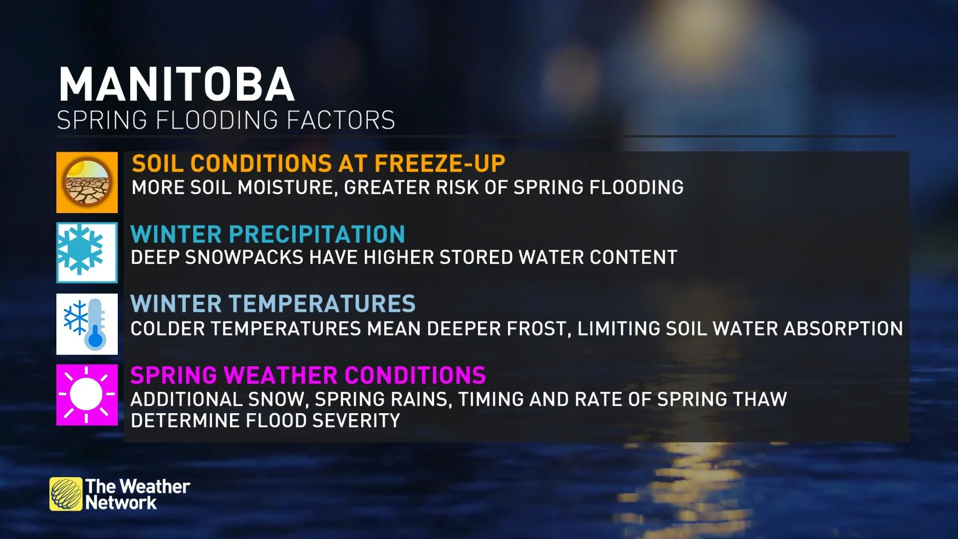
WATCH: TOP FACTORS FOR SPRING FLOOD POTENTIAL IN THE RED RIVER BASIN
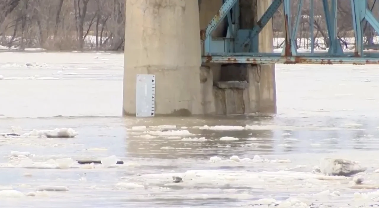
Thumbnail courtesy of Chris D., showing the Selkirk bridge on the Red River in Manitoba.


