Canada's December has been warm, but will winter eventually show up?
Is winter ever going to arrive? That's the burning question on many Canadians' minds as the usual cold and snow seem to be absent this year.
Welcome to winter! Thursday marks the official start to the frosty season, though signs of any real wintry weather have certainly been hard to come by so far.
December was forecast to be warm, and mild it was, indeed! There's really been no consistently cold weather anywhere in these last few weeks leading up to the holidays.
Millions of Canadians have been feeling the warmth, with some locales in the country even hitting record-breaking territory –– more than 20°C above normal. A green-brown Christmas is expected for a lot of Canada's population, as well, much more than what is normally seen.

Visit our Complete Guide to Winter for an in-depth look at the Winter Forecast, tips to plan for it and much more!
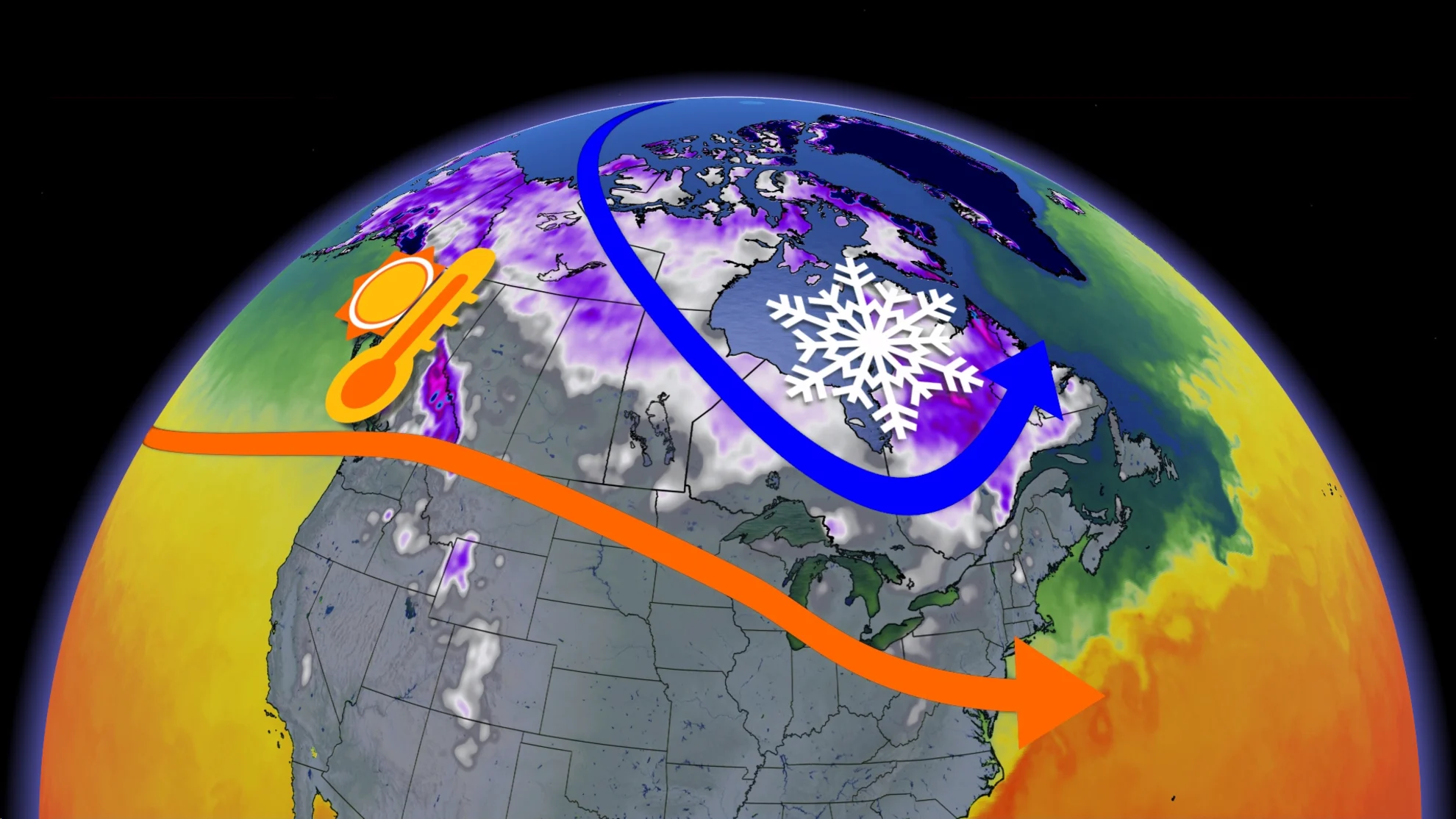
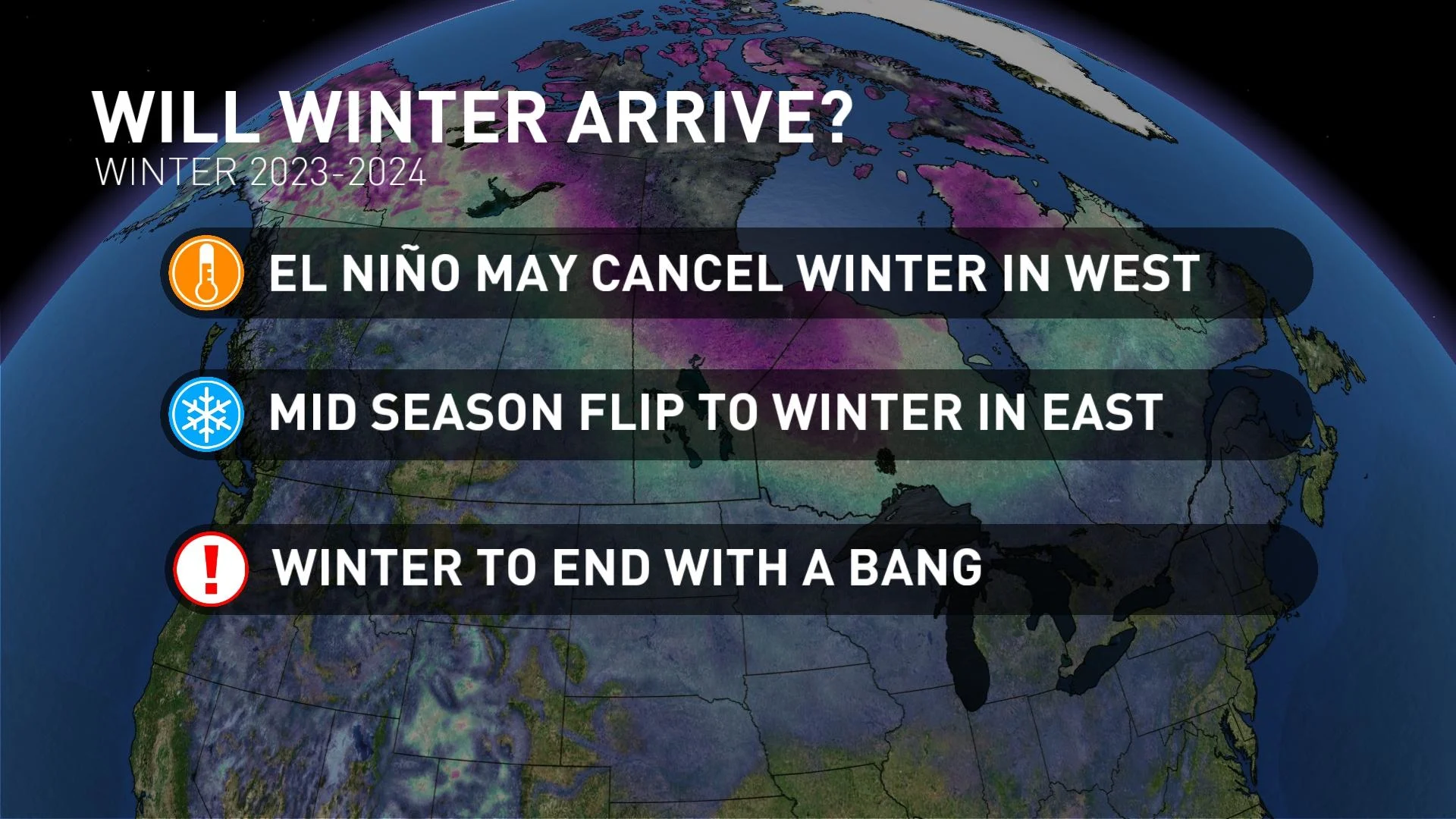
El Niño has a reputation for bringing mild winters to much of Canada, and it appears that this season will feature one of the strongest events on record.
So, can we expect a mild winter across the country this year? Or will some traditional winter weather finally show up? The answer is not so simple.

Western Canada
In the West, the chances for a "true" Canadian winter are low, and we expect El Niño to pretty much cancel the winter season as we know it.
Some colder air is possible for the region at times, but will be lacking any sort of consistency, as mild Pacific air will dominate the pattern.
Much of British Columbia will see below-normal precipitation, below-normal snowfall, and more sunshine than we typically see during the winter. Ski slopes will likely continue to struggle with alpine rain events, as well.
MUST SEE: Is Vancouver International Airport destined for a snowless winter?

It'll be a similar story across the Prairies as mild, Pacific air is expected to be more prevalent than Arctic air. While there will still be periods of high-impact winter weather, above-normal temperatures and below-normal snow totals look to round out the season as a whole.

RELATED: Hopes for Edmonton's ski season are going downhill with no snow or cold
Eastern Canada
In the East, where there has already been signs of early winter weather, there may be a return in store, but we will have to be patient.
The fading of a typical El Niño winter is still in the cards, with more typical wintry conditions anticipated, but later in the season now.
January appears to be colder than December, especially during the first half of the month. The potential is there to dive into winter, but it may take time and several cold fronts to unlock the Arctic air.

SEE ALSO: Winter's multi-layered precipitation threats and the forms they come in
By the middle to end of January, there is, however, a risk of a significant thaw event in parts of Ontario and Quebec (not something completely unheard of as January thaws do happen). The traditional back-and-forth between cold and warm battles may even out the month to near normal.
The end of winter still appears to finish strong in the East, with February trending towards being the coldest month of the season. The cold weather that winter is known for will likely come during this month, and stay consistent.
Be sure to check back on Jan. 3 for a look at what the first month of the new year has in store in our official January Outlook!