Approaching clipper may end Ontario snow-drought
Meteorologist, PhD
Saturday, January 24, 2015, 1:11 PM - Coffee shop conversations across southern Ontario continue to revolve around the current ‘snow-drought’ and asking when it will end.
While there is a lot of cold weather in the long range forecast, we do not have any major storm system in the forecast for at least the next 7 days.
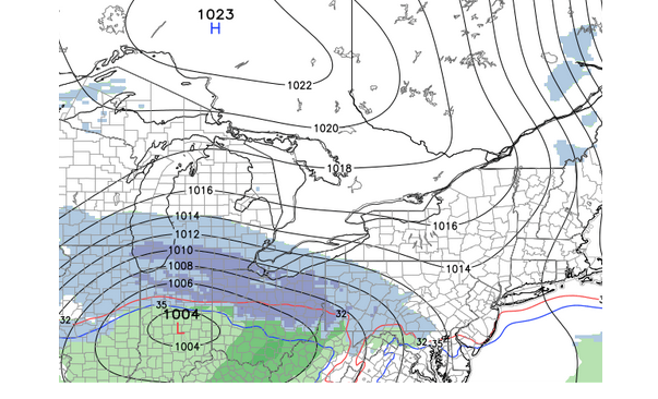
We have been tracking the potential for two Clipper systems next week, but it is looks like the first system will pass too far to our south to bring widespread snow to the Greater Toronto Area. The image below shows a model forecast for late Sunday afternoon with snow spreading into southwestern Ontario, but that area of snow will continue to track southeast and not reach the GTA.
However, during Sunday night and Monday morning, a northeast wind will produce some lake effect snow near Hamilton and in Niagara. Accumulations will not be heavy, but we do expect some impact to travel along the QEW from near Burlington to St. Catharines.
While we will not see any significant snow Monday through Wednesday, it sure will feel like winter with noticeably colder temperatures than what we have experienced during this past week.
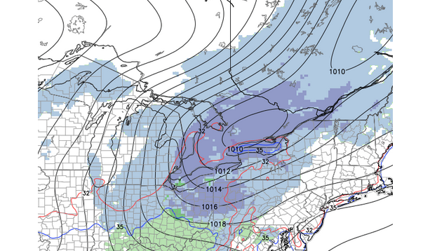
Another clipper system will track through the Great Lakes on Thursday. This will briefly bring milder temperatures for Thursday and the potential for a period of light snow. The image below is a model forecast for Thursday afternoon. While this system has the potential to give us a coating of snow, we do not expect that this will have a significant impact on our increasing snow deficit.
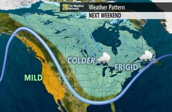
As we head into next weekend, we will be entering an extended period of well below seasonal temperatures that will continue through at least the first week of February. Siberian air will to Canada, and as a result the first several days of February have the potential to be even colder than what we saw during early January.
So getting back to the drought, will there be any snow with this pattern? January has proven that a cold pattern does not mean that we will see significant snow, and at this point are no clear signs pointing to an end to the “snow drought” outside of lake effect areas.
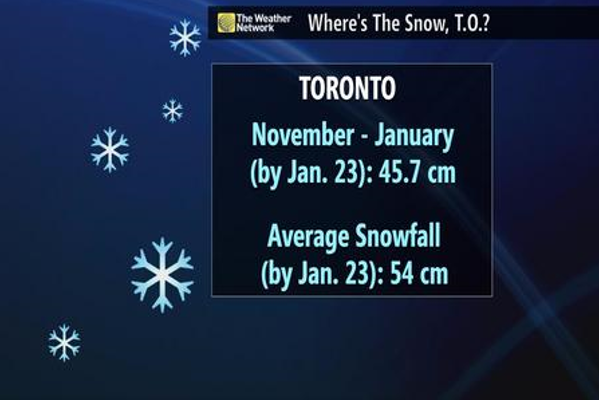
When we consider snowfall amounts at Pearson Airport since November 1st, the snowfall total of 45.7 cm is less than 10 cm below average. However, since we do not live at the airport, what has fallen in your backyard is likely very different from the official reports.
Also, most of our snow fell in November and early December. Since December 12th, only 12 cm of snow has been recorded at the airport, which is well under half of what we typically see during that time period. In addition, the bare ground through the Holidays and during parts of January has really set this winter apart from last winter.
However, as we make the transition from winter towards early spring, typically the weather pattern does become more active and storm tracks across the Southern United States start to shift north, closer to the Great Lakes. Also, the long range models are in reasonably good agreement that precipitation amounts across Southern Ontario will be close to “normal” for the month of February as a whole. Normal precipitation with below season temperatures certainly would provide the potential for a couple of significant snowfalls later in February. So, don’t put away your shovel just yet!