What is El Nino?
Meteorologist/Science Writer
Monday, September 12, 2016, 10:44 AM - El Niño - the warm phase of the El Niño Southern Oscillation (ENSO) - is a major player when it comes to the world's weather.
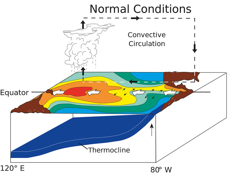
In your average year, there's a very typical pattern of pressure, wind and water temperature across the equatorial Pacific Ocean. High pressure in the east and low pressure in the west drive strong winds from South America to southeast Asia across the ocean surface, while a return flow blows in the opposite direction high above the water.
This "conveyor belt" of wind (shown as the dashed lines in the left-hand image below) pushes warm surface water towards the western end of that part of the ocean (indicated by the bold white arrows in the left image), and in response, colder water wells up from below at the eastern end.
If you looked at the entire surface layer of the equatorial Pacific Ocean all at once under these conditions, there would be a noticeable slope to it - deeper around Indonesia and northeastern Australia and shallower along the west coast of South America - which is maintained by this strong westerly push.
|
|
|
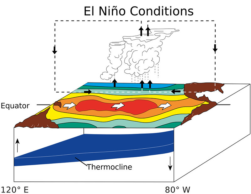
When an El Niño occurs (shown on the right, above), which we've seen most recently through 2015 and into 2016, the strong westerly conveyor belt of wind breaks up into two or more smaller circulations. This relaxes that westerly push of the surface water, and at the same time, a series of large-scale, slow-moving waves in the ocean's topmost layer of water - known as equatorial Kelvin waves - push the warm water towards the east (the bold white arrows in the right-hand image, above). This evens out the depth of the surface layer of the ocean, cutting off the cold water along the coast of South America, while at the same time, transporting a large amount of heat over a long distance. This displacement of heat disrupts normal weather patterns over various parts of the world.
In the video above, depicting the moderate 2009-2010 El Niño, these Kelvin waves can be seen moving the deeper, warmer water eastward.
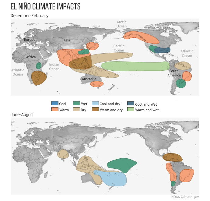
At the very least, western Canada ends up having a warmer than normal winter during these events, but the effects of an El Niño can be felt right across the country at times. For example, the ice storm that struck eastern Ontario and southern Quebec in January 1998 occurred during the peak months of the strongest El Niño on record. The pattern tends to have less of an impact on summer weather.

Typical impacts of El Niño on the world during Northern Hemisphere winter and summer. Credit: Climate.gov
Also, El Niño has an effect on wind shear across the Pacific, North America and the Atlantic, which has an impact on storms. Over the eastern Pacific, weaker wind shear allows more, and stronger tropical storms and hurricanes to form. Meanwhile, stronger wind shear over North America and the Atlantic tends to limit the number of tornadic storms on land, and reduces the number and strength of tropical storms and hurricanes over the ocean.
Next up: What is La Niña?
Sources: NOAA | Climate.gov


