Seven year-old tornado scar still visible from space
Digital Reporter
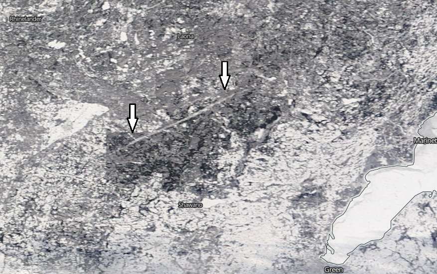
Friday, January 16, 2015, 2:54 PM - The path of an EF3 tornado that tore through a forested area in northeast Wisconsin in 2007 is still visible from space, as evidenced by a recent NASA satellite image.
The image in the video above was taken by NASA's Terra Satellite on January 10, 2015.
It features the 64-kilometre scar the twister left on the land. According to the National Weather Service, the tornado destroyed more than 5,500 hectares of land on June 7, 2007, creating a deep scar that's easily visible against a backdrop of trees.
While the snow is helping to accentuate the scar, it can be seen during the summer months as well.
Here's a NASA satellite image taken two days after the tornado hit in 2007:
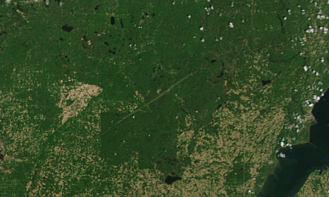
"The path torn through this densely wooded area stands out quite clearly in the satellite image, as tens of thousands of trees were leveled by the devastating funnel cloud," NASA wrote at the time.
"One of the tornadoes to strike the area was given an F-3 rating by the National Weather Service, classifying it as a “strong” tornado that causes severe damage and has wind speeds between [254 and 331 kilometres] per hour."
Below: Satellite image taken on January 10, 2015: