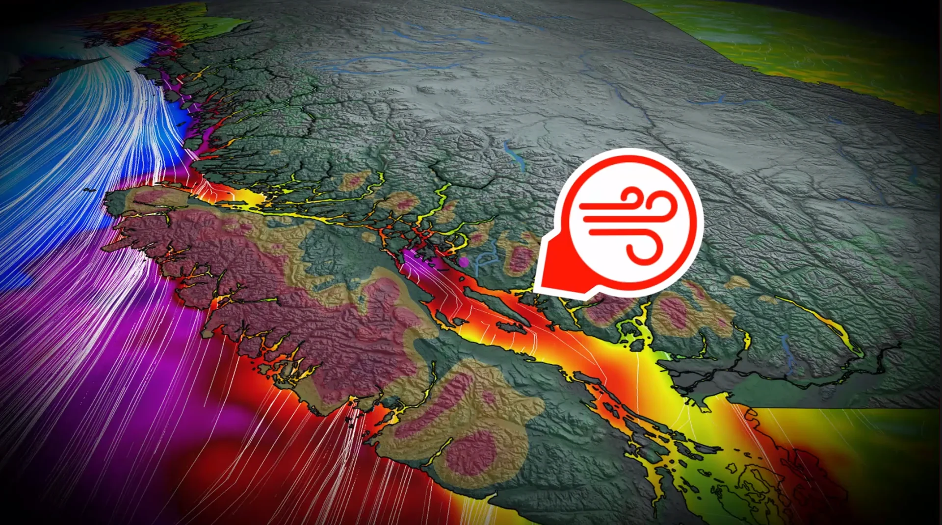
Windstorm raises overnight outage threat across coastal B.C. Saturday

Parts of the South Coast could see wing gusts up to 100 km/h and up to 200 mm rainfall through the weekend.
Another powerful low is approaching the B.C. coast Saturday, once again bringing multiple weather threats to the province by the evening hours.
Fall storms are not out of the ordinary for B.C., but this season so far has been a rough one.
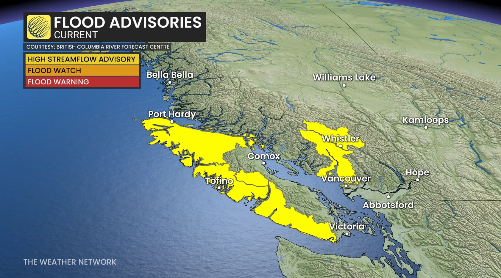
Several evacuation alerts and orders, as well as shelter-in-place advisories, were issued for communities throughout the Squamish and Pemberton areas due to the flood threat from the relentless rains earlier in the week. Many have since been lifted.
SEE ALSO: Historic El Niño nears its peak, months of impacts yet to come
Bands of heavy rainfall will only be the secondary threat with this system, however, as the strong winds are expected to be the main threat into pre-dawn Sunday.
Coastal flooding statements are in effect for parts of southern Vancouver Island and Metro Vancouver.
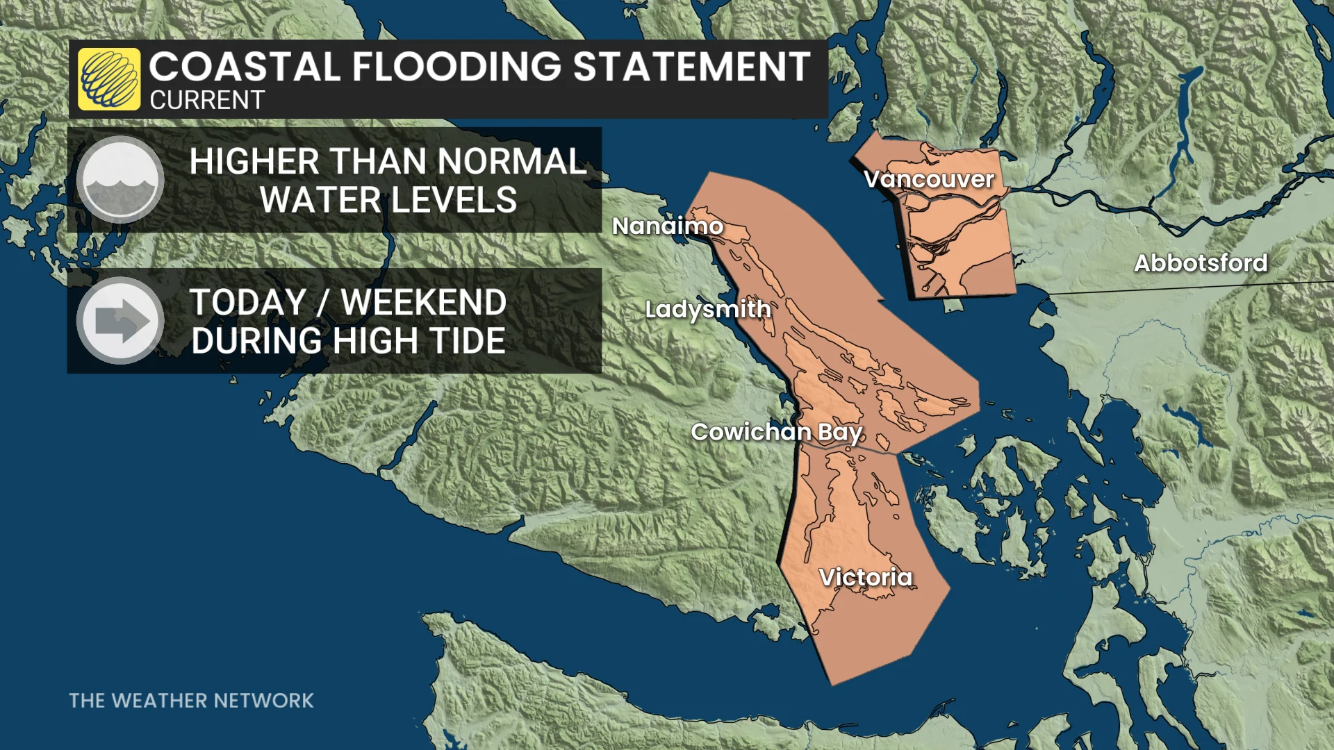
"High tides are likely to surpass predicted levels due to storm surge enhancement," Environment and Climate Change Canada (ECCC) warns in the statement.
Weekend windstorm threatens outages, tree damage
By early Saturday evening, wind gusts are forecast to pick up over the northern section of the Strait of Georgia and parts of Vancouver Island, including Greater Victoria, as well as the North and Central Coasts. Some gusts could reach up to 100 km/h.
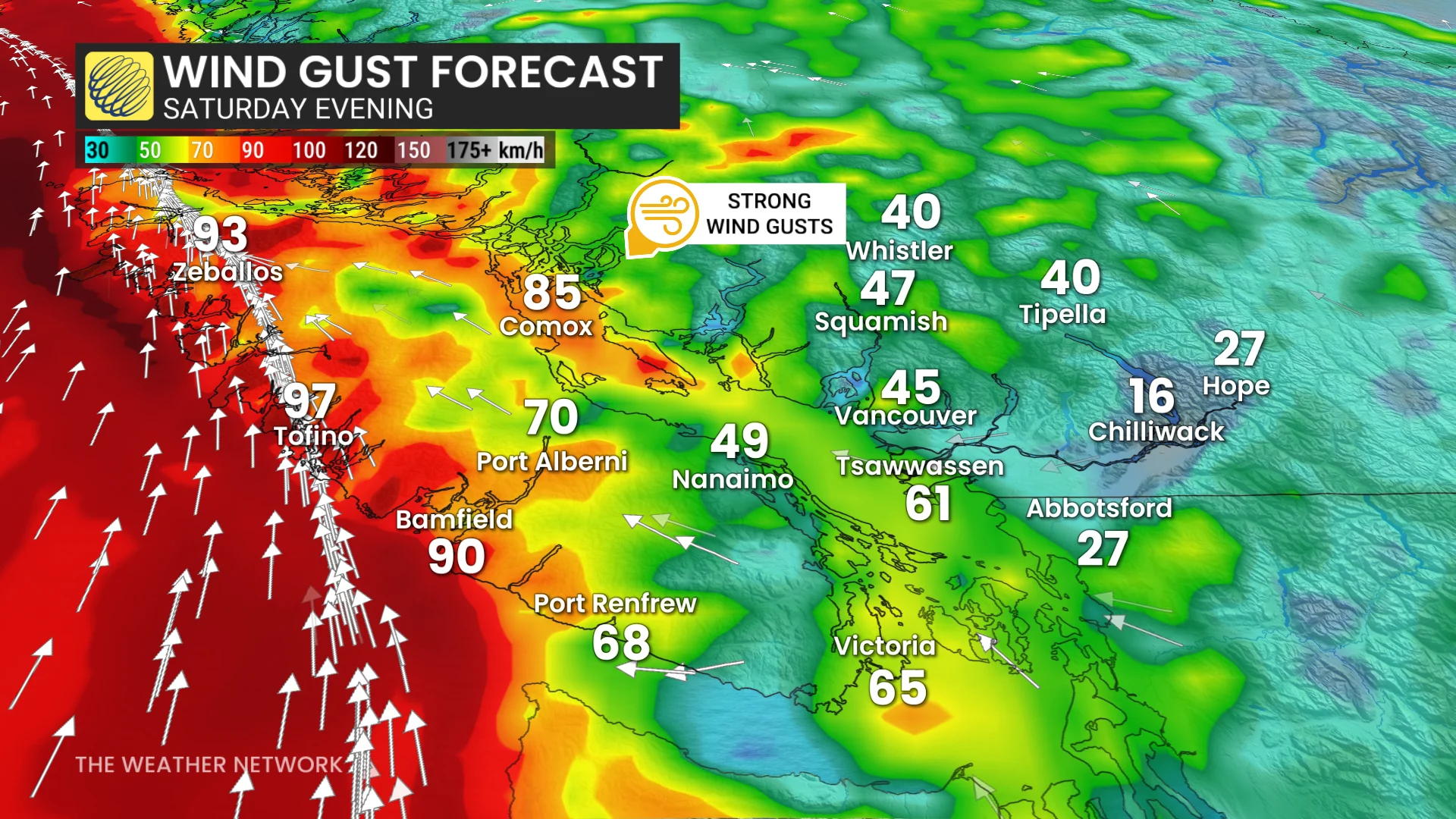
This will be a classic windstorm for much of the island, with widespread outages likely through the night. Ferry delays and cancellations will also become more likely toward the end of the sailing day.
Metro Vancouver will also see winds pick up by Saturday night as the low's frontal system pushes inland, but it should be far less impactful than on the island. It's unlikely this will be a windstorm event for the Lower Mainland.
DON'T MISS: The polar vortex just made a historic reversal. What now, Canada?
Peak forecast wind gusts:
Tofino: 100 km/h
Comox: 90 km/h
Sunshine Coast: 90 km/h
Greater Victoria: 80 km/h
Campbell River: 80 km/h
Tsawwassen: 80 km/h
Downtown Vancouver: 60 km/h
Abbotsford: 60 km/h
Nanaimo: 60 km/h
The rainfall associated with this system is expected to be less organized and more scattered than we've been seeing over the past week, which is why it is only a secondary threat compared to the wind this time around.
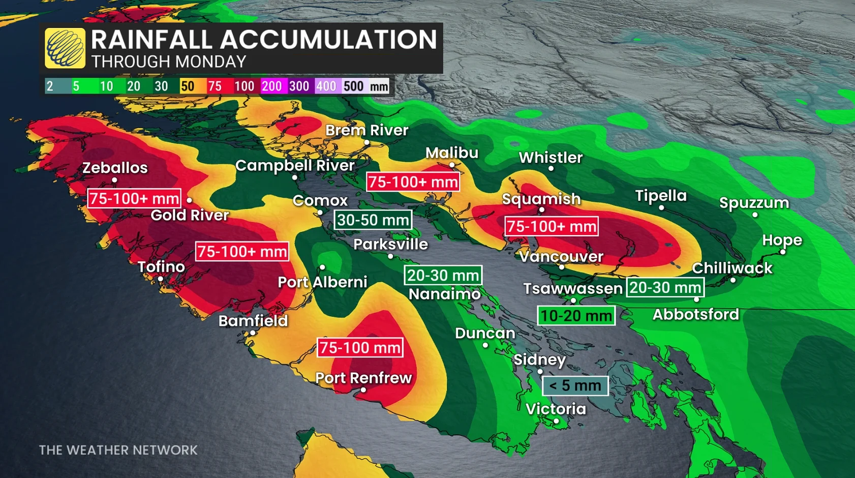
Water levels in lakes and rivers will still be high, however, so keep an eye out for any new alerts that may be issued.
Coastal waves are forecast to be large with the high winds, but they should coincide with low tide. This should hopefully mitigate any coastal flooding.
However, larger tides are forecast for next week, so forecasters will be keeping a close eye on any storm development during then.
Stay with The Weather Network for the latest updates and information on your weather in B.C.