While winter is near, Canada's weather is telling a different story
Even though winter and the holidays are around the corner, Mother Nature doesn't seem to be indicating that across a large part of Canada this month.
December has already been one for the record books in parts of Canada. Some areas in Nunavut already saw new, monthly highs while other centres in northern Alberta and Northwest Territories were potentially doing the same for daily temperatures on Wednesday.
WINTER 2024: El Niño will play a critical role in the weeks ahead
The trend for abnormal December temperatures continues this week. An influx of Pacific air is taking a countrywide trek, spreading above-seasonal temperatures across the country.

A good example of this will be on Thursday. A forecast high of 1°C may not sound warm, but considering it is for Churchill, Man., that is rather mild. It will be an astounding 20 degrees warmer than where it should be in mid-December.
Meanwhile, the colder air that we would normally see in December has to go somewhere. Funny enough, it's taking a trip south, way south. Think New Mexico and Texas, where northern parts of the latter could actually see snow. Both states will actually be colder than most of Canada, too.
RELATED: Texas will see more snow on Thursday than most Canadians will
What's happening with Canadian weather?
A trend unravelling in the global pattern is painting a non-winter-like picture in Canada for the next few weeks. Why is that?

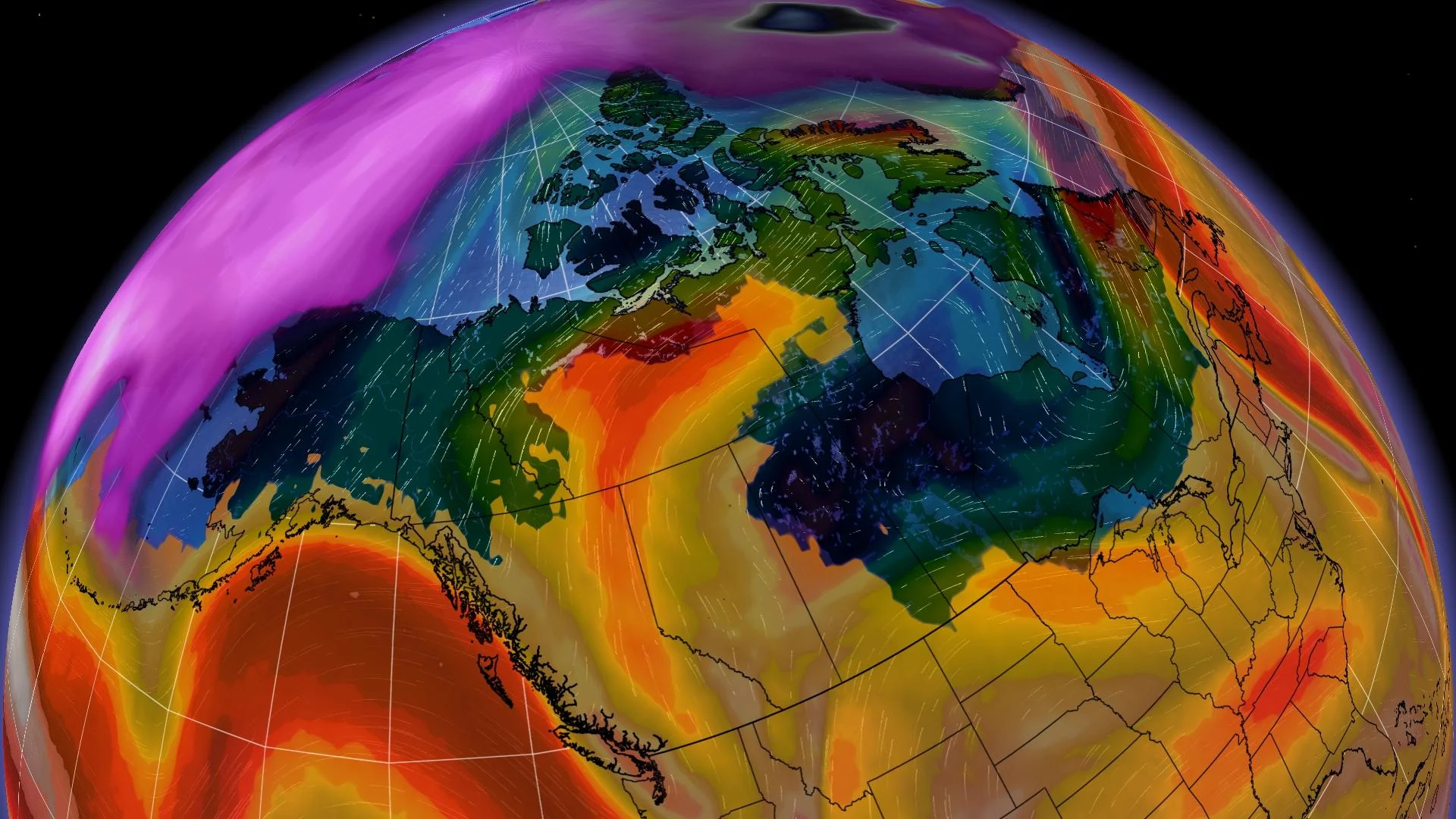
Before we get to that, let's take a moment to set the scenery. When you think about December in Canada, a frequented player is the polar vortex, which remains to be seen this year. Instead, our December pattern features a strong jet stream.
It acts like a cell around the bitterly cold air, barely allowing it to budge from Siberia with long-range model trends. As a result, Arctic air remains firm in its place, resulting in decreasing chances for it to escape. So, it's unlikely the extreme cold will be a theme in Canada.
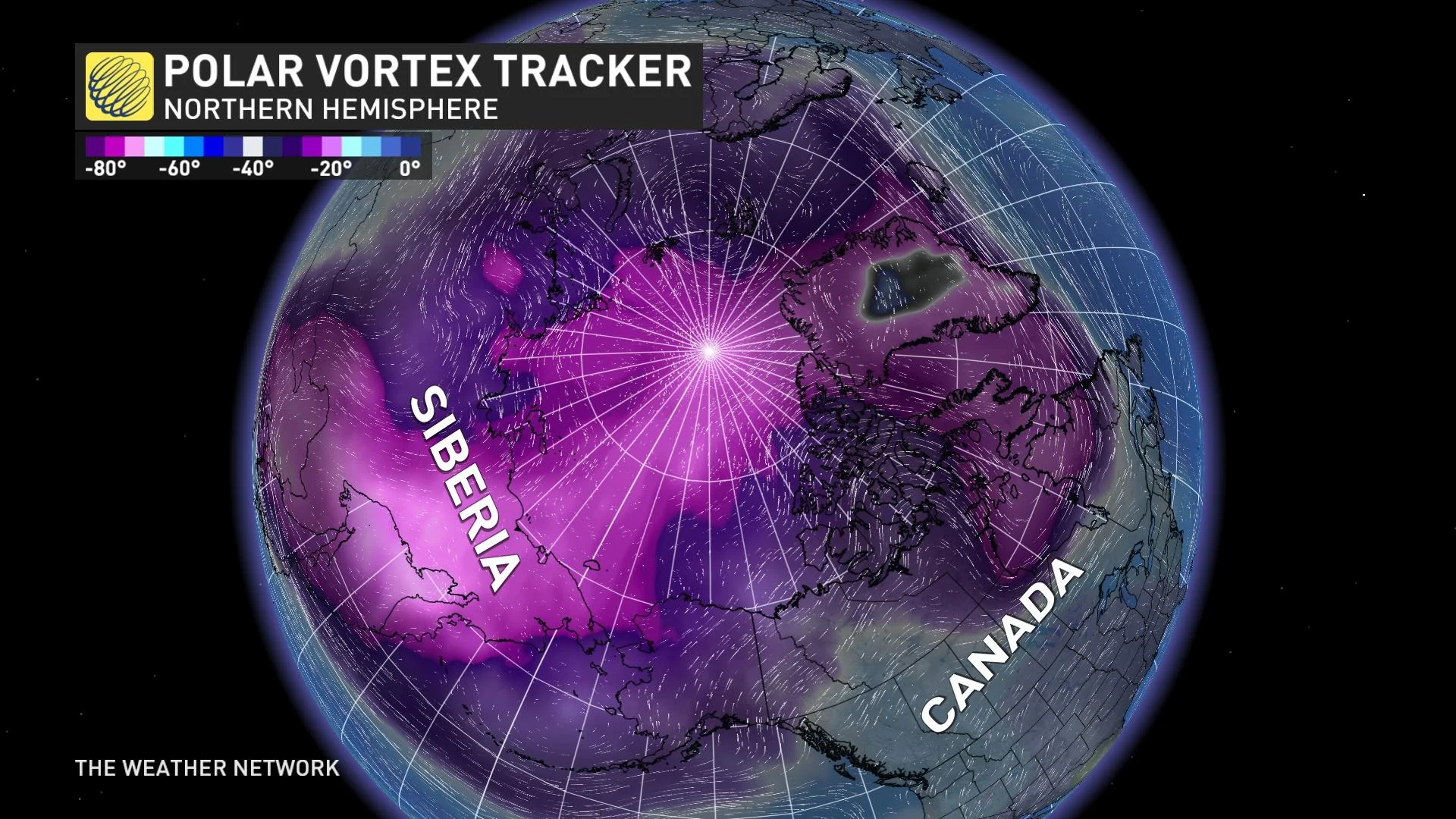
Instead, persistent Pacific air has been given the green light.
Several waves of above-seasonal temperatures will spread from the West to the East Coast this week and next, as mentioned earlier.
Ridges of high pressure paired with little combative or extreme temperature contrasts will result in lower chances for large-scale storms, so active weather may be lacking seven to 14 days out.

More so, the warmer-than-normal air will optimize surface snowmelt. That means any snow that has fallen will be tough to keep around.