Mammoth, continent-spanning storms surround Canada

Clouds gracing the skies above our heads are often part of systems that stretch far beyond the horizon
Canada recently found itself surrounded by storms so large that they slipped around the curve of the Earth.
Two vast low-pressure systems churning off either end of the country spun up ferocious winds, headache-inducing pressures, and filled skies with clouds that reached between entire continents.
MUST SEE: Winter 2023-2024 could be best in years for observing the night sky
It’s been a wild week (and month, and year…) across Canada. Heavy snows, gusty winds, freak thunderstorms, and temperatures bobbing up and down like a seasick buoy took a toll on folks from Vancouver Island to Cape Breton.
But for all the tumult in the skies above—and the seemingly endless chaos we endure down here on the ground—our atmosphere always features pangs of frequent beauty if you take the time to look.
It’s awe-inspiring to ponder the vast scale of our atmosphere when we look at these storms from above. The two geostationary satellites that keep steady watch over the Americas—nicknamed GOES-East and GOES-West—each have a wide view of the Atlantic and Pacific Oceans.
One ferocious Atlantic storm
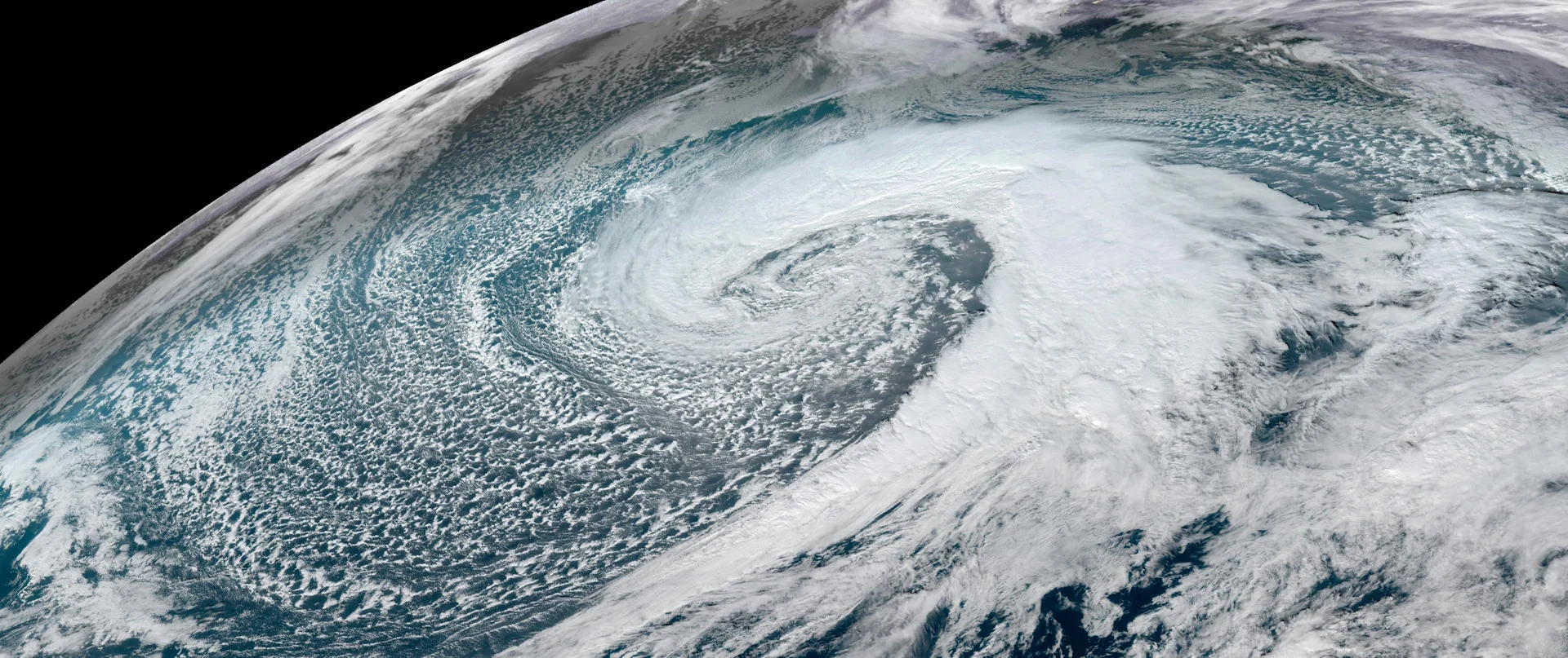
Take a look at this behemoth of a storm that spiraled over the northern Atlantic on Thursday, December 7.
A visible satellite image centred over the northern Atlantic Ocean on December 7, 2023. (NASA/EOSDIS Worldview)
This low-pressure system grew so immense that its clouds touched Canada, Europe, and the Caribbean all at once, an area of influence covering millions of square kilometres all connected by a single storm.
It’s almost impossible to imagine such a large expanse—that a sky full of intricate clouds above our heads doesn’t even begin to encapsulate the sheer size of the system producing each puff and wisp.
A visible satellite image from GOES-East on December 7, 2023. (NOAA)
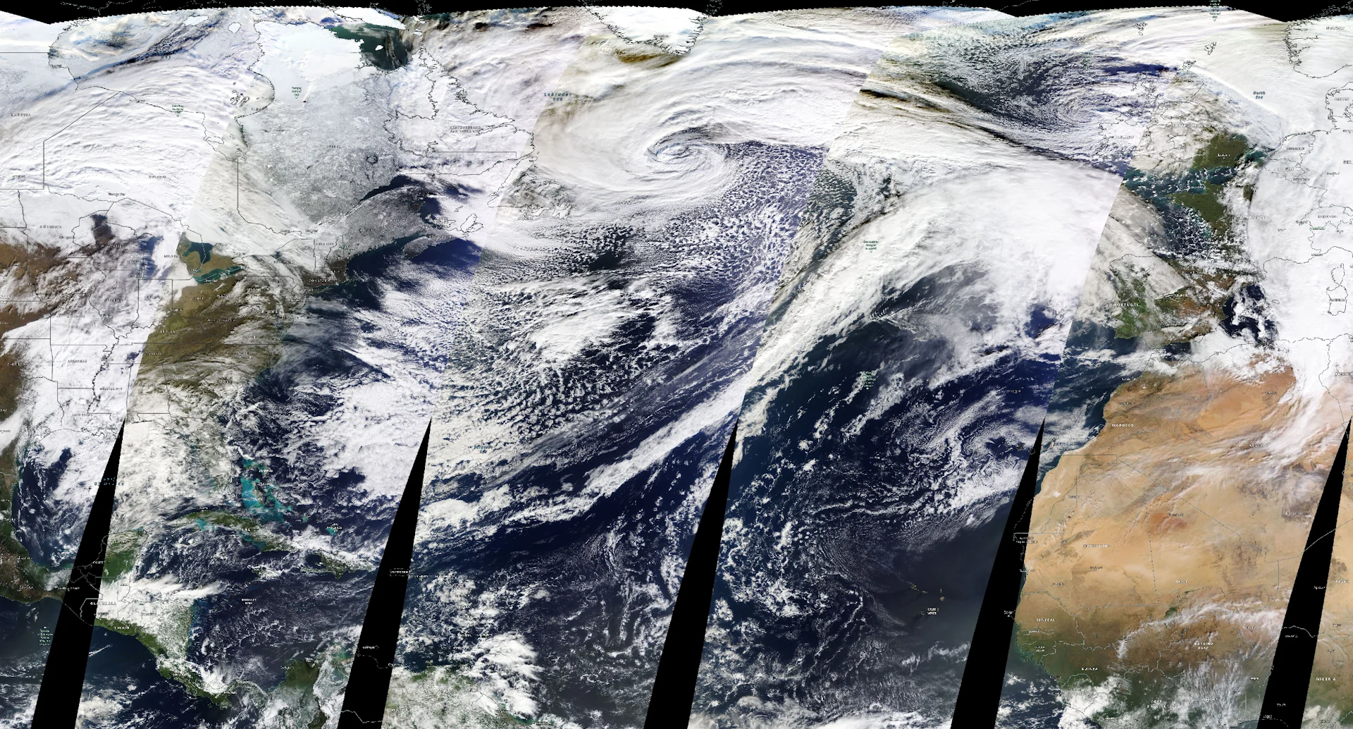
In fact, the storm over the Atlantic grew so large on December 7 that our usual GOES-East satellite couldn’t capture the entire thing in one frame.
The widescreen composite image of the storm above was captured by NASA’s Terra, a polar-orbiting satellite that takes true-colour images of most of Earth’s surface every day.
That low-pressure system reached its pinnacle strength in the pre-dawn hours on Friday with a minimum central pressure that dipped to at least 937 mb, according to an analysis from NOAA's Ocean Prediction Center. For some perspective, that’s about the same pressure you’d expect to see at the centre of a major hurricane.
But a hurricane’s strongest winds are confined to a relatively small area because those systems are driven by strong thunderstorms around the eye. An ‘everyday’ low-pressure system like this one over the Atlantic is largely driven by winds roaring into and out of the jet stream.
Those winds spread out as they enter and exit certain parts of the jet stream, leaving a void in the upper levels that air from below has to rush upward to fill. This leaves less air, and lower air pressure, at the surface.
The enormous evacuation of air from the ground to a passenger plane’s cruising altitude spreads the newly born storm’s energy over a wide area. It’s a process that creates these glorious cinnamon-bun-esque masses of clouds and wind churning over entire oceans.
A Pacific storm to gaze at for days
The Atlantic certainly doesn’t have a monopoly on impressive lows.
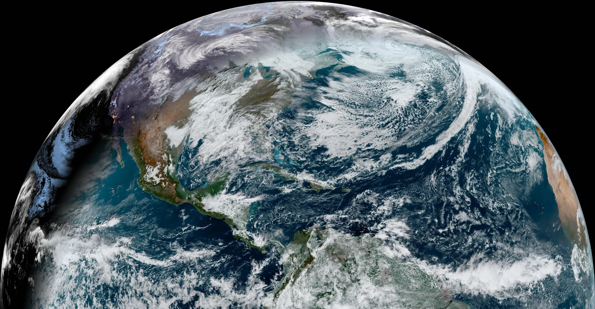
A forceful jet stream roaring across the northern Pacific Ocean gave rise to quite the storm a few days earlier. This picturesque storm formed in the Gulf of Alaska and gradually swept into the West Coast.

A visible satellite image from GOES-East on December 4, 2023. (NOAA)
Much like its Atlantic counterpart, the system’s size and intensity gave it an impressive reach across the Pacific Ocean.
Southerly winds streaming into the storm pulled mild air and tropical moisture from the Hawaiian Islands thousands of kilometres away, setting up a classic ‘Pineapple Express’ atmospheric river that brought drenching rains to the U.S. Pacific Northwest and portions of British Columbia.
This is a classic weather pattern for big precipitation events across B.C.’s South Coast. Fortunately, the worst of the rain missed the area to the south.

Some communities in Washington recorded more than 150 mm of rain in 24 hours as the moisture washed ashore, swelling many rivers in the Seattle/Everett area to major flood stage, and even producing record flooding on the Stillaguamish River.
Storms like the two that bookended Canada this past week are relatively common during these turbulent cooler months. The next time you’re staring at a gorgeous sky full of fascinating clouds, take a peek at weather satellites and see if those clouds connect you to destinations unseen.
Header image courtesy of NOAA.