Uncertainty, stress for flood-battered Manitoba with more clouds on the horizon
Manitoba municipalities already dealing with major flooding are preparing for the worst — yet another possible downpour this weekend.
FORECAST: Heavy weekend rain threat in southern Manitoba
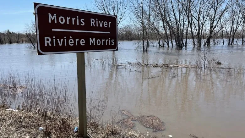
Things are especially bad in southern Manitoba, where many communities are sandbagging and building dikes.
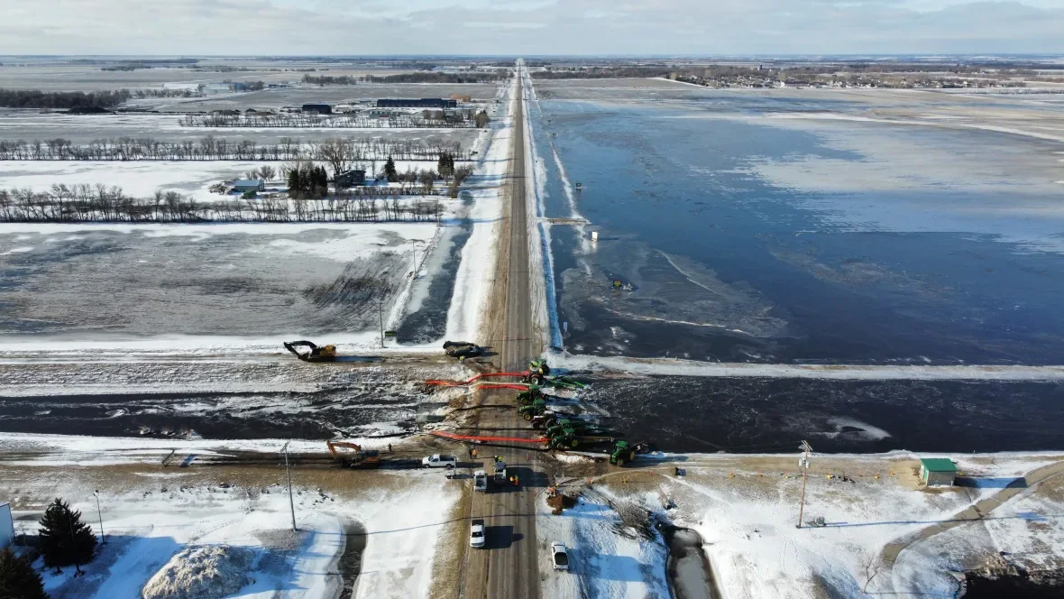
Highway 75 at Morris will close Friday to protect the town from the rising Red River.
Crews were piling mud onto the highway on Wednesday to prepare for closing the ring dike around the community.
Mayor Scott Crick says water is lapping the underside of the bridge into Morris, and weather has been so unpredictable lately it's impossible to tell how long it might be closed, especially in light of rains this weekend that could either bypass Manitoba altogether or bring between 15 and 25 mm of rain, CBC meteorologist John Sauder says.
"The best case scenario is the dike is closed, the water comes up for a few days and recedes quickly. The worst case scenario is we could be closed for two to four weeks like we were in 2011," Crick said.
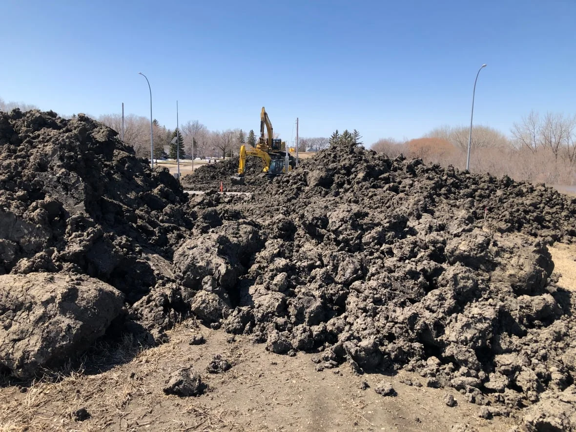
Crews pile mud onto Highway 75 near Morris on Tuesday in preparation for the ring dike around the community to close on Friday. (Alana Cole/CBC)
Chris Propp, the director of water infrastructure for the province, says crews are on site around the clock.
"They're closely monitoring river levels and taking some actions now to keep that highway open as as long as possible," Propp told CBC Manitoba's Radio Noon on Wednesday.
PUMPING UNDERWAY
Elsewhere, pumping operations are underway in most ring dikes, including those at Emerson, Morris, St. Adolphe, St. Agathe, Rosenort, Brunkild, Riverside, Letellier and Dominion City, he said.
The Red River floodway continues to be in operation as well as the Shellmouth Dam and Portage Diversion.
Jay Doering, a flood expert and professor of civil engineering at the University of Manitoba, says the province will have to prepare for "what-if scenarios" in case of more precipitation this weekend.
Drone video footage captured on Tuesday morning from Winkler, Man. A damaged culvert near Winkler caused floodwaters to rise on Monday night. With the help of the fire department and community members, the water was redirected over the dike and into a nearby field. (Submitted by Joey Siemens)
"We sort of have a manual as to what to do based on flows that we expect to see in either the Red or the Assiniboine rivers, so I think we stick with the plan" he said. "But it's important that we look at the what-if scenarios: What happens if we get 20 millimetres of rain? What happens if we get 40, 60 or, God forbid, one of the models shows 80 millimetres of rain between now and next Wednesday.
"It's important to know what the impact of those what-if scenarios are so that we can begin to make appropriate plans now."
People who lived through the 1997 floods might be concerned about the ability to stave off damage, but Propp says the province has learned a lot since then:
The floodway has been expanded, and there are better standards for infrastructure within the Red River Valley.
Older developments are protected to a one-in-100-year flood level — which is roughly equivalent to the 1997 flood — and newer developments and ring dikes must meet the standard of a one-in-200-year flood level.
Upgrades are planned for older developments and dikes.
"In terms of infrastructure, we certainly are in better shape than 1997," Propp said.
WATCH: SOAKING RAINS LEAD TO OVERLAND FLOODING
In another development, the Red River crested on Wednesday in Grand Forks, N.D., the National Weather Service reports.
That's about 2.6 metres (8.5 feet) below the 1997 flood crest and about 1.2 metres (four feet) below the 2011 crest.
The river is expected to crest in Pembina, N.D. — right outside of Emerson, Man. — on May 4 at a level 1.7 metres (5.6 feet) below the 1997 level and 0.8 metres (2.6 feet) below the 2011 level.
This article was originally published for CBC News and written by Rachel Bergen. With files from Alana Cole, Meaghan Ketcheson and Margaux Watt.


