Closely watching the next storm as any rain in Manitoba is problematic

With another round of rain on the way for flood-battered communities across southern Manitoba, experts are suggesting to prepare for the worst, with sandbagging efforts and road closure preparations already underway. The province is on high alert and struggling to keep rising flood waters at bay after recent storms pushed the region over 200 percent of its normal precipitation. This weekend’s system, the third Colorado low is just three weeks, could exacerbate the situation with confidence increasing that as much as 50 mm of additional rainfall could hit the Red River Valley. More on the worrisome forecast that spreads into this weekend, below.
RELATED: Uncertainty, stress for flood-battered Manitoba with more clouds on the horizon
WEEKEND OUTLOOK: MORE HEAVY RAIN TAKES AIM AT SOUTHERN MANITOBA
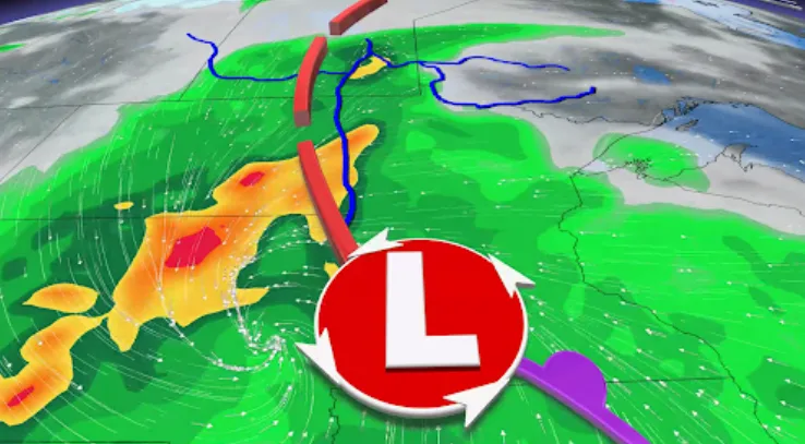
Special weather statements are in effect for southern Manitoba and southeastern Saskatchewan in advance of another Colorado low that’s expected to track into the Red River basin this weekend.
This is the third such system we’ll see across the region over the past couple of weeks. The upcoming system could bring additional rainfall that’ll fall over communities “already experiencing highly saturated ground and overland flooding,” Environment and Climate Change Canada (ECCC) said in its statement.
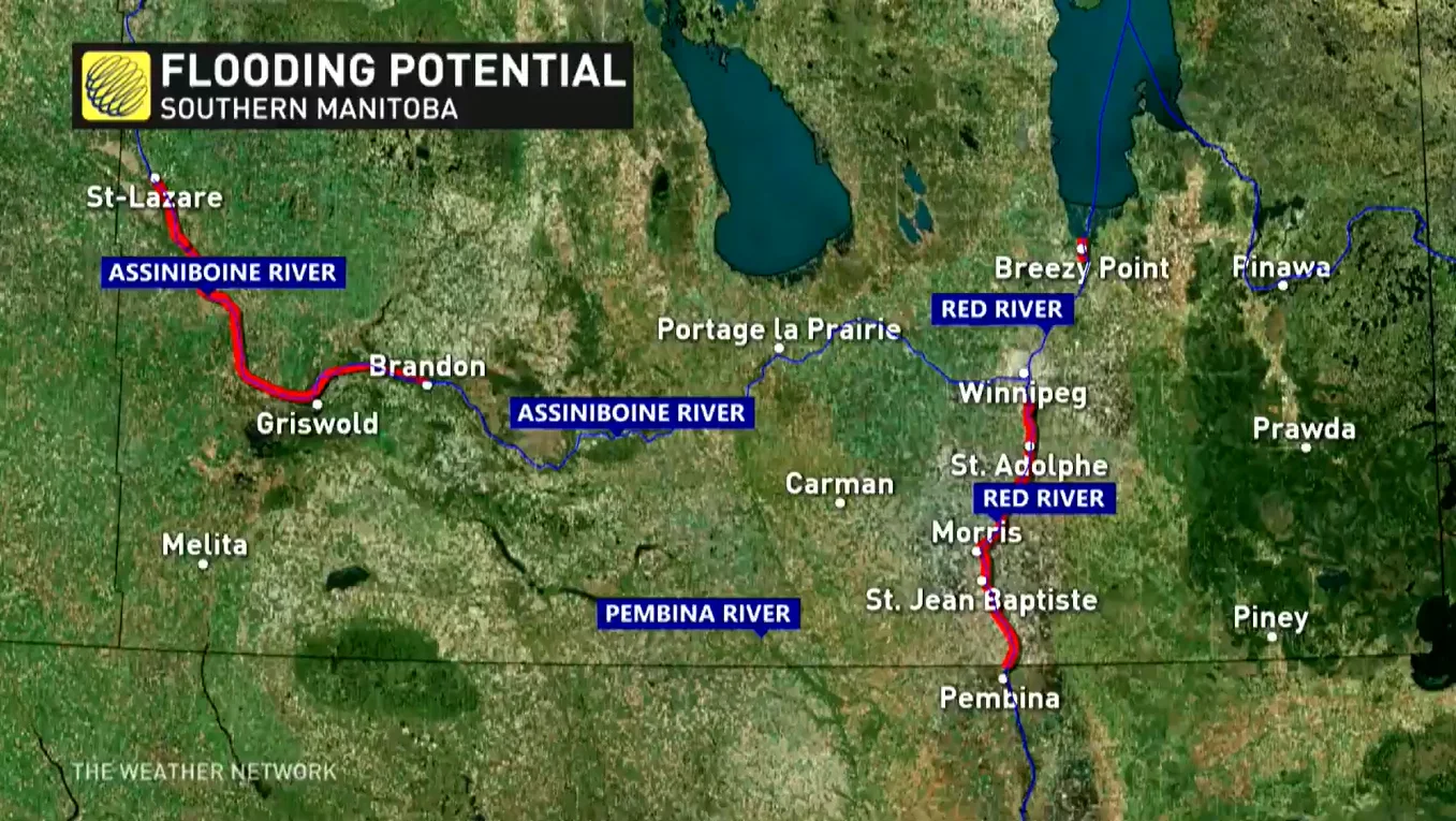
Water levels for most tributaries in the Red River basin had peaked or were holding steady after the heavy rain from last weekend and two days of rapid increases.
On Tuesday, a flood warning had also been issued for the Assiniboine River from St. Lazare to Griswold, west of Brandon.
Forecasters continue to monitor the development of an incoming system that’ll arrive on the southeastern Prairies this weekend. The additional rainfall could put unneeded stress on waterways, rivers, and streams.
The system will develop and move over the central Plains states on Friday. Rain on the northern edge of the system will push into Saskatchewan and Manitoba on Friday night. Rain will continue through the day on Saturday before tapering to scattered showers and the system pulls east on Sunday.
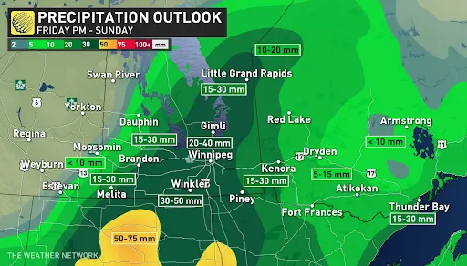
Confidence is increasing that rainfall amounts of 30-50 mm are possible across the hardest-hit areas in southern Manitoba, with southeastern Saskatchewan likely seeing lesser amounts based on the latest computer model trends.
Most of the precipitation will likely fall as rain, although some snow is possible over the higher terrain of southwestern Manitoba on the back side of the low on Sunday. For areas near the international border, greater precipitation totals are likely.
Watch the video above to see the three different rainfall scenarios we could see this weekend.
WATCH: BASEMENTS FLOOD AND ROADS COLLAPSE IN MANITOBA DURING LAST WEEKEND'S POTENT SPRING STORM
Officials continue to warn residents to stay off local waterways, as the risk for high flows, debris, and cold temperatures all present a significant safety risk.
Beyond this weekend’s storm, the region appears on track to experience drier and warmer conditions heading into the first full week of May.
Be sure to check back for the latest weather conditions across Manitoba.


