Storm aftermath brings power outages and flood preparation in Manitoba
Southern Manitoba's most recent storm has moved on, leaving frigid air, a messy cleanup and renewed flooding fears in its wake.
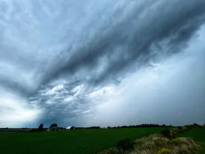
Heavy rain, snow and at times a freezing mix of the two, accompanied by powerful winds, hammered a large swath of the south from Friday to Sunday — just eight days after a three-day snowstorm pounded the same regions.
A weather system called a Colorado low was responsible for both weather events.
SEE ALSO: Winnipeg homeowners grapple with damaged homes amid flooding from spring storm
"Colorado is not the source of all ills, but it's been bedevilling us for a while now," said Environment Canada meteorologist Dan Fulton.
Several school divisions have cancelled classes or buses on Monday due to poor road conditions or power outages.
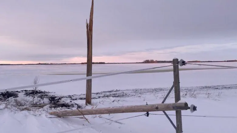
Manitoba Hydro's website on Monday morning still listed about 620 outages, affecting more than 13,000 customers.

Manitoba Hydro says crews are out 'dealing with the mayhem left by the weekend's storm. (@manitobahydro/Twitter)
The worst damage is in the southwest, up to the Parkland region and through to the Interlake, Hydro said in a tweet on Monday.
"We've got dozens of wood poles down or broken that need to be replaced to get power back on."
The system brought between 50 and 70 millimetres of rain to Winnipeg but Altona recorded the most, at 76 mm. Brandon received just 38 mm but it clocked the strongest wind gusts at 100 kilometres an hour.
Other high rainfall totals were recorded in Selkirk (57 mm), Morden (56 mm), and Pinawa (52 mm).
The downpours overloaded sewer systems in Winnipeg, leaving underpasses and many roads impassable, with drivers being forced to abandon stalled vehicles.
Flooded basements and yards led to a rush on pumps at hardware stores, with many cleared out of stock.
"It was kind of almost a summertime system, especially Saturday evening, as some of those stronger storms with some thunder and lightning involved approached Winnipeg. We were getting some pretty high rainfall rates," Fulton said.
"Adding to the challenge [right now], a lot of the infrastructure is still kind of clogged [and] that certainly made for some pretty bad flooding."
There were 1,142 storm-related calls or emails to the City of Winnipeg's 311 service through the weekend, city spokesperson David Driedger said.
Of those, 695 were about flooded streets or ditches, 412 about basement flooding and 35 about rising water levels in retention ponds.
A spokesperson for CAA Manitoba said the automobile agency on Sunday had more than double its average number of tow-related calls — 89, compared to a typical Sunday with 40.
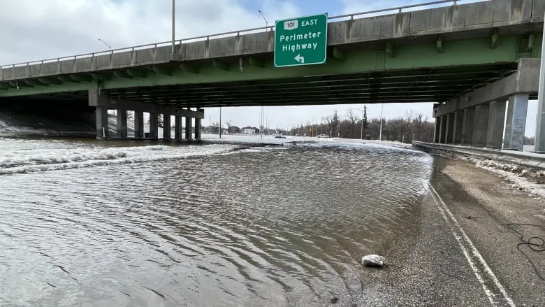
At the edge of Winnipeg and East St. Paul, southbound Henderson Highway is flooded. (Cameron MacIntosh/CBC)
The agency is also expected to surpass its average Monday number of 150 tow-related calls, in part due to poor road conditions and a backlog from Sunday.
As for snow, the hardest hit area was once again the Parkland region and its higher terrain around Riding Mountain National Park, Fulton said, but he did not yet have totals.
The earlier snowstorm brought on by a Colorado low left some places under as much as 82 cm of snow.
All of the precipitation in the past week has also forced up river levels and prompted flood warnings along the Red River Valley from Emerson to the floodway inlet just south of Winnipeg. Overland flood warnings are also in place.
The storm system has moved into Ontario, with much colder temperatures coming behind it.
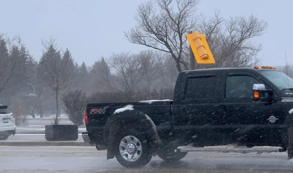
This traffic light on Grant Avenue in Winnipeg gave in to the wind gusts on Sunday. (Darren Bernhardt/CBC)
Most areas around the south are expected to see some sun return Monday but with a high around –3 C. The normal high for this time of year is 14 C.
The temperatures should slowly climb back up through the week, possibly even reaching double-digit highs by the end of the week, but Environment Canada forecasts more clouds and rain.
"For this weekend, there is the potential for yet another system. But you know what, that's five days away, and I'm going to try not to worry about it yet because, well, hopefully the five days will push it one way or the other," Fulton said.
"But yeah, there are indications there might be another one coming this weekend. I'm really hoping it doesn't materialize."
The story was originally published for CBC News on April 25, 2022.