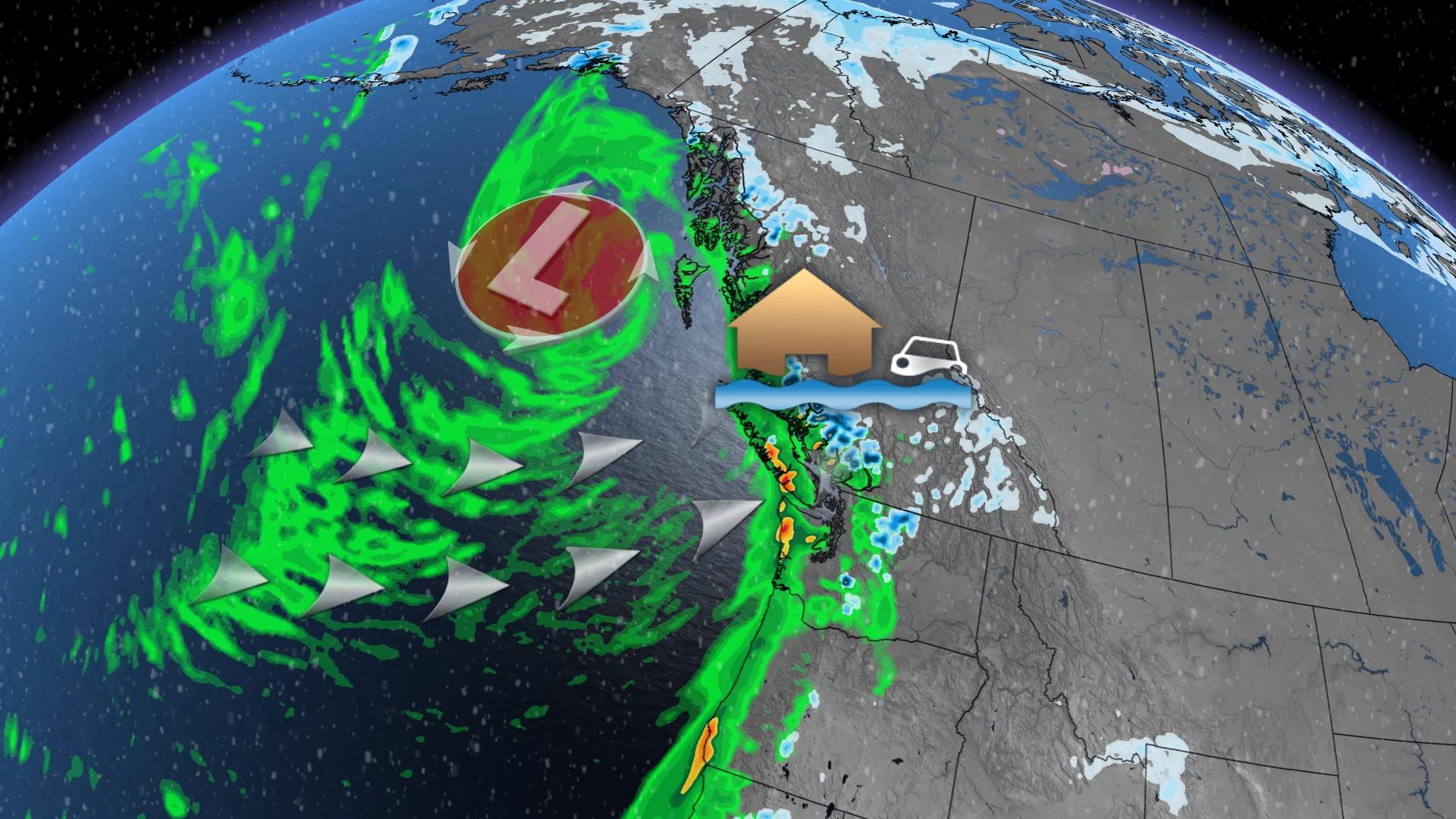
Typhoon remnants bring damaging winds, pouring rain to South Coast

Parts of the South Coast could see wing gusts up to 100 km/h and up to 200 mm rainfall through the weekend.
Forecasters have been closely watching yet another powerful system aimed at British Columbia's South Coast through the week, and it's finally here.
Fall storms are not out of the ordinary for B.C., but this season so far has been a rough one. Several evacuation alerts and orders, as well as shelter-in-place advisories, have been issued for communities throughout the Squamish and Pemberton areas due to the flood threat from the relentless rains.
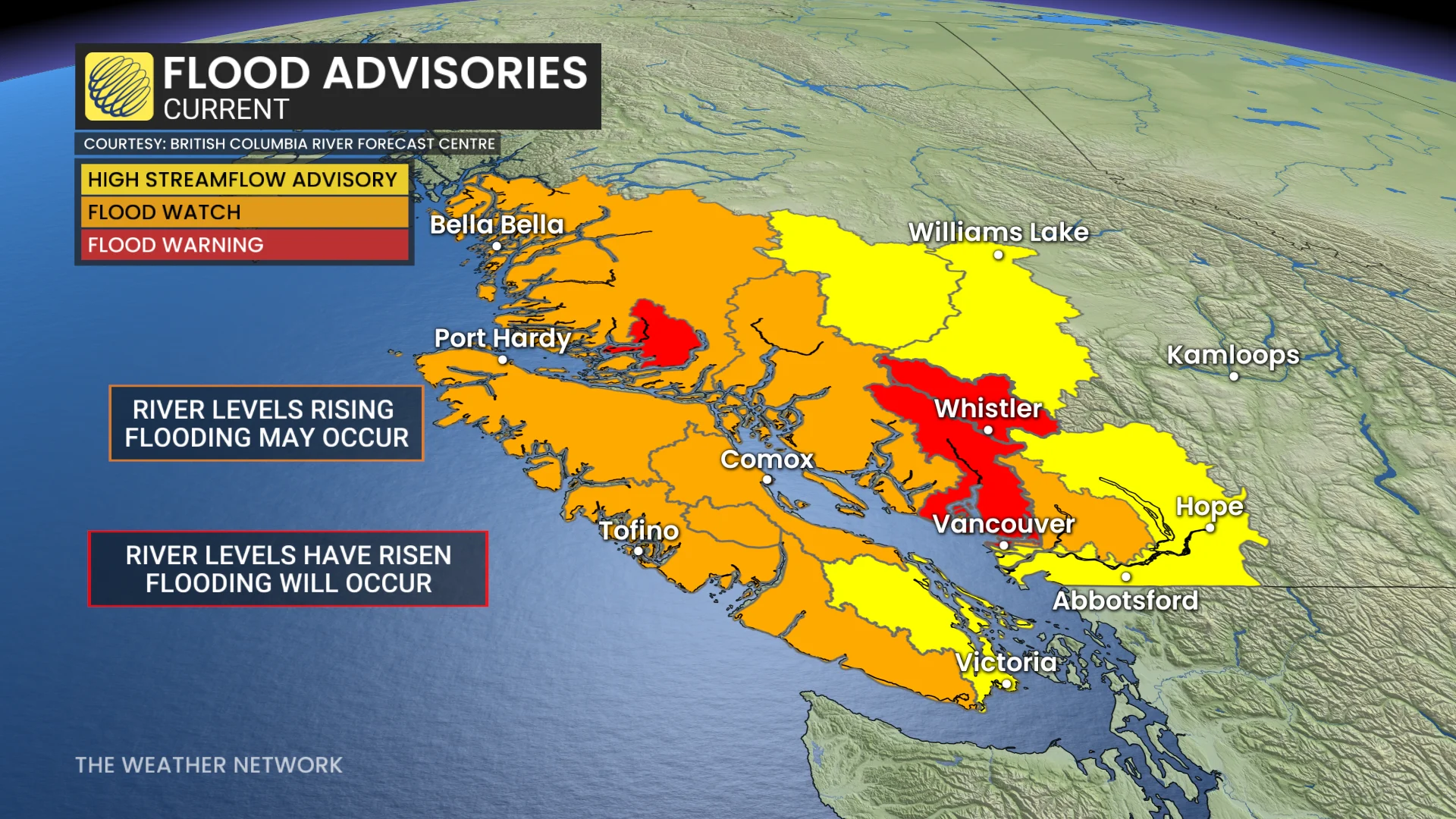
This series of storms may be making some folks feel especially on edge as Nov. 13 marks the five-year anniversary of the Abbotsford floods, which were caused by a similar stormy pattern. In a matter of hours, thousands were displaced from their homes, and five lives were lost.
SEE ALSO: Historic El Niño nears its peak, months of impacts yet to come
Luckily, the Abbotsford area will miss out on the brunt of the heavy rains into this weekend.
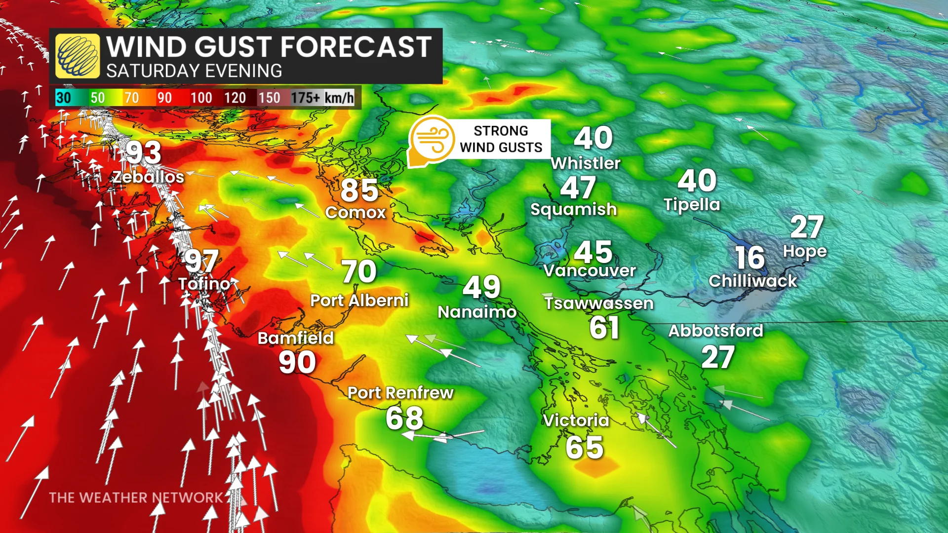
Winds are also forecast to pick up over the weekend and could become damaging for parts of Vancouver Island. Power outages from fallen trees are likely, as well as ferry delays and high surf.
Coastal flooding statements are in effect for parts of southern Vancouver Island and Metro Vancouver.
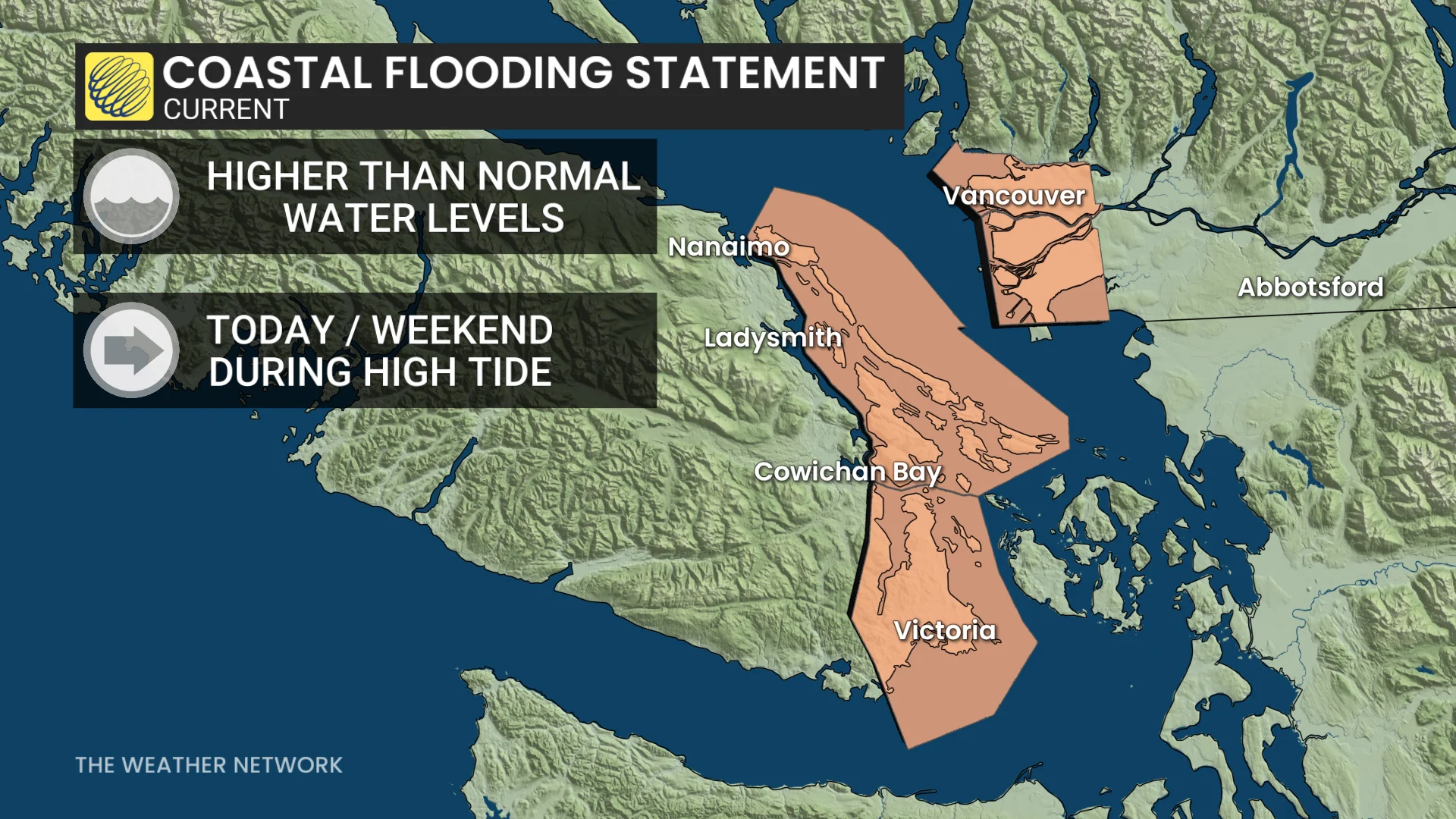
"High tides are likely to surpass predicted levels due to storm surge enhancement," Environment and Climate Change Canada (ECCC) warns in the statement.
Typhoon remnants drive weekend windstorm, heavy rain, alpine snow
This latest round of stormy weather is actually the remnants of Typhoon Cempaka after the system recurved across the Pacific earlier in the week. Thanks to the tropical energy, this system is forecast to pack a punch to the B.C. coast through the weekend.
Western Vancouver Island will especially feel the impacts from this, and rainfall warnigns have been issued by ECCC. Tofino has already received around 250 mm of rain, and could see another 50-100+ mm by the end of the weekend.
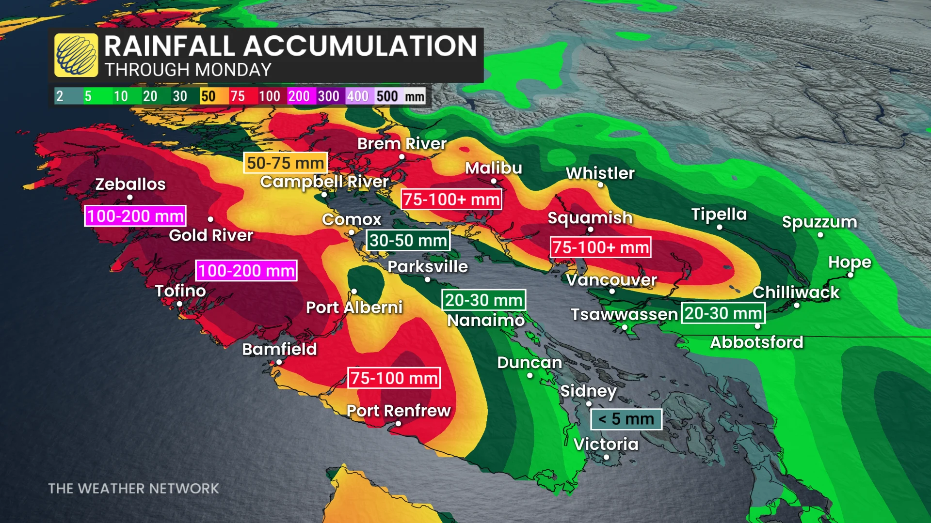
According to ECCC, rainfall totals are expected to be highest across northern Vancouver Island, including Zeballos, where there was a landslide from last weekend's storm, and Tahsis. Some localized areas could see rain totals over 120 mm.
By Saturday evening, wind gusts are forecast to increase to almost 100 km/h over parts of Vancouver Island and into the northern section of the Strait of Georgia. This is also when forecasters expect to see the most intense rain.
Metro Vancouver will also see winds pick up, but it should be far less impactful than on the island.
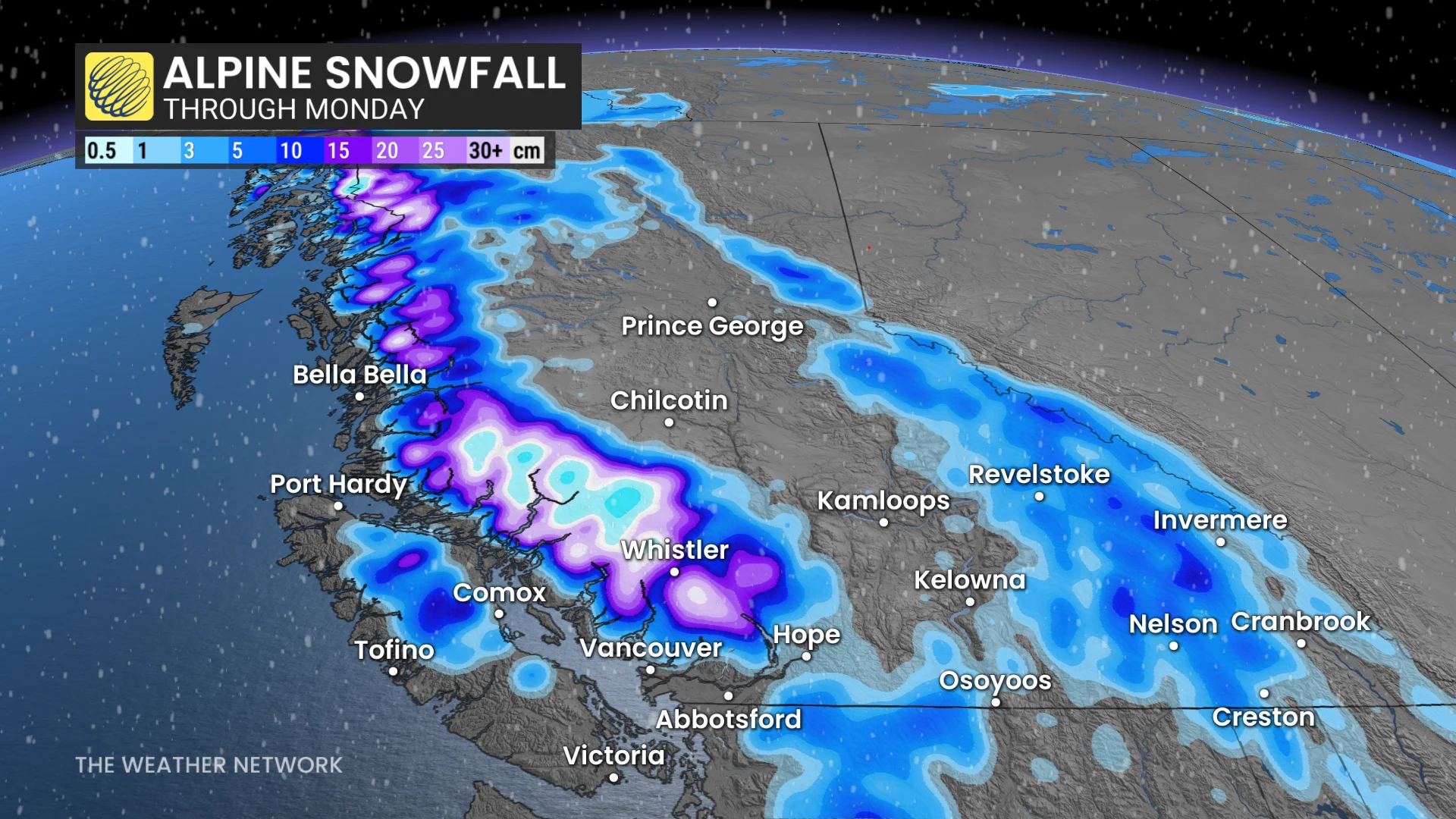
Freezing levels are also forecast to drop across the Interior, which means we could see some heavy alpine snow as the moisture-laden system moves inland toward the end of the weekend.
DON'T MISS: The polar vortex just made a historic reversal. What now, Canada?
Folks travelling through the mountains should stay alert for any icy or slick patches from the snowy transition.
With the ground already saturated, there is a risk of overland flooding rushing down some of the mountain slopes. Damage to infrastructure is also possible.
A red flood alert has also been issued for the Sea-to-Sky Highway, along with widespread traffic advisories.
Many storm drains may also be blocked due to the falling leaves, which raises the risk of localized flooding. Remember to never try to drive through a flooded road, as it doesn't take much water to make a vehicle float or flood the engine.
Be sure to monitor for any new alerts issued by municipal and provincial authorities throughout the weekend.
Stay with The Weather Network for the latest updates and information on your weather in B.C.