Ontario: Chance of thunderstorms, showers as late-season warmth moves in

Southern Ontario is seeing the risk of thunderstorms and passing showers on Sunday, however the storms that do occur are expected to be non-severe in nature. The good news is that the showers will move out by the evening, just in time for the Bianca Andreescu ceremony at Mississauga's Celebration Square. Details on who is seeing the risk for thunderstorms, plus a look at the late-season surge in temperatures this week, below.
WEATHER HIGHLIGHTS:
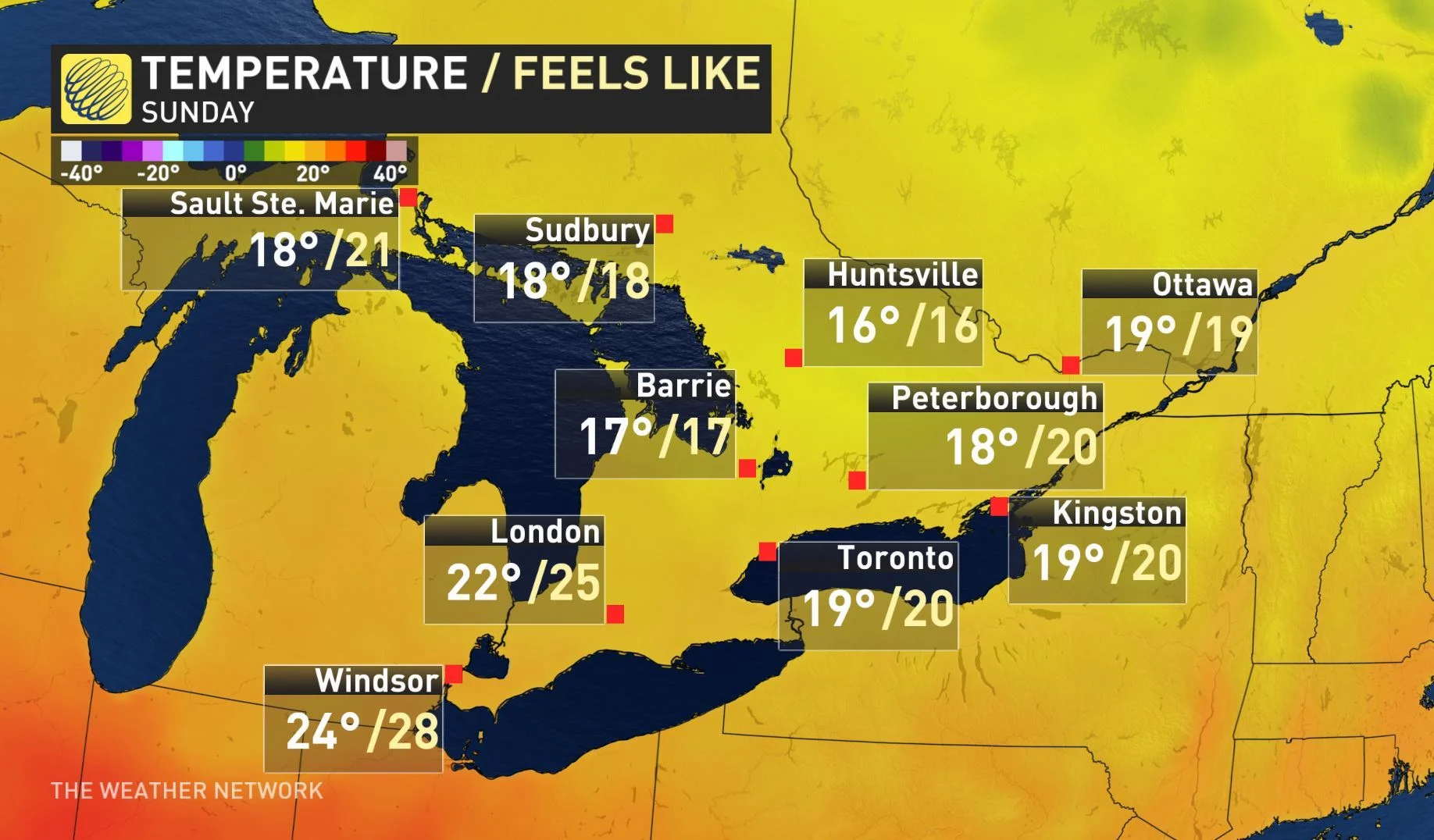
Temperatures slightly drop on Sunday as showers track through
Spike in temperatures by mid-week, including return of higher humidity
Track of Humberto will impact late-week weather
Stay on top of ALERTS in your area
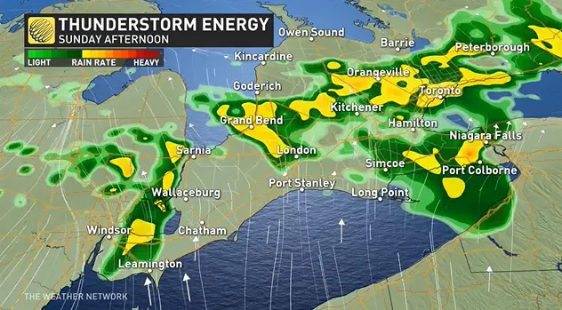
WATCH BELOW: TRACKING THE RAIN AND THUNDERSTORM ENERGY
A low pressure system tracking across southern Manitoba will extend showers into Ontario's cottage country ahead of its associated warm front, which will track through on Sunday morning into the afternoon.
This front is bringing the potential for thunderstorms in southern Ontario with the chance of storms most likely along the shores of Lake Huron and the southern Georgian Bay region.
Light showers are expected to move in to the GTA by late morning and will end by late afternoon -- allowing for cloudy, but mainly dry, conditions in time for the outdoor Bianca Andreescu celebration in Mississauga.
The low pressure system will brush past extreme southwestern parts of Ontario into the early hours of Monday morning, and there could be a few rumbles of thunder around this time as well.
Temperatures will be seasonably cool across much of southern and eastern Ontario, but the cooldown won't last long.
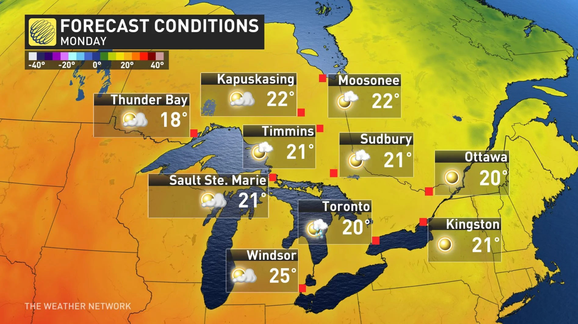
Next week will feature abundant sunshine, pleasant temperatures and a slow warming trend with daytime highs reaching the mid- to upper-20s by Thursday, with humidity making a return to the south. Humidex values could approach or exceed 30 in some areas.
"Next week will feature abundant sunshine with temperatures near to above seasonal through the week," says Weather Network meteorologist Dr. Doug Gillham.
TROPICAL INFLUENCE TO WRAP UP SUMMER?
Looking ahead even further, Tropical Storm Humberto may play a role in the final days of summer across southern Ontario.
Gillham says it's "uncertain how long the warm weather lasts," thanks to the uncertain track of what will be Humberto. "The west to east progression of weather systems across the country would slow down if we have a hurricane slowly tracking north near the U.S. East Coast," says Gillham.
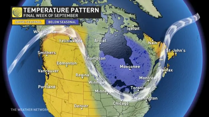
COOLER WEATHER EXPECTED FOR LATE SEPTEMBER
After an extended period of pleasant late summer weather next week, a cooler pattern, but near seasonal, is expected to return to southern Ontario during the final week of September, Gillham says, but the dip in temperatures may end up holding off until late that week.