Humberto strengthens, could make rare strike on Bermuda

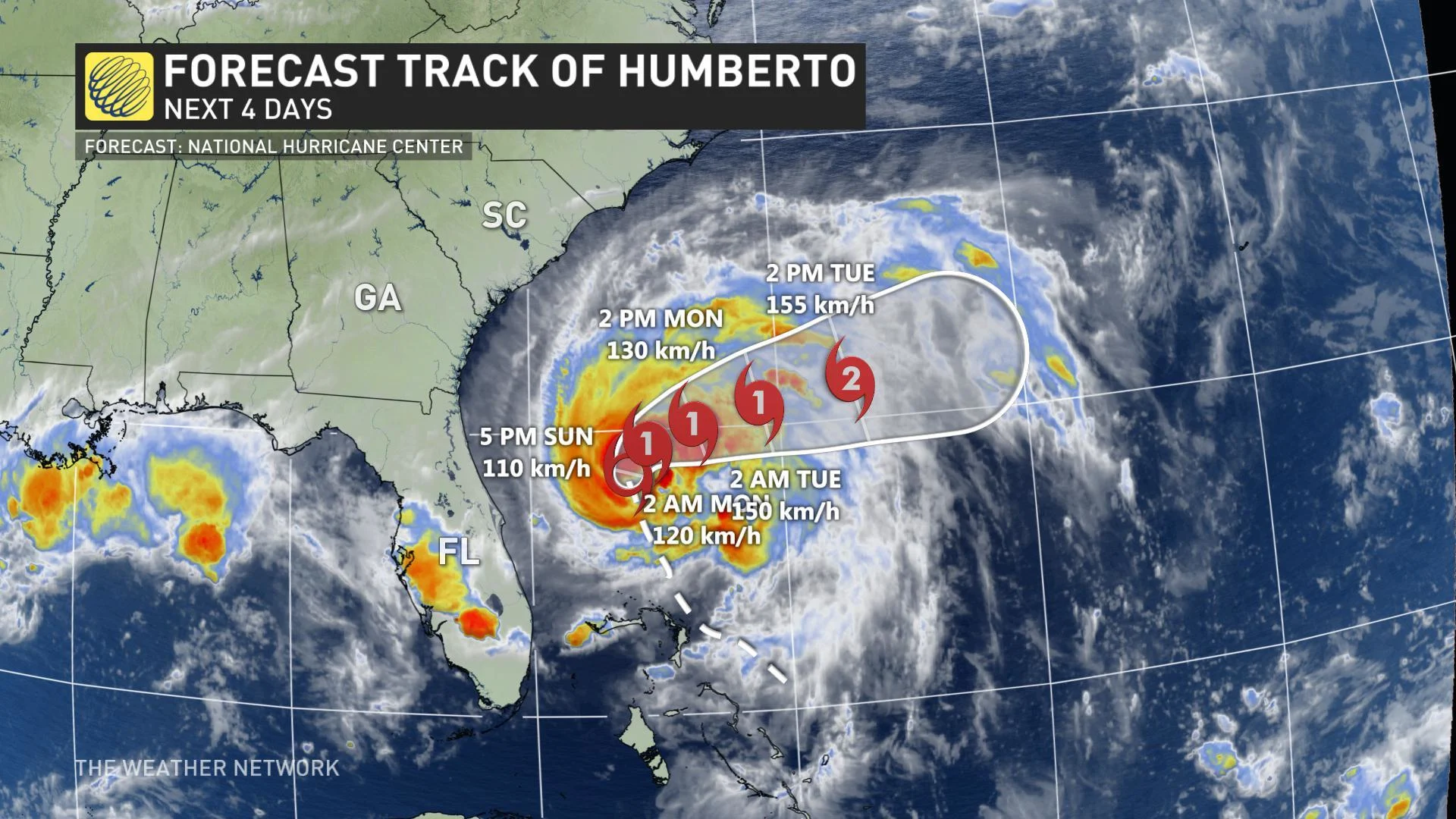
Tropical Storm Humberto continued to strengthen on Sunday and while it is now moving away from the Bahamas and the eastern United States, its course seems set to take it on a rare path -- directly toward Bermuda.
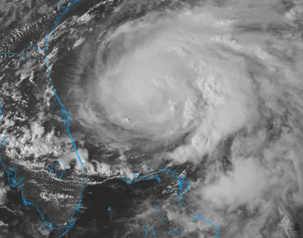
As of Sunday evening, U.S. Air Force Hurricane Hunter aircraft found Humberto's maximum winds were around 110 km/h, with higher gusts, and confirmed the storm was moving due north at about 9 km/h. The storm is expected to continue strengthening at least through Wednesday and is likely to reach hurricane strength early Monday morning. The current forecast from the U.S. National Hurricane Center puts Humberto at Category 2 strength as it approaches Bermuda through midweek.
IT'S TIME TO HELP: How one Canadian is trying to impact Bahamian relief
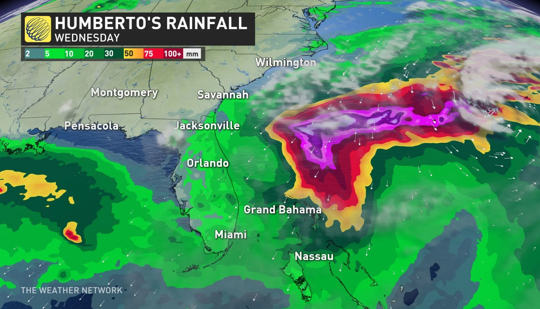
Humberto's only impacts to the U.S. are likely to be swells and rip currents along the southeast coast for the first half of the week, but its track toward Bermuda is worth watching. Despite its isolated position in the Atlantic, direct hits from hurricanes are relatively rare, with prevailing tracks generally curving closer to the Eastern Seaboard.
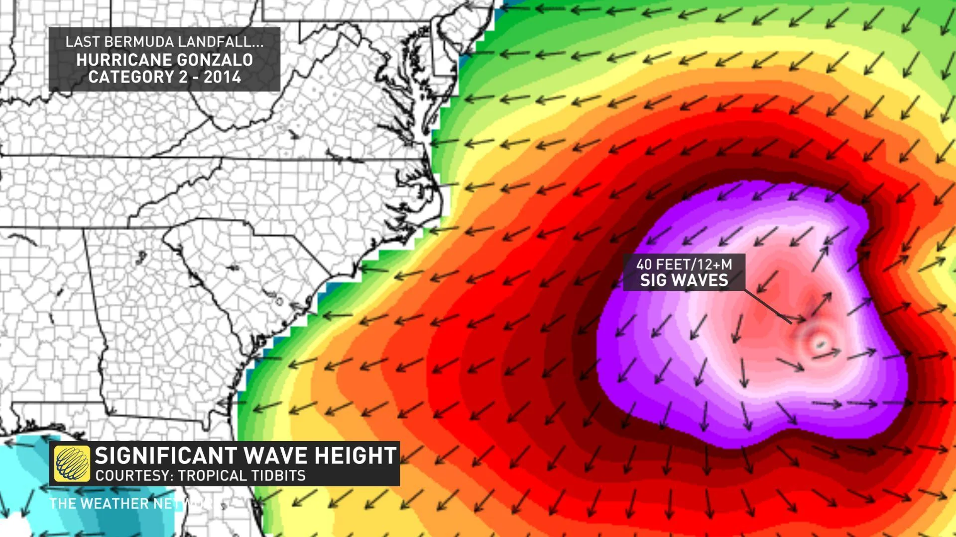
While the track will be adjusted as the storm continues on its path, model guidance suggests that Bermuda will see, at the very least, some tremendous waves as the storm passes this week.
Longer-range models suggest that some of these major swells may ultimately impact the shores of Nova Scotia as well, though that will depend on the eventual strength and track of the storm.
The last major hurricane to make a nearly-direct hit on Bermuda was 2016's Hurricane Nicole, which blasted the island with 220 km/h wind gusts and more than 170 mm of rain, even though the centre remained just offshore. 2014's Gonzalo was the last Category 2 hurricane to make landfall.
ATLANTIC STAYS ACTIVE NEXT WEEK
Humberto isn't the only storm on the horizon. A trough off the Africa coast that's been tracking across the Atlantic Ocean over the weekend will likely begin to strengthen as it approaches the Caribbean Sea this week. The NHC gives this disturbance an 80 per cent chance of developing into a tropical cyclone over the next 5 days.
There remains a high level of uncertainty in the track for this future system, with some models suggesting a northern turn towards Haiti and Cuba. This track will interact with the greatest elevation across the two countries but will lead to a potential impact on the Bahamas late this week.
Stay with us here at The Weather Network as we continue to cover the peak of hurricane season.


