Ontario's 9th tornado of the year confirmed ahead of next strong storm risk

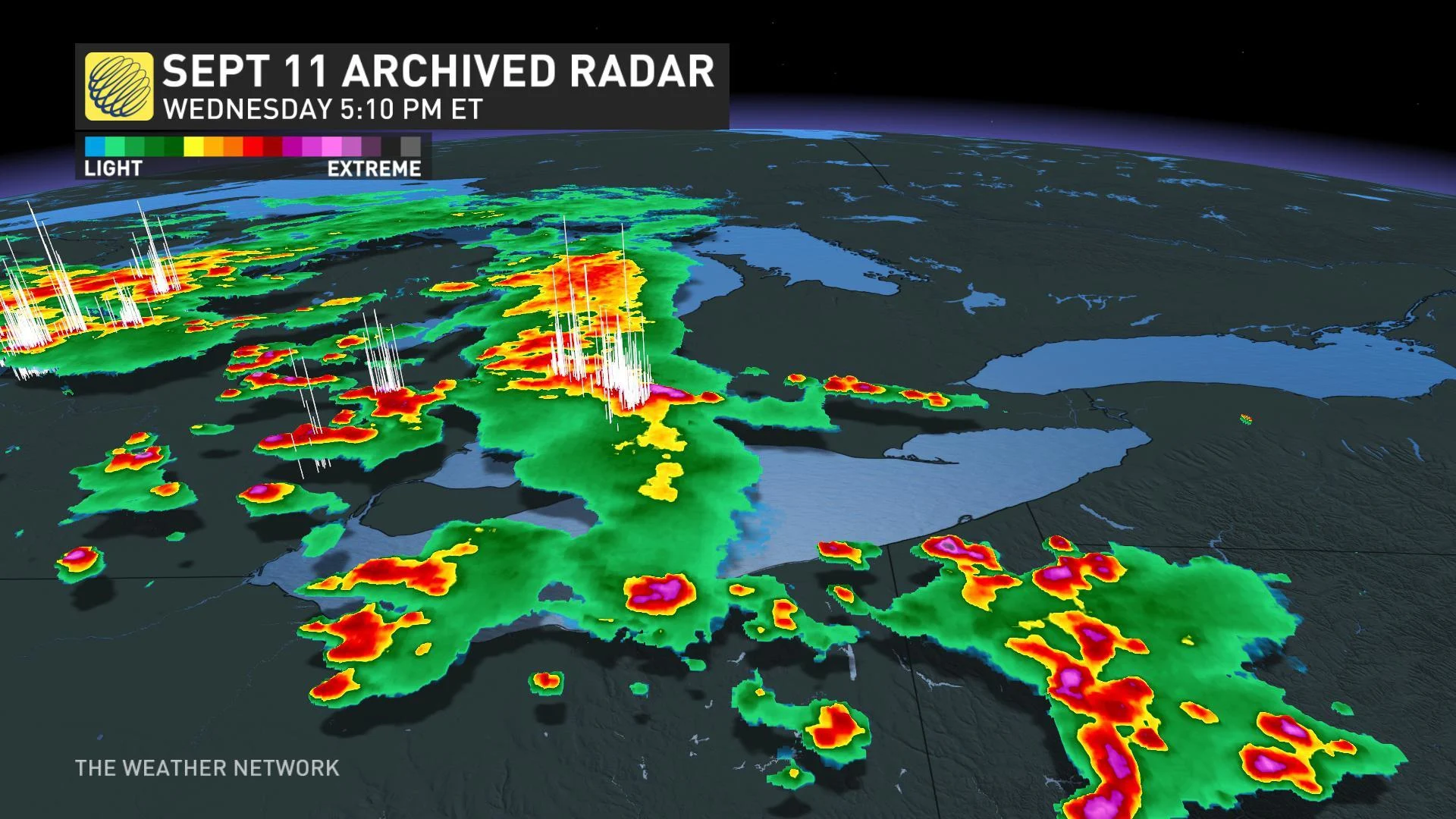
The brief surge of hot and humid weather that flooded southern Ontario on Wednesday was the perfect fuel for numerous thunderstorms during the late afternoon and evening hours.
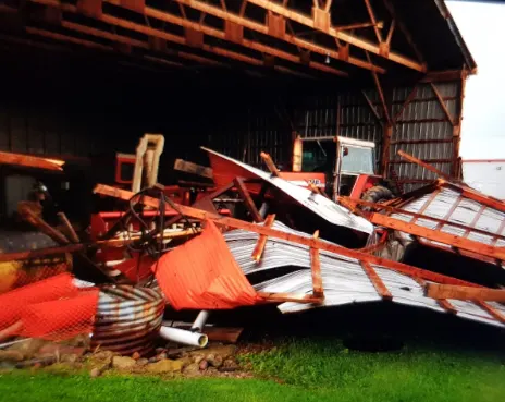
After damage surveys conducted by the Northern Tornadoes Project on Thursday, Environment Canada confirmed that a tornado did indeed touch down Wednesday evening southeast of Petrolia, in southwestern Ontario. The survey team also confirmed damage related to a downburst, also near Petrolia.
SEE ALSO: Tornado potential brewing again for Friday
The tornado has been given a preliminary rating of EF-1, with maximum winds of 140 km/h. This is the 9th confirmed tornado for the year in Ontario.
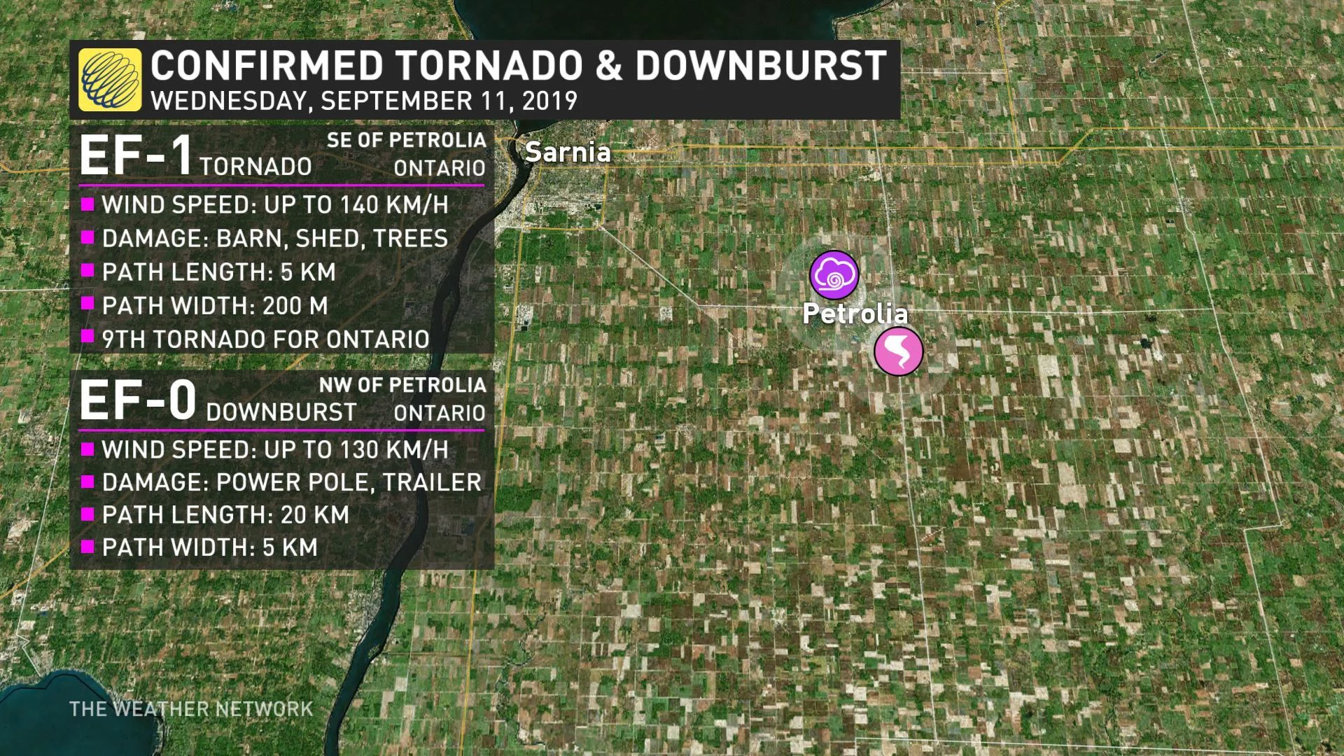
The downburst, which also did damage in the Petrolia area, had maximum estimated winds of 130 km/h, equivalent to an EF-0 tornado.
At least one barn was completely destroyed on Rokeby Line in the Township of Enniskillen.
At the height of the storm, a wind gust of 120 km/h was reported in the Windsor area, with rainfall totals upwards of 40 mm setting a new daily record for the city.

Storms began to bubble up over Michigan through the early afternoon and tracked east towards Sarnia and Windsor by the mid to late afternoon.
"Wind profiles for the afternoon did suggest marginally favourable conditions for some rotation in the atmosphere if stronger storms did develop," says Weather Network meteorologist Kelly Sonnenburg.
Storm Hunter Mark Robinson was in the thick of Wednesday's storms, where he said sheets of rain, powerful winds, and significant lightning strikes made for some treacherous travel.


