Heavy spring snow and ice hit Manitoba, Ontario and Quebec

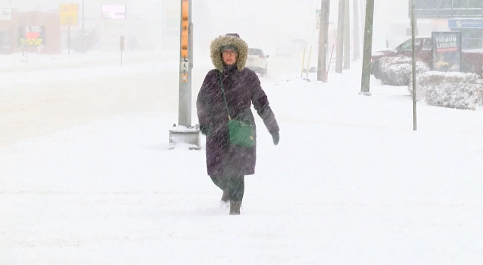
Travel delays and school closures rack up, as April snowstorm hits parts of Manitoba, northern Ontario and Quebec through Wednesday
Millions of Canadians are being hit by potent wintry weather, with major impacts to travel and power likely through Thursday.
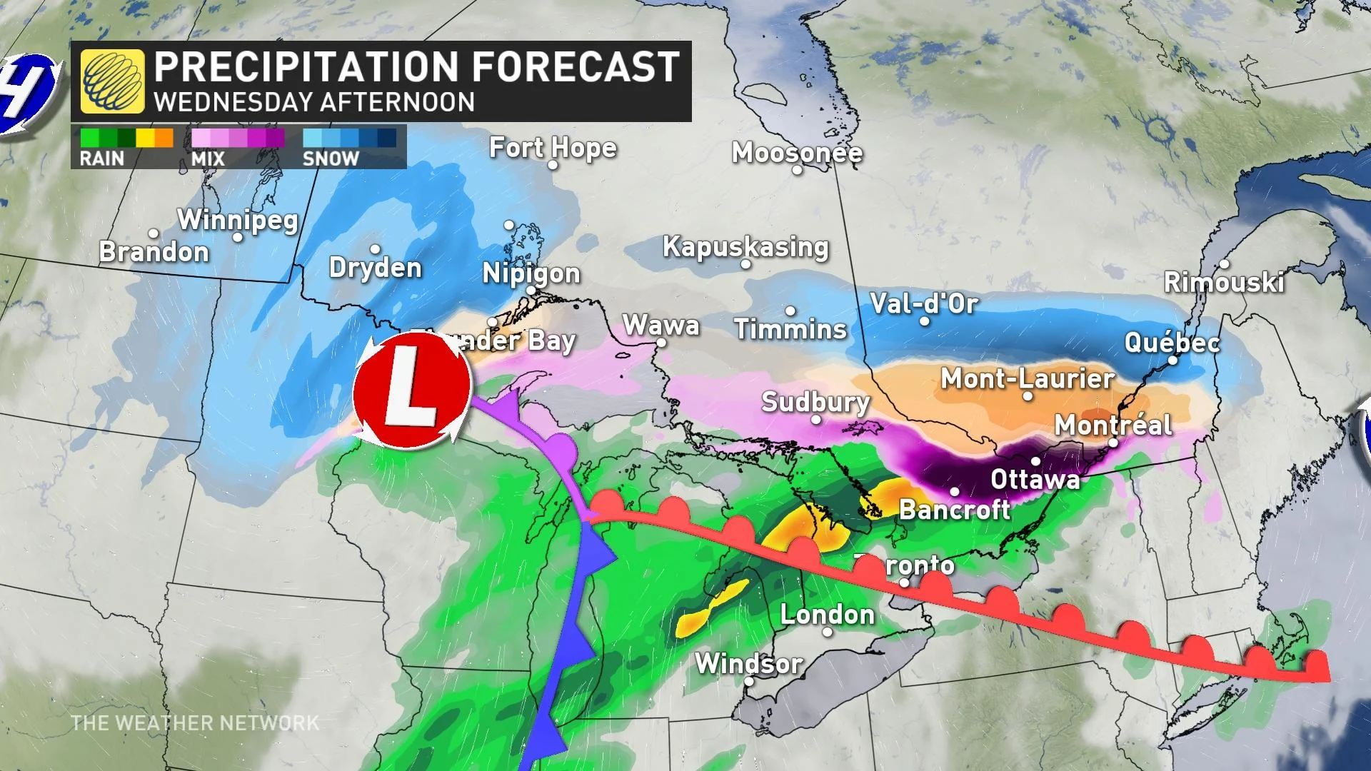
The powerful and far-reaching Colorado low will spread a significant swath of spring snow and whipping winds across parts of southern Manitoba and northern Ontario, with an ice storm and freezing rain threat spanning into much of eastern Ontario and southern Quebec.
RELATED: Canada, who ordered 20 degrees and a blizzard this week?
Snow and winds cause problematic travel
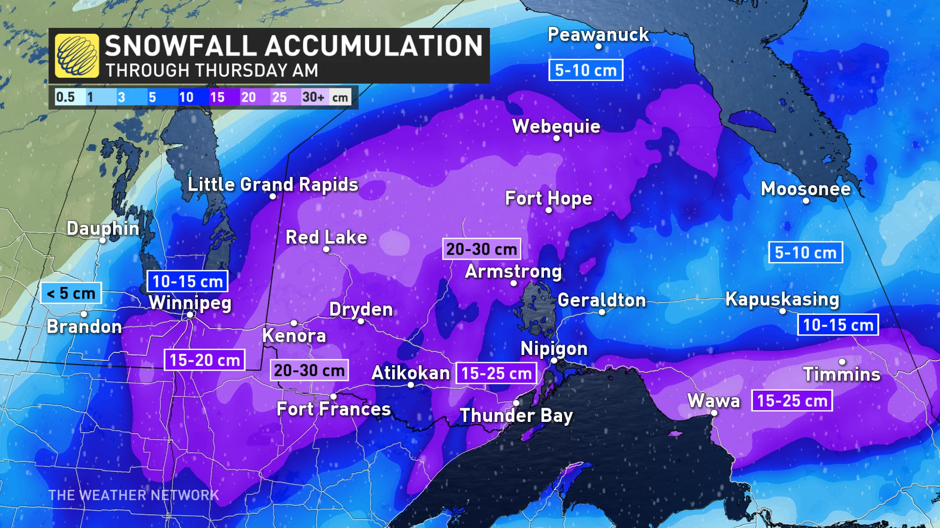
The moisture-laden storm running into cold air parked over northern Ontario is a recipe for snow, and plenty of it.
Snow will continue to spread across the region through Thursday.
The heaviest snow may linger over the same communities for hours at a time, bringing the potential for 15-30 cm in many locales in Manitoba and northern Ontario.
The precipitation will transition over to a wintry-mix near Lake Superior.
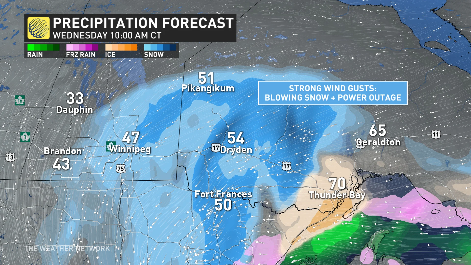
Strong winds will lead to reduced visibility for some through this event, especially in southern Manitoba, where a winter storm warning is in effect. Drivers are urged to avoid non-essential travel if possible since commuting will be dangerous.
"Consider postponing non-essential travel until conditions improve," says Environment and Climate Change Canada (ECCC) in the warning. "Public Safety Canada encourages everyone to make an emergency plan and get an emergency kit with drinking water, food, medicine, a first-aid kit and a flashlight."
Large swaths of Highway 11 and Highway 17 between Winnipeg and Thunder Bay will be extremely tough to navigate for a time during the storm. Prepare for localized road closures.
CANADA’S APRIL OUTLOOK: Will spring’s sluggish start continue this month?
Ice accretion could cause power outages
From Sault Ste. Marie to Huntsville, across to Bancroft and Brockville, the threat for freezing rain sets up. Snowfall will be north of that band. The deteriorating conditions prompted several school bus cancellations across northeastern Ontario early Wednesday.
The band of freezing rain expands and pushes towards the Ottawa Valley as well, prompting a freezing rain warning there. The warning also covers much of southern Quebec for Wednesday, where some school closures were reported early in the day.
Between 5-15+ millimetres of ice accretion is likely, with power outages and tree damage of concern. Locally higher totals are possible. Freezing rain will transition over to rain by Wednesday evening.
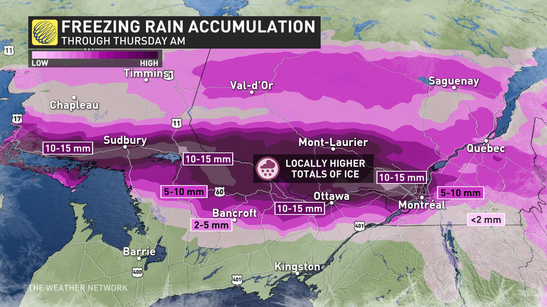
Ice accretion could make side roads dangerously slick, including the potential for isolated tree damage and power outages. The bulk of the heaviest rainfall won't freeze on contact because the precipitation rates will be so high.
Temperatures spike above freezing by Wednesday evening. Still, 10+ mm of ice accretion is likely in the worst-hit locations.
Conditions will gradually improve through the day on Thursday as the Colorado low pulls out of the region and a ridge of high pressure builds in.
WATCH: Incoming storm brings blizzards and thunderstorms to millions of Canadians
Stay tuned to The Weather Network for the latest forecast updates on the incoming snowstorm for southern Manitoba and Ontario.