Elevated risk for severe storms in southern Ontario as warmth builds

A potent Colorado low is set to rumble through southern Ontario, with early summer-like warmth and a severe thunderstorm threat for some.
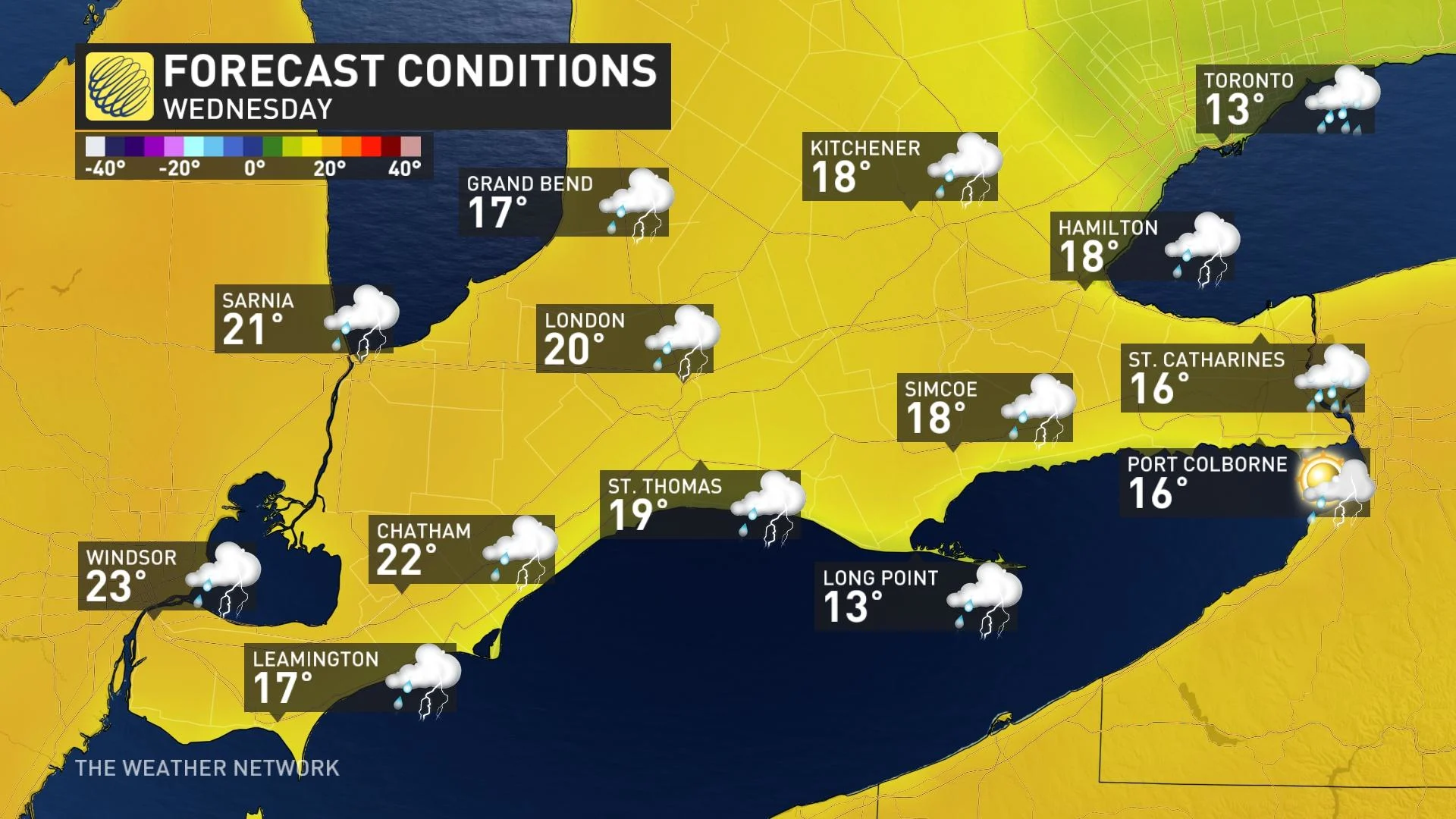
Southern Ontario will see the warmer side of spring Wednesday, while its neighbours to the east and west get a wintry dose.
A potent low will bring heavy rain, blustery wind gusts, much warmer temperatures and a threat for severe storms Wednesday. In some areas in the southwest, there's a good chance to reach Canada's first 20°C temperature in 2023.
DON'T MISS: Snowstorm to pack a wintry wallop in Manitoba, Ontario and Quebec
Heavier rain spreads Wednesday morning
This low-pressure system will strengthen in a hurry after reaching the Great Lakes region Tuesday evening, bringing some rain across the shores of Lake Huron and Georgian Bay. This is going to be quite a potent system, bringing heavy moisture into central and southern Ontario.
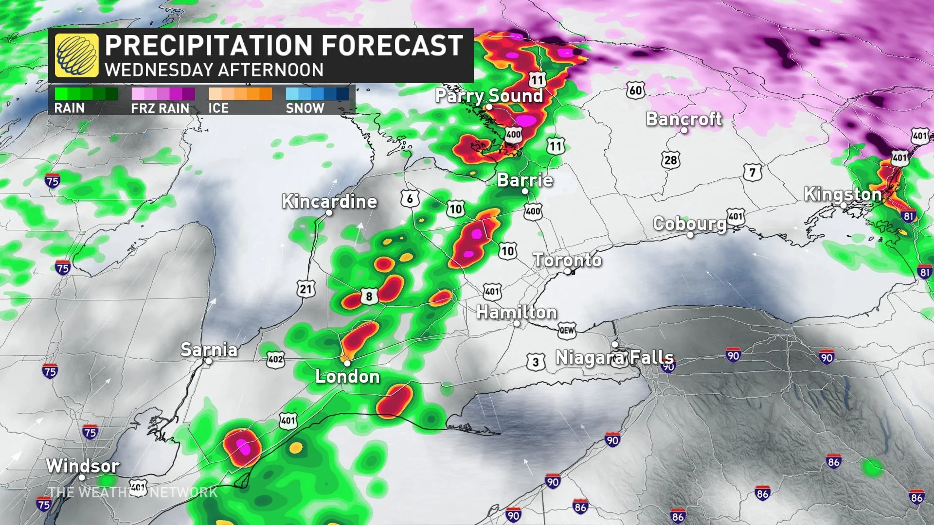
By Wednesday morning, heavier rain will push into the Greater Toronto Area (GTA), with precipitation continuing for Owen Sound and parts of cottage country.
Temperature-wise, a strong warm front associated with this Colorado low will be ushering in blustery, southerly winds above the escarpment.
Some areas across extreme southwest Ontario could hit 20°C or higher on Wednesday afternoon, with Windsor having the best chance of garnering the country's first reading at that mark this year.
Severe thunderstorm threat Wednesday afternoon
But there is a price to the warmth.
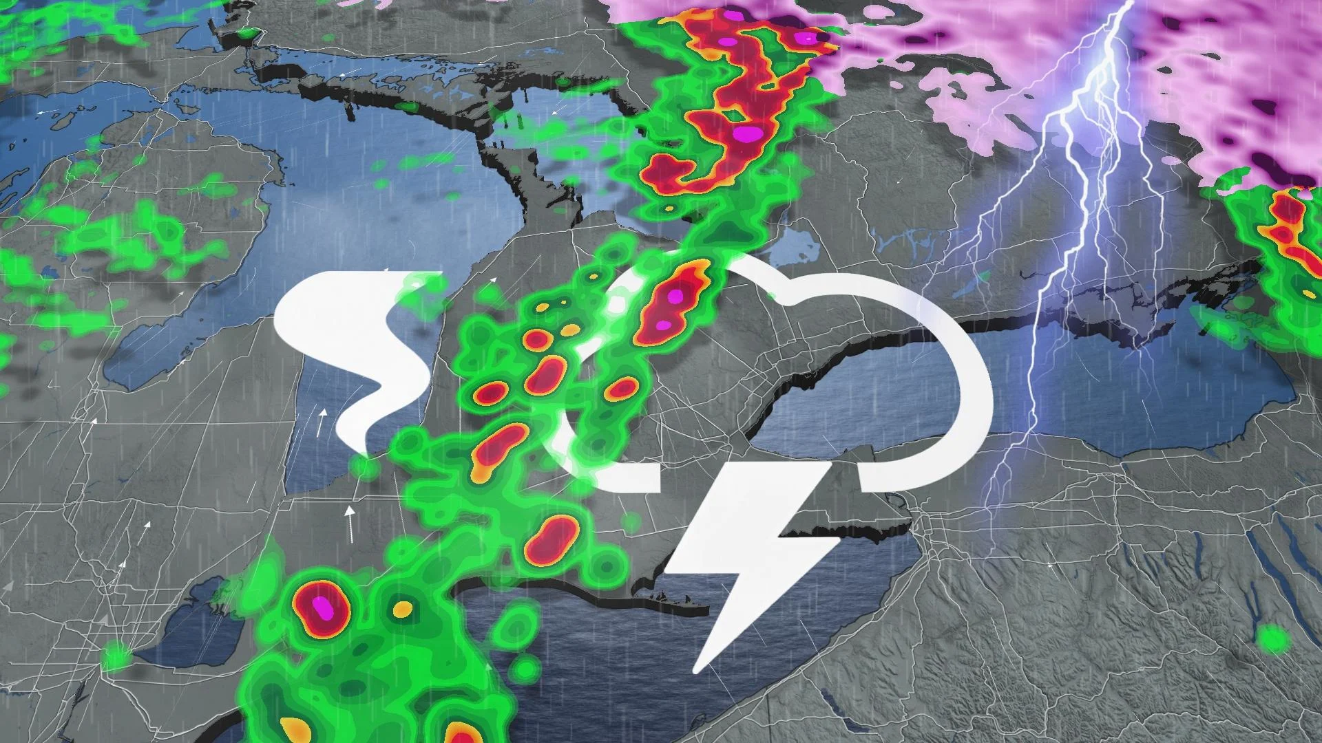
The moist air will provide the instability needed to fuel a thunderstorm risk across southern Ontario. This risk extends into Wednesday afternoon as instability peaks and the strongest lift arrives to spark the storms.
While the thunderstorm risk will extend from northeastern Ontario, through cottage country and to the southwest, the more severe storms are likely to be from the west end of the GTA to Niagara, and down to Windsor and Sarnia Wednesday afternoon and evening.
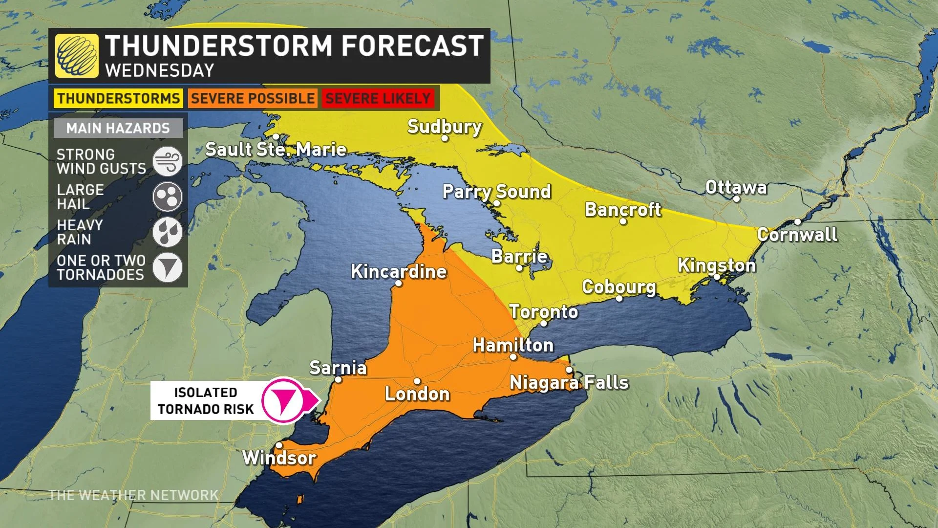
Gusty winds, heavy rain and hail are the main threats with thunderstorms that develop.
There is an isolated tornado risk in extreme southwestern Ontario. Storms east of Lake Huron could still become severe, but we're mainly looking at hail and wind gusts as the main hazards with those cells.
The greater risk for tornado development will be in Michigan, where the parameters are more favourable and there is less of a cooling influence from the Great Lakes.
CANADA’S APRIL OUTLOOK: Will spring’s sluggish start continue this month?
Warmup for GTA Wednesday evening, storm risk remains
Throughout the afternoon, we will see some breaks in the precipitation, but not everyone will feel the warmth. A stubborn east wind will likely delay a temperature warmup across the GTA until later Wednesday evening.
By late Wednesday afternoon into the evening, there is a chance to see embedded thunderstorms with this rain.
Rainfall amounts will be heaviest near Lake Huron and Georgian Bay shores, as well as the eastern end of Lake Ontario, where 40-60 mm is possible. 30-50 mm is possible for areas just inland of Lake Huron and Georgian Bay, and parts of cottage country. Widespread totals of 10-30 mm are possible elsewhere, with higher amounts in thunderstorms.

The rainfall will add to the flood-hit areas in the southwest, particularly the Grand Bend watershed, which has a watch in effect still.
By Wednesday night, the rain clears out of the GTA and westward, but will continue through eastern Ontario before ending by Thursday morning. The widespread gusty winds will ease a bit Wednesday night, but becoming gusty again Thursday behind the system.
WATCH: A tornado risk for Ontario? We break down the possibilities
Stay tuned to The Weather Network for the latest forecast updates for southern Ontario.