Snow machine starts up in Ontario after remaining idle through January

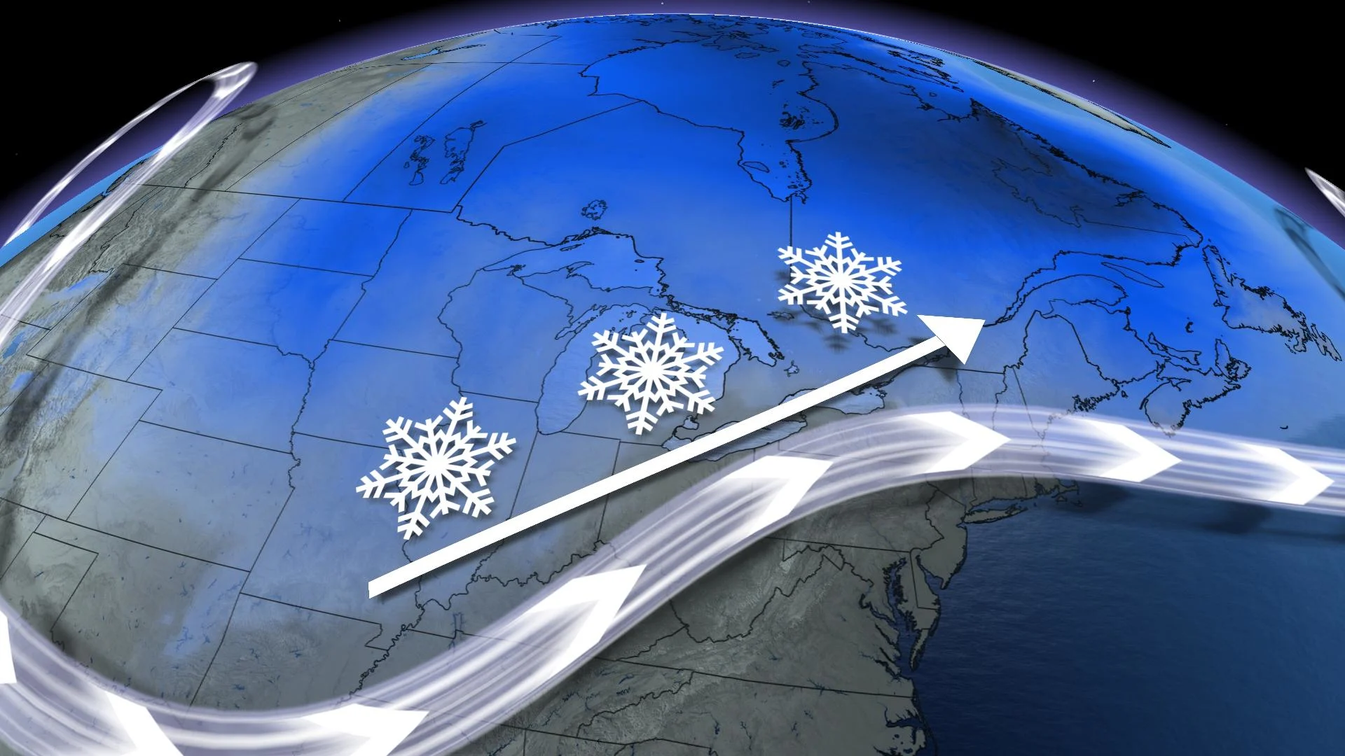
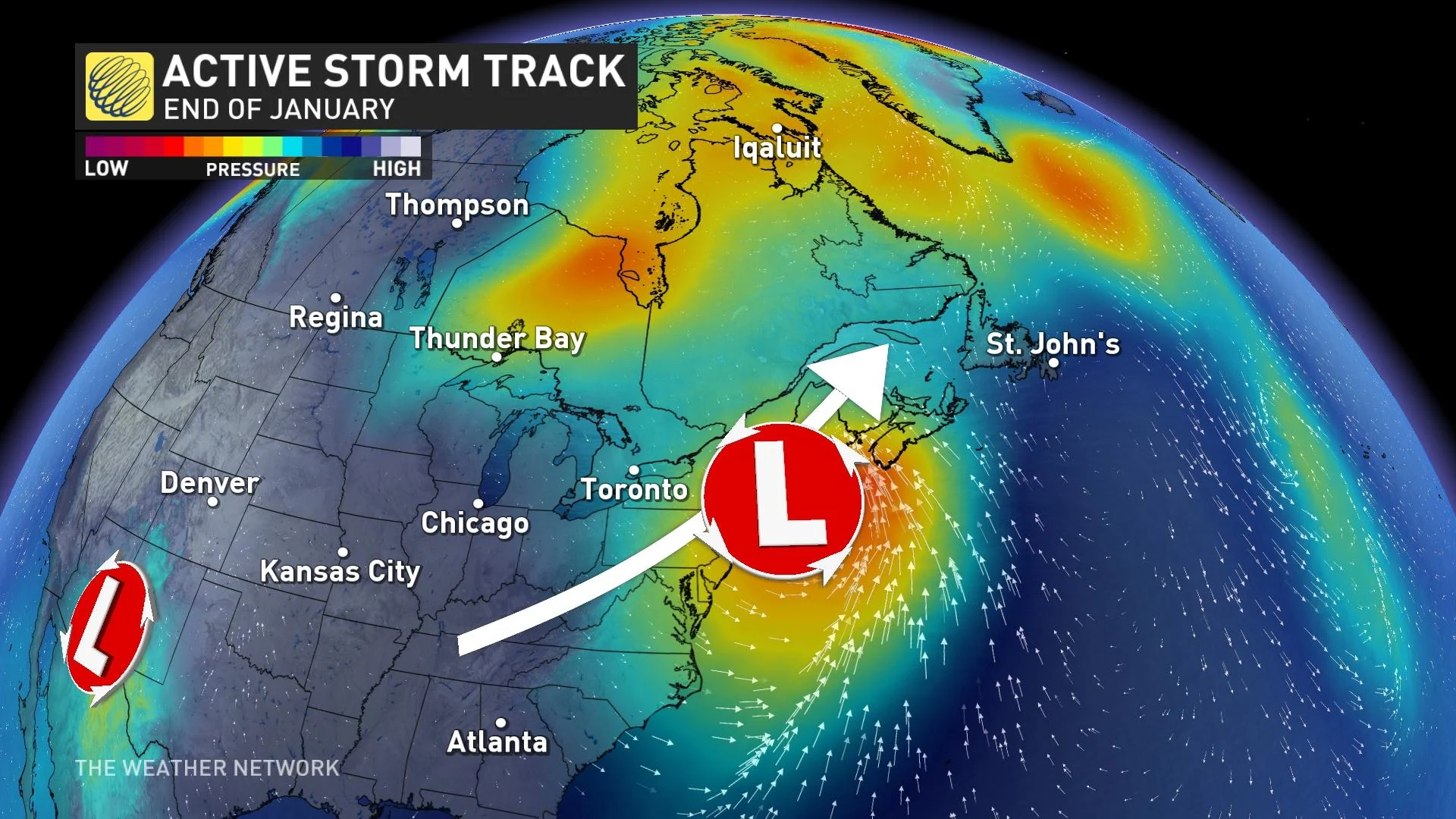
An active storm track along the jet stream is set to swing and park itself over or just south of the Great Lakes through the final days of January.
If you’ve checked your long-range weather recently, you’ve probably noticed multiple days of snow icons in your forecast – and no, that isn’t a mistake.
An active storm track along the jet stream is set to swing and park itself over or just south of the Great Lakes through the final days of January, bringing multiple systems and several chances for snow in southern Ontario through next week.
While the long-range forecast always comes with some level of uncertainty, here is a look at what we know so far when it comes to snow in southern Ontario. Further details will become available as the forecast becomes more clear.
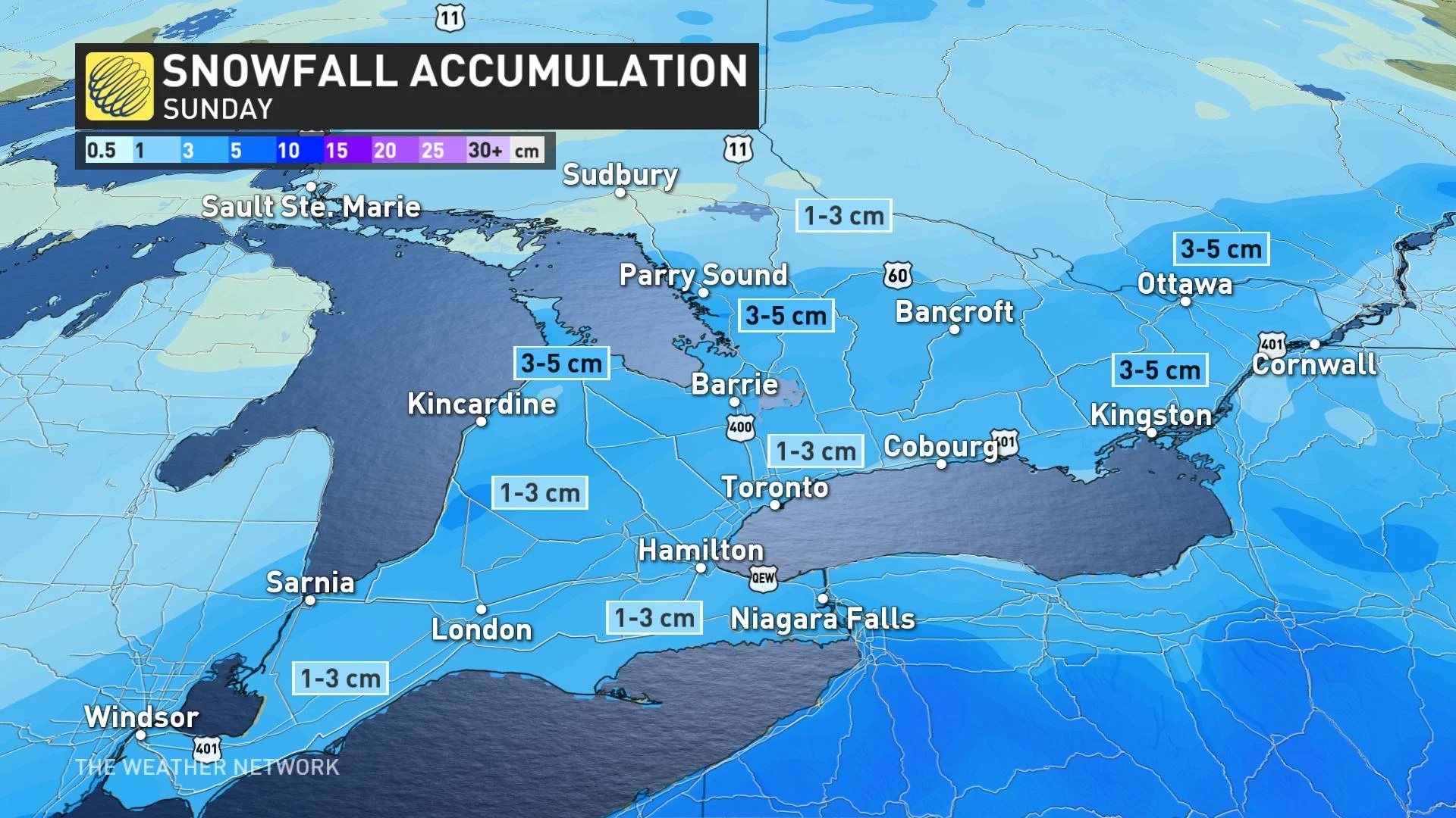
Sunday system scrapes south
The tail end of this weekend will feature a system that will track south of the region, but will likely only spread a few centimetres to a thin coating of snow across the area.
Mid-week Texas low
It’s next week when a moisture-laden storm will brew early in the week, starting in the U.S. Deep South that will continue its trek towards southern Ontario and Eastern Canada by mid-week.
Due to its origins, this system will usher in much more moisture with it, so we can assume snowfall totals will be much higher. The track of this system will need to be monitored due to the warmer air associated with it.
A farther north track could result in some of the snow transitioning to ice or even rain.
Possible weekend clipper
While fairly far out, long-range forecast models are all hinting at the likelihood of some western clippers that could slide across Ontario in the final weekend of January.
Snowfall totals are highly uncertain, but we do know clippers typically bring a quick burst of snow as they slip through an area, given their usual lack of moisture.
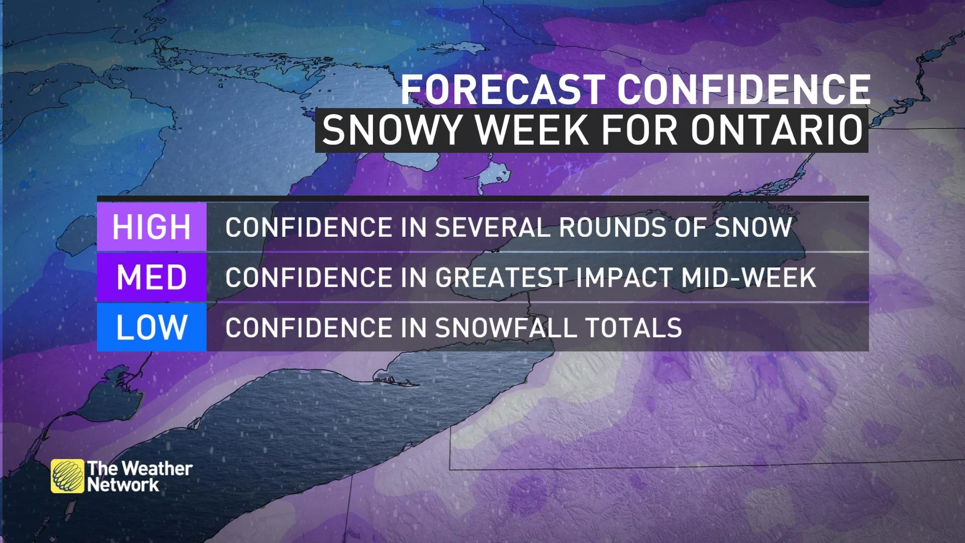
Due to the common uncertainty in long-range forecasts, these details are subject to change and only provide an early glance at what is possible ahead in the weather pattern.
We encourage you to check back in with the forecast if you have plans or travel commutes ahead next week.