Winter 'vacation' comes to an end with return of classic Canadian cold

Winter break is over, Canada! A major pattern change is set to develop, bringing a return to classic Canadian winter weather for Western and Central Canada for the end of January and into February
You are certainly not alone if you are starting to ask yourself, "was that it?" when it comes to the 2022-23 winter season across Canada. With a widespread lack of extreme cold throughout the country to start out 2023, many may be wondering if we've managed to escape the worst of the frigid temperatures.
Despite the milder start, we'll say this -- don't start packing away the parkas just yet. As Canadians we know, winter can have a lot more in the tank well into February, March, and even beyond.
RELATED: World’s coldest air in 2023 was just recorded, and it's on the move to Canada
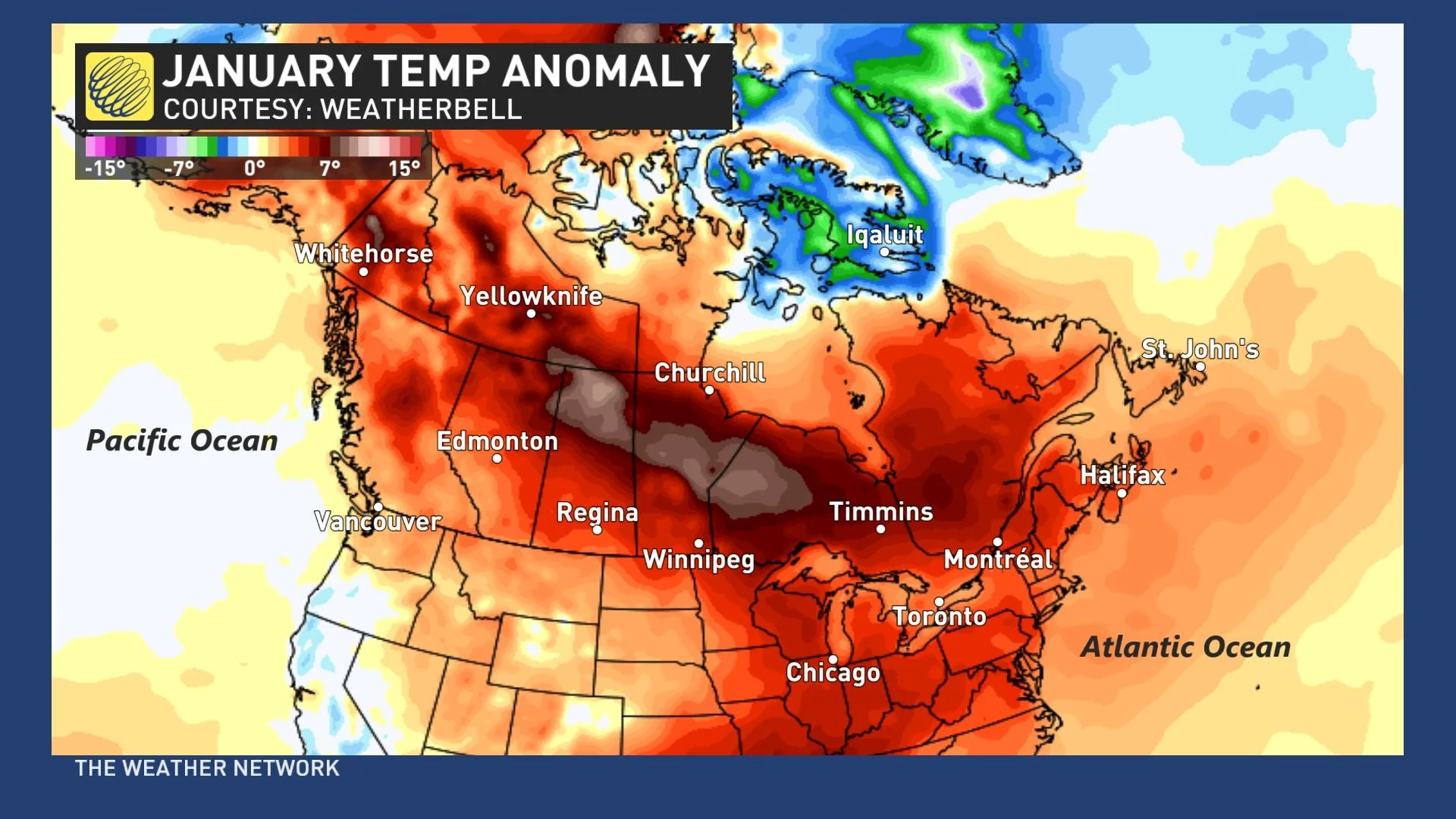
The final days of December and the first half of January featured widespread above seasonal temperatures, coast-to-coast. With the exception of Baffin Island and surrounding communities, the rest of the country experienced temperatures anywhere from a few degrees to nearly 10 degrees above seasonal.
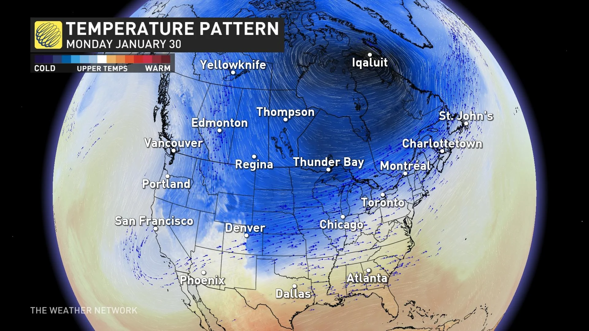
As we head towards the final week of January, cold air that has been locked in across the North and Siberia, due to a fairly zonal jet stream, will start to make its appearance on our side of the pole.
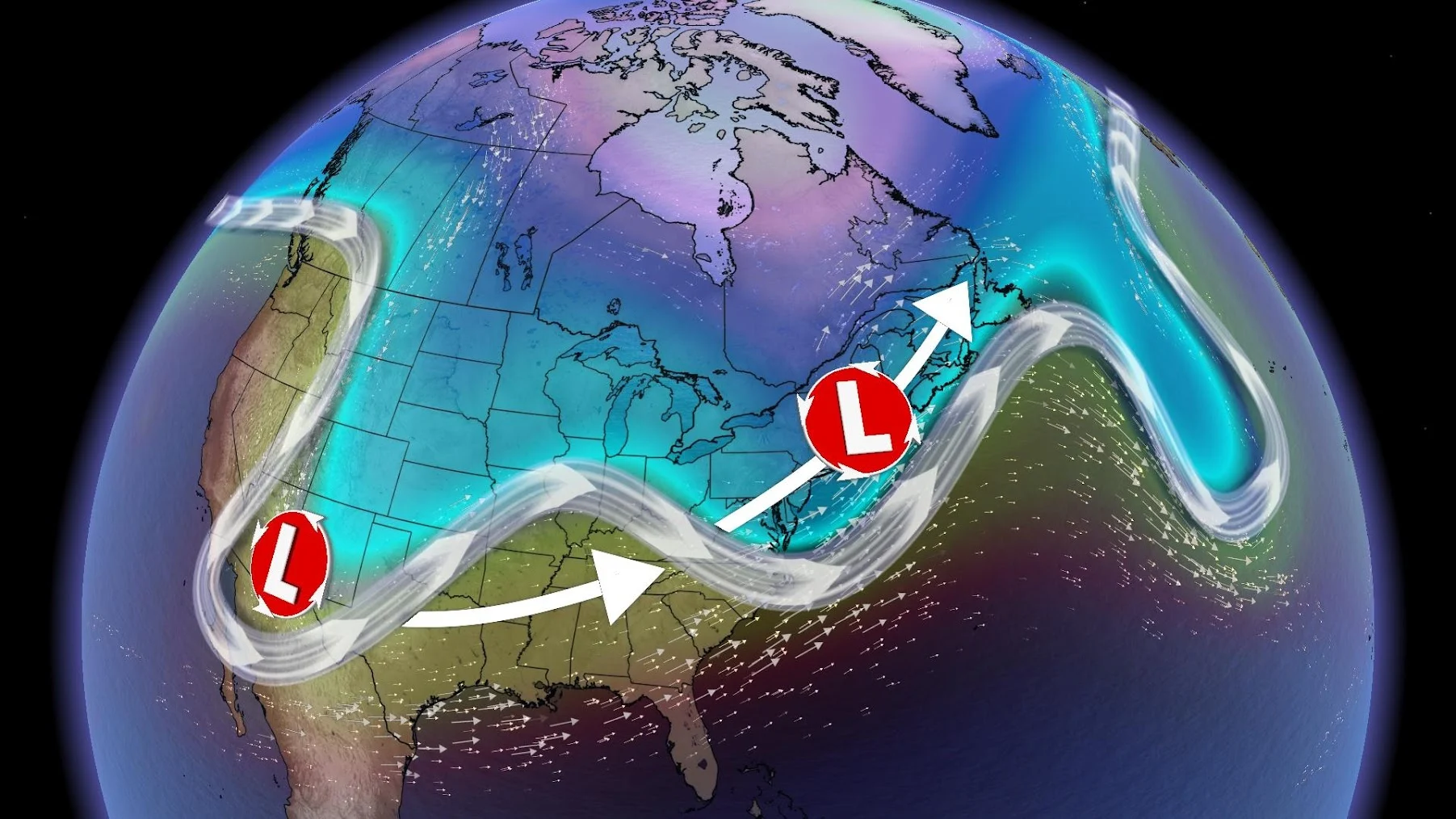
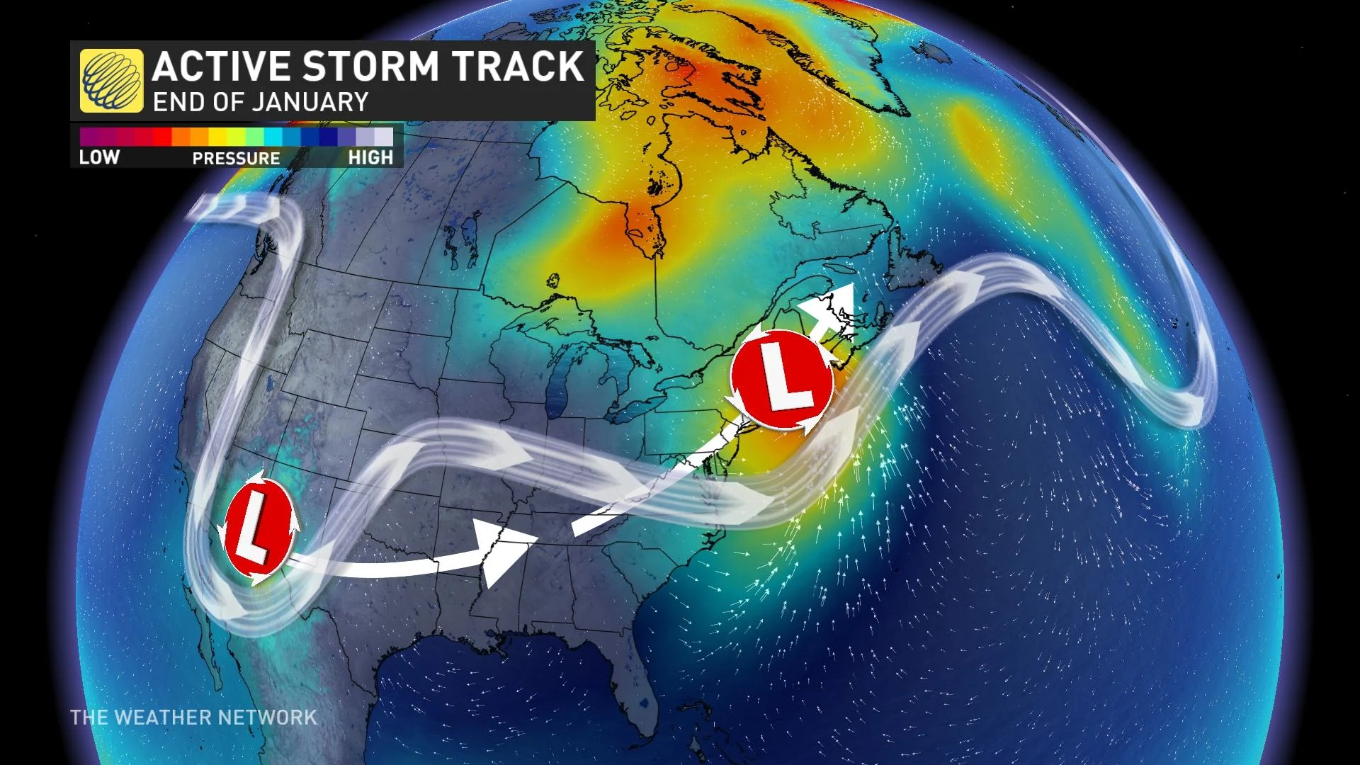
The jet stream will become more amplified, allowing the cold air to seep south. The ridges and dips in the jet stream will allow more low-pressure systems to start their trek across the continent, and also help to draw the colder air south into parts of the country.
The eastern half of the country for the final week of January is forecast to prove fairly stormy as a series of Texas and Gulf lows blossom and march north, spreading a messy mix of snow, ice and rain.
MUST SEE: Canada's halftime snowfall check-in, see how your city measures up
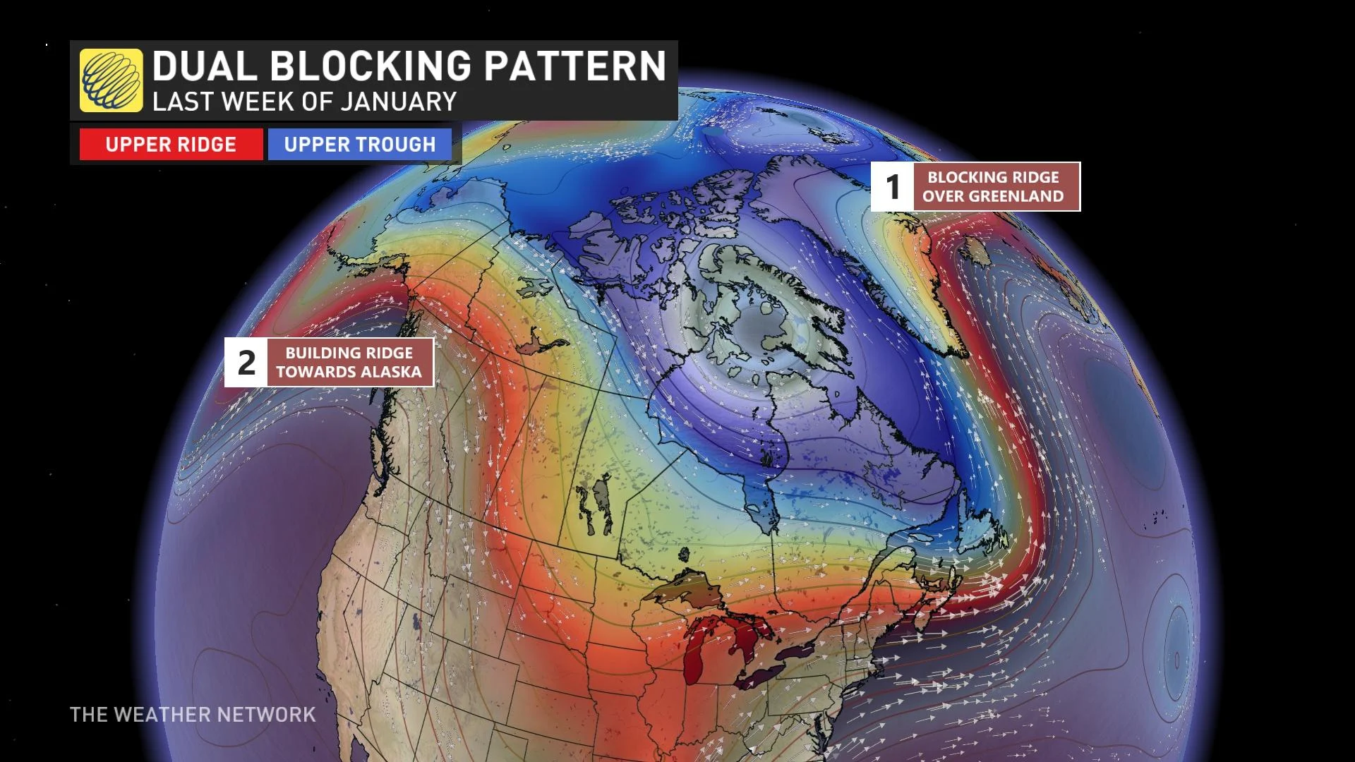
A dual blocking pattern will also assist in reinforcing and spreading the frigid cold across Canada and into some of the United States. A building ridge over Alaska and over Greenland will force the cold air south, allowing for -20°C and even -30°C temperatures to creep into the forecast across Central Canada.
Towards the start of February, while the east will still have the chance to see shots of cold air, the core of the cold air will likely settle in across the western half of the country.
A ridge over the U.S. southeast will allow milder temperatures from the subtropics to catch a ride north with storm systems as they make their way up the U.S. East Coast into Eastern Canada. This will prevent the east from locking into persistent cold, and experiencing a more back-and-forth type temperature pattern instead.
Stay tuned for what's ahead for February as we get set to release our national February outlook on Wednesday, February 1.