
Several snow chances eye Ontario and Quebec heading into next week

We’re looking at several chances for snow over the next couple of days for folks across portions of Ontario and Quebec.
Folks across Ontario and Quebec are enjoying a deserved calm weekend after the wild winds that buffeted Central Canada on Friday night. Scattered lake-effect snow will develop for some areas Saturday night into Sunday, serving as a preview of a much larger storm arriving for the two provinces on Monday and Tuesday. More on what to expect in the days to come, below.
DON'T MISS: A recurving typhoon brings chilly air, storm threat to Central Canada next week
SATURDAY NIGHT AND SUNDAY: SOME LAKE-EFFECT SNOW POSSIBLE
Saturday saw some much-needed calm across parts of Ontario and Quebec after the wicked winds that swept over Central Canada on Friday.
Hundreds of thousands of customers between the two provinces lost power during the strong winds, which gusted well above 100 km/h in spots on Friday evening.
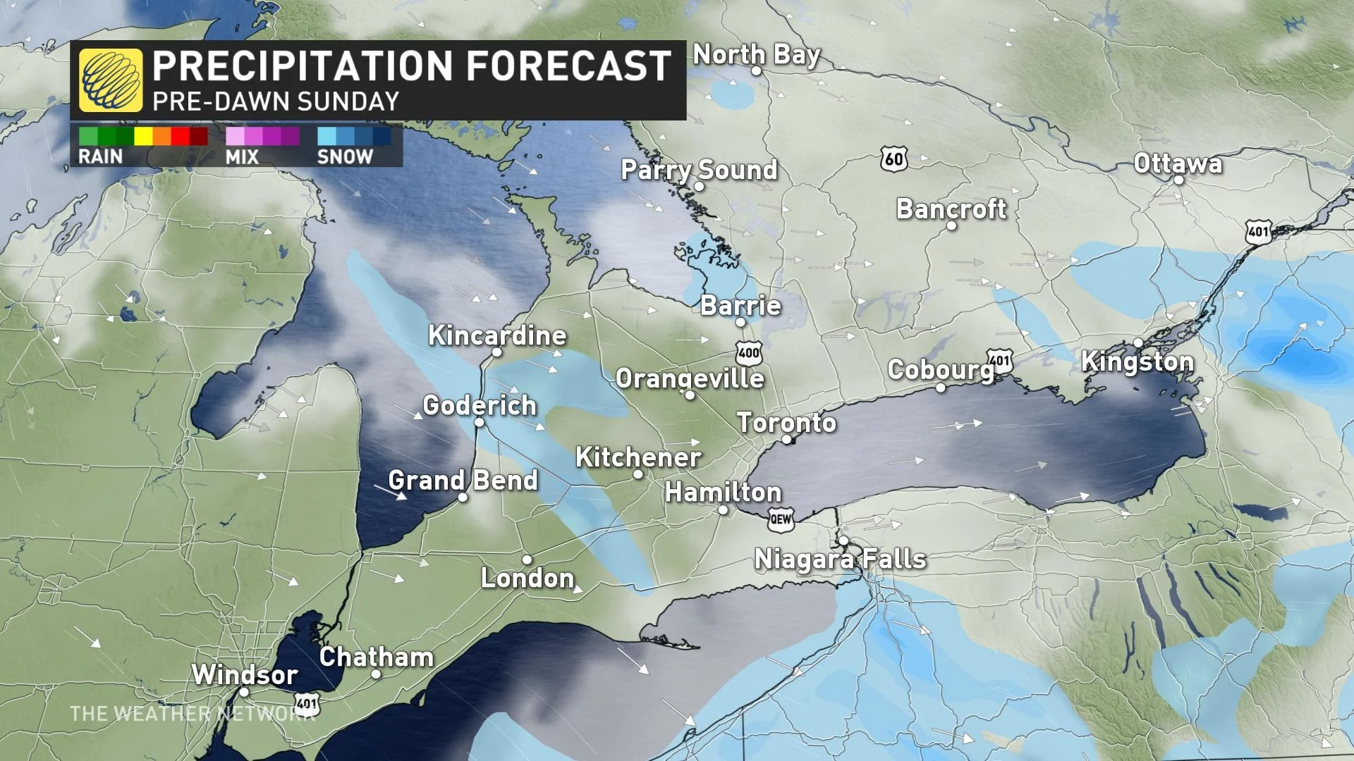
We’ll see some unsettled weather across southern Ontario on Saturday evening, however, as cool northwesterly winds blow over Lake Huron, Georgian Bay, and eastern Lake Ontario. Bands of light snow could develop across their respective shores, potentially lingering into Sunday morning.
Temperatures will remain cool as northerly winds spil across the region, with single-digit high temperatures expected again on Sunday.
MONDAY INTO TUESDAY: SPRAWLING STORM APPROACHES EASTERN CANADA
We don’t have to wait long for the next potentially impactful system to approach Ontario and Quebec.
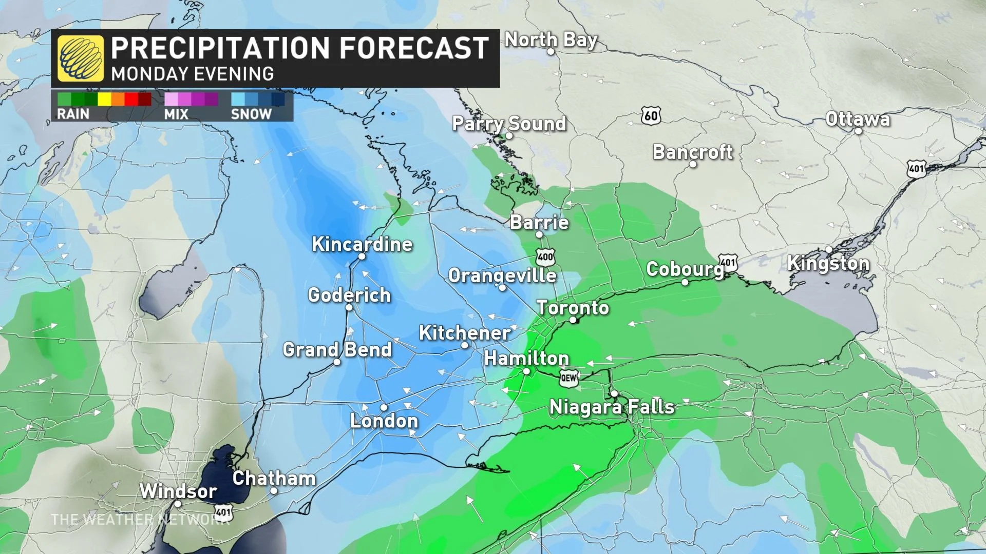
This far-reaching, moisture-rich system will approach Ontario and Quebec from the south beginning Monday and lasting into Tuesday. While it’s still too early for specifics, forecasters can see two scenarios playing out, one of which could bring significant snowfall to eastern Ontario and southern Quebec.
The snowier scenario would see cold air trapped at the surface across eastern Ontario and southern Quebec, forcing much of the precipitation to fall as snow.
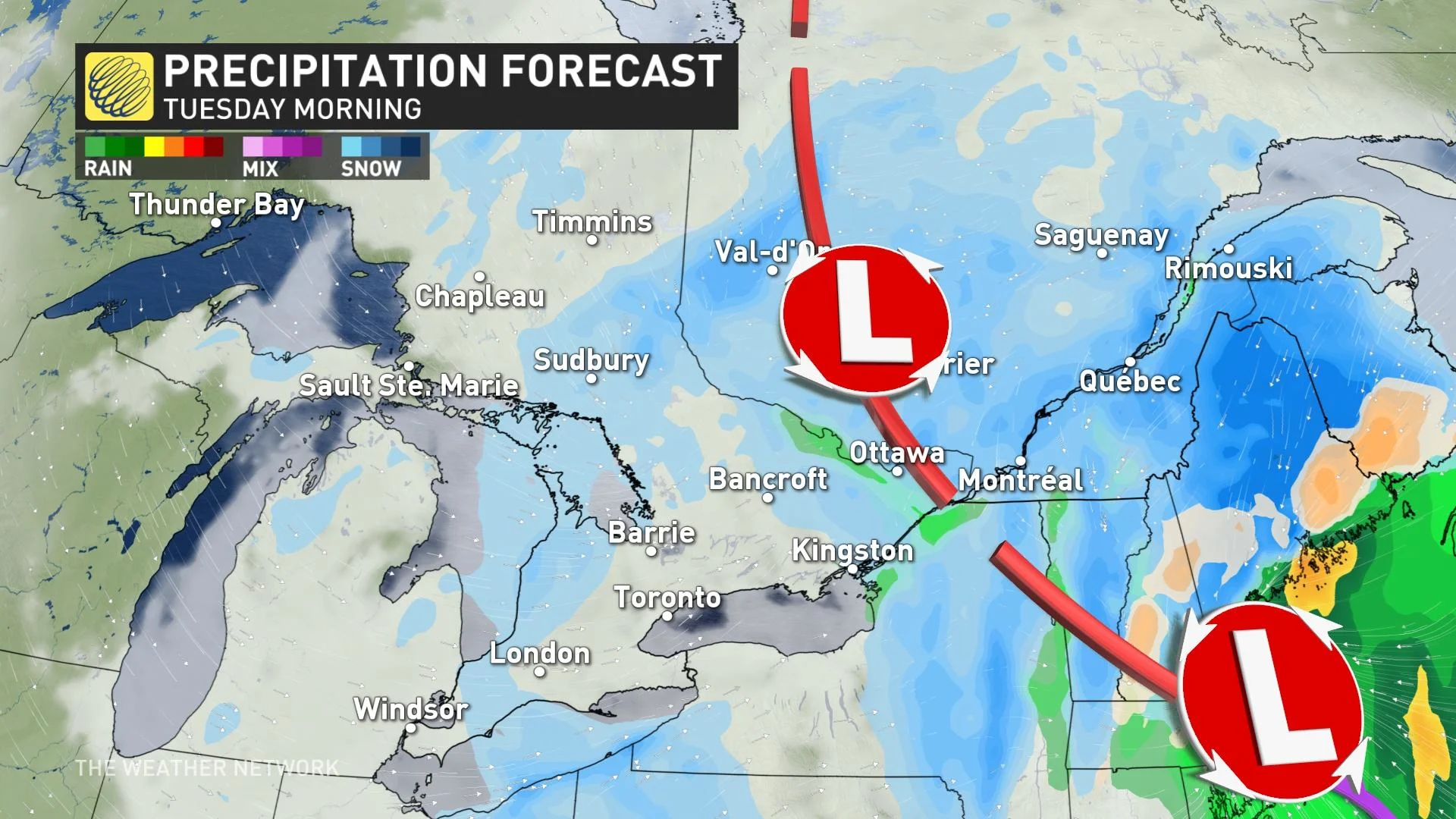
A warmer scenario is also possible, which would make this a mostly rain event for the National Capital Region and Montreal, shunting the snow farther up the St. Lawrence.
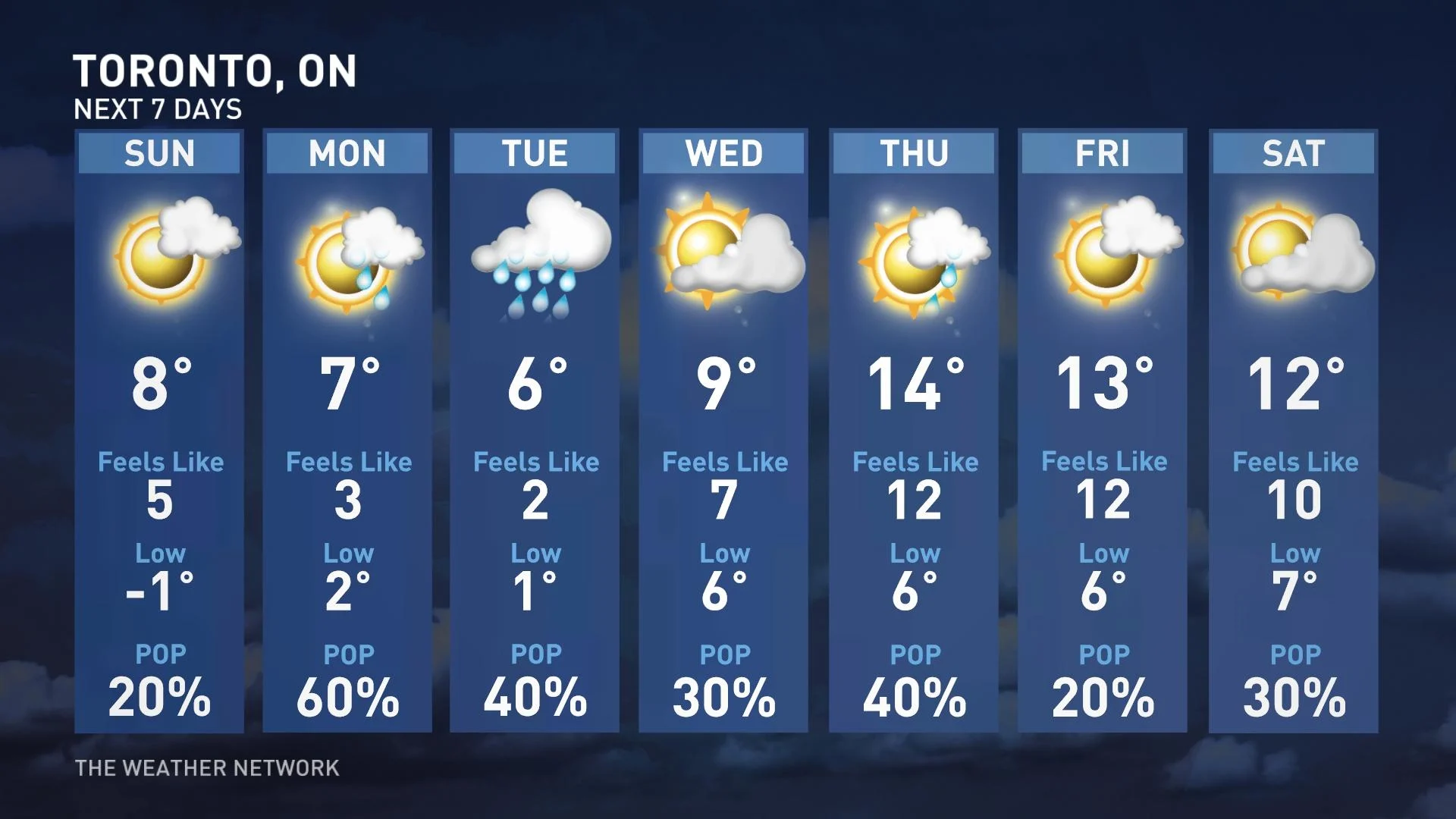
Looking ahead, another system could affect the region Wednesday night into Thursday before temperatures moderate toward the end of the week.
Watching the potential for a few days of warmer weather during the final few days of April, but a cooler pattern is expected for early May as a blocking pattern is expected to rebuild.
Stay tuned to The Weather Network for the latest forecast updates across Central Canada.