
Severe thunderstorm risk intensifies on the Prairies on Friday

Stay alert for rapidly changing weather conditions across portions of the Prairies expecting severe thunderstorms Friday
A hot, muggy, and active pattern across the Prairies will continue fuelling a multi-day risk for severe thunderstorms heading into Friday.
Friday’s storm potential will build over portions of Alberta and Saskatchewan with a risk for large hail, downpours, and strong wind gusts.
Stay aware of severe weather watches and warnings in your area, and have a plan in place to seek safe shelter if threatening conditions approach your location.
Alberta's 2026 Summer Forecast: Strong start, but with some concerns
Severe thunderstorm risk on the Prairies on Friday
A significant heat wave continues on the Prairies to end the week. Val Marie, Sask., saw the country’s hottest temperature on Tuesday with a reading of 36.3°C.
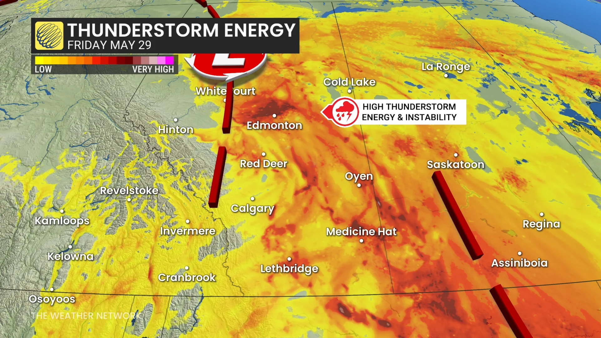
The upper-level ridge of high pressure responsible for this summer-like heat will help to organize Friday’s severe thunderstorm risk across portions of the region.
Forecasters are watching two areas of concern.
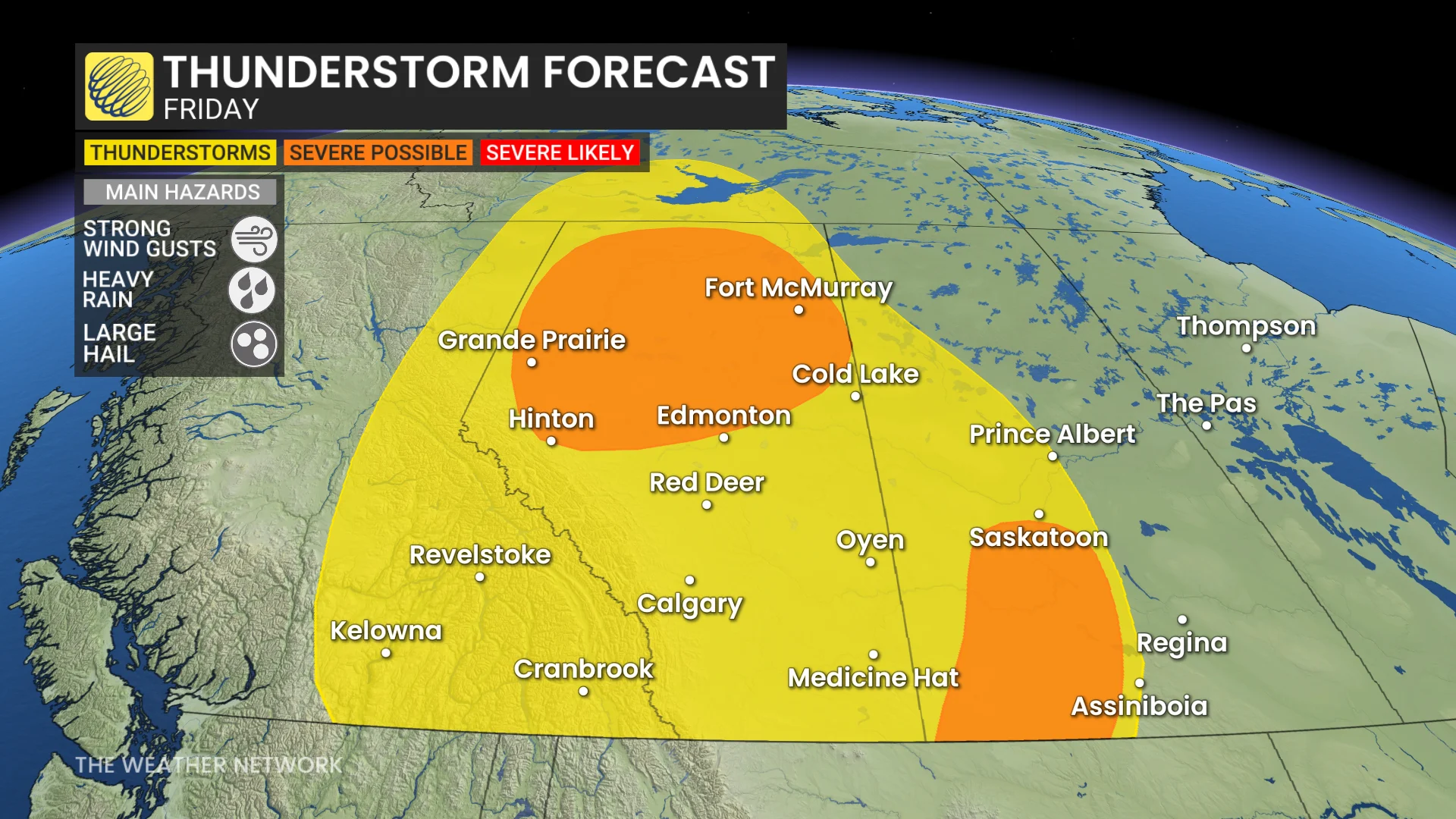
The first is across the northern half of Alberta during the afternoon and evening hours, when conditions will be very favourable for the development of severe thunderstorms. The greatest risk from these storms will be large hail, as well as strong wind gusts and heavy rainfall.
Southwestern Saskatchewan could also see the risk for severe thunderstorms on Friday afternoon. These storms could produce potent wind gusts, large hailstones, and downpours. Activity here will increase by the evening and overnight hours as a low-pressure system approaches the region.
A month’s worth of rain possible
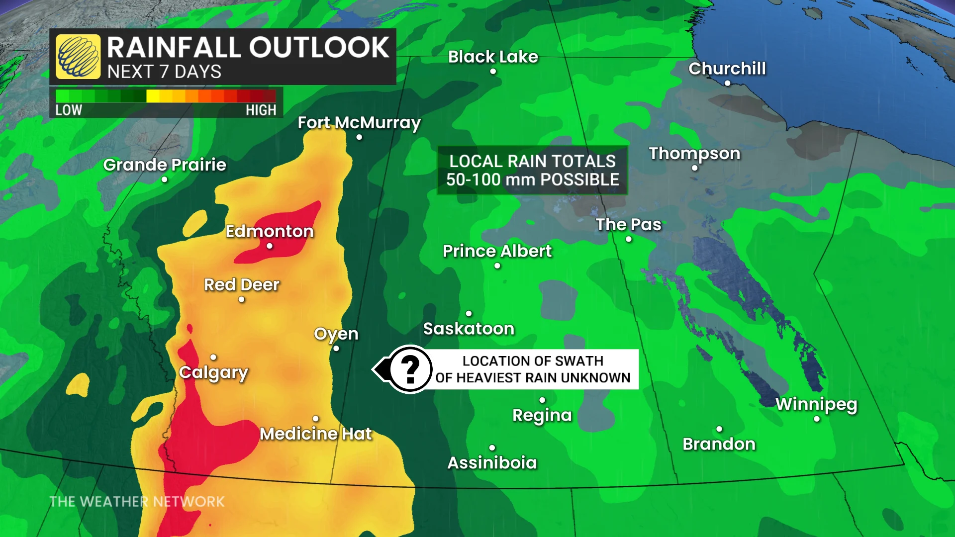
A wet pattern is expected through the weekend and into early next week as a trough starts to move into the western Prairies. This will push the warmest conditions off toward the eastern Prairies while western sections remain unsettled.
SEE ALSO: What's the wettest time of year in your corner of Canada?
Confidence is high that parts of the western Prairies will see significant rainfall totals. While there’s some uncertainty in the precise locations, rainfall between Sunday and Tuesday could produce accumulations of 50+ mm, with some model guidance showing as much as 75-100 mm.
That’s a significant total for this time of year. Depending on where the heaviest rain sets up, some areas could see a month’s worth of rain in just a couple of days. For context, Edmonton averages 75 mm of rain in June, while Calgary averages around 113 mm.