End of stifling Prairie heat in sight while stormy rains continue

The intense heat and humidity on the Prairies is coming to a soggy end in the days ahead.
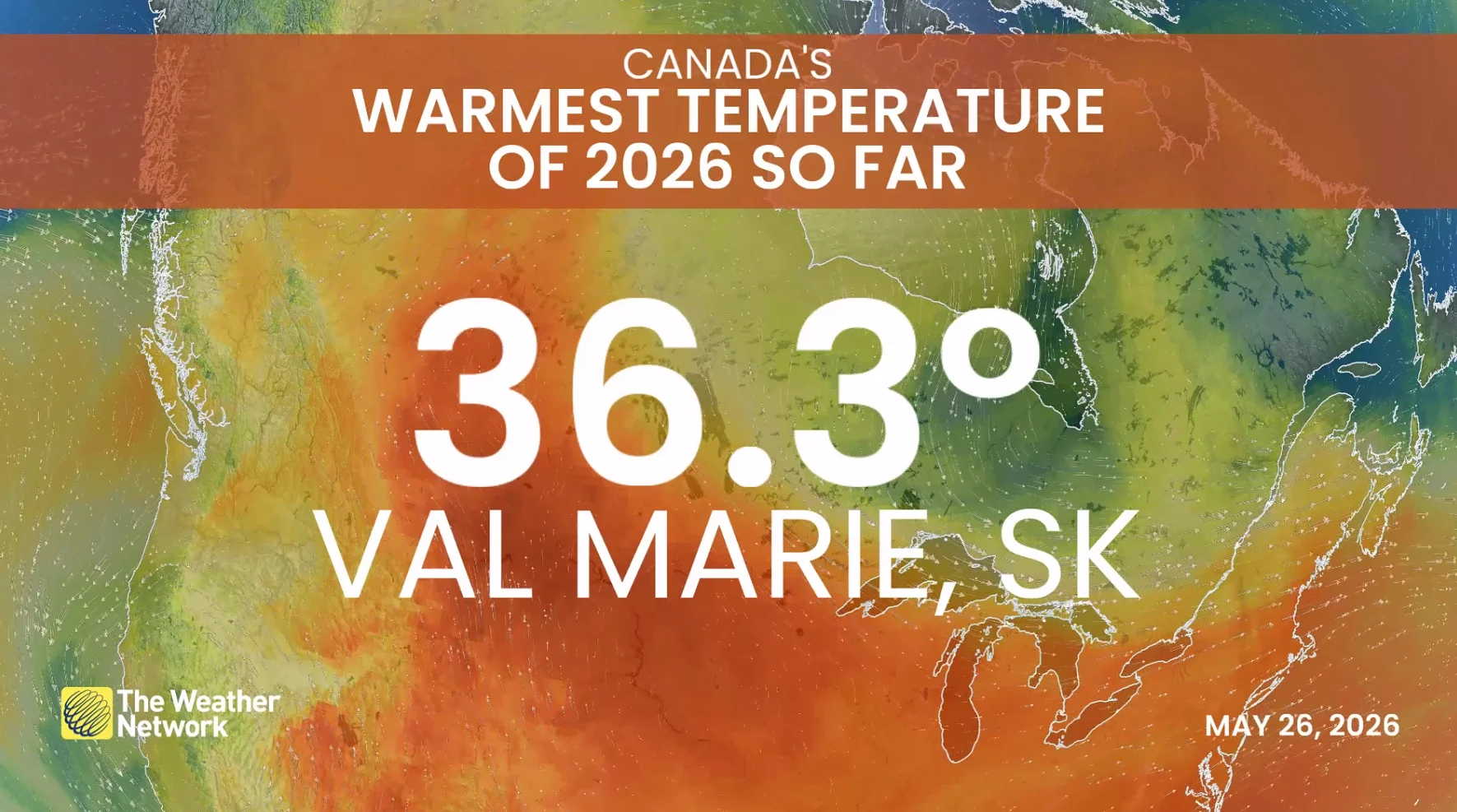
A heat wave over the Prairies, thanks to an upper ridge of high pressure parked over the provinces, has brought widespread temperatures into the low 30s. In fact, Val Marie, Sask., now holds the honours of the hottest place in Canada so far this year after temperatures reached a stifling 36.3°C on Tuesday! Even though Lytton, B.C., has now been dethroned, it could be only a matter of days before we see another community set a new heat record for the year.
DON'T MISS: Visit our complete guide to Summer 2026 for an in depth look at the Summer Forecast, tips to plan for it and much more!
In addition to the intense heat, folks across Alberta have had to contend with thunderstorms developing along the edge of the high pressure ridge--known as 'ring of fire' storms.
By this point, folks are probably wondering, will this pattern ever end? The good news is that we are in the home stretch to see the heat finally break, but it will come at a soggy cost.
When will the heat wave end?
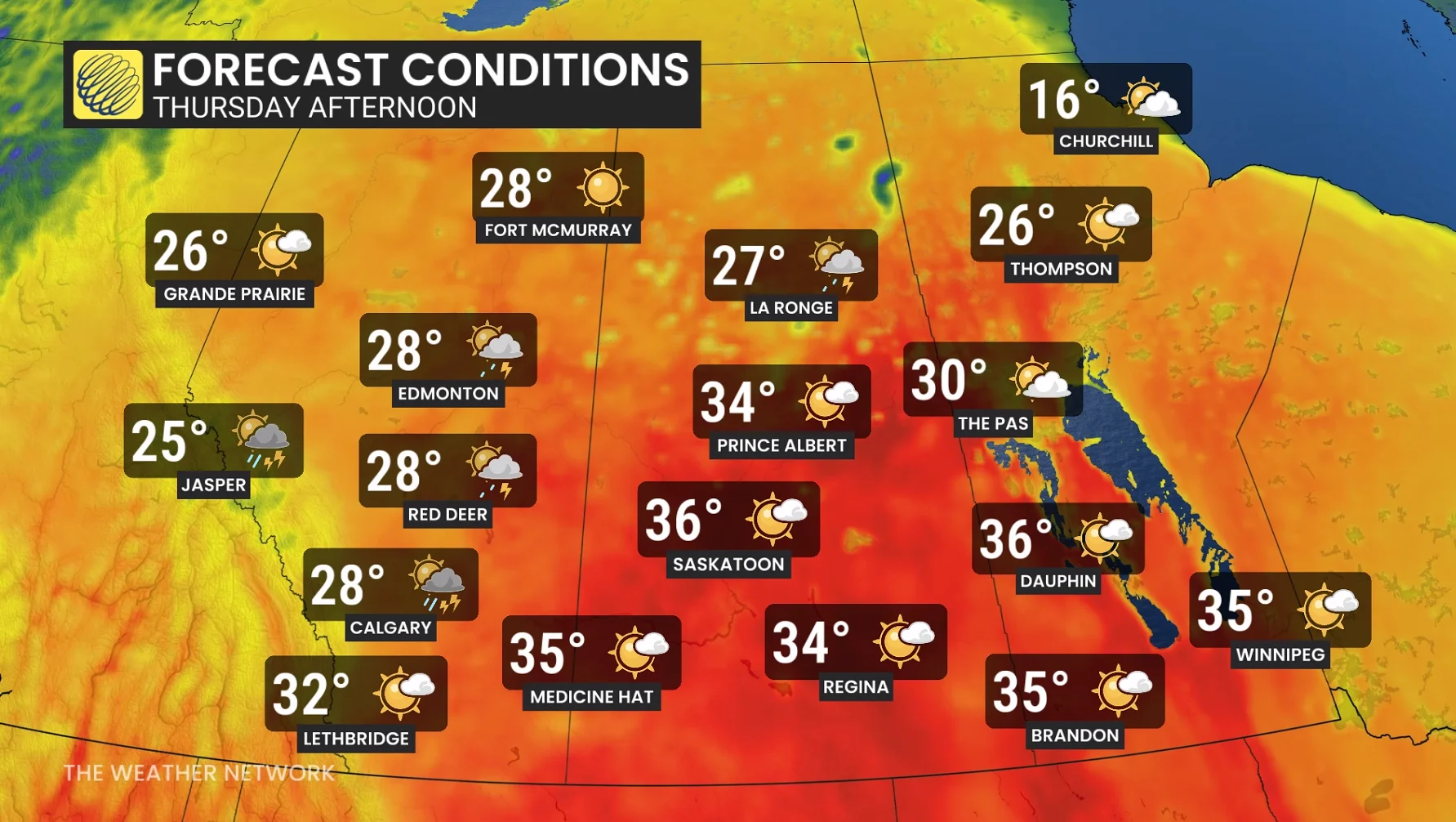
The heat and humidity will continue through the rest of the week across the Prairies, with Thursday looking to be another day when we could see a new hot spot be crowned.
The upper-level ridge, however, will begin to shift eastward into Manitoba by the weekend. This will help to relieve Alberta of the heat, with Saskatchewan following suit early next week as the ridge continues to shift.
Manitoba will likely continue to feel the hot temperatures into the middle of next week, until an upper-level low over the West Coast pushes east and gives the heat the boot.
Heat breaks, but stormy weather moves in
The multi-day 'ring of fire' storm setup will continue across Alberta and parts of western Saskatchewan through the end of the week.
Unfortunately, even as the ridge shifts east, folks won't have much time to dry out as a wetter pattern moves in for the weekend and into early next week.
SEE ALSO: Understanding wildfires can help protect you and your home
A low-pressure trough will push into the western Prairies, bringing significant rainfall totals between Sunday and Tuesday. A steady stream of atmospheric moisture from the south will move northward onto the Prairies, delivering over 50 mm of rainfall in the three-day period. Some folks could even see 75-100 mm of locally heavy rains.
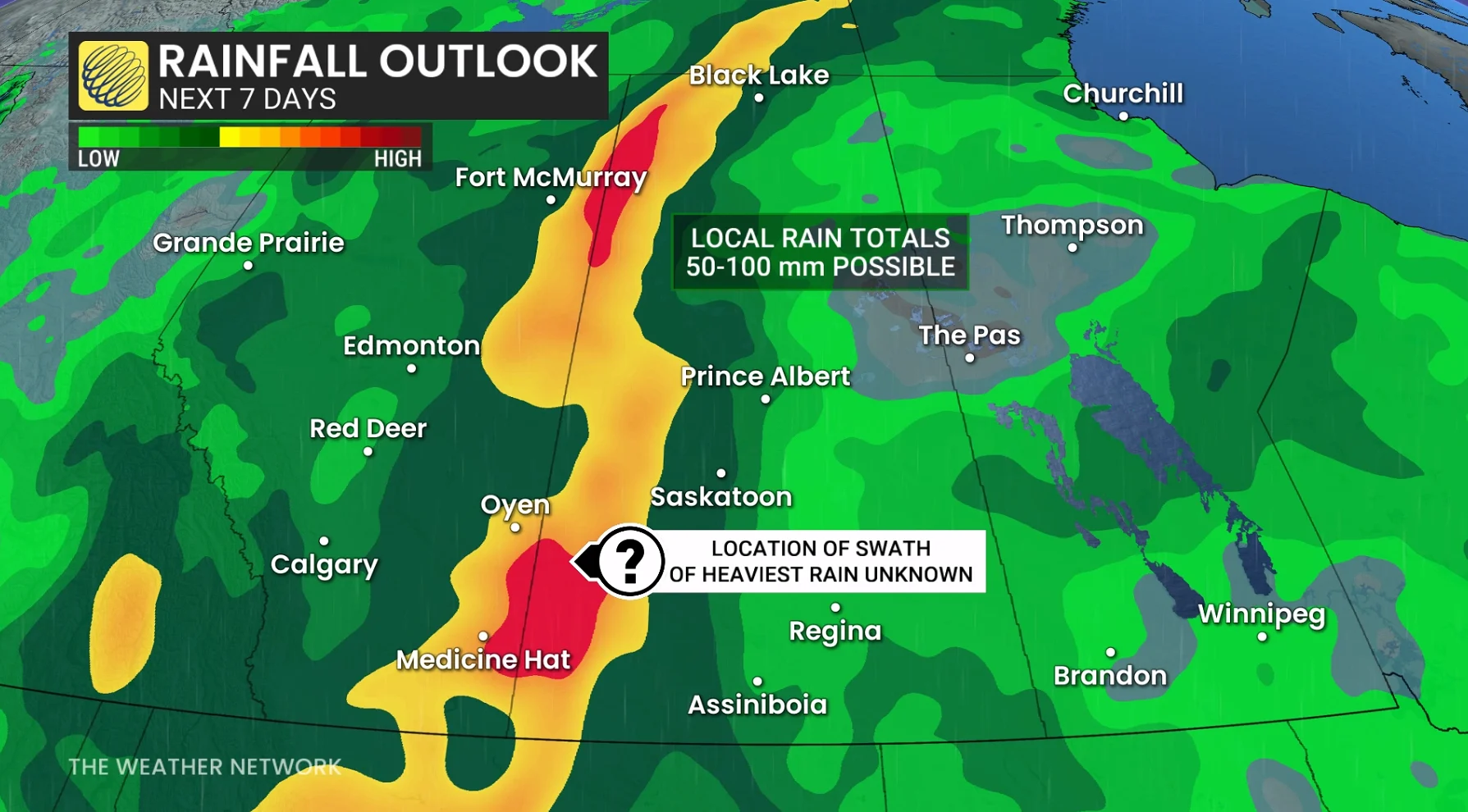
The silver lining is that areas seeing the most rain and overcast conditions will also see temperatures temporarily dip below seasonal, which may be a welcome break after the heat wave. The soaking rains will also be great for forested and agricultural regions, especially as we continue to head deeper into wildfire season.
Stay with The Weather Network for more information and updates on your weather across the Prairies.