Prairies brace for severe storms before soaking rain threat ramps up

Damaging winds, hail and torrential downpours may lead to days of heavy rain in parts of Alberta and Saskatchewan
After rounds of severe thunderstorms sweep across the Prairies to end the workweek, attention will quickly shift to an even bigger concern looming for next week: widespread soaking rain with the potential for localized flooding.
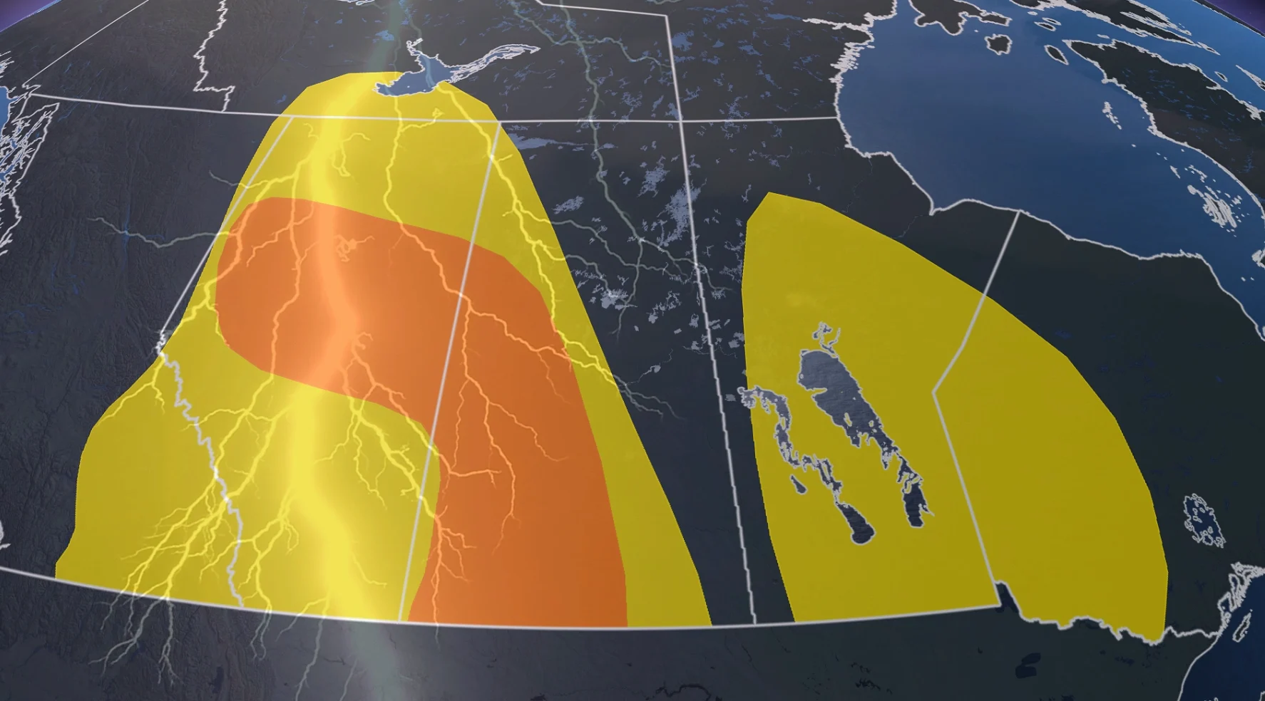
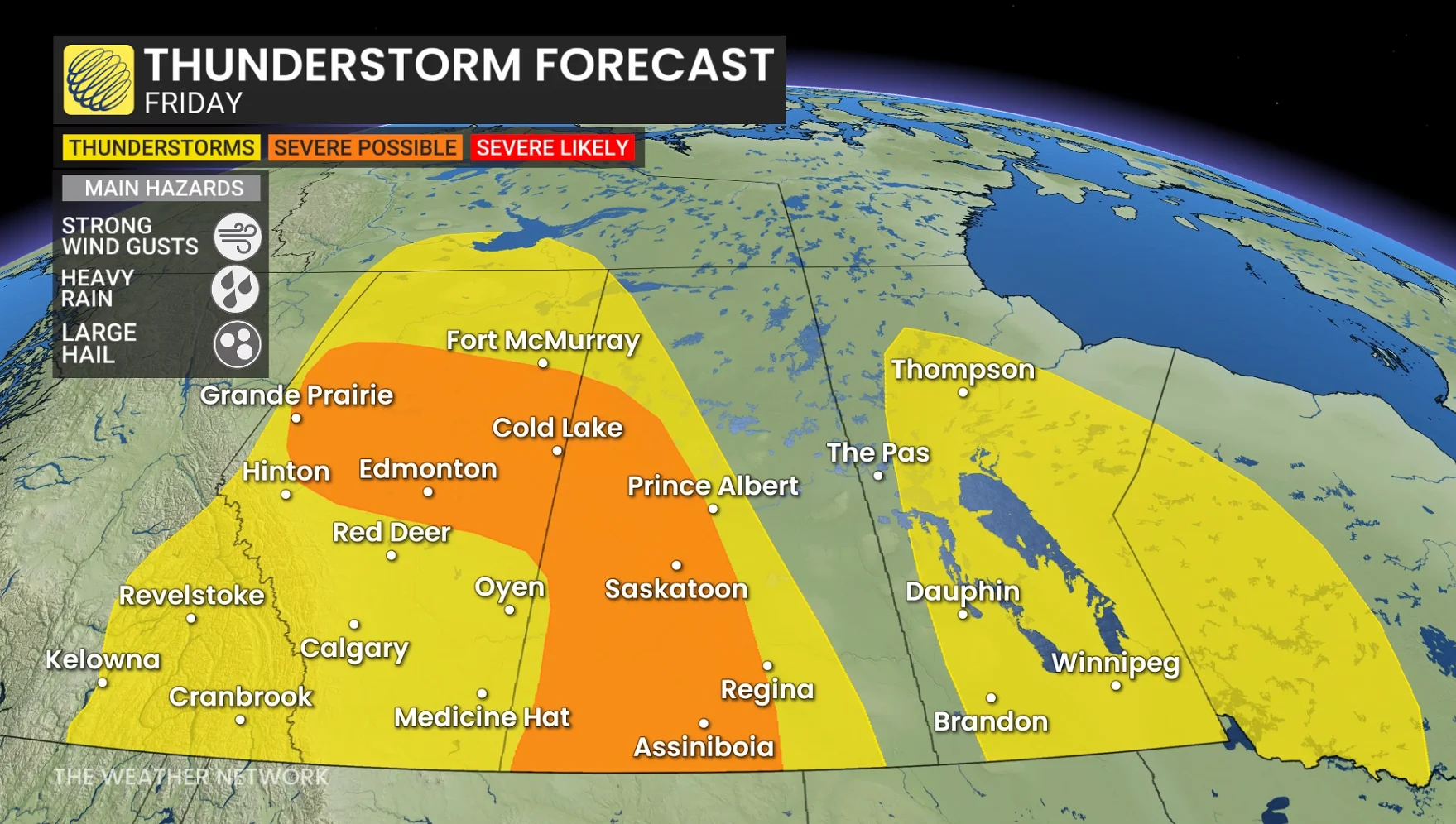
The first wave arrives Friday as a trough moves across Alberta, causing thunderstorms to develop throughout the afternoon and evening. Forecasters are closely monitoring central Alberta, including the Edmonton region, with the risk zone extending into southwestern Saskatchewan.
Atmospheric instability and deep moisture pooling over the region will lead to favourable conditions for severe thunderstorms capable of generating large hail, torrential downpours and wind gusts of 90 to 100 km/h.
DON'T MISS: Visit our complete guide to Summer 2026 for an in-depth look at the Summer Forecast, tips to plan for it and much more!
Storm risk shifts east Saturday
The storm threat will not subside after Friday night. Instead, it slides eastward on Saturday as the same weather system moves into Saskatchewan.
SEE ALSO: Whirling disease found in another Alberta watershed
Southwestern Saskatchewan is expected to have the most instability, making it the most likely area to see severe thunderstorm activity throughout the day. Heavy rain, damaging wind gusts and hail will once again be the main threats.
A few weaker thunderstorms may also develop across parts of Manitoba late Friday along a weak surface boundary, though the severe threat appears to be limited for the time being.
While the thunderstorms may cause localized damage, forecasters believe the bigger story is yet to come.
DON'T MISS: Uncovering the hidden dangerous beneath our roads
A wetter pattern settles in next week
Another trough is expected to move into the Prairies late this weekend and early next week, bringing much more rain.
Forecasters are keeping a close eye on Sunday through Tuesday, when a steady supply of moisture could bring widespread rain to parts of Alberta and Saskatchewan.
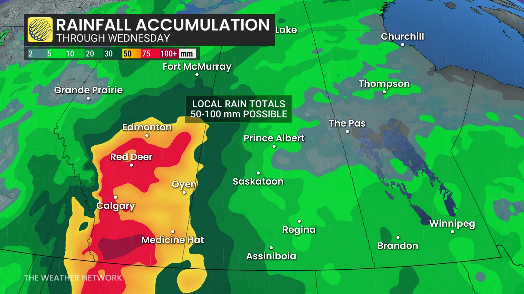
While it is unclear where the heaviest rain will fall, there is increasing confidence that some areas will receive more than 50 mm, with isolated totals approaching 100 mm.
Edmonton receives an average of 75 mm of rain throughout the month of June. If the heaviest rain band remains in one area, some communities could receive nearly a month's worth of rain in just a few days.
WATCH | 2026 Prairie Summer Forecast: Strong start to the season, but is that good news?
Stay with The Weather Network for the latest updates across the Prairies