
Ontario storm threatens biggest snowfall of the year so far for many

Multiple systems will be impacting southern Ontario this week, with forecasters keeping a close eye on a mid-week Texas low that will threaten significant snowfall amounts across the region.
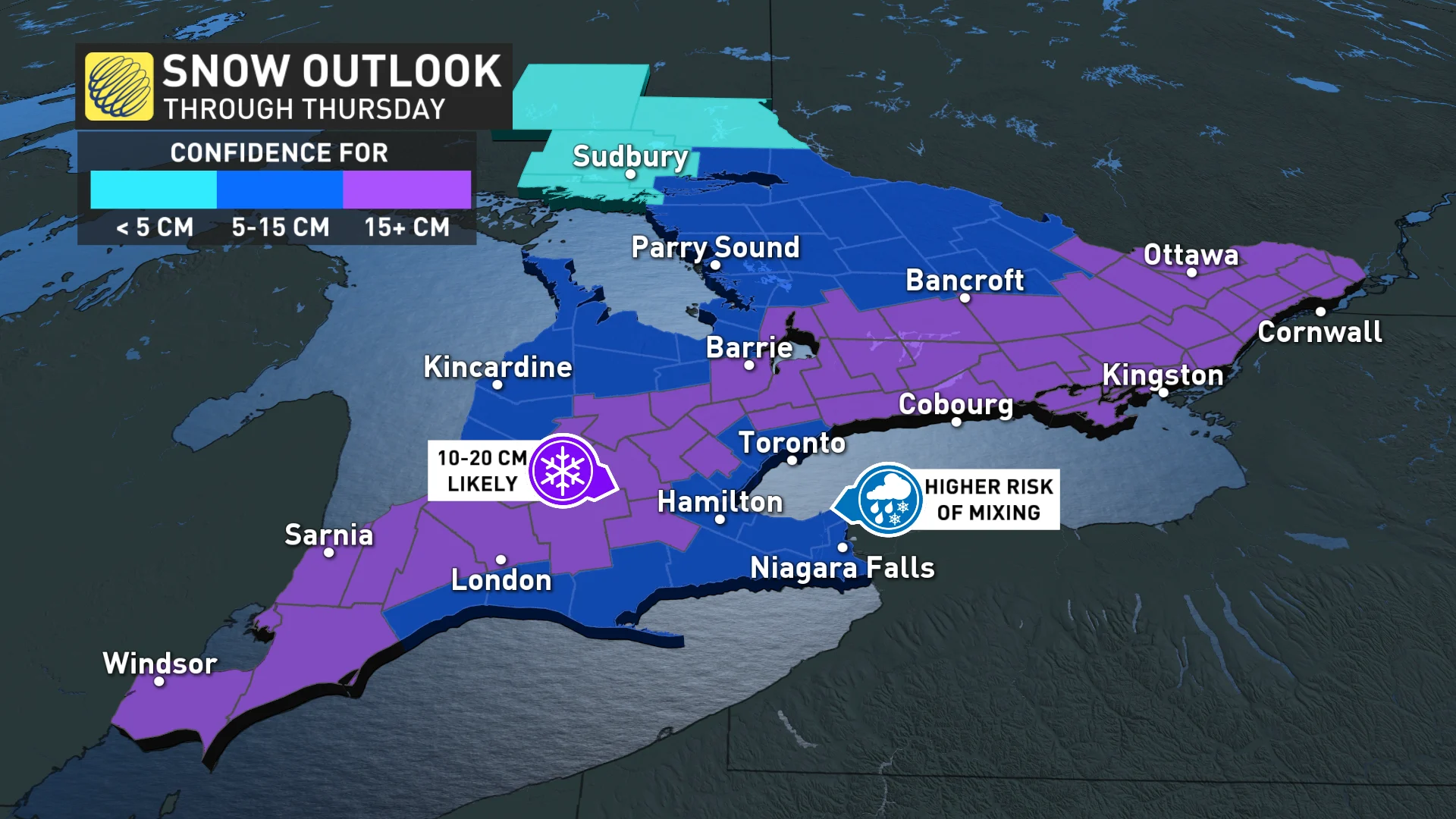
Ontario is set to face multiple systems and several chances of snowfall this week. Forecasters warn that there is the potential for significant snowfall by the middle of this week and many could see 10-20 cm.
A weak clipper will bring light snowfall into eastern Ontario and parts of the Greater Toronto Area (GTA) on Monday evening into Tuesday morning. This is just the tip of the iceberg for what's to come.
A larger storm will take aim at the region towards the middle of the week. This moisture-laden system, originating stateside in the Deep South, will track towards southern Ontario and Eastern Canada.
Due to its origins, this system will usher in much more moisture with it, along with colder air that will boost potential snowfall totals.
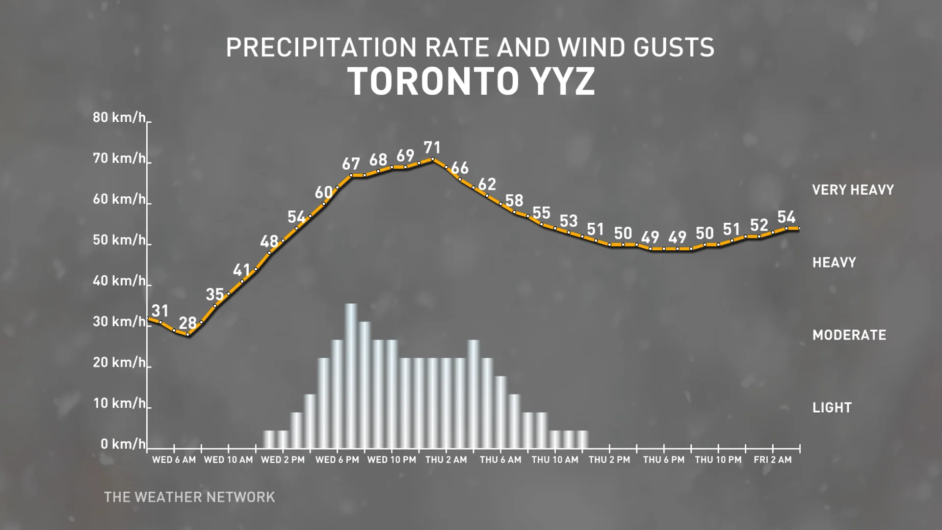
Snowfall will begin to build across extreme southwestern Ontario on Wednesday morning, before spreading across the GTA in the afternoon. Snowfall rates will pick up in intensity in the evening, potentially as much as 2 cm an hour, which will likely cause havoc on the roadways for the commute.
Motorists should plan ahead and allow for extra time on the roads or postpone non-essential travel as delays are likely.
We are still several days out, but storms in the past that have taken similar tracks often leave a swath of 10-20 cm of snowfall across the hardest-hit regions.
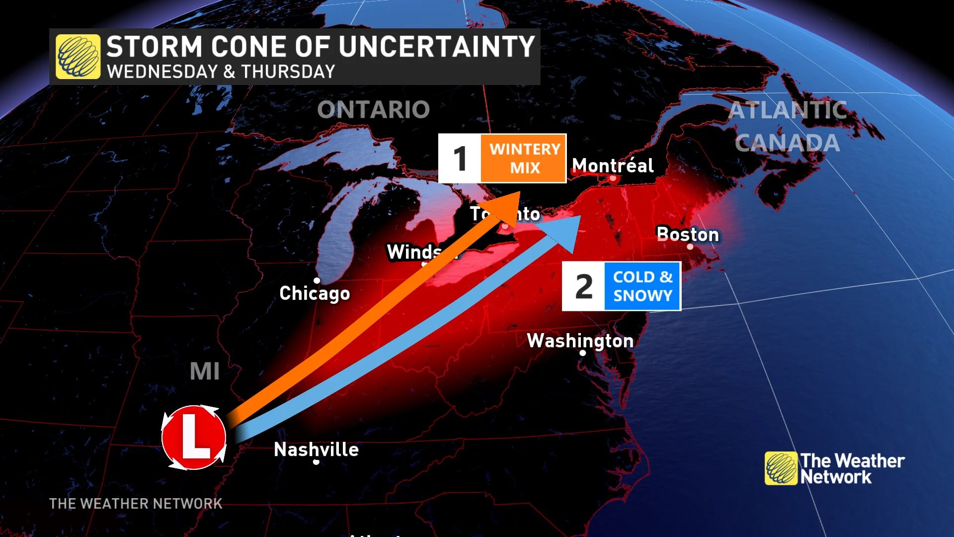
The track of this system will need to be monitored due to the warmer air associated with it. A farther north track could result in some of the snow transitioning to ice or even rain.
This system will wrap up west to east on Thursday morning, but roads will likely still be in poor shape across many areas.
SEE ALSO: La Niña fades, so what does that mean for a Canadian spring?
While fairly far out, long-range forecast models are all hinting at the likelihood of some western clippers that could slide across Ontario in the final weekend of January. Snowfall totals are highly uncertain, but we do know clippers typically bring a quick burst of snow as they slip through an area, given their usual lack of moisture.
Due to the common uncertainty in long-range forecasts, these details are subject to change and only provide an early glance at what is possible ahead in the weather pattern.
Check back in with The Weather Network for updates on the forecast for Ontario.