Expect a turbulent March across Canada as the seasons duke it out
March greeted Canada with a sharp divide between warm and cool. Will it stay that way? Here’s what you can expect from this turbulent transition month ahead
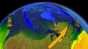
Welcome to meteorological spring! There’s no shortage of spring-like weather throughout Canada this week, even as frigid air churned across the country during our quadrennial leap day to close out February.
This bumpy transition month breathes warm hope into the winter-weary among us, while often providing brutal reality checks that March is still firmly within range of snow, ice, and plenty of frigid air.
The Weather Network’s exclusive spring outlook came out this week to detail what you can expect through the season ahead. But what’s heading your way over the next few weeks?
Here’s a look at your March outlook for communities across Canada.
SPRING 2024: Get an in-depth look at the Spring Forecast, tips to plan for it, and much more!

Turbulent conditions are such a hallmark of March weather that the old saying ‘in like a lion, out like a lamb’ grew out of those frequent lurches between spring-like comfort and winter-borne chills.
While this month looks to greet Canada like a lamb, March may not go out like a lion so much as it could draw to a close like an indecisive housecat torn between two seasons.
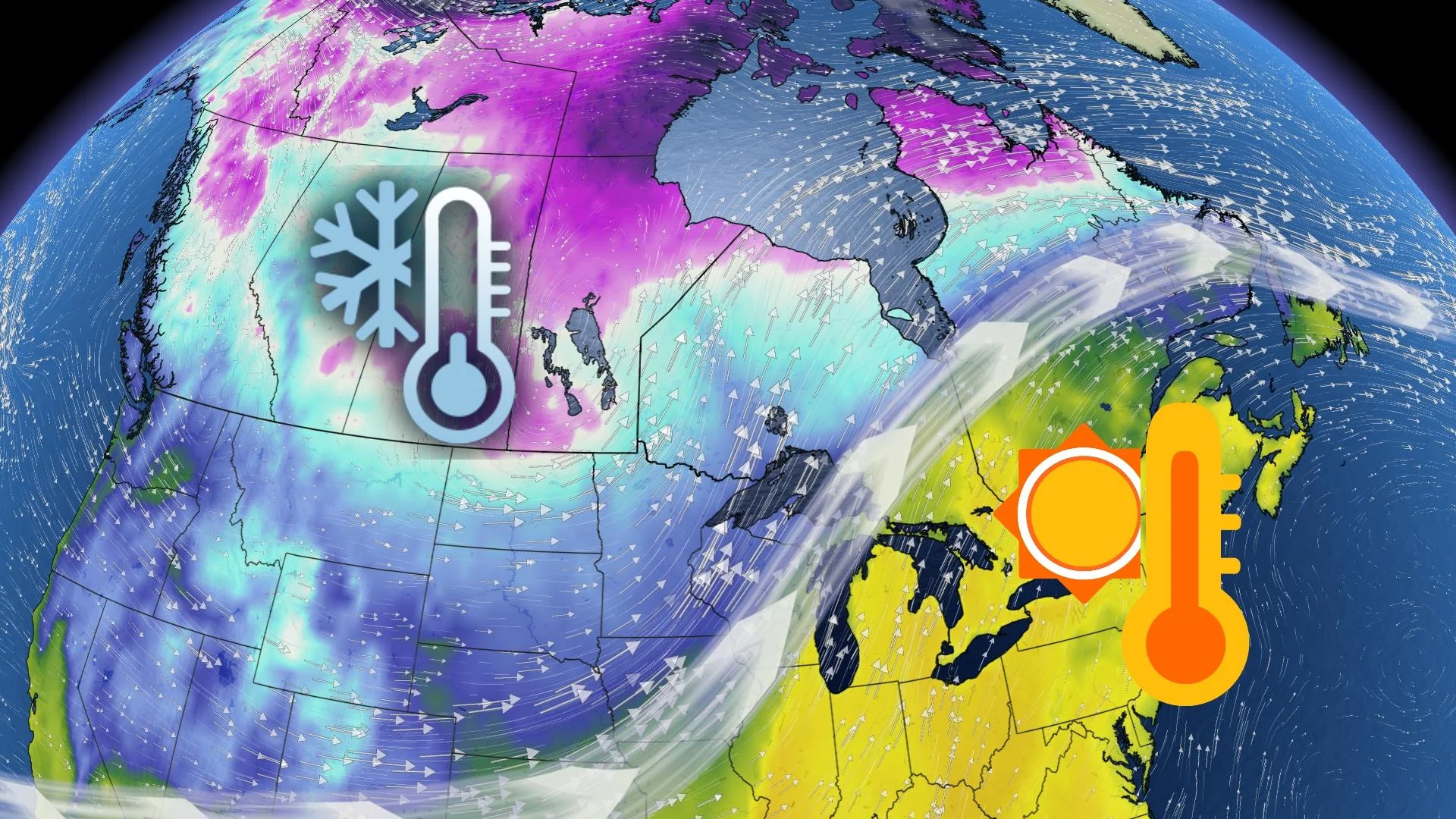
Warm temperatures dominated the country throughout the month of February. Some spots in Ontario notched their all-time warmest February temperatures on record during the final days of the month.
Much like we’ve seen throughout this season, February’s persistent warmth was occasionally interrupted by bursts of cold that swept from the Prairies to Atlantic Canada—and those cooldowns were fleeting chills as opposed to solid cold snaps.
Early March looks to continue February’s warmth
That trend is likely going to continue into early March. Above-seasonal temperatures—and at times record-breaking readings—are likely throughout the eastern half of Canada for the first two weeks of the month.

DON’T MISS: Earth just experienced its hottest 12 months in recorded history
March is off to a cooler start out west as a favourable upper-level pattern across British Columbia and Alberta allows cold air to spill out of the north. This cool and active pattern is fantastic news for ski resorts that have been aching for snow this season. We’ll see continued periods of chilly and at times stormy weather wash over Western Canada into the second week of the month.

It’s important to remember that this time of year is a period of transition in the atmosphere. Seasonal temperatures steadily rise through the month. Below-seasonal temperatures now can still get quite chilly, but it doesn’t necessarily imply the brutal conditions we might see in the heart of winter.
Mild air spreads into mid-March, uncertain chill risk by late month
Chilly conditions across the West won’t last forever. Heading into the middle of March, we’ll see a gradual pattern shift that allows milder conditions to spread west. Temperatures will first warm on the Prairies before a milder pattern takes hold along the West Coast.
Widespread mild conditions are likely by mid-March across almost all of Canada. Above-seasonal temperatures will persist for the eastern half of the country, but we should avoid the remarkable extremes we saw in the closing days of February.

SEE ALSO: Atlantic ‘hurricane alley’ sees ominous mid-July heat in February
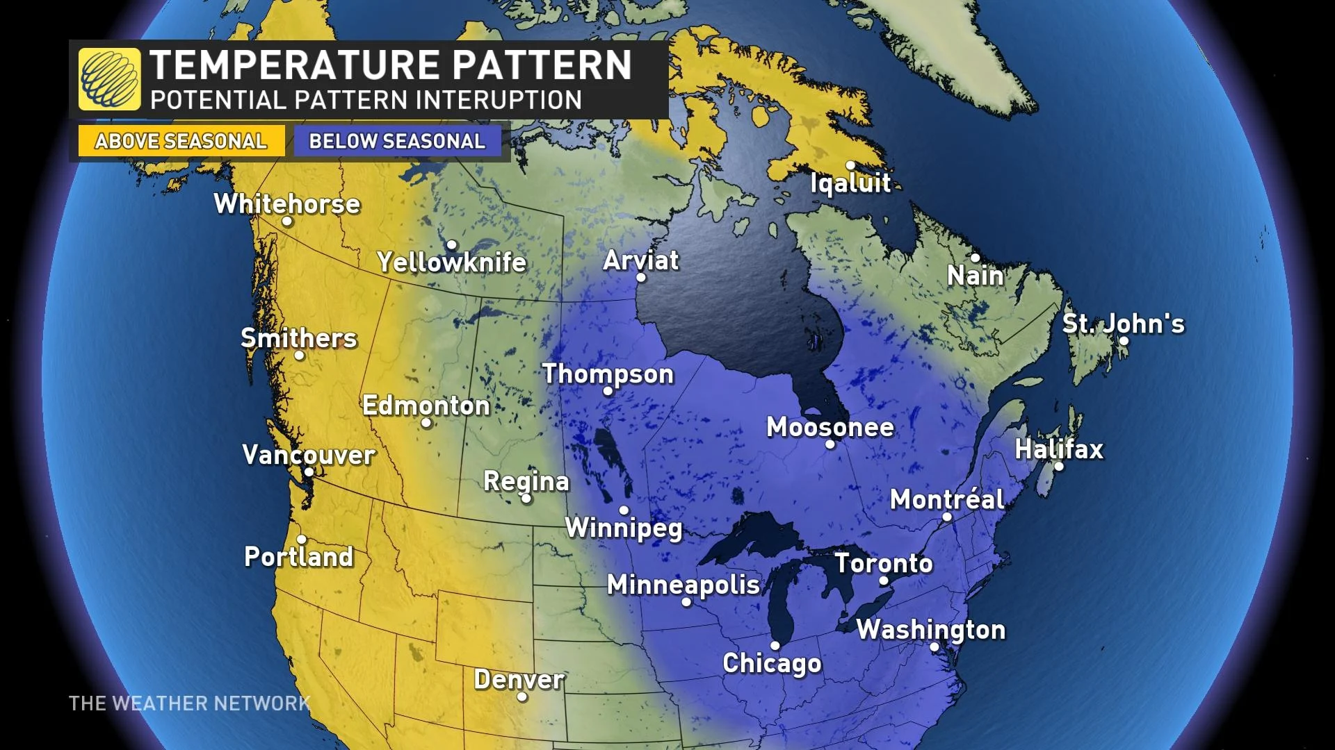
Confidence starts to wane a bit heading into the final weeks of March. Forecasters are watching a potential pattern interruption for a vast swath of the country toward the end of the month.
There are conflicting signals for how the pattern will shape up across and around Canada around the end of the month. One rule of thumb is that the prevailing pattern tends to win in the end. Warmer temperatures have consistently ruled the roost this season, even when cold air managed to break through.
That said, upper-level patterns over both the Pacific Ocean and the Atlantic Ocean may favour cooler conditions for parts of Canada at the end of March.
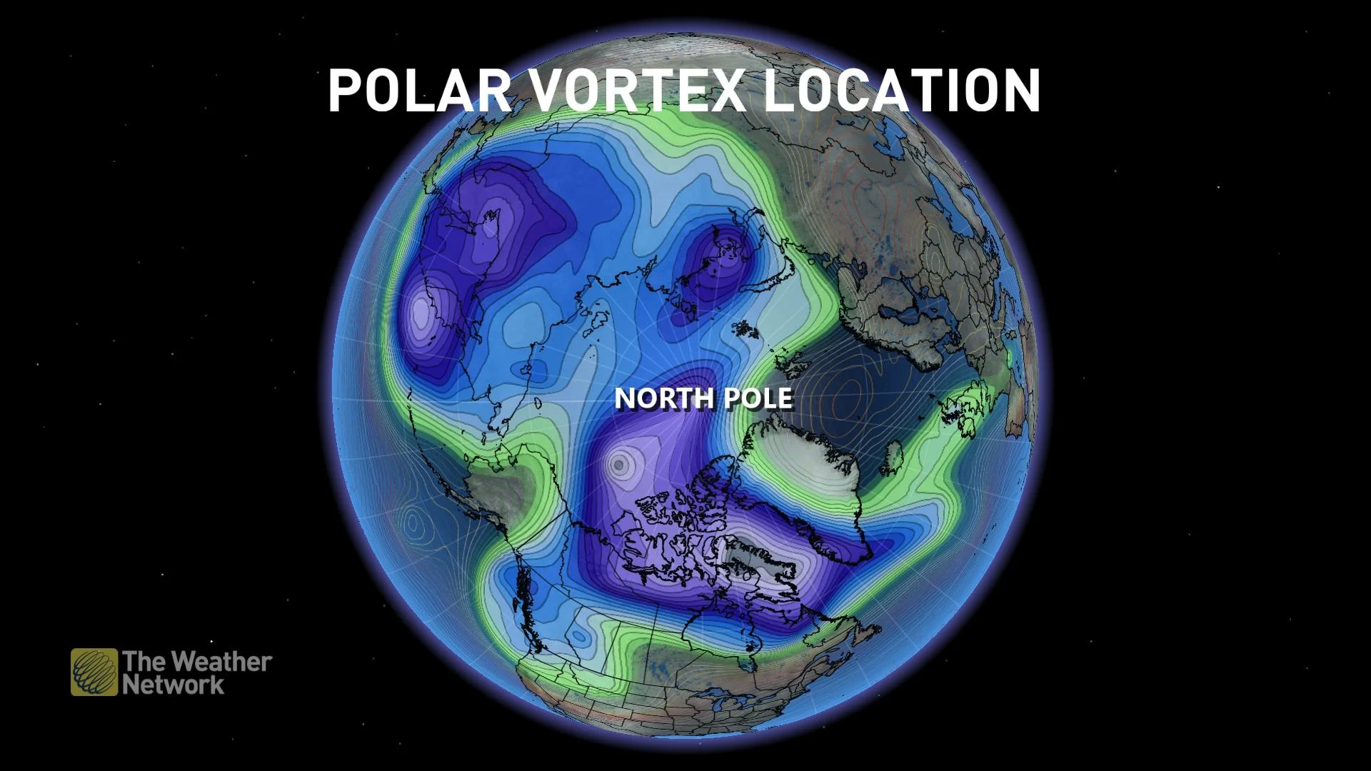
The polar vortex is another wild card. We’ll likely see a major disruption in the polar vortex late in the month that could send frigid air spilling out of the Arctic toward lower latitudes. However, it’s not a lock that those cold temperatures would move over Canada. This chill could spill over the other side of the globe toward Asia, which would leave warmer conditions for Canada.
MUST SEE: How global warming is reshaping winter life in Canada
Given this potential for a pattern interruption, forecasters see the chance for below-seasonal temperatures across the eastern Prairies, the Great Lakes, and east into southern Quebec and portions of the Maritimes.
Confidence is lower than usual, though, given the complex nature of different features in the atmosphere that can influence overall patterns. It’s also unclear if this would be a fleeting chill—like we’ve seen for much of the season—or a long-duration visit of below-seasonal temperatures.
Stay with The Weather Network for all the latest on your forecasts at home and across Canada.