Are B.C. and Alberta experiencing the worst ski season ever?

Is there any hope for the 2023-24 Western Canada ski season? We take a closer look
We’re through the first week of February and can reflect on the snowfall accumulated across British Columbia and Alberta, or lack thereof.
The extreme temperature swings and long periods without sustained precipitation have severely impacted the total snowfall accumulated across all the main mountain ranges in British Columbia and Alberta.
RELATED: No snow, no problem: Ski resorts push season passes to secure sales

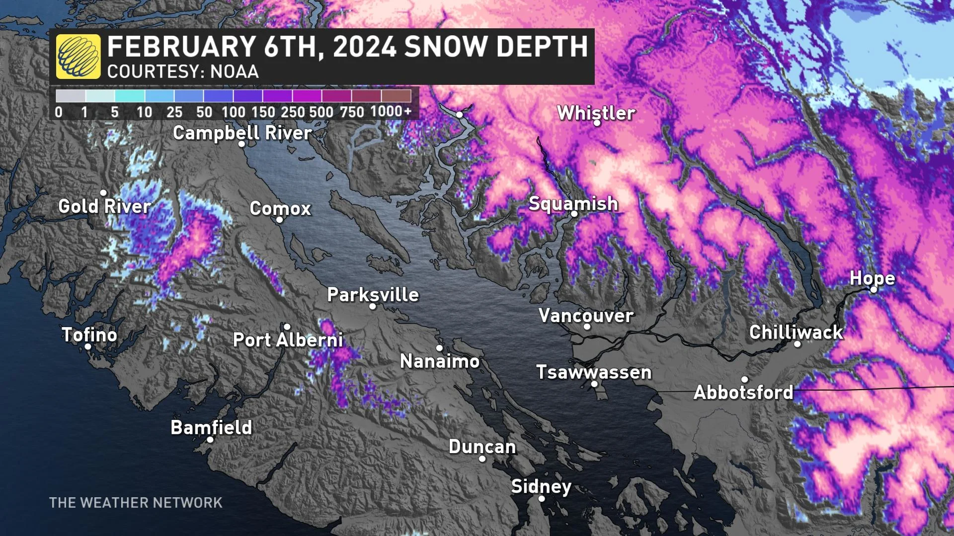
A new B.C. snow condition survey will be published on Feb. 8, but the January update reflected most of the province was between 30-60 per cent of average values. Expect the latest update to even show a more dire snow deficit across portions of the province.
These snow values are also reflected in the myriad of ski resorts in British Columbia and Alberta, with most resorts sitting well below 50 per cent of their annual average snowfall.
Ski resorts on Vancouver Island and the North Shore have limited run availability or even full mountain cloures in terms of skiable downhill areas.
These resorts offer much more than just downhill skiing, so I’d encourage you to visit any of the local ski resorts around the South Coast.
Here’s a look at Whistler and the season-to-date snowfall, compared to the previous full seasons:

With just 470 cm of snowfall, we’re lagging behind, Whistler. The largest season since the mid-1990s was the winter of 1998-99 with more than 1,600 cm recorded mid-mountain.
You might be surprised by the 2009-2010 seasonal total, with images of snow struggles from the Winter Games, particularly on Cypress Mountain. In November 2009 it snowed more than five metres across Whistler Blackcomb, before the storm track dried up by February.

Moving into the Interior, here’s the latest snowfall accumulation for a local ski resort near Kelowna, Big White.

With just 366 cm of snowfall accumulated at 1890 metres, the season is off to a sluggish start in the Interior, as well, although most of the mountains have significantly more terrain open than the coastal range. Big White needs to accumulate another metre of snow to avoid having have one of the worst accumulations of the past few decades.
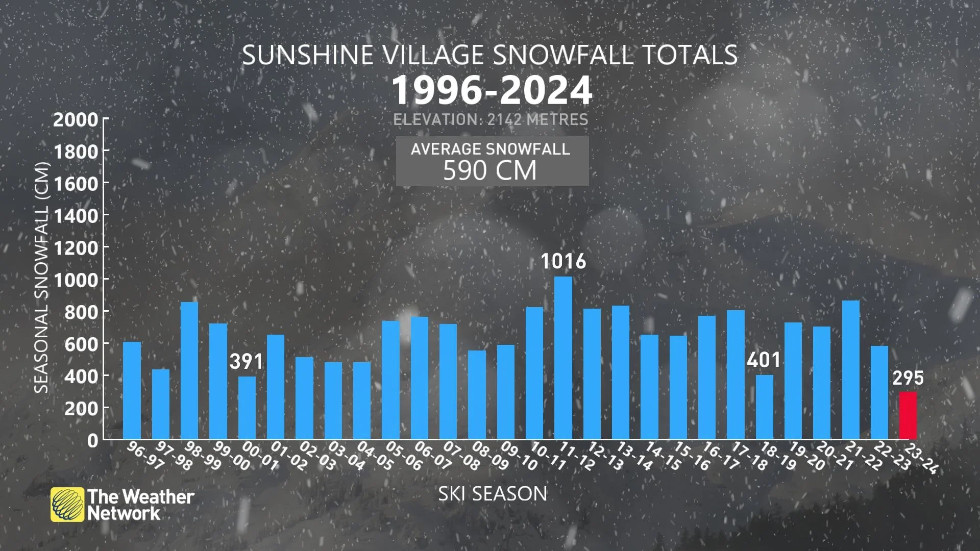
Over in Alberta, Lake Louise and Banff are also on the lighter side of things, with between 2.5 and 3 metres of snowfall accumulated to date. A far cry from the 1,016 cm reported in Sunshine Village in 2011-12. Who misses La Niña?
February outlook
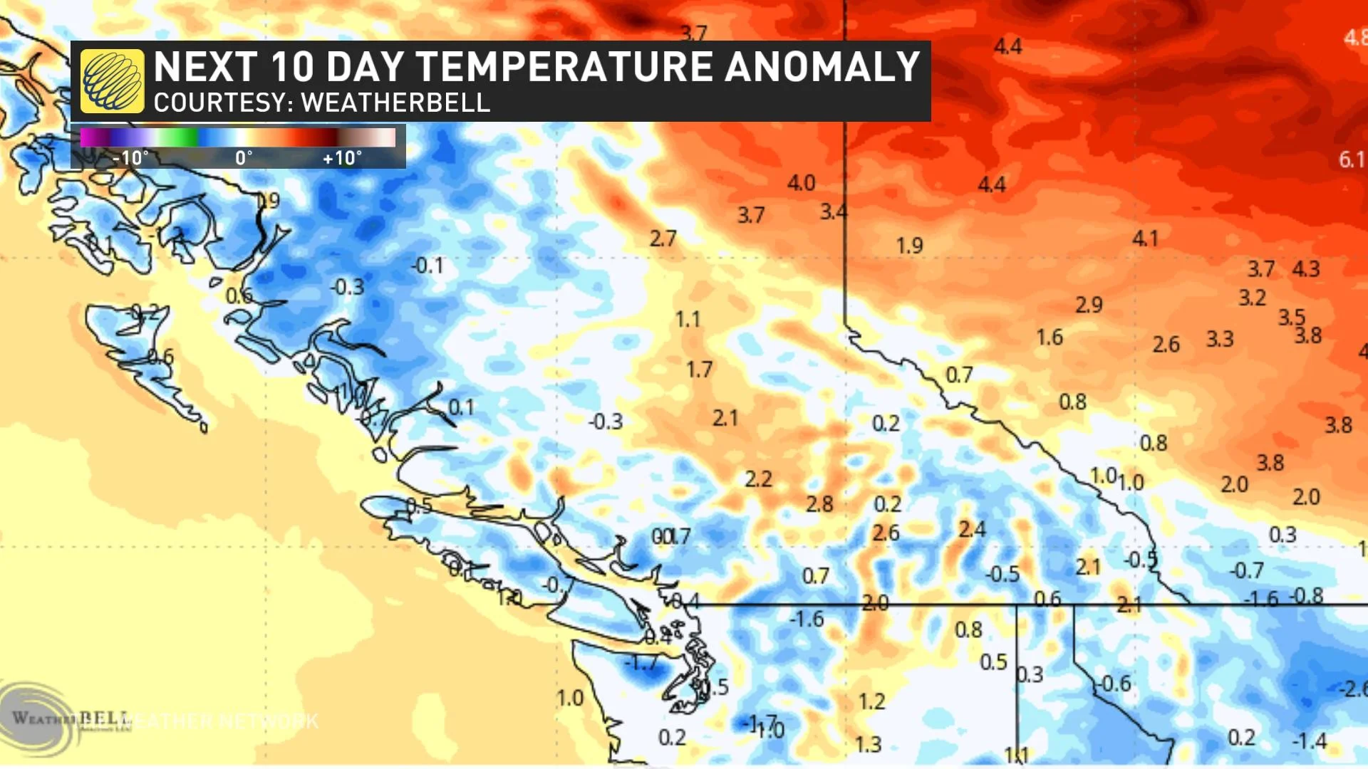
The next 10 days highlight an unfortunate, significant precipitation deficit continuing for the Vancouver Island and Coast Mountain ranges.
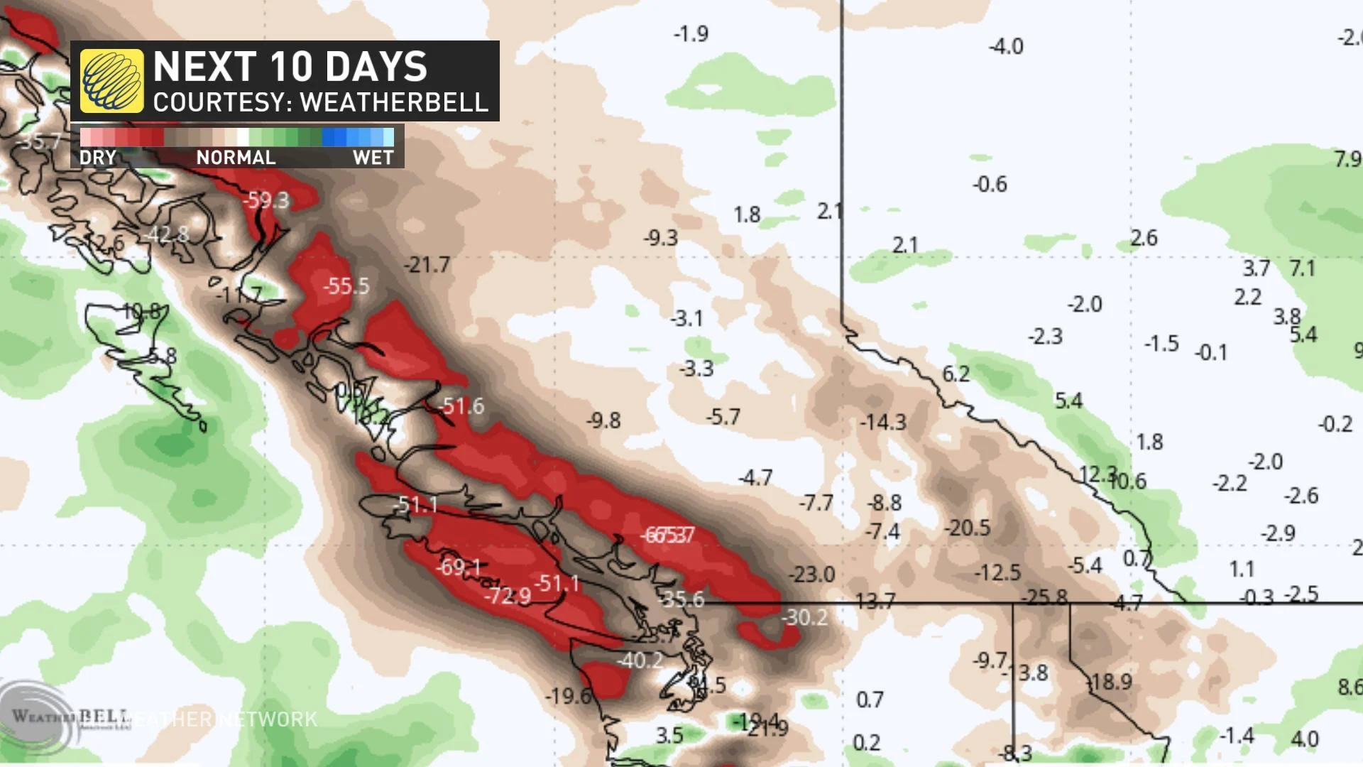
The Interior is naturally drier, but over the next 10 days, precipitation will also be trending towards the drier side.
A couple of regions that could experience an influx of snowfall include southeastern B.C, particularly the Kootenays and the Rocky Mountains, where normal or even slightly above-normal precipitation is possible.
The primary driver of the snowfall won’t be an active Pacific storm track, but rather upslope snow from low-pressure systems that develop on the leeside of the Rocky Mountains.
A silver lining?
The temperatures. It’s going to be the perfect forecast for manufacturing snow, with temperatures near-to-below seasonal the next 10 days.
Did you know that Sunshine Village farms snow? There are several techniques to increase snow cover on a mountain artificially, but these forecast temperatures will be ideal to make artificial snow and maintain current snow bases.