Canada's spring gets sidelined as winter fights back for start of the season
Beware: Spring gets sidelined by winter’s wild ride to the finish line
March is typically known as a wild weather month across Canada -- the true transition month from winter to spring. That transition however, isn't always a smooth one, as conditions can range from a full blown winter storm, to abundant sunshine and 20°C temperatures at times.
The battle between winter's Arctic air and the warmer spring conditions continue to play out across the country, resulting in any and all types of extreme weather.
SPRING 2024: Get an in-depth look at the Spring Forecast, tips to plan for it, and much more!
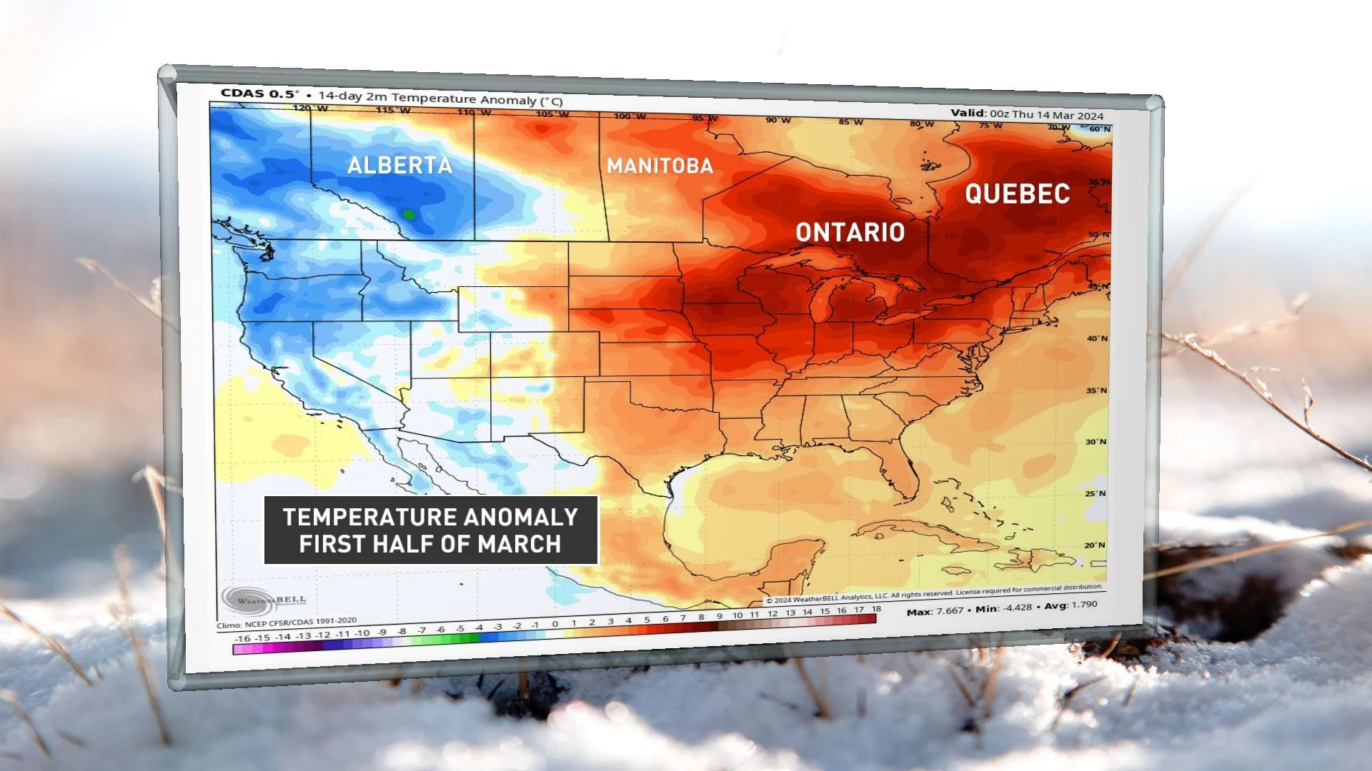
So far, much of the eastern Prairies and eastern Canada have sat well above seasonal for the first half of March, while British Columbia and Alberta, have sat slightly below, thanks to the colder first week of the month. In fact, Whistler-Blackcomb has nearly doubled its total snowfall accumulation over the past several weeks, with the cooler pattern, now surging close to 900 cm of snowfall accumulation for the season –– just a couple metres below normal.
A major pattern change will begin to unfold this weekend however, and continue to evolve into next week as we near the official start to spring on Tuesday, March 19.
See what this means, below.
Record-setting warmth spans western Canada this weekend
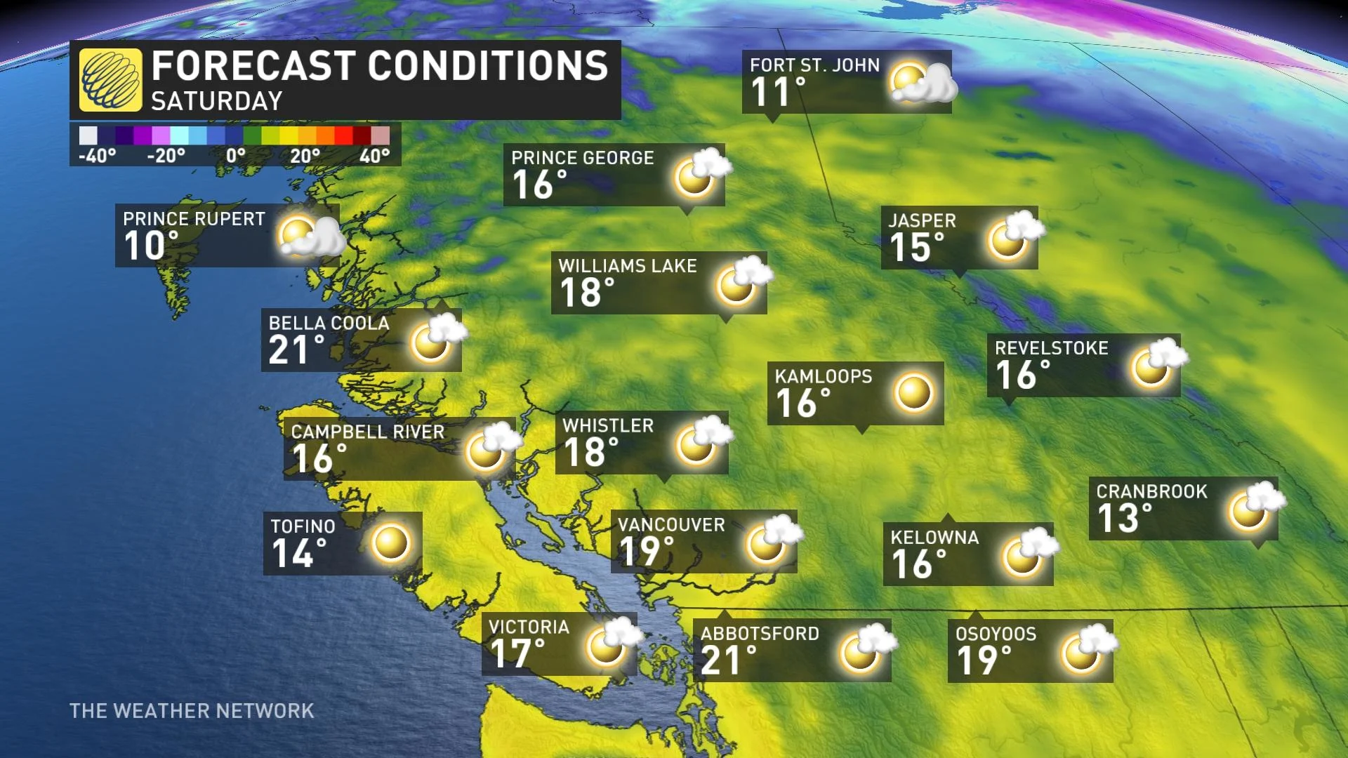
First, record shattering warmth will hit parts of western Canada this weekend. The most extreme temperatures relative to normal will be across northeastern B.C., and northern and central Alberta. Places like Grande Prairie, Peace River, Fort St. John and Slave Lake could shatter their records for the day on Sunday, as temperatures soar well into the upper teens. Record breaking temperatures are also likely in the Edmonton area.
Much of western and southern Alberta will reach the upper teens to lower 20s on Sunday, while the southern and central interior of B.C. will reach the mid to upper teens throughout the weekend.
MUST SEE: Temperatures soar in B.C. as spring-like warmth brings May feel
The ski hills will lose some snowpack with the impending pattern change, but there are signs to finish the month with more accumulating snowfall on higher terrain.
Arctic air sinks south for the official start of spring
Much colder air will spill into to the eastern Prairies, Ontario, and Quebec for parts of the weekend and into next week, with gusty winds and even snow chances sneaking in once again. Quite the contrast from the balmy, and even early summer-like feels across parts of the region this week.
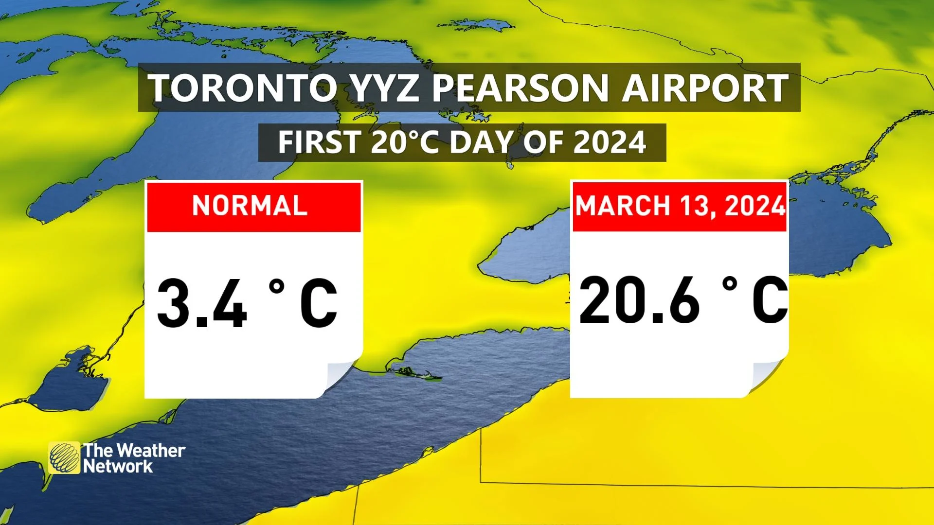
The city of Toronto just hit its first 20°C day of the year already on Wednesday, far surpassing the normal high of a chilly 3°C.
DON'T MISS: Everything you need to know for April's spectacular and rare solar eclipse
The first round of unsettled conditions rolled in as rain across Ontario on Thursday, followed by chances for snow as conditions cool behind the system.
While forecast confidence is currently low for snow placement and exact totals over the Great Lakes, there's more certainty in the cooling pattern, and the unsettled weather that follows into next week. That means, prepare for the changing conditions and possibly more winter driving to come.
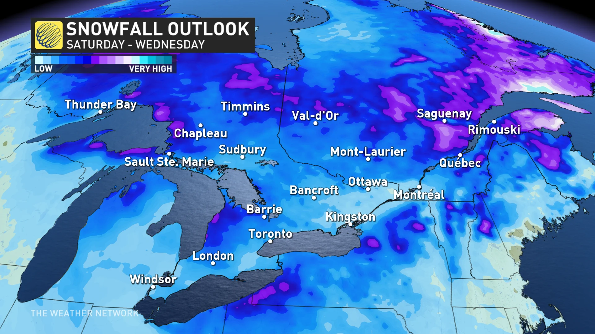
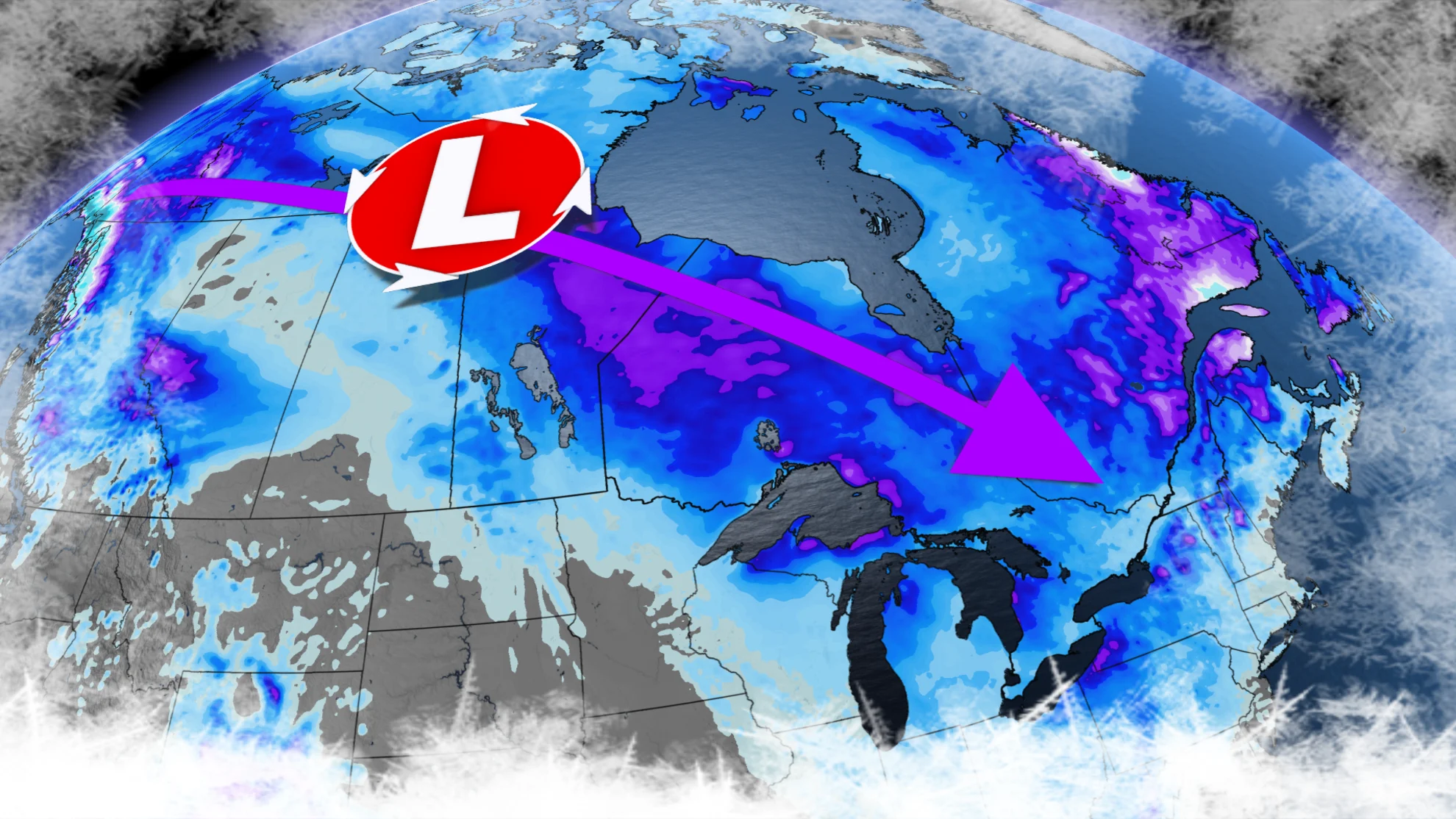
Meanwhile, a strong clipper will develop over the Northwest Territories, and track through central Manitoba through Friday, bringing periods of gusty winds and significant snow to northern Saskatchewan and Manitoba.
WATCH: A cross-country clipper brings snowy conditions from west to east
Alberta will start to cool by the middle of next week, with another system potentially bringing some substantial snow to the region. Cooler conditions will also span B.C. by the end of next week, with a return to unsettled weather and more alpine snow.
While much of Atlantic Canada won't see a drastic cool down so to speak, the region will definitely hover much closer to seasonal values, with an active pattern, and back-to-back storm systems set to bring messy conditions in the weeks to come.
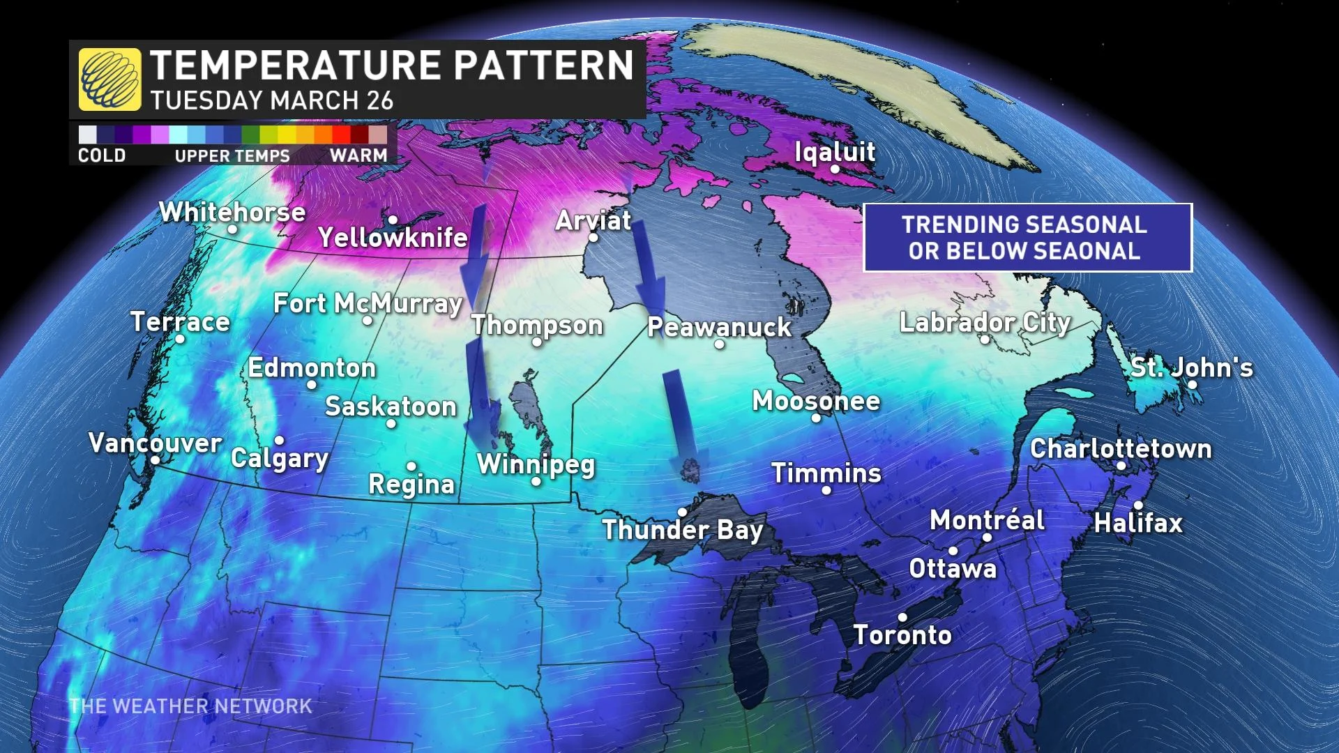
This cooling pattern will linger across the country through the start of spring, and as we end off the month of March, so be sure to keep the winter gear nearby, and be prepared for anything as the seasons change. This is Canada, after all!