Warmth springs forward in southern Ontario with rain, thunderstorm risk
Spring is anxious to get an early start in southern Ontario this week with double-digit warmth, rain and a thunderstorm risk, but don't let your guards down as cooler air will return by the end of the week
Southern Ontario is on the receiving end of an early spring gift from Mother Nature this week, with double-digit warmth arising, but it will come with a wet, and eventually a chillier cost by Friday.
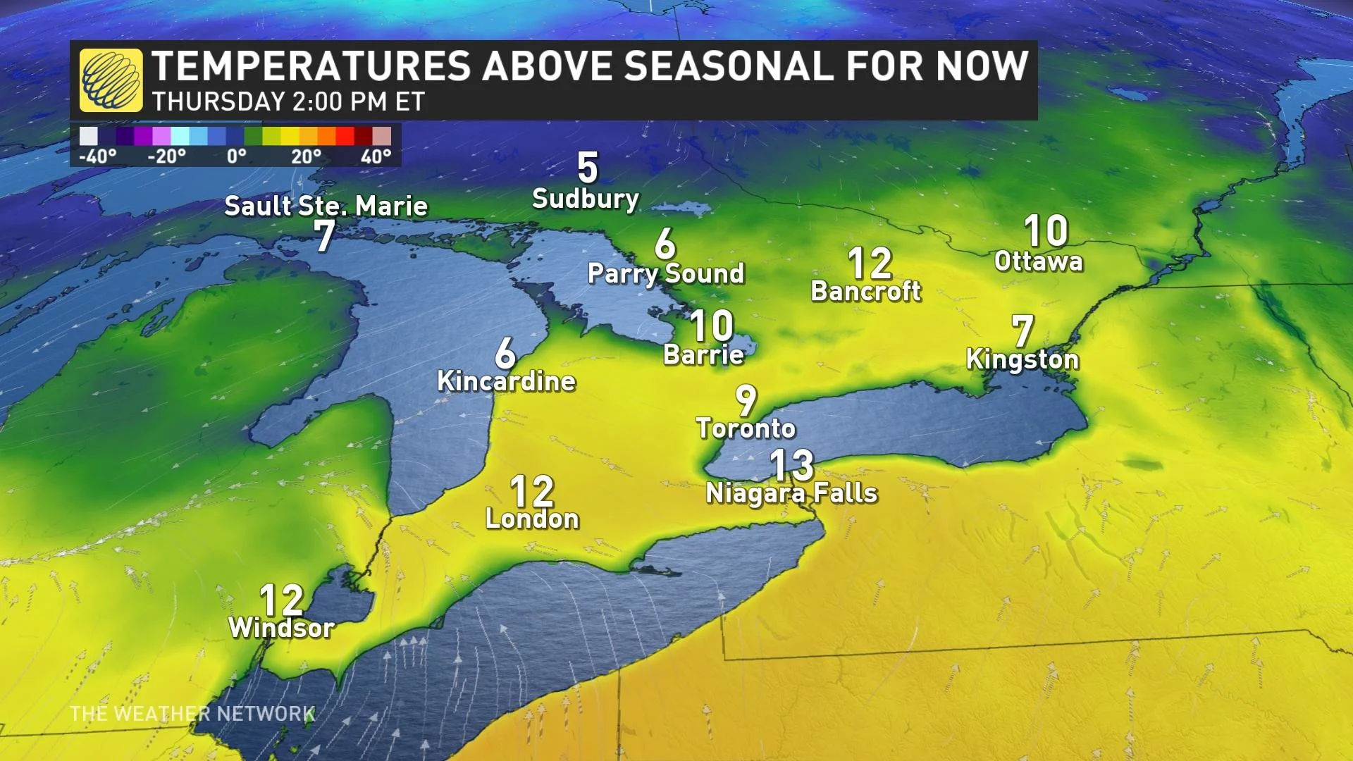
The influence of the upper-level ridge this week will combine with southerly winds blowing across the border to help boost temperatures on Wednesday.
Daytime highs in the mid-teens are likely across southern Ontario, with a comfortable 17°C expected in Toronto on Wednesday. Folks in far southwestern Ontario near Windsor will creep into the upper teens on Wednesday, with someone possibly getting close to the 20-degree mark.
Temperatures drop a bit for Thursday, but it will still be mild.
DON'T MISS: Everything you need to know for April's spectacular and rare solar eclipse
However, there is trouble brewing for Thursday and Friday, and again on the weekend. Multiple systems move in with some unsettled weather, including rain and the chance of thunderstorms, before colder temperatures move back in and bring southern Ontario back to reality with a shot of snow for some areas.
Thursday and Friday: Rain, thunderstorms and flurries
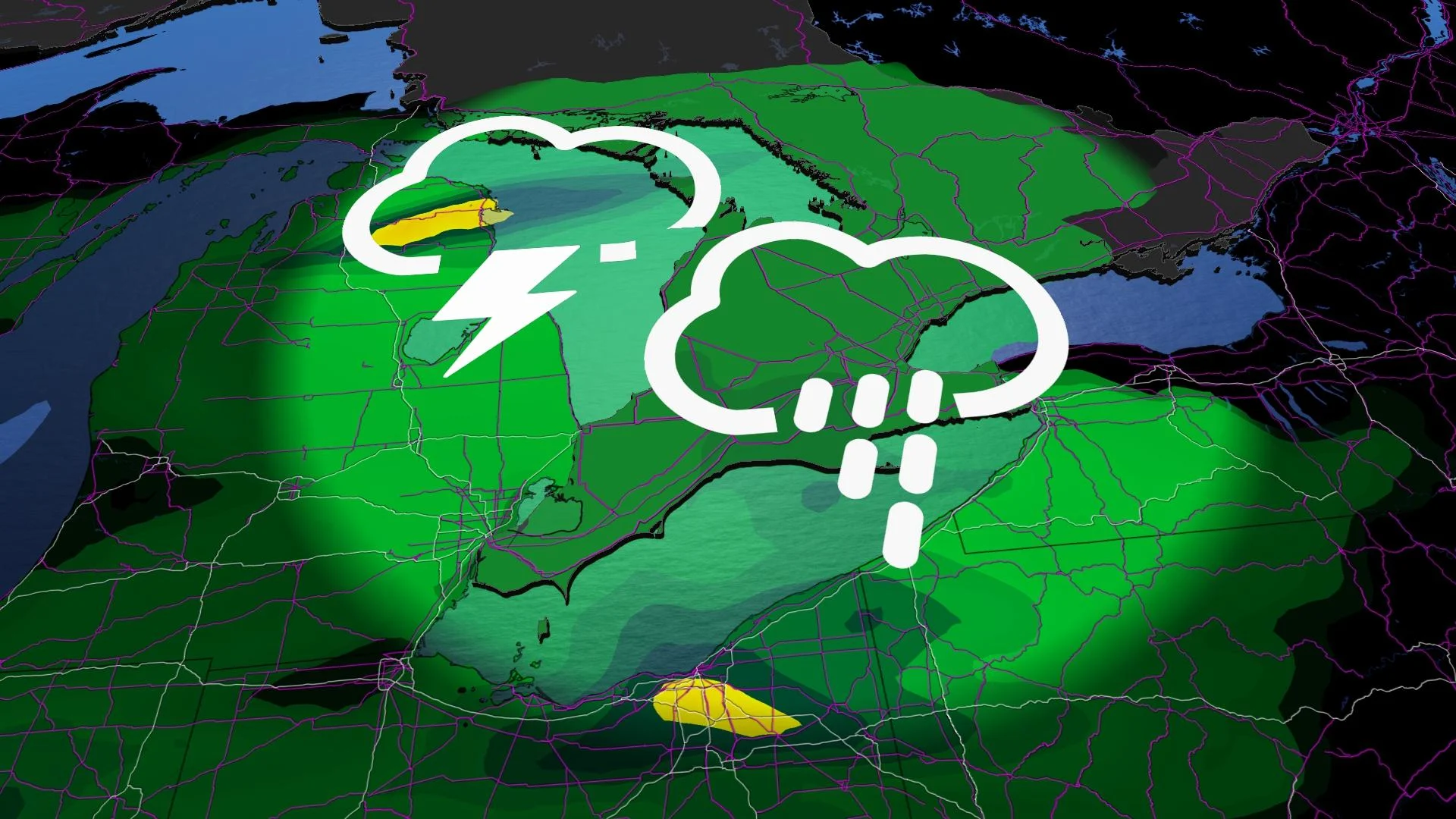
The day will start off nice enough in southern Ontario, but a system traversing the central U.S. with many types of weather, including rain, severe thunderstorms and the risk of tornadoes, will nudge into the region later in the day.
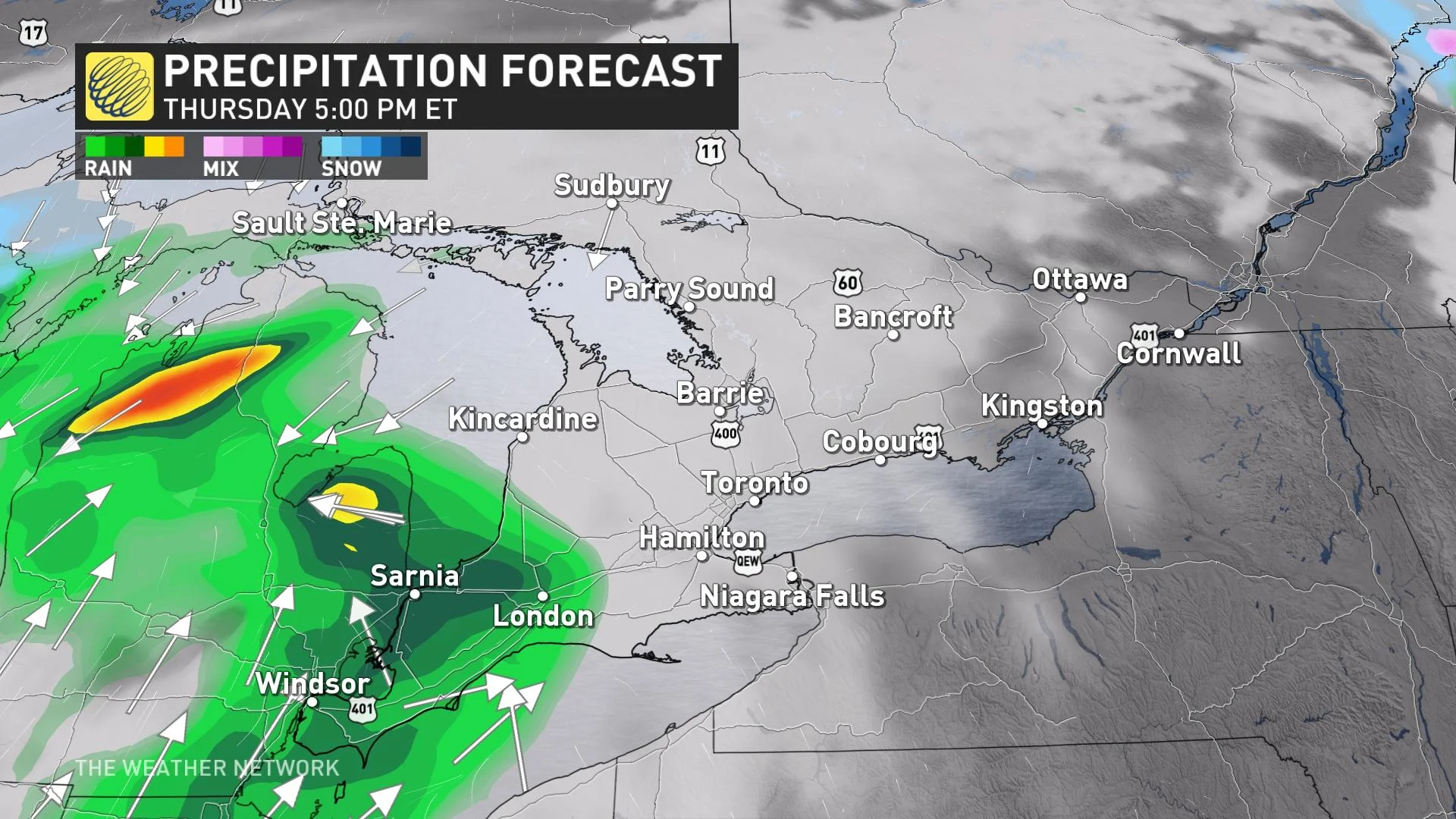
Cloud cover will thicken in southern Ontario by Thursday afternoon, allowing for rain to creep into extreme southwestern Ontario first before hitting the Greater Toronto Area (GTA) in the late evening period.
As a result of some instability, there is even a chance of weak thunderstorms throughout Thursday afternoon and evening, with the risk in the extreme southwestern corner of the province.
The rain will continue Thursday overnight and into Friday morning, with lake-effect showers a possibility.
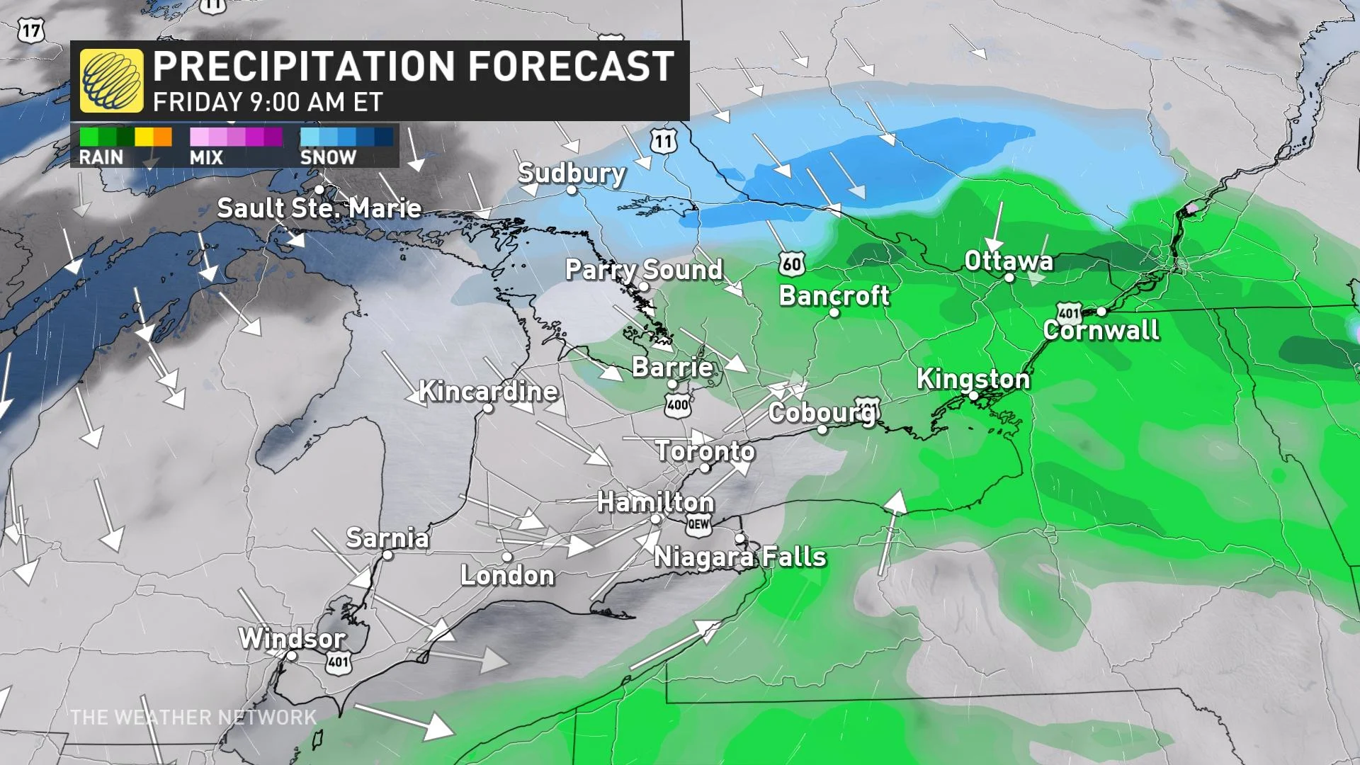
Also on Friday, precipitation may change over into a period of flurries in parts of cottage country as the first round of colder air moves into the province. So, don't get used to the warmth. Expect cooler, more seasonal temperatures in behind this system for the weekend, and colder temperatures for beyond.
Sunday lookahead: May not be so green on St. Patrick's Day
On the weekend, another system will develop and move in to close it out, featuring stronger dynamics and ingredients for more impactful weather.
The long-range pattern supports a deep trough in Eastern Canada while ridging occurs in the West. This will mean a pattern flip for Ontario. As a result, colder, more seasonal air for mid-March will funnel into Ontario.
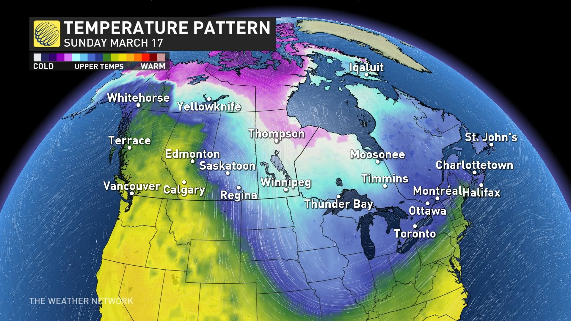
So, this means the return of winter weather as the colder blast of air could mean more snow across many parts of Ontario by the end of the weekend, along with a cooldown next week.
Confidence is very low right now for exact snow totals and placement in the Great Lakes. Confidence is higher for a late-weekend system cooling down temperatures and bringing unsettled weather. Expect the return of winter driving conditions, so make sure you don't change your winter tires, yet.
Anticipate a much colder pattern to develop around the official first day of spring, continuing through the end of March and into early April.
Stay with The Weather Network for all the latest on your forecast across Ontario.