Fiona vs. Ian: These hurricanes test upper limits of weather forecasting

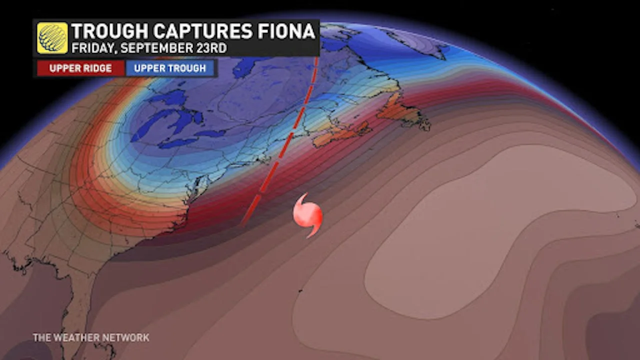
A traffic analogy might be helpful here. As if merging onto a highway, Fiona quickly phased with an upper trough steamrolling towards Atlantic Canada. Conversely, Hurricane Ian's situation was far more chaotic and nuanced.
The best forecasting tools in the world thrived with Hurricane Fiona but conveyed weakness with Hurricane Ian. Why?
Four days before Hurricane Fiona made landfall, we knew which part of Atlantic Canada would face the highest risk. An expanding wind field and transition to a post-tropical cyclone made an exact landfall location less paramount.
On the other hand, just a few days before Hurricane Ian's landfall, there was lower confidence in a precise track. Several models were reluctant to track Hurricane Ian across central Florida, leaving an escape route open towards the Florida Panhandle.
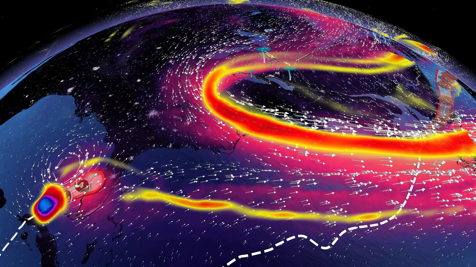
A traffic analogy might be helpful here. Hurricane Fiona traversed around a robust Atlantic high-pressure system. Then, as if merging onto a highway, Fiona quickly phased with an upper trough steamrolling towards Atlantic Canada. The weather players were straightforward and well-understood by numerical weather prediction models. Conversely, Hurricane Ian's situation was far more chaotic and nuanced.
MUST SEE: P.E.I.'s iconic Teacup Rock is gone after post-tropical storm Fiona
You can think of Hurricane Ian navigating unfamiliar city traffic, including plenty of pedestrians, traffic lights and crosswalks. Just as your city commute time can vary tremendously, computer models interpret these subtleties differently. Google Maps, 36 minutes. Waze, 24 minutes. We've all been there.
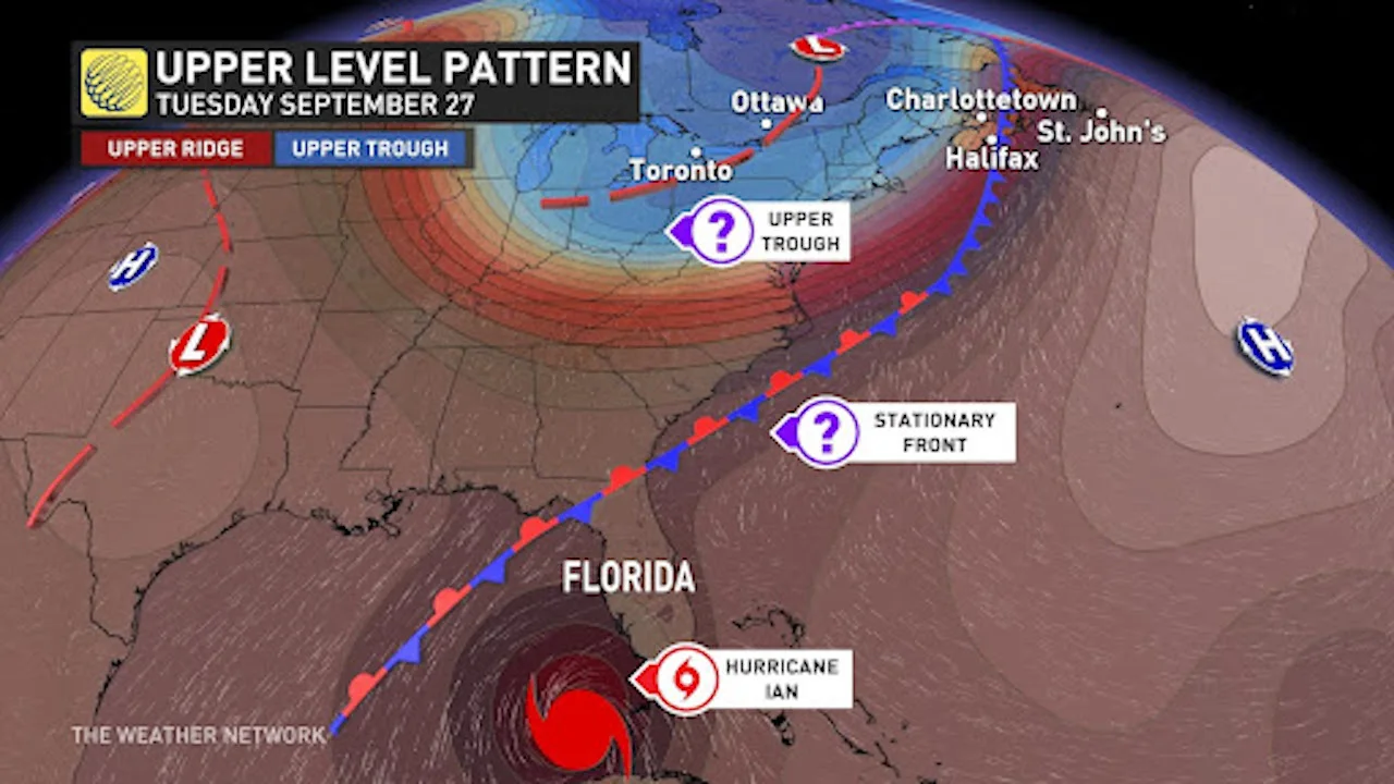
All that would bring Hurricane Ian inland is a gentle tug from a passing trough, far removed from the storm. There’s a stationary front draped offshore from the East Coast of the U.S., asserting just enough influence to nudge Hurricane Ian inland, likely causing many billions of dollars in damage across Florida.
When a hurricane parallels the coast of Florida, stakes rise as computer models attempt to resolve an immensely complex problem, with each track wobble shifting catastrophic storm surge impacts to a different region of the Florida coast.