Florida in the crosshairs of 'life-threatening' impacts from Hurricane Ian

The Atlantic Ocean has churned out another destructive storm, Hurricane Ian, which is expected to bring 'life-threatening' impacts to Florida including catastrophic winds, storm surge and flooding on Wednesday and Thursday
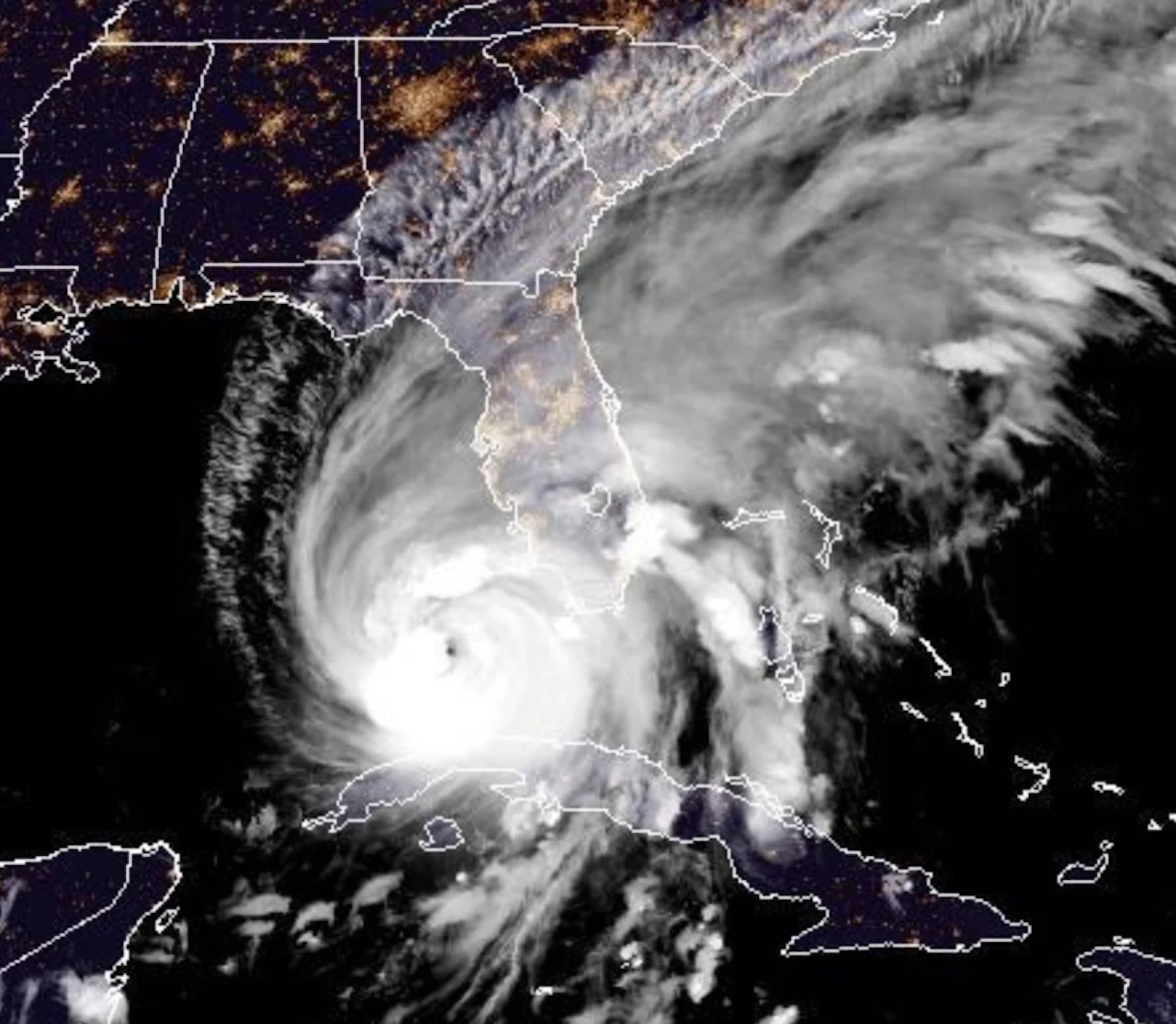
After powerful Hurricane Ian battered Cuba Tuesday, it is now approaching the Florida coast, with the eye just under 300 km south-southwest of Punta Gorda, Fla.
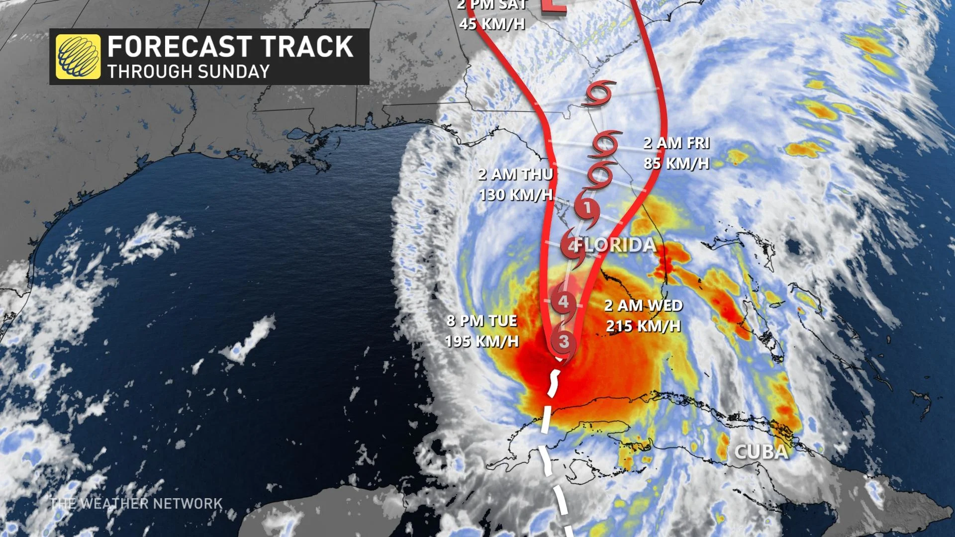
Situated in southeastern Gulf of Mexico, Ian is still holding on as a major Category 3 hurricane with current maximum sustained winds of 195 km/h, according to the National Hurricane Center's (NHC) Tuesday evening update.
Hurricane, tropical storm and storm surge warnings are in place.
The agency is calling for Ian to bring "life-threatening" impacts to Florida including catastrophic winds, storm surge and flooding on Wednesday and Thursday. Ian is forecast to strengthen into a Category 4 storm Wednesday morning.
On the forecast track, the centre of Ian is expected to pass west of the Florida Keys Tuesday night, and approach the west coast of Florida within the hurricane warning area sometime on Wednesday.
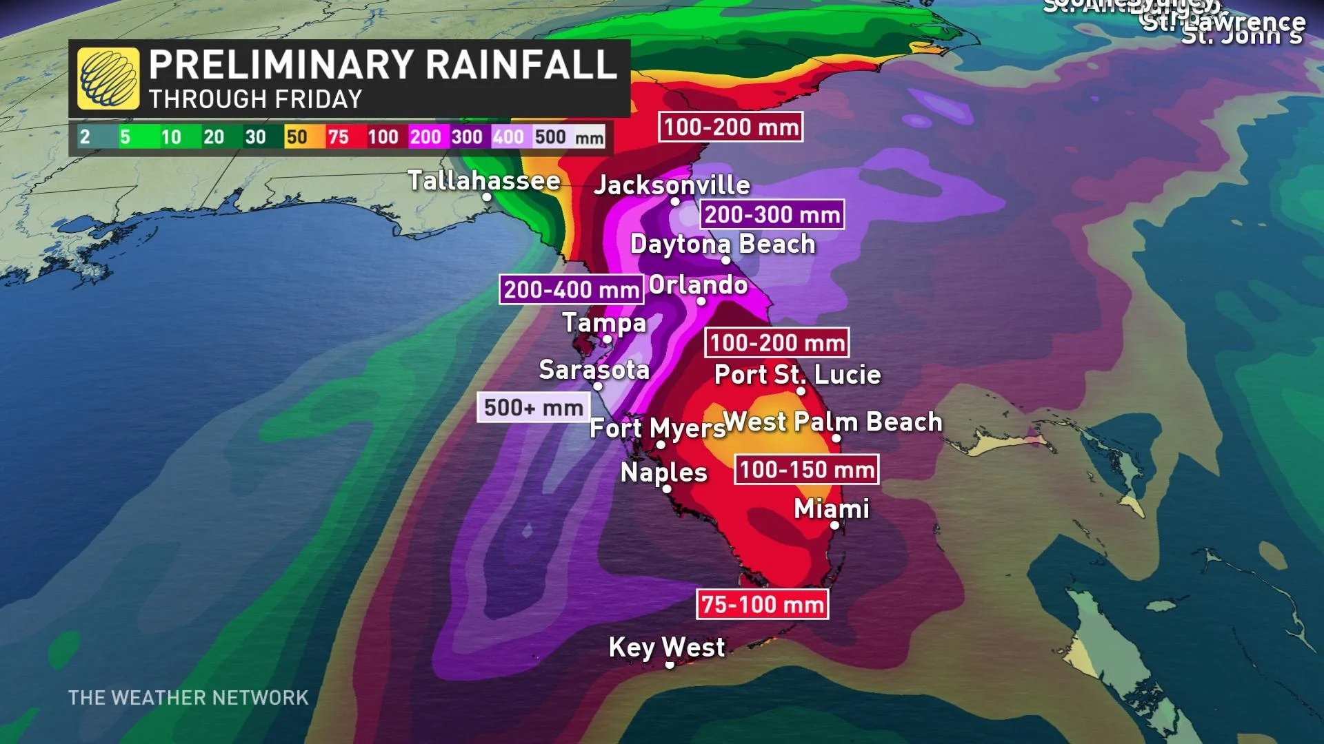
The state of Florida could receive remarkable amounts of rain through Friday. The Tampa area has the potential to see 500+ mm of rain, an unthinkable amount to fall in just 72 hours. Daytona could see 200-300 mm, and the Miami area could get up to 150 mm.
However, it is not only rains that are of concern to the state. Ian's pressure could create storm surges that elevate the sea level. If it gets its timing right, Ian could have its peak storm surge at high tide and raise water levels 2-4+ metres above ground level.
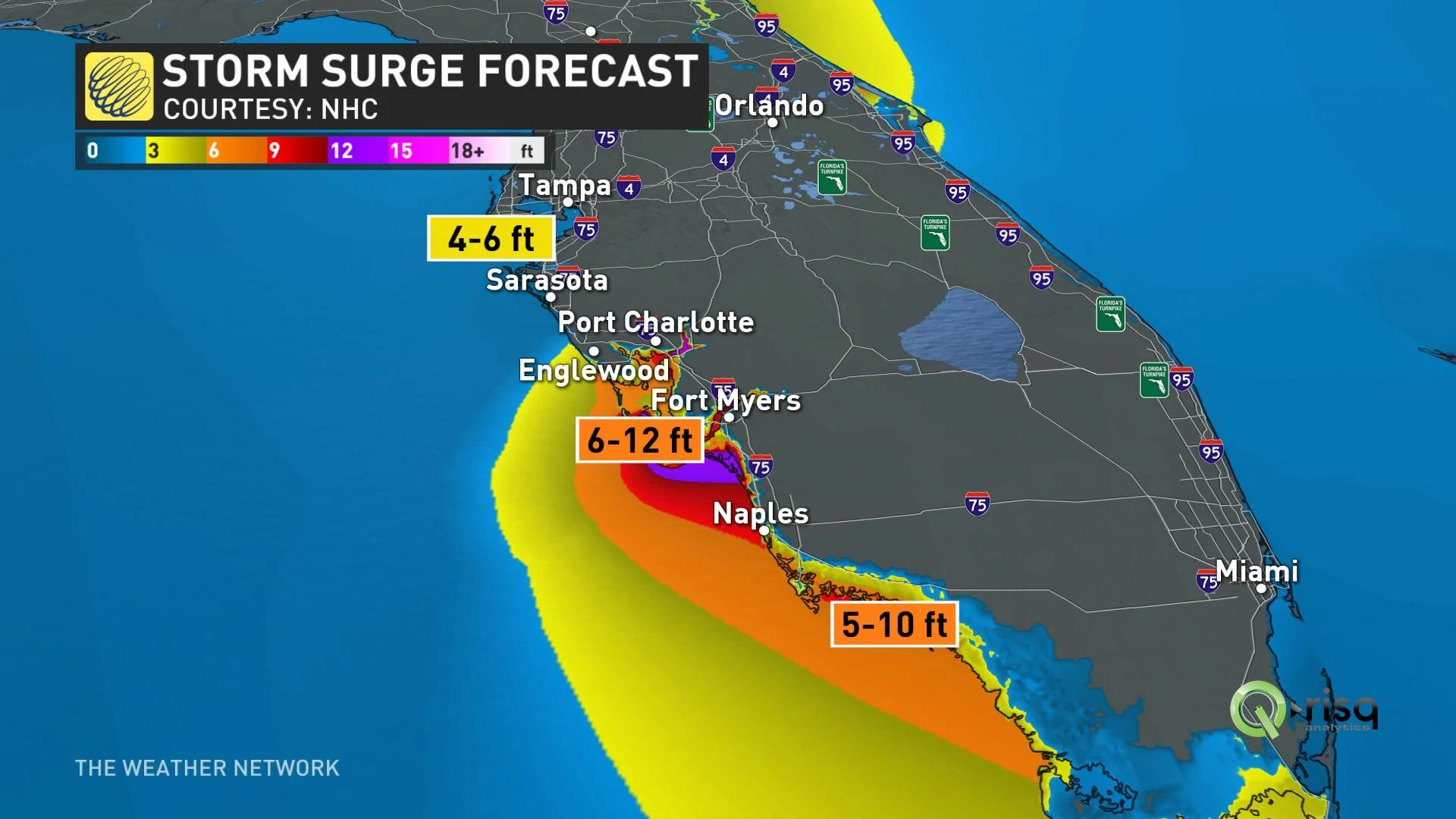
Mandatory evacuations have already been announced in the Tampa Bay area of Florida, the most storm surge-prone city in the United States, due to the hurricane's potentially catastrophic storm surges.
Post-Ian moisture could climb through the United States and appear in Canadian long-term forecasts. Depending on the direction the storm decides to go, southern Ontario could see a rain remnants. More likely, though, the system will stay east and exit into the mid-Atlantic, and beyond our shores.
WATCH: Fiona wallops Atlantic Canada with destructive winds and storm surge
Thumbnail courtesy of NOAA.
Stay tuned to The Weather Network for the latest forecast updates on Hurricane Ian.