Eyes on the Gulf of Mexico as a new tropical storm is likely coming

The Atlantic is gearing up for the likelihood of its next tropical storm, Bertha, after the formation of a tropical depression on Sunday
The 2026 Atlantic hurricane season has started off in an unusually quiet fashion with only one named storm so far.
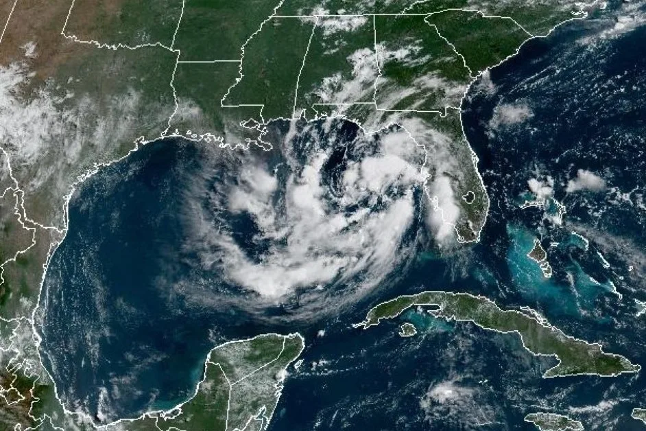
But that could soon change with a new tropical depression in the northern Gulf of Mexico. With that, forecasters are expecting it to become a named storm later on Sunday or by Monday. When it does, it will take on the Bertha moniker, the second named storm of the Atlantic hurricane season.
RELATED: Experts issue 2026 hurricane outlook, what it could mean for Canada
Interests in Alabama, Louisiana, Texas and Mississippi should be on alert, and will need to monitor the forecast for updates on its progress in the coming days.
Bertha is likely coming soon
A tropical storm watch has been issued for the Florida Panhandle, ranging from the Ochlockonee River to the Florida-Alabama border.
Additional watches will likely be required over the next day or two.
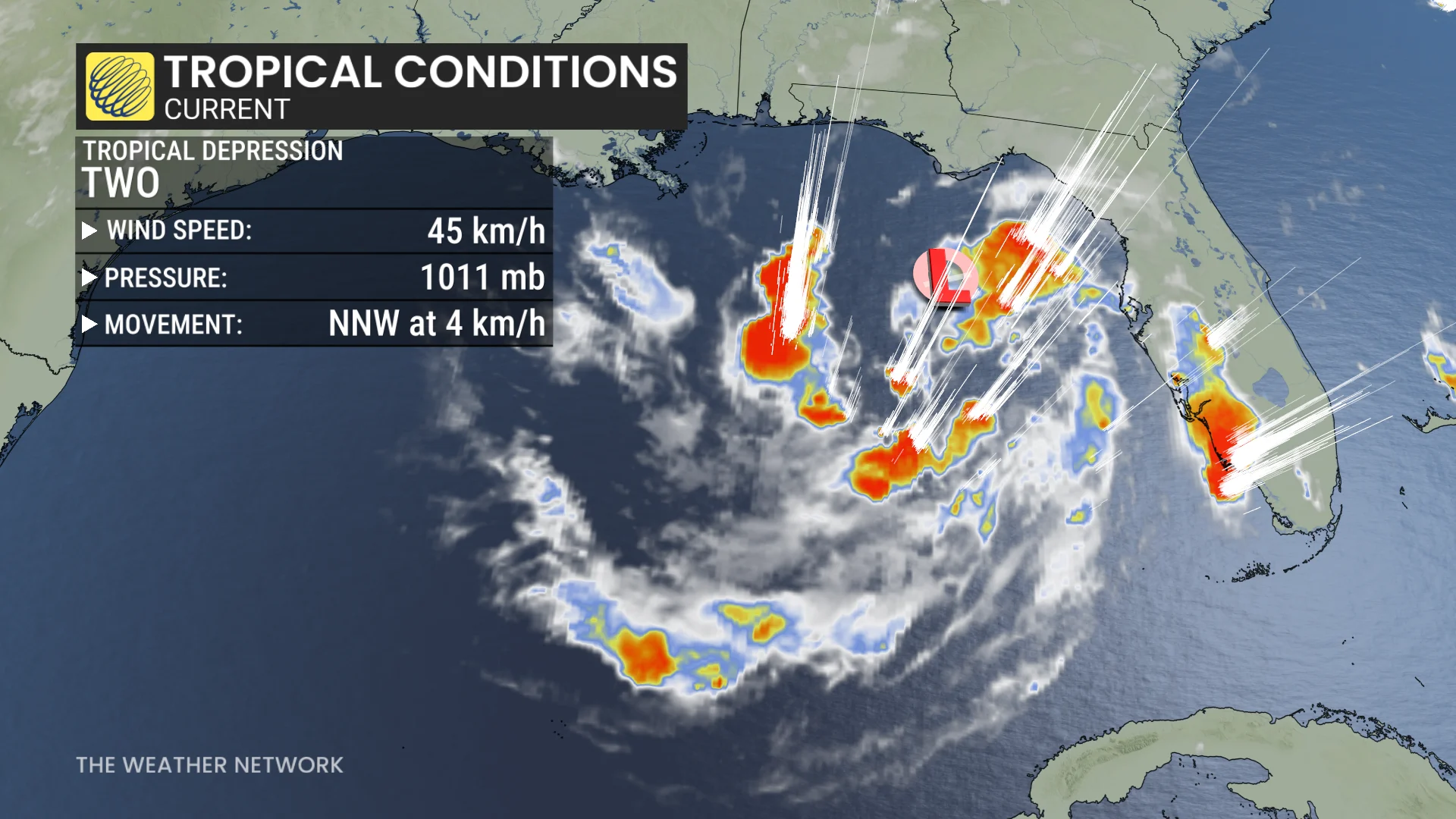
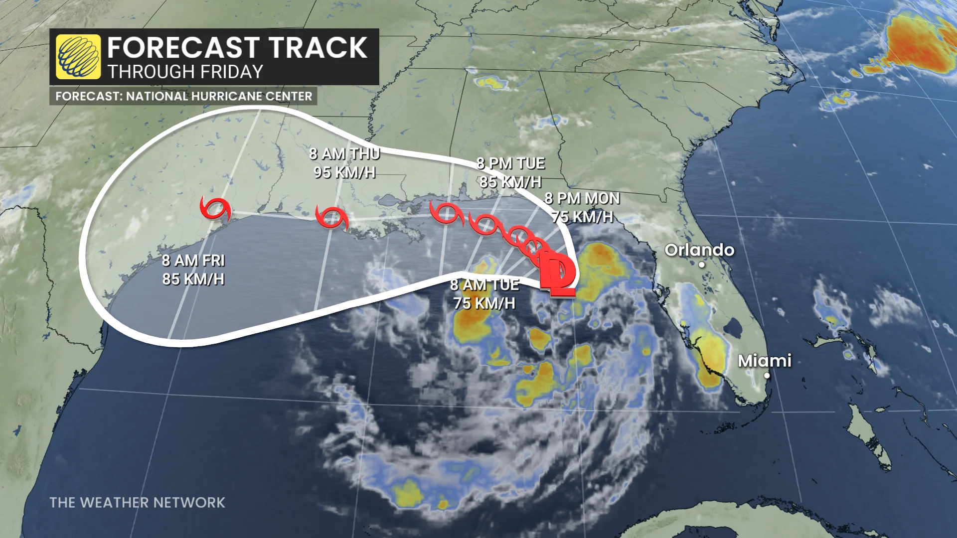
As of Sunday morning, the depression is moving toward the north-northwest near 4 km/h, with a slow, northwestward or north-northwestward motion expected during the next day or two, followed by a turn toward the west.
On the forecast track, the depression will move near or along the northern Gulf Coast during the next several days.
According to the U.S. National Hurricane Center (NHC), maximum, sustained winds are near 45 km/h) with higher gusts. Gradual strengthening is forecast, and the depression is expected to become a tropical storm tonight or on Monday.
The tropical depression is expected to produce rainfall of 50-100 mm, with locally higher totals 200 mmm, through Thursday along the eastern and central Gulf Coast from western Florida to southern portions of Alabama, Mississippi, and Louisiana.
This rainfall may produce areas of flash flooding, especially in urban areas.
Forecasters predicting a below-average hurricane season
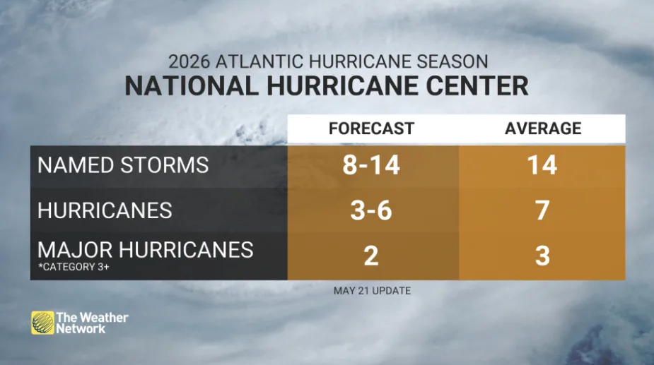
The Atlantic hurricane season has officially started and will continue through the end of November. This year, NOAA is forecasting a below-average hurricane season, with expectations for 8-14 named storms, 3-6 hurricanes, and up to two major hurricanes reaching Category 3 or higher.
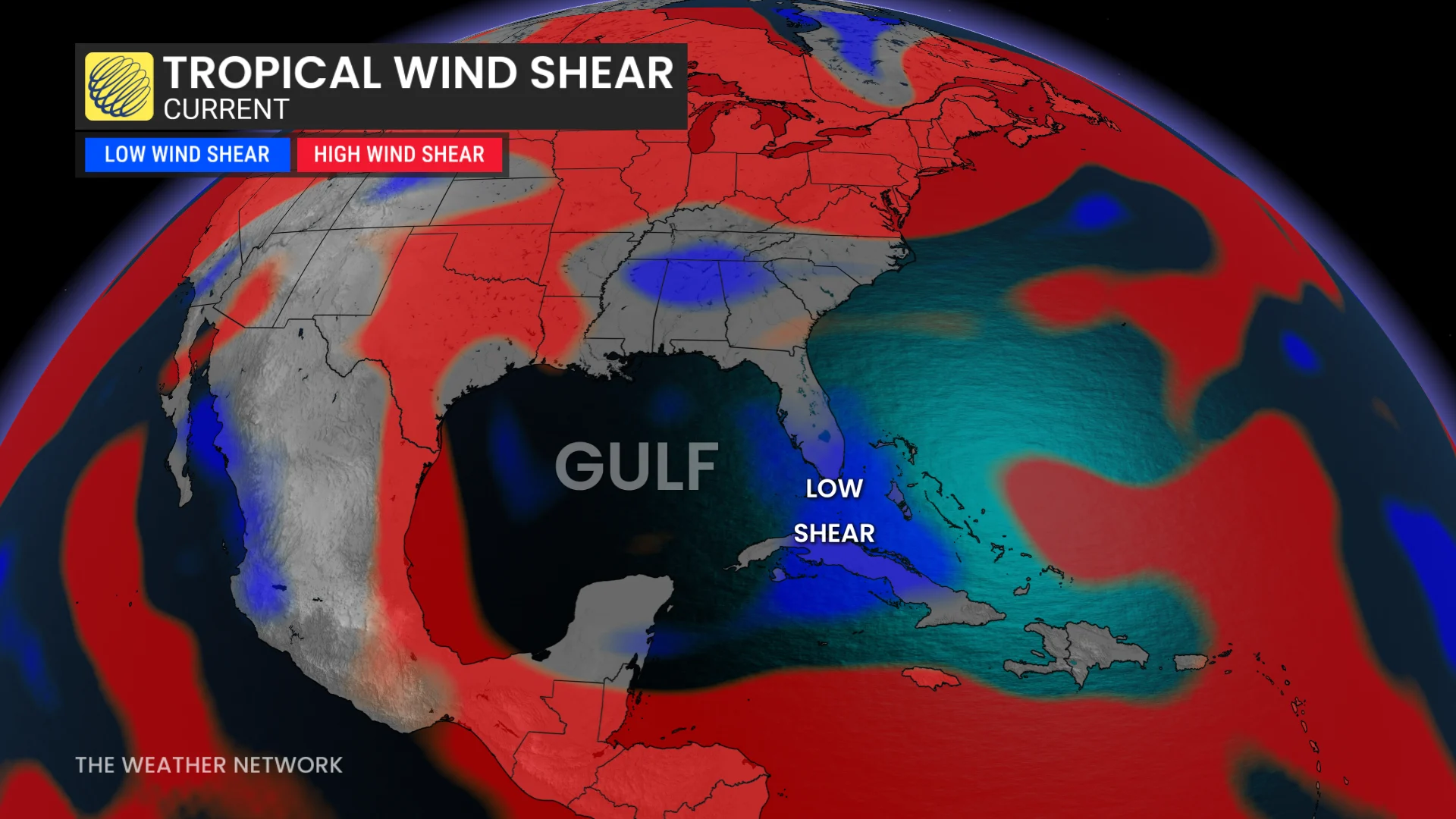
El Niño, which has now been officially confirmed, is a key factor in this forecast. El Niño typically reduces tropical cyclone activity in the Atlantic basin due to stronger, upper-level winds that can disrupt storm formation.
Looking ahead, El Niño is projected to strengthen further as the region moves into the winter of 2026-27, potentially influencing global weather patterns beyond this hurricane season.
Stay updated on evolving conditions, and remember, even a small amount of moving water can pose significant dangers.
Thumbnail courtesy of NOAA.