Arthur threatens the Gulf Coast as the Atlantic's first named storm in 2026
The first named storm of the 2026 Atlantic hurricane season, Arthur, is expected to bring intense rainfall and high winds, resulting in a prolonged flood risk for areas from Texas to Mississippi.
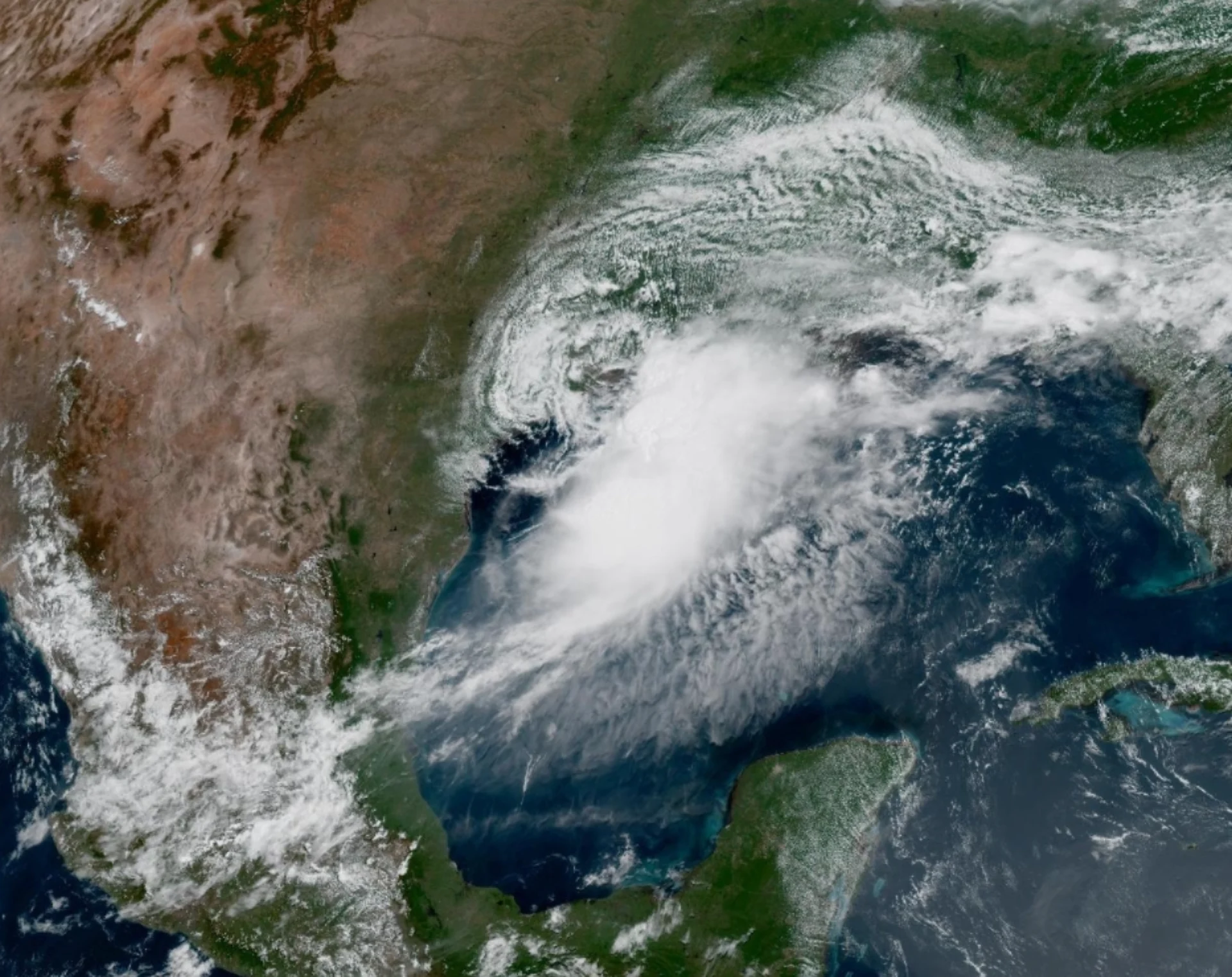
The Atlantic has its first named storm of the season, Arthur, which threatens the U.S. Gulf Coast states with extreme rainfall and flooding.
While rainfall amounts will be extreme, accompanied by intense wind gusts, Tropical Storm Arthur won't become a hurricane before it moves inland over Louisiana Wednesday night.
RELATED: Experts issue 2026 hurricane outlook, what it could mean for Canada
Flooding will be the concern from southeastern Texas across Louisiana, and central Mississippi and Alabama over the coming days.
Arthur will pack a punch in its short-lived life
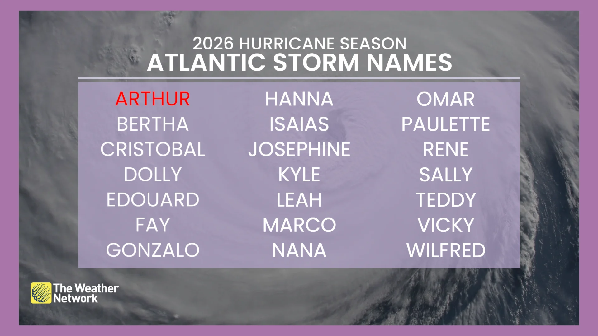
The 2026 Atlantic hurricane season has started off in an unusual fashion.
The subtropical low that has been riding the Texas coastline has managed to gather enough energy from the Gulf of Mexico to become the first named storm of the season, Arthur.
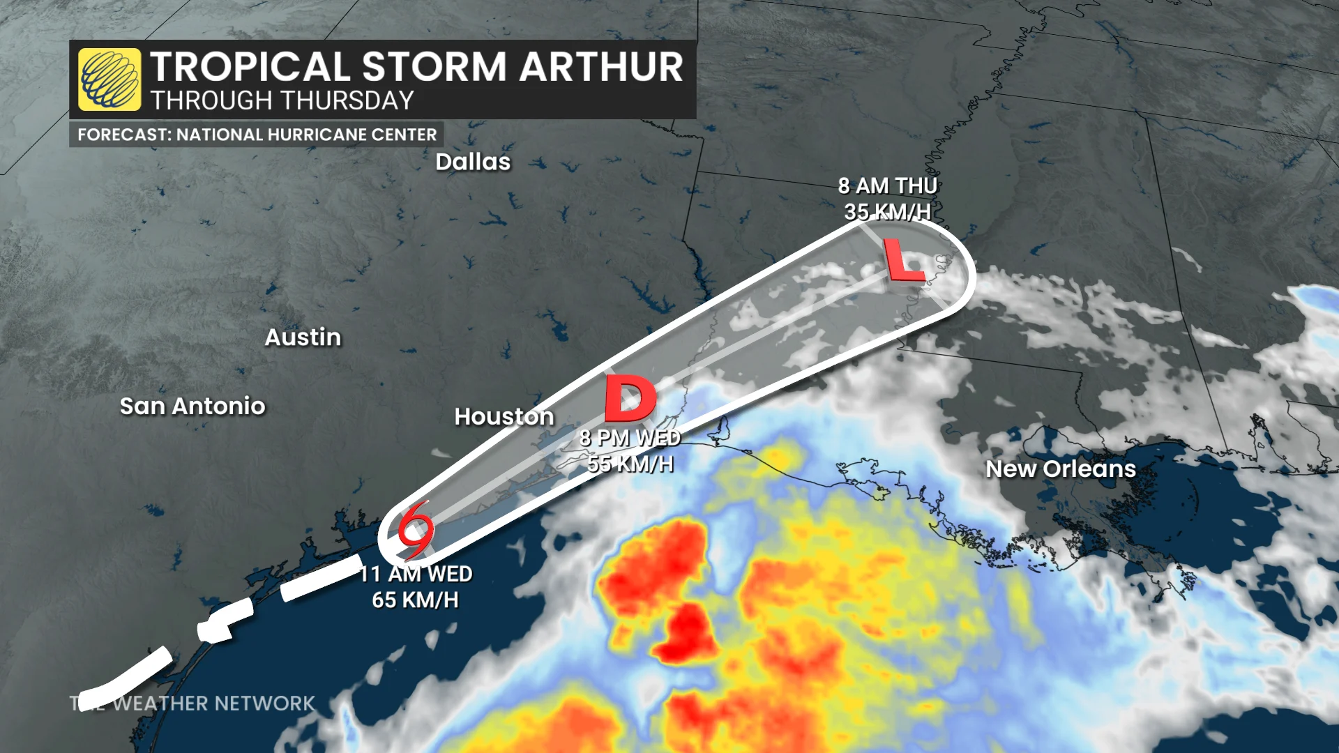
A tropical storm warning is in effect for parts of the Gulf Coast, from Sargent, Texas, to Morgan City, La.
On the forecast track, Arthur should move farther inland over southeastern Texas and southwestern Louisiana through Wednesday night, according to the latest forecast update from the U.S. National Hurricane Center (NHC).
Maximum, sustained winds are near 75 km/h with higher gusts. Weakening is anticipated as the low moves farther inland, and it could dissipate by tonight or early Thursday.
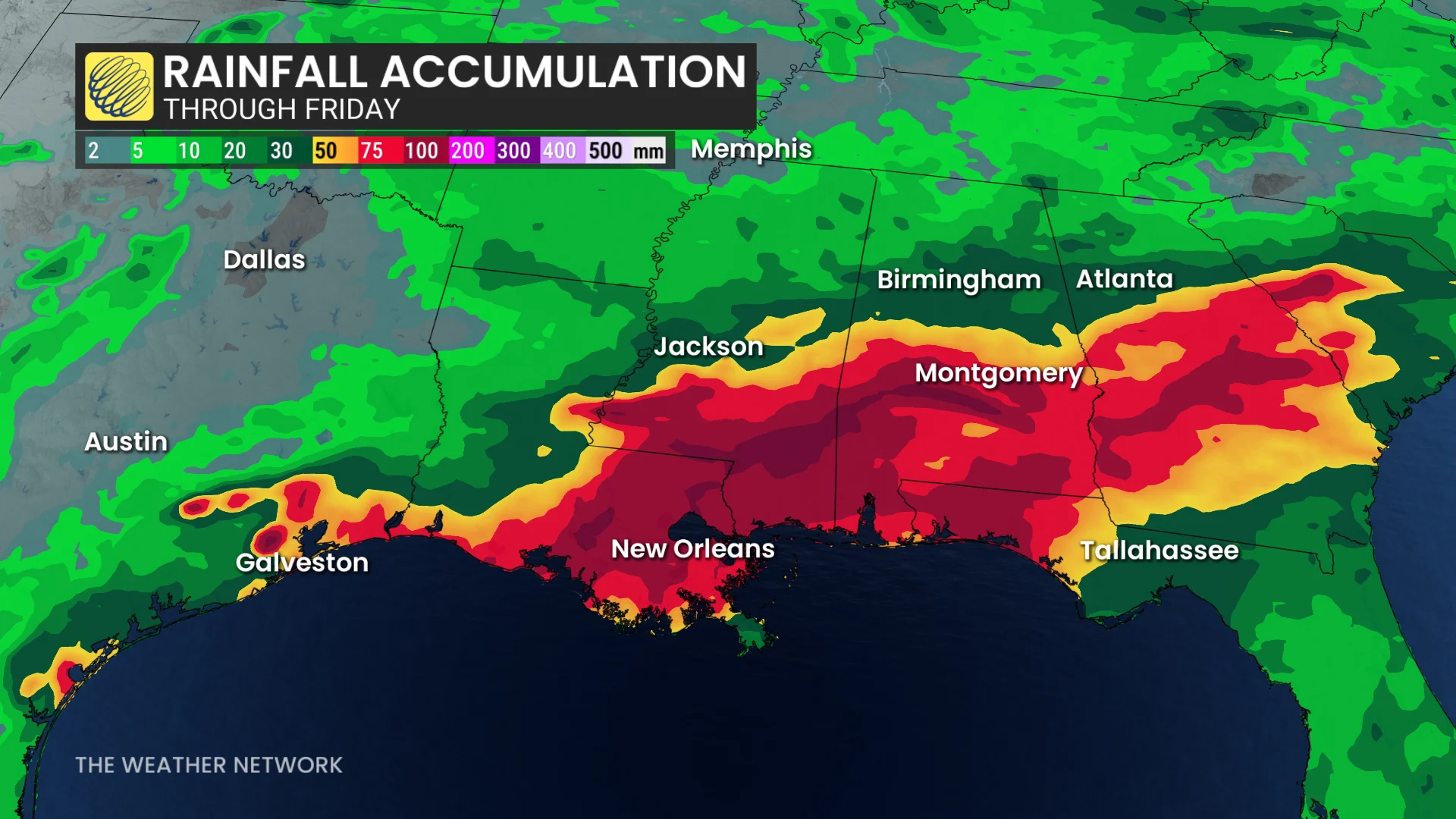
Tropical Storm Arthur is expected to produce rainfall totals of 125 mm to 250 mm, with isolated higher totals near 400 mm, through early Friday from the Texas coast, east-northeast into southern and central portions of Louisiana, Mississippi, and Alabama, along with western portions of Georgia and the Florida Panhandle.
This could generate dangerous to life-threatening flash flooding.
A couple of tornadoes are possible through Thursday from parts of the Texas coast into southern Louisiana, Mississippi, Alabama, and the western Florida Panhandle.
Forecasters predicting a below-average hurricane season
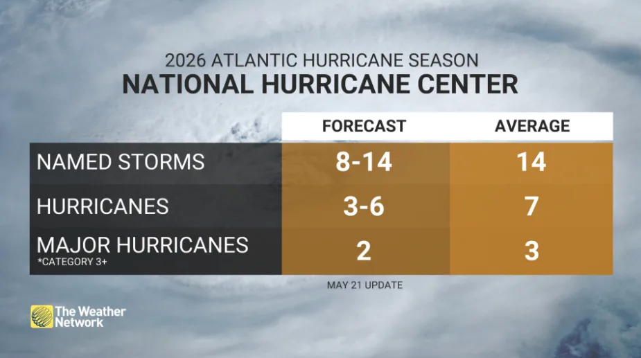
The Atlantic hurricane season has officially started and will continue through the end of November. This year, NOAA is forecasting a below-average hurricane season, with expectations for 8-14 named storms, 3-6 hurricanes, and up to two major hurricanes reaching Category 3 or higher.
El Niño, which has now been officially confirmed, is a key factor in this forecast. El Niño typically reduces tropical cyclone activity in the Atlantic basin due to stronger, upper-level winds that can disrupt storm formation.
Looking ahead, El Niño is projected to strengthen further as the region moves into the winter of 2026-27, potentially influencing global weather patterns beyond this hurricane season.
Stay updated on evolving conditions, and remember, even a small amount of moving water can pose significant dangers.
Thumbnail courtesy of NOAA.