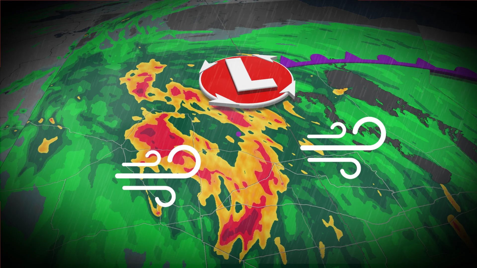
Eastern Prairies face large hail, soaking rains and damaging wind potential

Folks in Saskatchewan and Manitoba will need to stay alert on Sunday as a similar pattern to Saturday's storm threat will unfold, with a potential for damaging winds, large hail and heavy rain.
After a stormy Saturday across parts of the Prairies, there will be a renewed threat for severe storms to develop throughout Sunday.
In fact, multiple rounds of hazardous weather is expected from the morning to the evening in parts of Saskatchewan and Manitoba.
Be sure to monitor the radar if you’ve got plans through Sunday night, and stay aware of potential watches and warnings in your area.
DON’T MISS: What is a mesoscale convective system? How an 'MCS' can spell danger
Severe weather likely in multiple rounds on Sunday
Moisture and instability streaming over the Prairies to end the weekend will bring a fresh threat for strong to severe thunderstorms across the region.
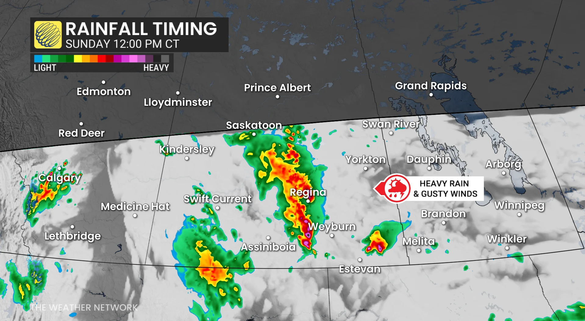
The greatest concern will exist in southern Saskatchewan into southern Manitoba, including areas around Regina and Brandon.
A low over southern Saskatchewan is producing showers and thunderstorms through the morning and afternoon. Multiple rounds are expected on Sunday, with stronger storms pushing into southeastern Saskatchewan and southwestern Manitoba.
Favourable dynamics like CAPE are providing an environment for a potent, late-season severe weather risk.
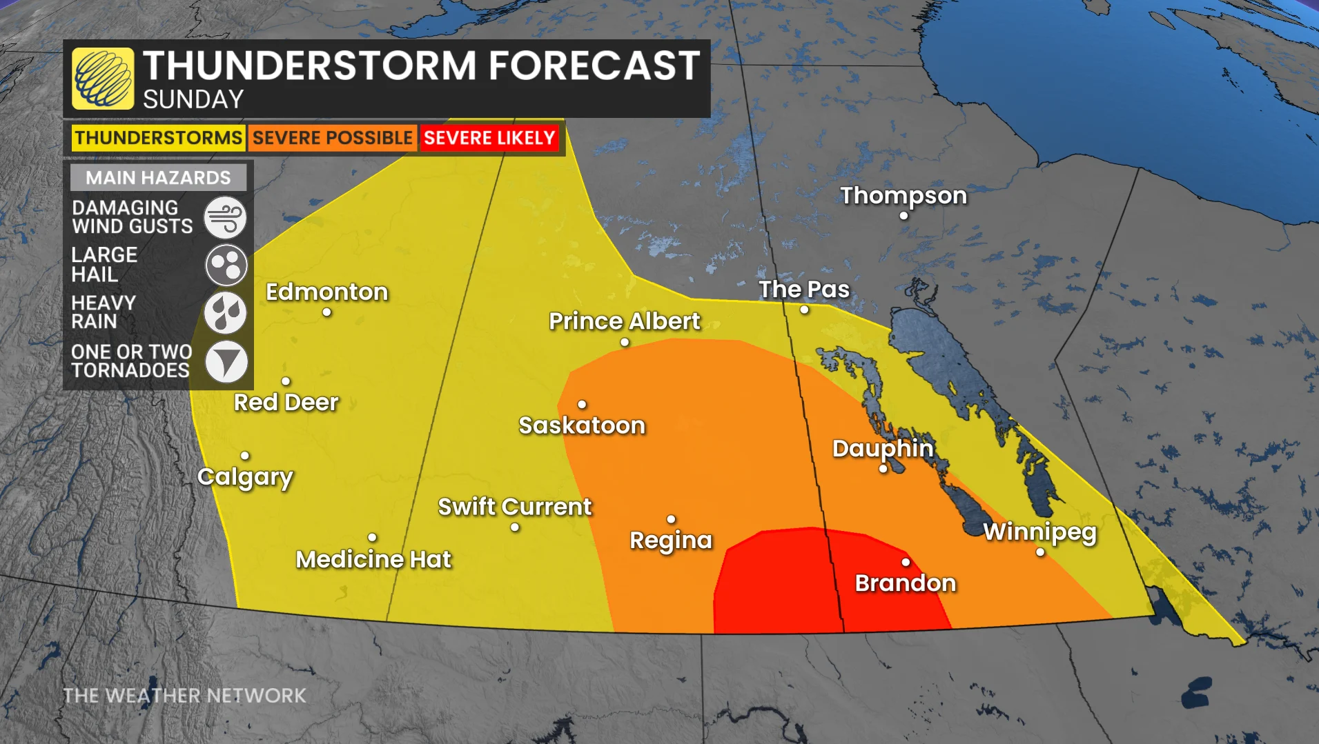
Storms really start to organize across southeastern Saskatchewan as the upper low approaches and adds more lift. We could see supercells developing, bringing the risk of large hail and damaging winds, as well as torrential rain.
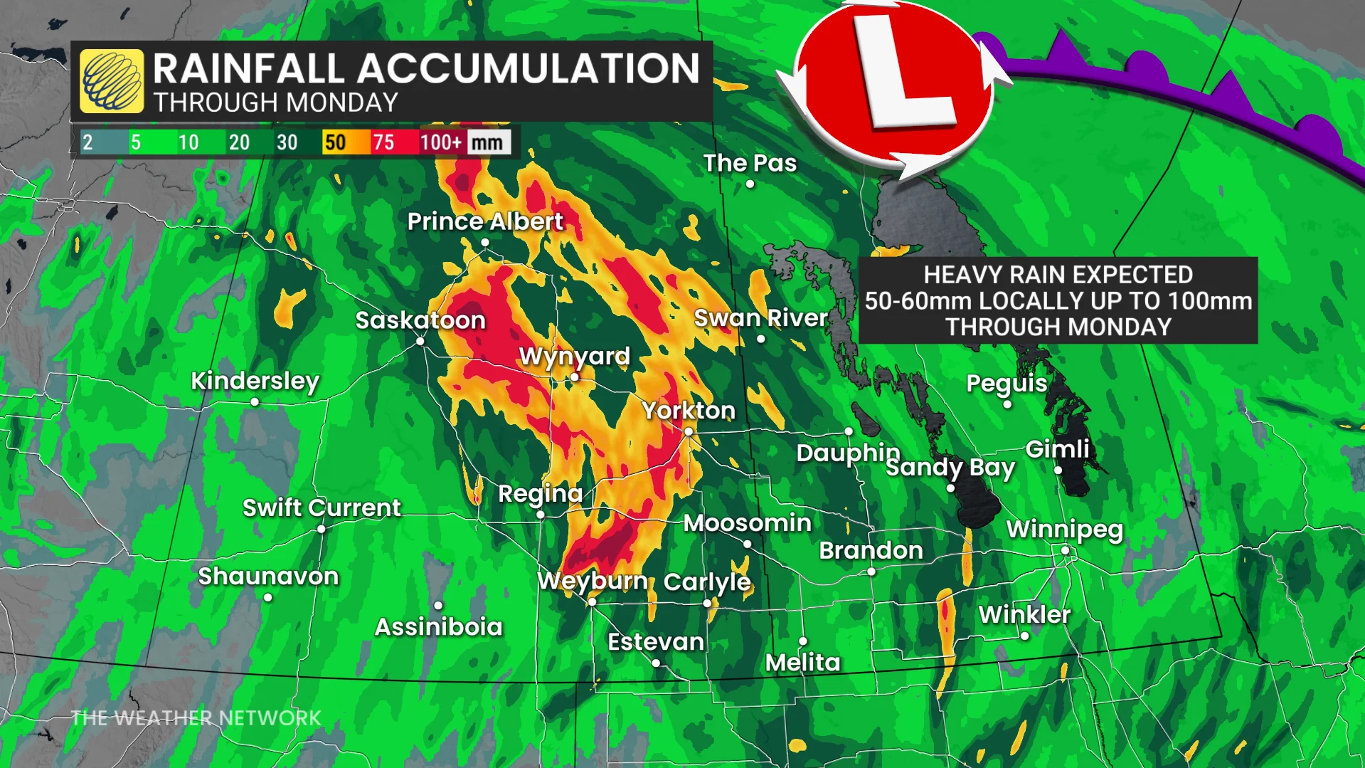
Rainfall warnings are in place for parts of southern Saskatchewan, with 50–60 mm possible and localized totals of 80–100 mm in thunderstorms into Monday.
The heaviest rain is expected Sunday afternoon in southern Saskatchewan, and could last into Monday morning.
As the afternoon goes on, storms are expected to quickly grow into one or more organized lines.
By Sunday evening and overnight, the line of storms push east into southwestern Manitoba, with the threat shifting more towards strong winds and heavy rain.
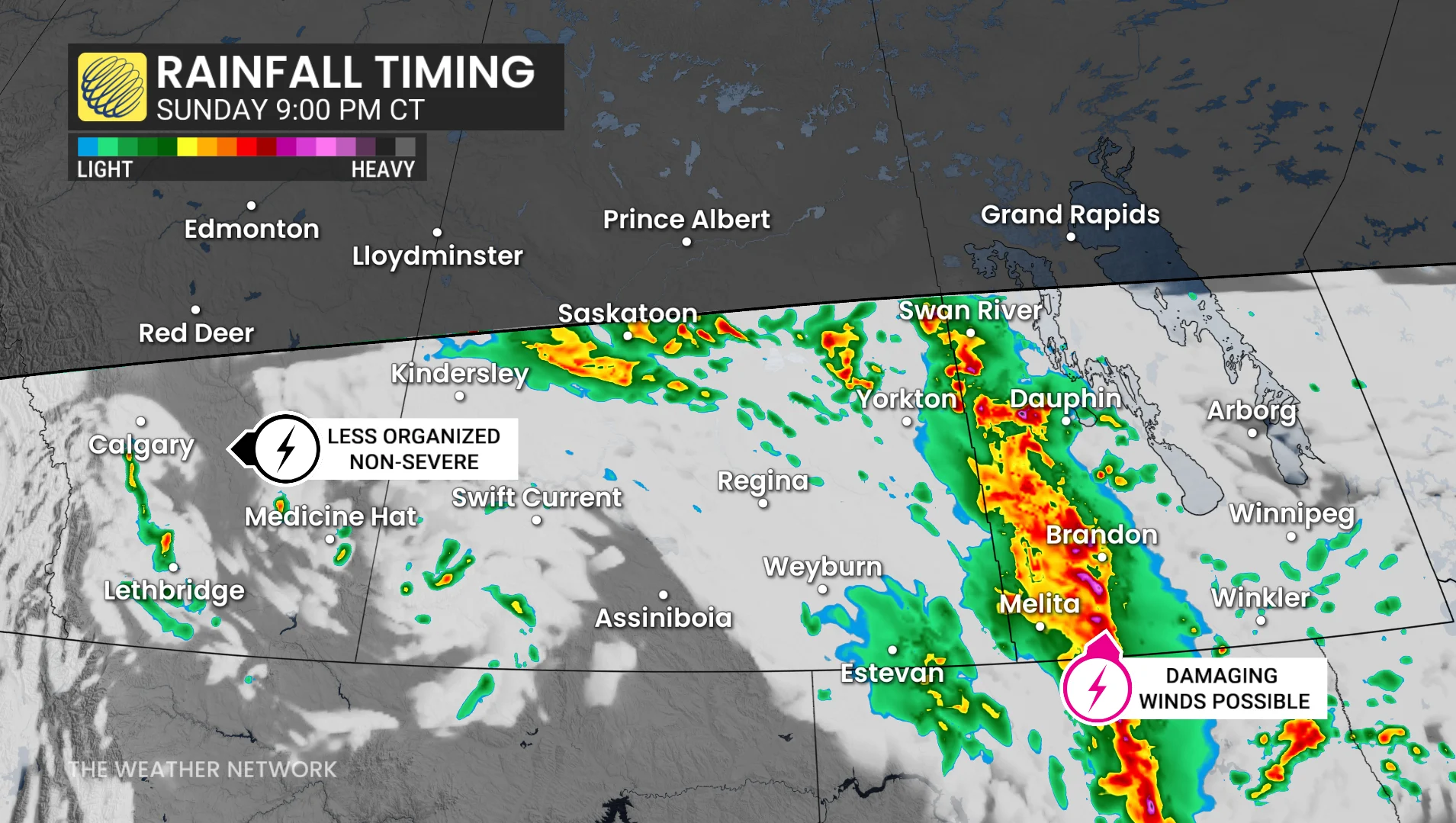
Storms and heavy rain continue through Sunday overnight and into Monday morning across southern Manitoba.
On the backside of the low on Monday, the rain threat is in the cards for Saskatchewan.
Stay with The Weather Network for all the latest on conditions across the Prairies.