Frost warnings and overnight night snow hits southern Ontario

Spring will hit the pause button Wednesday as temperatures plunge below zero and the threat for frost and snow creeps in.
Southern Ontario has taken a step back into March-like weather territory, with a sharp temperature plummet that was accompanied by snow flurries and a frost threat that will last into Thursday morning. Those in frost-prone areas are urged to cover up plants. However, conditions will improve for the end of the week, thanks to a blocking pattern in Eastern Canada. Several days of sunshine lies ahead for southern Ontario, continuing through the weekend. More on the major temperature dip and what's coming, below.
RELATED: Atmospheric gridlock halts weather in Eastern Canada, here's how
MID-WEEK: TEMPERATURES TUMBLE, WITH THREAT FOR SNOW AND FROST
A trough brought in much cooler air Tuesday, with a quick burst of Arctic air pushing into the lower Great Lakes region, sending temperatures plummeting. This prompted Environment and Climate Change Canada (ECCC) to issue a frost advisory for the City of Toronto, Niagara and the Windsor-Essex regions.
"Cover up plants, especially those in frost-prone areas. Take preventative measures to protect frost-sensitive plants and trees," ECCC says in the advisory, adding that the threat for frost will persist Wednesday night into Thursday, as well.
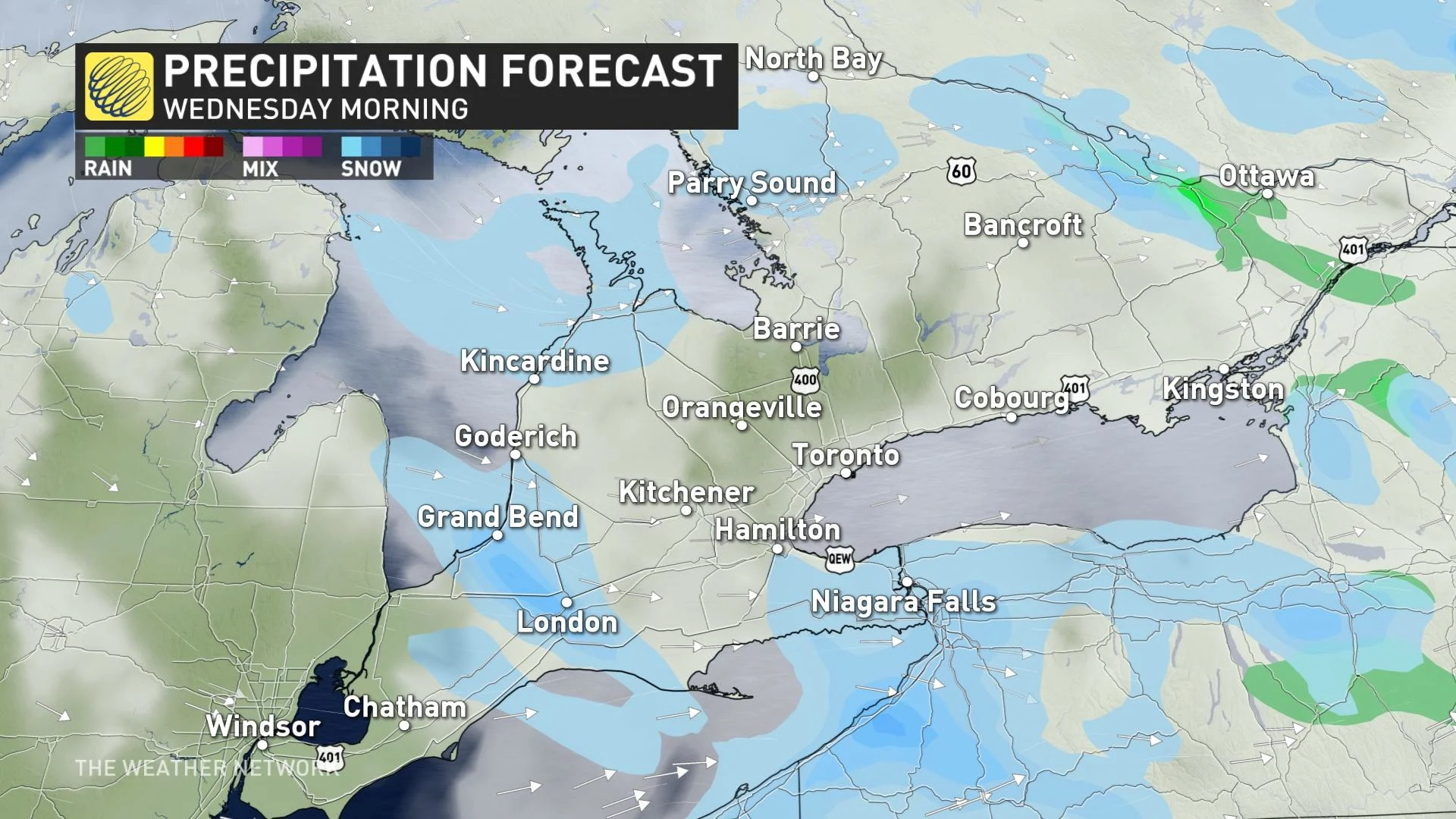
In addition to the frost, as rain showers moved out of southern Ontario, a band of scattered flurries made its way into the region Tuesday evening from southern Lake Huron, pushing into the western Greater Toronto Area (GTA), Golden Horseshoe and Niagara in the overnight hours.
Another band of flurries will push in Wednesday morning from northern Lake Huron shores, eventually petering out in the afternoon.
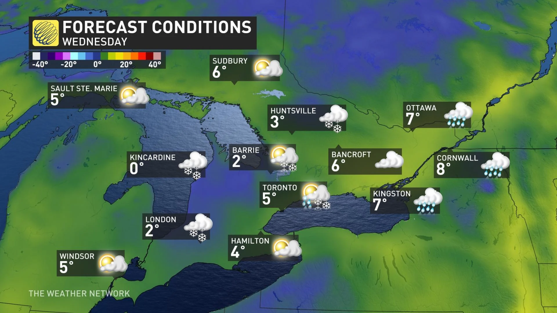
Temperatures could be up to 10°C below seasonal on Wednesday, taking us back to March-like weather. Daytime highs stuck in the low single digits, hovering close to the freezing mark in many areas. In fact, the streak of below-seasonal air will put parts of southern Ontario on par with the regions closer to the Arctic Circle. Kincardine, for example, can expect a high of just 0°C on Wednesday.
MUST SEE: Toronto has yet to hit 20 C this spring, here’s when it could happen
Beyond Wednesday, Ontario's weather will be locked into a more pleasant ridging pattern with sunshine, but it's not enough to pump temperatures into seasonal or above seasonal territory.
The colder northerly air moving in will keep temperatures cool and below seasonal for the days ahead. An easterly wind will develop off Lake Ontario this weekend, holding temperatures back a few degrees around the west end of Lake Ontario, including the GTA.
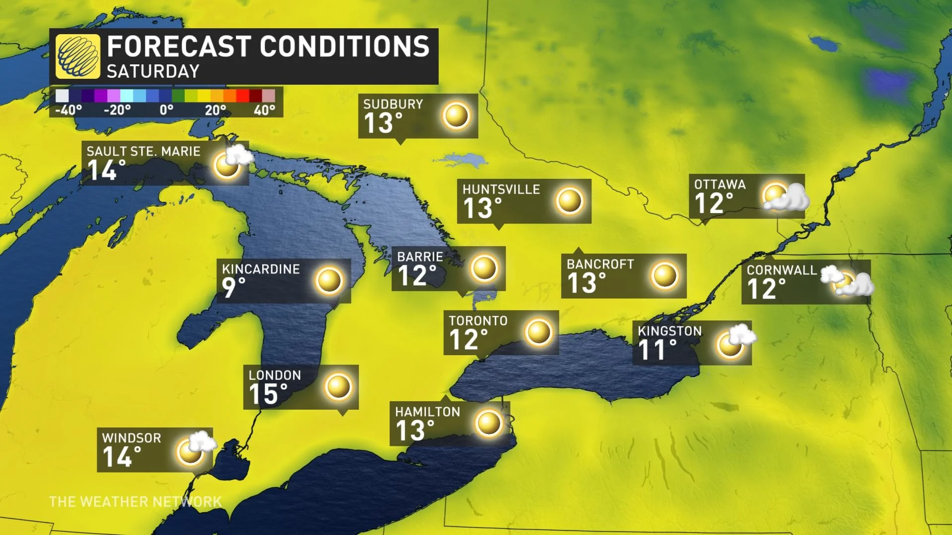
Several days of sunshine for southern Ontario will continue through the weekend.
This spell of below-seasonal conditions looks to continue through the beginning of May, with no signs of consistent warmth locking in any time soon.
Stay with The Weather Network for the latest conditions across Ontario.
Thumbnail image courtesy: Melinda Singh/Twitter