Confidence increasing in a very strong El Niño by this summer

Certain models are quite forceful in suggesting that a very strong El Niño is on the horizon
Each passing week provides more signs that a strong El Niño is likely as water temperatures rapidly warm across a key region of the Pacific Ocean.
Our budding El Niño will have far-reaching effects on weather patterns around the world, including on this year’s hurricane seasons, as well as overall summertime conditions here in Canada.
DON’T MISS: El Niño may split Canada’s summer in two
Temperatures warming very quickly in key Pacific region
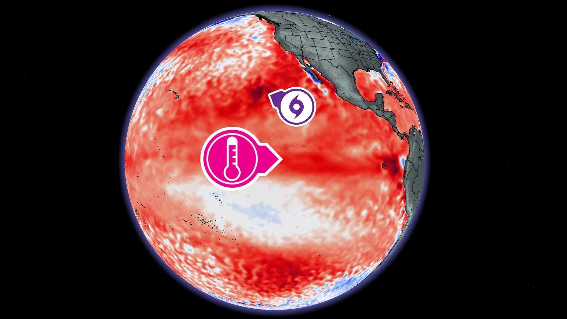
Forecasters look at a rectangular patch of Pacific waters known as the Niño 3.4 region to help judge the status of El Niño-Southern Oscillation (ENSO).

Sea surface temperatures here quickly flipped from below-seasonal to above-seasonal through the first four months of 2026. Average temperatures in this region are now running around 0.3°C above seasonal and climbing.
El Niño occurs when the atmosphere responds to warmer-than-normal waters that persist in the Niño 3.4 region for several consecutive months.
Forecasters increasingly confident in a strong El Niño
Not only are we likely heading into an El Niño pattern, but weather models are providing increased confidence that this will be a strong event.
The well-regarded European model, run by the ECMWF, has gotten plenty of attention in recent days for its almost shocking insistence that El Niño will grow very strong through this summer.
This particular ensemble model runs many different scenarios with slightly different starting conditions to capture a broad range of possibilities.

RELATED: Experts are changing how we measure El Niño and La Niña
Just about every member of the ensemble shows water temperature anomalies in the Niño 3.4 region reaching or exceeding 2.0°C above seasonal. This isn’t a foregone conclusion, of course, but it’s another data point in support of a very strong El Niño to come.
Last month’s prediction from the U.S. Climate Prediction Center (CPC) called for a one-in-four chance of a very strong El Niño by this autumn. Forecasters with the CPC will issue their next outlook on Thursday, May 14.
Hawaii, Mexico, California have to watch busy hurricane season
A busier-than-normal hurricane season is possible in both the central and eastern Pacific basins as this pattern ramps up.
We record about 15 named storms, 8 hurricanes, and 4 major hurricanes during a typical eastern Pacific hurricane season.
DON’T MISS: Experts issue 2026 hurricane season outlook, what it could mean for Canada

Warmer-than-normal ocean waters, paired with more unsettled conditions than usual, could afford more opportunities for tropical cyclones to sweep through the region.
This would place greater risk for direct impacts from tropical cyclones to communities across Mexico’s west coast, including Acapulco and Puerto Vallarta, as well as the Hawaiian Islands. California and the U.S. Southwest would also have to watch for a flood risk from the remnants of storms.
The same pattern may result in a slower-than-normal hurricane season across the Atlantic basin. However, it only takes one landfalling storm to cause significant impacts for the affected areas. All coastal residents are advised to prepare for the season well in advance of any storm’s formation.