Another 3-5+ cm of snow before Arctic air reloads in Ontario this weekend
Light snow to end the week in Ontario, with a cold weekend ahead, and mid-month warm-up on the horizon
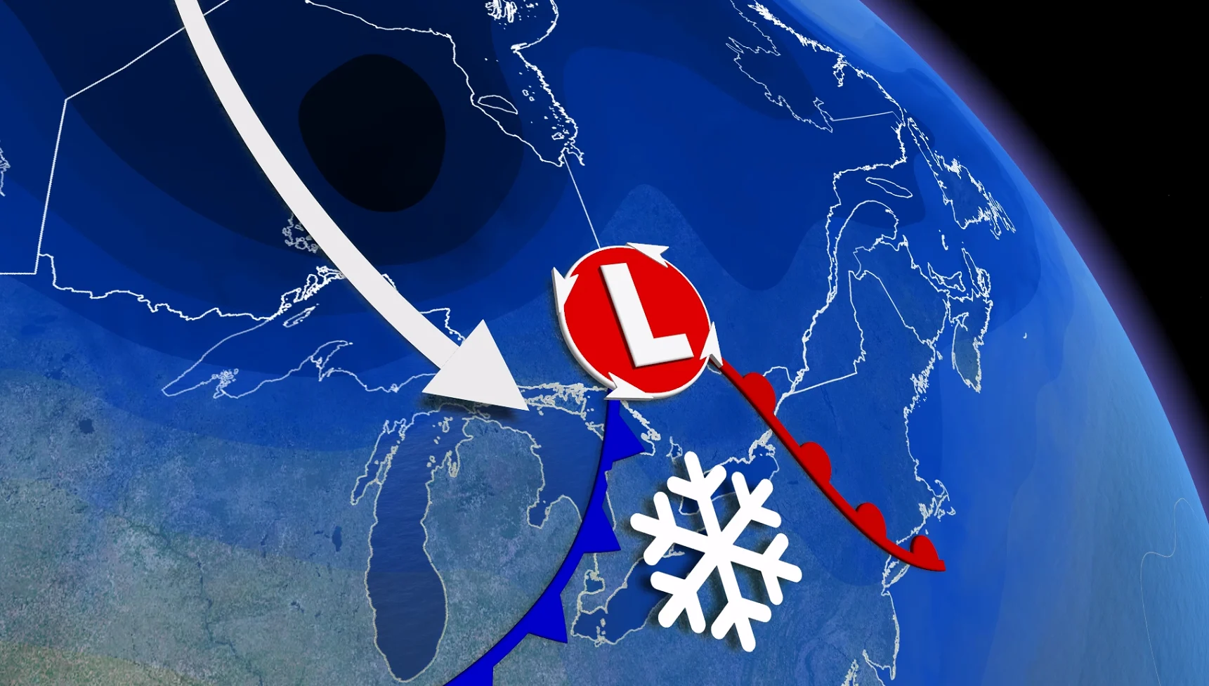
A cold Arctic air mass will grip Ontario this weekend, following a widespread snow event.
Forecast models indicate a shift to a milder and more active weather pattern through mid-February, with the potential for multiple messy systems next week. These could bring a mix of precipitation, including snow, freezing rain, and rainfall, depending on the region and temperature fluctuations.
DON'T MISS: February’s significant daylight comeback is here, Canada
While winter is far from over, this transition marks a significant departure from the intense Arctic air expected this weekend. It is unlikely that temperatures will drop as low for the rest of the season, though conditions will remain variable.
Snow to impact both the morning and afternoon commutes on Friday
On Thursday and Friday, a clipper system from northwestern Canada will cross the province, resulting in 3-5+ cm of snow for most areas.

Locally higher amounts of 5-10 cm are expected near Lake Huron, Georgian Bay, and parts of northwestern Ontario.
Residents in the Greater Toronto Area (GTA) and southern Ontario should prepare for snowy roads during Friday's morning and afternoon commutes. Strong winds of 40-60+ km/h, with even higher gusts along lakeshores, will lead to blowing and drifting snow, reducing visibility, particularly near snowbelt regions.

Risk for the coldest wind chill of the season this weekend
This weekend, Arctic air will deepen across Ontario, with daytime highs in the mid-minus teens and nighttime lows plunging into the -20s.
RELATED: Ontario’s longest cold snap in over a decade: Is the end near?
Wind chills could reach the low -30s in some areas, creating frostbite risks for exposed skin in just minutes. This frigid air mass may result in cold weather warnings.

Arctic air may begin to ease next week
Long-range weather models suggest a possible shift in the persistent cold pattern gripping Ontario.
DON'T MISS: Groundhog Day 2026: See the predictions here!
There are early signs that the atmospheric blocking responsible for the recent stretch of colder-than-seasonal weather might weaken late next week.

If this pattern breaks down, there’s potential for temperatures to moderate closer to seasonal or even rise slightly above normal. For Toronto, typical seasonal highs for this time of year are near -1°C.