A spring swing sees a temperature swap in Canada to end April

The end of the month could even be a bit more disappointing than usual with colder-than-normal air dominating much of Canada. There is one notable exception, however.
While parts of Canada have been teased by mid-summer heat this month, you can expect a more typical end to the month for some. It could even be a bit more disappointing than usual with colder-than-normal air dominating a lot of the country.
However, there is a small exception to this chillier-than-normal pattern: Parts of Western Canada.
DON'T MISS: Heads up, travellers: Florida’s severe drought raises fire worries

A ridge of high pressure is forecast to build across British Columbia and Alberta for the final weekend of the month, bringing temperatures that will climb into the low and even mid-20s for a couple days.
This will be a welcome forecast for most, as April has featured below-seasonal temperatures dominating much of the West, marked by recent snowfalls for B.C. and blizzard conditions for the southern Prairies.

DON’T MISS: Bug bites and rashes got you down? Here are 8 remedies
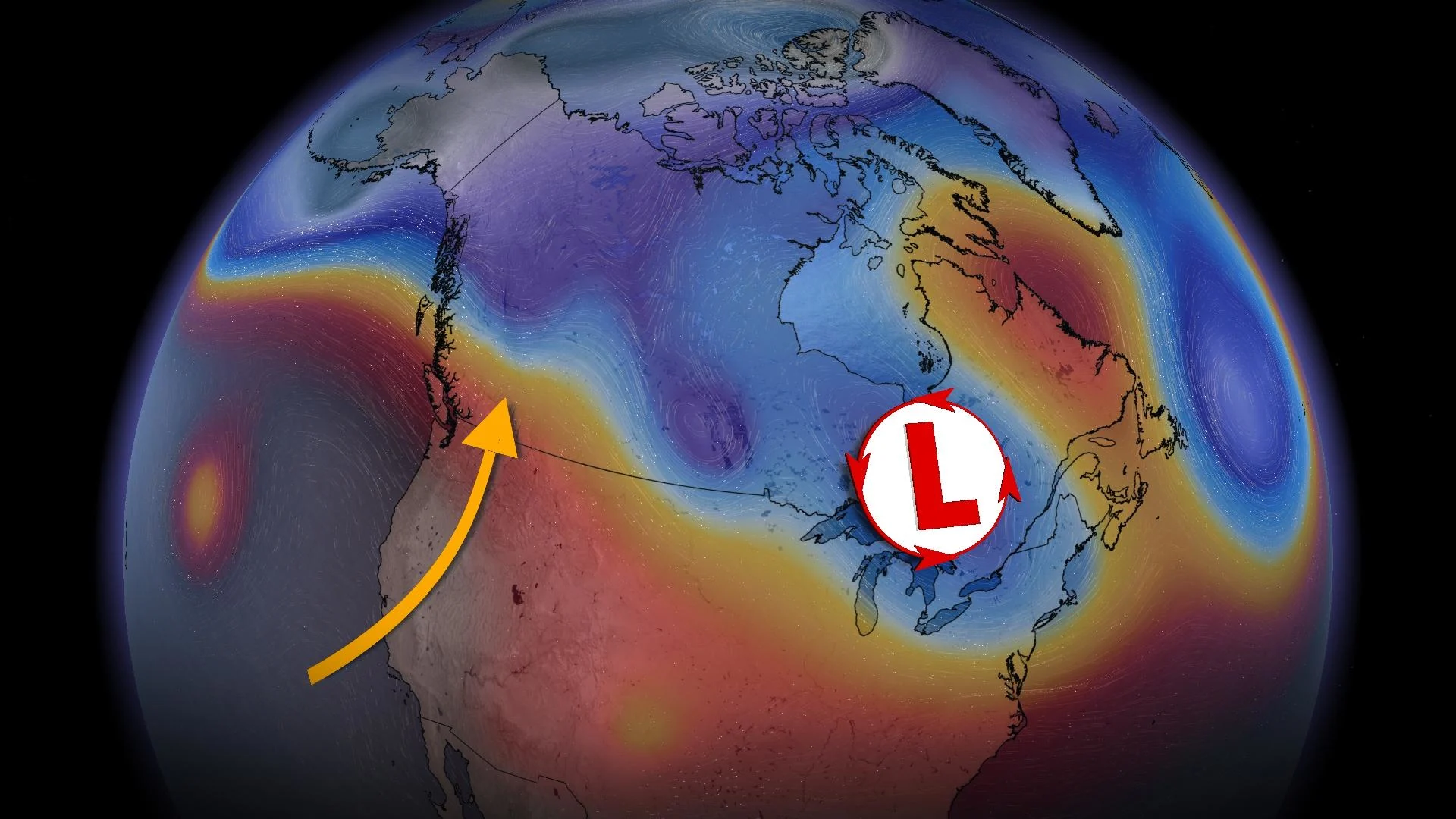
A cool and wet pattern is forecast for the final week of April and into the start of May across Ontario and Quebec.
A pair of upper lows will likely position themselves over the Great Lakes over the next week or two, delivering rounds of wet, unsettled weather and below-seasonal temperatures.

Fair weather conditions with some periods of showers or flurries can be expected across Atlantic Canada, but residents can thank an area of high pressure located across Labrador from sparing the region of any major precipitation totals until at least the beginning of May.
There’s no end in sight for the dry stretch of weather across Atlantic Canada. Halifax is on pace for the driest April since 1966, with just more than 20 mm of rainfall recorded.
The Newfoundland forecast is suspiciously consistent, but a strong, predictable north wind blowing off the icy Atlantic Ocean will keep St. John’s daytime highs at 2°C for at least eight days.

It’s not a great sign for St. John’s that the warmest day of the year so far occurred on Jan. 15.
With files from Kelly Sonnenburg, Tyler Hamilton and Rachel Modestino, meteorologists at The Weather Network.