Winter warnings line the Prairies for potent spring snowstorm, dangerous travel

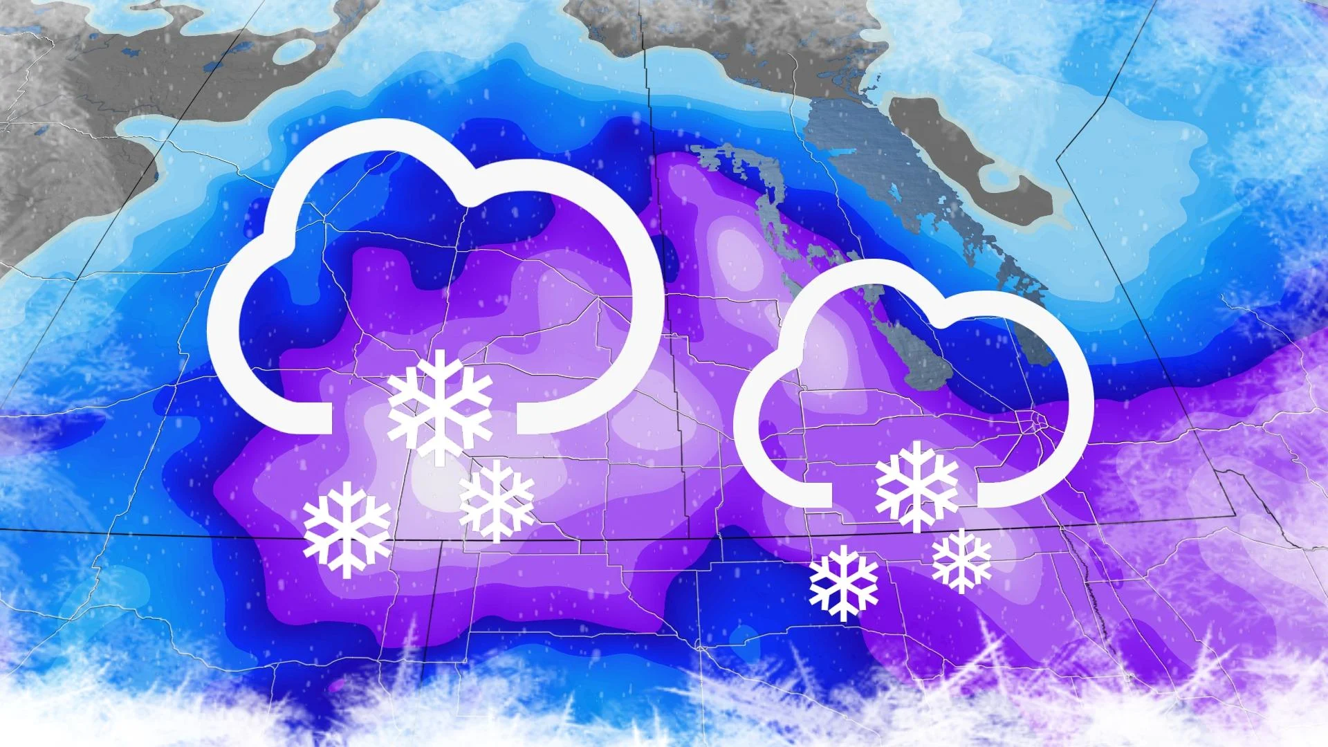
Wednesday will be a difficult day for travel across parts of southern Saskatchewan and Manitoba, with 20-40 cm of snow expected for some, along with high winds and blizzard-like conditions.
Drivers across parts of the Prairies are being urged to consider postponing non-essential travel Wednesday and Thursday, as a potent spring snowstorm with dangerous blizzard-like conditions takes aim.
Winter storm warnings line both southern areas of Saskatchewan and Manitoba, with snowfall totals climbing towards 40 cm not out of the question for some communities. For the city of Brandon, Man., this could be the biggest snowfall event this season if the region receives 24 cm of snow.
MUST SEE: Uncertainty swirls around 2023 hurricane season as El Niño looms
A low-pressure complex developing near the Canada-U.S. border will spread heavy snowfall into southeastern Saskatchewan and southwestern Manitoba as it travels eastwards. The snow will be heaviest on Wednesday, with howling wind gusts strengthening through the day as well, and accumulating snowfall continuing into Thursday.

Rapidly accumulating snow could make travel difficult over some locations, with blizzard-like conditions and reduced visibility expected.
"Consider postponing non-essential travel until conditions improve," says Environment and Climate Change Canada (ECCC) in the winter storm warning. "Public Safety Canada encourages everyone to make an emergency plan and get an emergency kit with drinking water, food, medicine, a first-aid kit and a flashlight."
WATCH: Road closures blanket southern Saskatchewan as snow piles up
Snowfall rates of 1-3 cm an hour will be possible, and locally even higher in convective bursts of snow. As a result, residents are being urged to prepare for road closures and possible power outages through the duration of the storm.
Between 20-40 cm of snow is expected in the hardest-hit areas, along with wind gusts of 60-80 km/h.

The strongest winds are expected to occur over the Manitoba parklands and extreme southeast Saskatchewan beginning Wednesday morning before gradually diminishing overnight.
The snow will continue into Friday morning, as well, with snowfall tapering off to flurries as the system finally pulls off towards the east.
RELATED: Get ahead of disaster: Six tips to manage flooding

Additional precipitation totals from this storm will continue to heighten flooding concerns across the south, with water levels expected to peak next week across parts of southern Manitoba where several flood warnings are in effect.
Despite the looming threat of a wintry system this week, it doesn’t look like we'll see persistent extreme temperatures in either direction through the rest of April into early May. However, the western half of the country will likely tip toward the colder side of seasonal for the second half of April.
WATCH: 4 provinces on alert as flooding targets millions of Canadians
Stay tuned to The Weather Network for the latest forecast updates on the Prairies.