PHOTOS: Tornado-warned storms pummel Alberta with heavy hail

It wouldn’t be summer without storms on the Prairies, and folks across Alberta saw some beefy storms on Tuesday evening as an active system rolled through the region.
DON’T MISS: How to stock your summer vehicle emergency kit before you hit the road
Several severe thunderstorms popped up across southern and central Alberta on Tuesday evening, the result of instability and favourable dynamics as a low-pressure system moved east across the Prairies.
One particularly intense storm prompted tornado warnings east of Calgary. Folks in Strathmore, Lyalta, and Carseland had to take shelter on Tuesday evening as a severe thunderstorm in the area developed strong rotation.
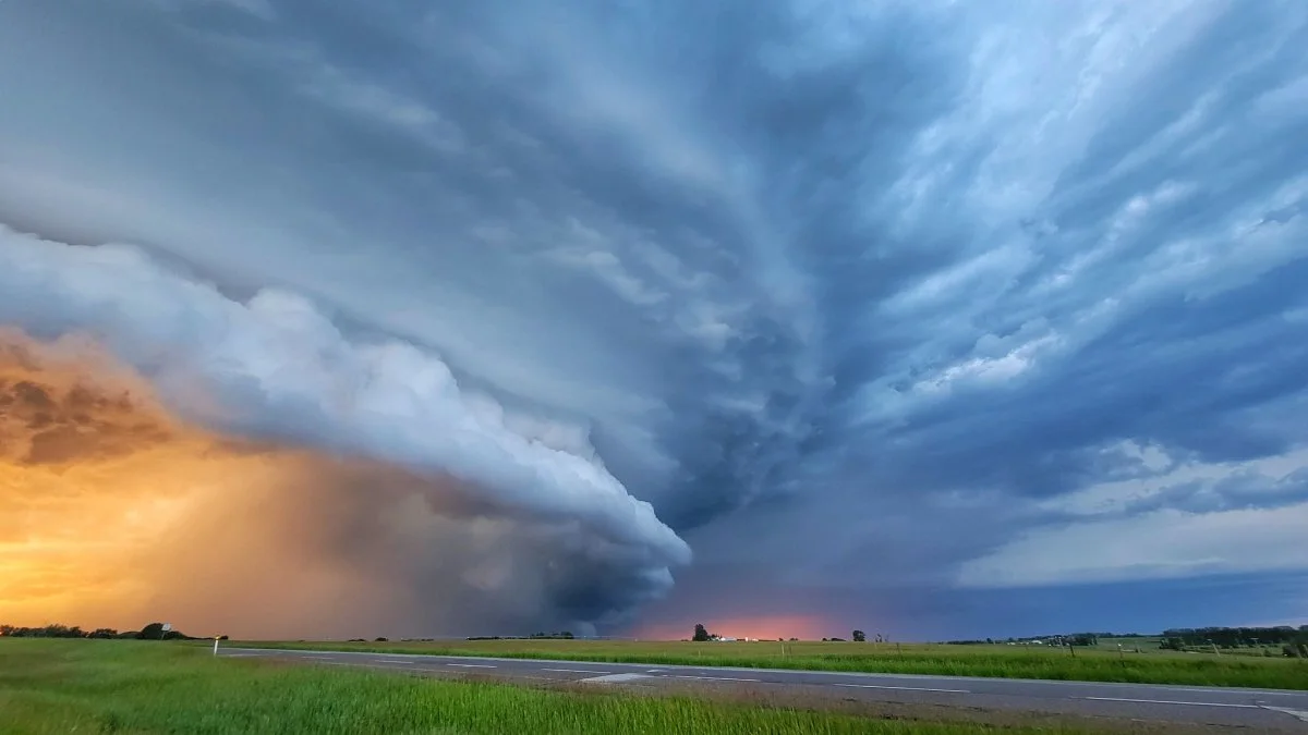
While there haven’t been any reports of tornadoes or tornado damage from the region, the storm was certainly impressive. The Weather Network’s Kyle Brittain followed the storm as it reached its peak. Brittain documented the storm’s photogenic structure and resulting hail that covered a section of the Trans-Canada Highway.
Wednesday’s severe weather threat will move east, threatening very large hail, strong winds, and possibly even a few tornadoes on the southern Prairies during the afternoon and evening hours. Follow the latest forecast for more information on what to expect Wednesday.
DON'T MISS: Get your allergies under control with these 7 products
Check out some of the impressive visuals that came out of Tuesday’s storms in Alberta, below.
Thumbnail courtesy of Kyle Brittain


