Nearly HALF the population of Canada is riding out this big storm

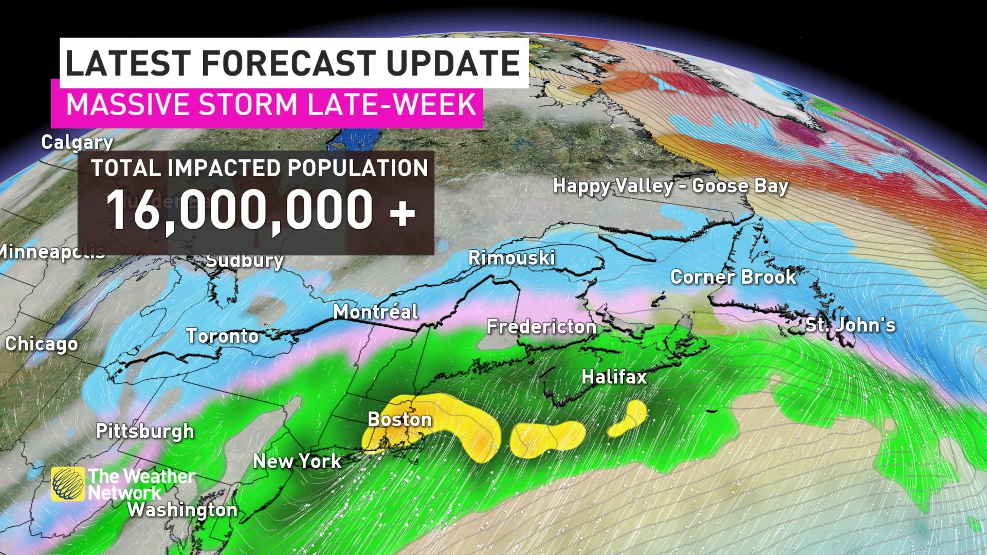
Three days, six provinces and 16,000,000 impacted Canadians. You won't be questioning the wrath of winter with this next powerful set-up across eastern Canada.
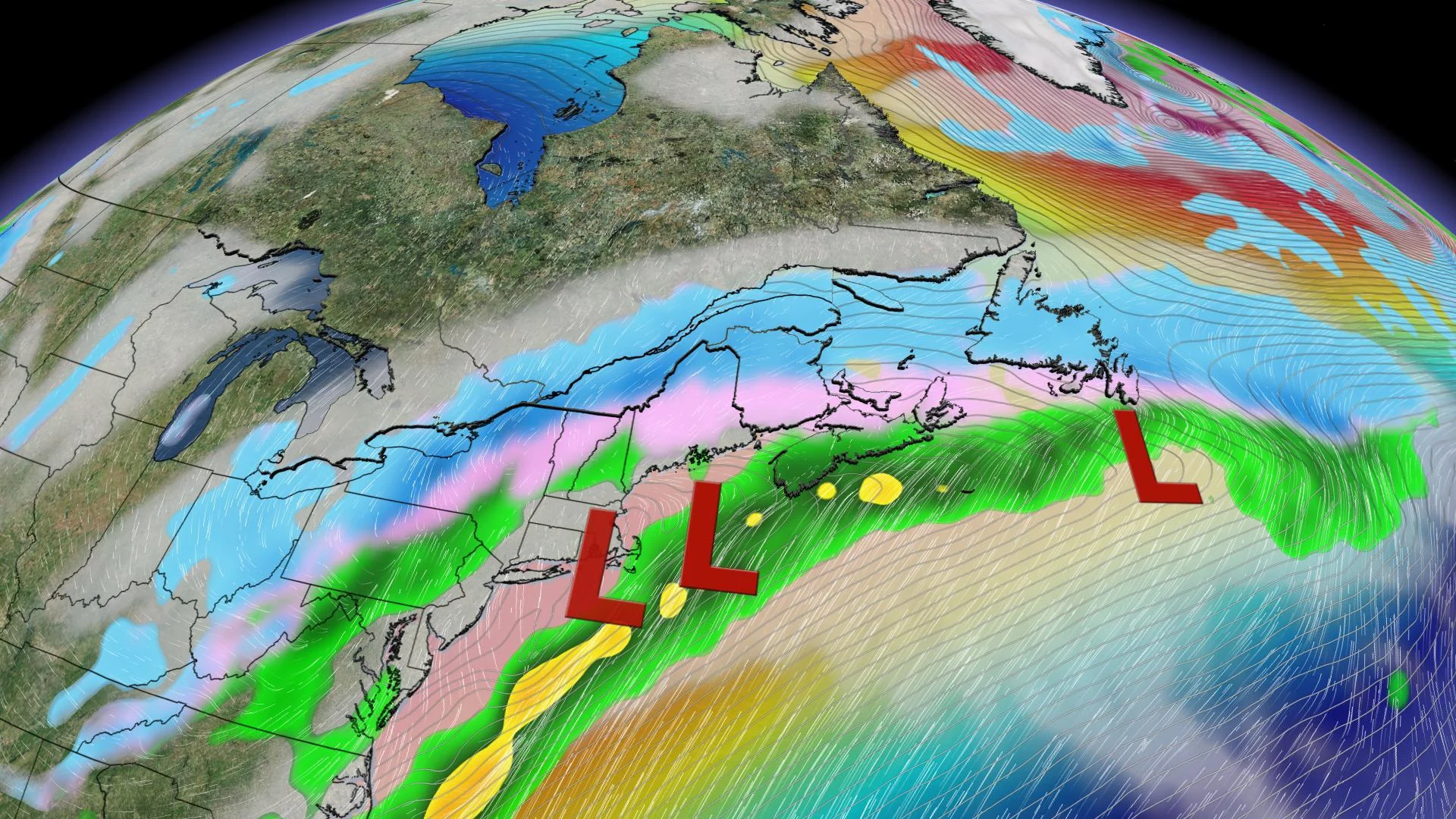
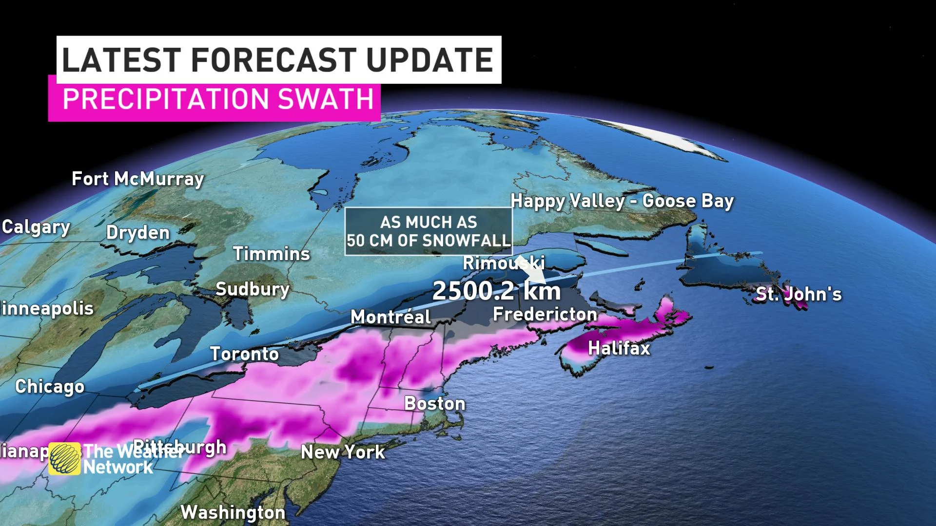
A massive and unique storm will put millions of Canadians right into the heart of winter this week as it stretches all the way from Windsor, Ontario right into Newfoundland and Labrador -- a span of about 2500 km.
BY THE NUMBERS:
3 days
3 different lows
6 different provinces
Highest snowfall amounts range between 30-40 cm, with the threat for up to 50 cm in New Brunswick
Storm track stretches 2500 km long
16,000,000 Canadians impacted
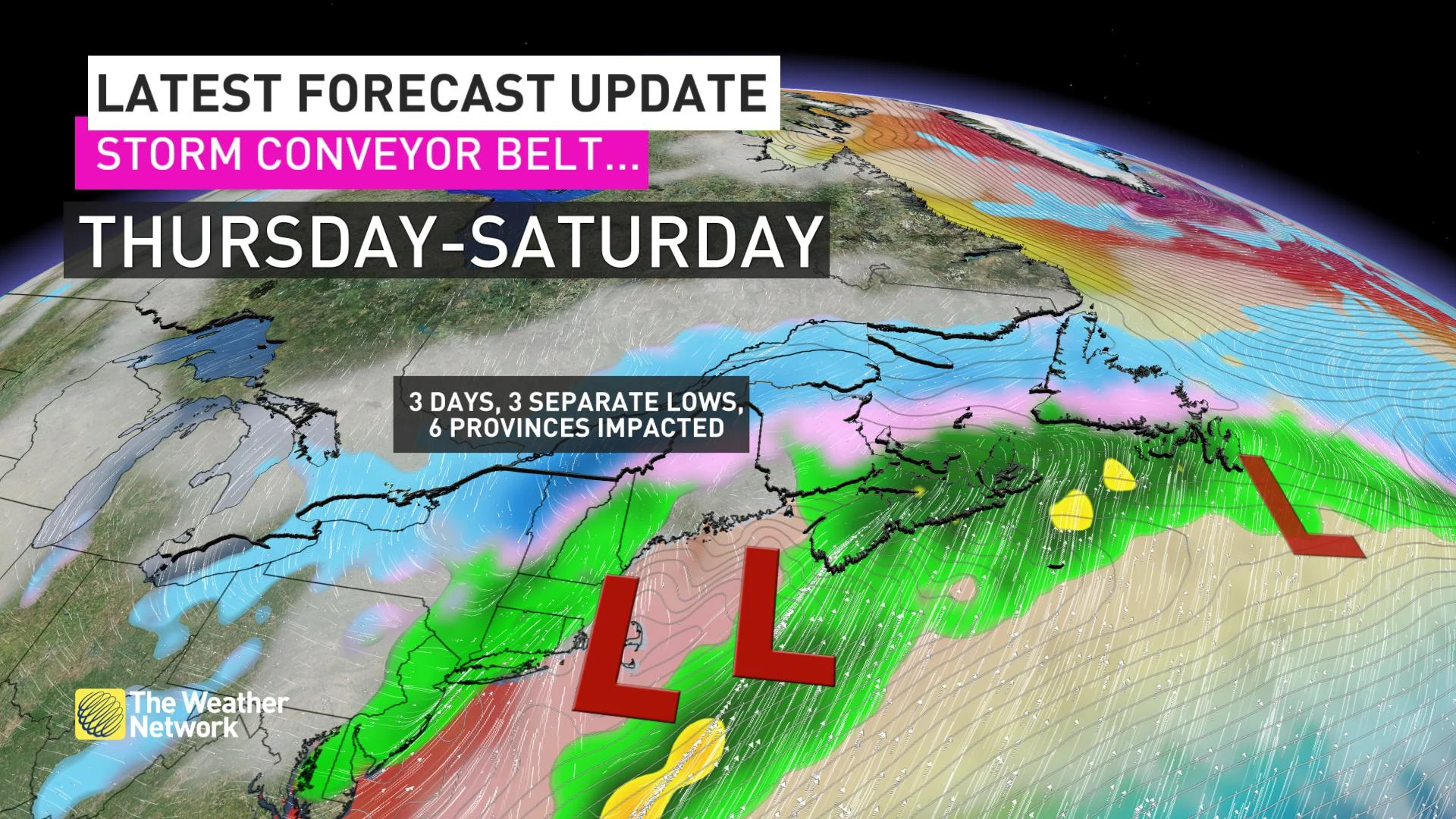
This is a widespread multi-day messy, sloppy, impactful weather event that will slow travel across most of eastern Canada right into Saturday.
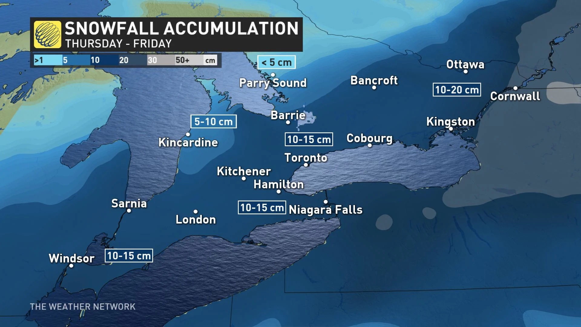
SOUTHERN ONTARIO: STEADY SNOW THROUGH EARLY THURSDAY
Much of southern Ontario will begin to feel the impacts from this storm late Wednesday night and into Thursday morning, with a widespread snow continuing through the early morning commute. Across the Niagara region, the snow is expected to change to ice pellets or freezing drizzle on Thursday, though with not enough ice accretion to cause major issues for trees and powerlines. Periods of light additional snow aren't out of the question on Friday as the next system tracks south and east of the region.
IN TOTAL: A widespread 10-15 cm of snow is expected through Friday with heavier amounts forecast across eastern sections of the province.
QUEBEC: DIFFICULT TRAVEL PERSISTS INTO SATURDAY MORNING
The system arrives in southern Quebec early Thursday morning, threatening to complicate travel with heavy snow and periods of freezing rain right into the early parts of the weekend. The heavier snowfall rate picks up in intensity Thursday night, remaining persistent through the overnight and for Friday as well.
IN TOTAL: Between 15-25+ cm is expected over southern Quebec, including Metro Montreal, through Saturday morning, with some parts of the Eastern Townships in line to pick up more than 30 cm.
ATLANTIC CANADA: EXTENDED PERIOD OF MESSY WEATHER, HEAVIEST SNOW ACCUMULATIONS
The multi-day impact begins across Atlantic Canada on Thursday as a couple of systems track along the boundary with mild air to the south and colder air to the north. This battleground of air masses sets the scene for prolonged periods of significant snow, rain and ice. Forecast confidence is high for an impactful snow storm for the region.
IN TOTAL: As much as 50 cm of snow is possible for parts of New Brunswick, P.E.I, and Newfoundland. There's also a risk for substantial amounts of freezing rain from near the Bay of Fundy across southern New Brunswick, most of Nova Scotia and PEI to southern Newfoundland, including the Avalon. Ice accretion of 10-20+ mm is expected.
With files from Weather Network meteorologist Tyler Hamilton