Quebec: 700+ incidents reported across province, up to 40 cm of snow possible

Friday will be an all-day snow event for most of the province, with 30+ cm on tap for Montreal, while some other areas could get up to 40 cm, through Saturday morning
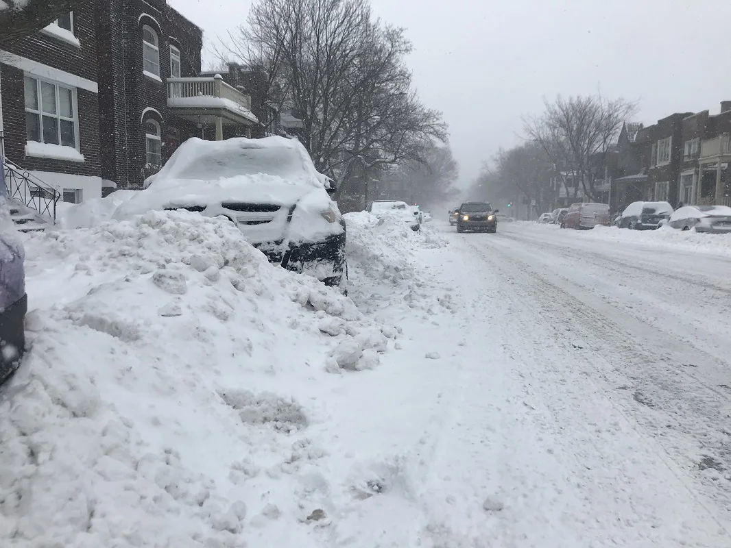
The heavy snow is well underway in Quebec, which is expected to continue all day in the province before tapering off overnight into pre-dawn hours Saturday. Montreal has already received more than 30 cm as of Friday afternoon, with still more to come, while upwards of 40 cm could fall in areas south of the city and extreme southern part of province. More details on timing, impacts, below.
WEATHER HIGHLIGHTS
Snowfall totals could hit 30-40 cm for areas south of the St. Lawrence River through Saturday morning; 20-30 cm along the river
Expect difficult travel, reduced visibility at times in heavy snow
System exits the province overnight, clear Saturday ahead
Stay up-to-date on the ALERTS in your area
FRIDAY: SNOW CONTINUES, INTENSIFIES, WILL IMPACT TRAVEL
Those in southern Quebec are advised to consider postponing non-essential travel Friday, as heavy snow will continue to impact the region through the day before easing off in the overnight hours and into early Saturday morning.
Some highways were either closed or down to one lane due to multiple collisions amid the heavy snow and strong winds. Dozens of flights have also been delayed or cancelled.
The Montreal Police and Sûreté du Québec warned people to avoid non-essential travel and on Twitter, Quebec's transportation minister said in the early afternoon that some 700 incidents had been reported on the roads so far.
“The situation will worsen over the next few hours. Precipitation and winds will intensify in many regions. I repeat — AVOID any non-essential travel," François Bonnardel said.
As of the Friday afternoon, Montreal has already received more than 30 cm of snow and more is forecasted for the city through the overnight hours. Even heavier amounts are expected communities south of the city and towards the U.S border, where upwards of 40 cm could drop in the same time period.

Snowfall and winter warnings remain in effect. Quickly accumulating snow, combined with reduced visibility at times due to northeasterly winds of up to 60 km/h could make for some treacherous conditions.
"Consider postponing non-essential travel until conditions improve. Rapidly accumulating snow will make travel difficult. Prepare for quickly changing and deteriorating travel conditions. Visibility may be suddenly reduced at times in heavy snow," Environment Canada says.
'VERY DIFFICULT TO STAND UP': QUEBEC REPORTER GETS KNOCKED AROUND BY PUNISHING WINDS
The snow will taper off by early Saturday morning for the province, with calmer winds and cold temperatures.
Thumbnail courtesy of Véronique Saumure.
Check back frequently as we closely monitor this system.