Hurricane Ian’s remnants could revive as a workweek nor’easter

Hurricane Ian smacked the Carolinas on Friday with strong winds, heavy rain, and a destructive storm surge along the coast. While the storm is winding down, it’s not done just yet.
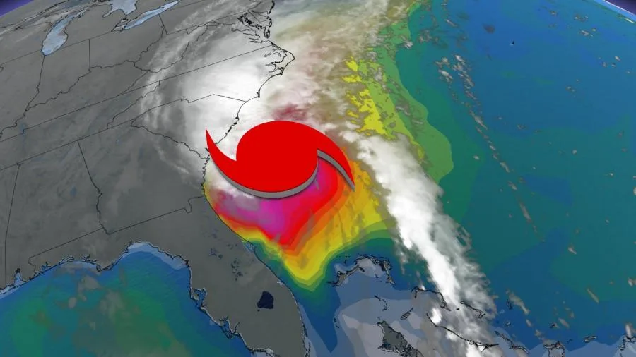
Hurricane Ian made its third and final landfall in South Carolina on Saturday afternoon, hitting between Charleston and Myrtle Beach as a Category 1 storm with 140 km/h winds.
PHOTOS: Towns devastated as destructive Hurricane Ian hits Florida
While it bore little resemblance to the monstrous hurricane that left a path of devastation in southwestern Florida earlier this week, Hurricane Ian caused quite a bit of damage in South Carolina as it pushed inland.
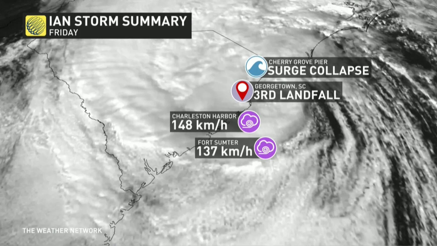
Myrtle Beach, a popular tourist destination, recorded its third-highest storm surge on record as the hurricane made landfall. A weather station in Charleston Harbor measured a wind gust of nearly 150 km/h at the height of the storm.
Pawleys Island, a barrier island near the point of landfall, found itself completely inundated with storm surge during the worst of Hurricane Ian. The community’s police department tweeted harrowing videos of the flooding on the island, calling it “catastrophic.”
Starved of the Atlantic Ocean’s plentiful warmth, the storm’s long track will end over the Appalachian Mountains this weekend as Ian finally pushes inland and eventually dissipates.
The U.S. National Hurricane Center (NHC) found that Hurricane Ian had transitioned into a post-tropical cyclone not long after landfall in South Carolina on Saturday.
WATCH: People describe riding out ferocious Hurricane Ian
This transition makes the system more like a nor’easter than a true hurricane—in fact, much like we saw with Fiona a week earlier, the transition allowed the storm to grow a larger footprint, bringing wind damage and flooding rains to a much wider swath of the southeast.
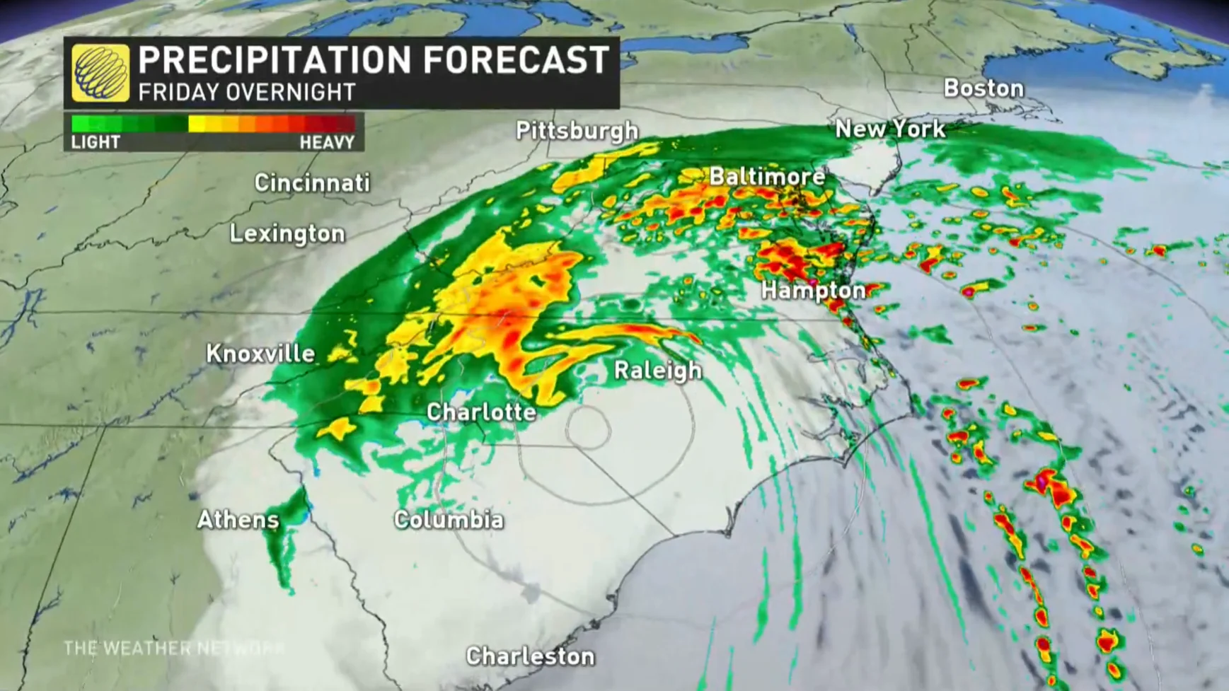
Damaging winds will continue to push through the Carolinas and into Virginia through Friday night and into Saturday morning. Winds had already caused nearly half a million power outages between the two Carolinas on Saturday evening, and the number will likely tick up through the night.
Where will Ian head next? Canada looks to be spared
Beyond the southeast U.S., where will Ian head next?
Emotions are certainly high across Canada's East Coast, just five days after Hurricane Fiona left a devastating mark across the region.
"Fortunately, Canada can thank sprawling high pressure across the country for shielding much of eastern Canada from any lingering precipitation from Ian's remnant energy this weekend," says Kelly Sonnenburg, a meteorologist at The Weather Network. "The high pressure will force moisture off towards the Mid-Atlantic of the U.S. and east into the Atlantic Ocean."
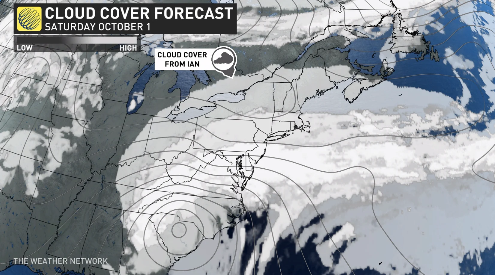
The only minor impacts from Ian's energy will possibly be some high clouds across southern Ontario, Quebec and into Atlantic Canada this weekend. Much welcomed news for a region that remains in full clean-up and recovery mode.
There are hints in the weather models that Ian’s remnant energy could fuel the development of a nor’easter off the U.S. East Coast by early next week. It’s too soon for specifics on where that potential system could track or what impacts it would have on land.
SEE: Satellite images show how Fiona's surge sucked sand off P.E.I.'s shores
WATCH: Terrible storm surge in Florida led to rescues across the state
Stay tuned to The Weather Network for the latest updates throughout hurricane season.