
Morning rain spreads across southern Ontario as humidity rises Tuesday

After a round of morning rain, Tuesday will be mostly cloudy and humid with a slight thunderstorm threat.
--
Periods of heavy rain and rumbles of thunder are moving across the Great Lakes region Tuesday morning, as a summertime low pressure system tracks through. The stronger storms are possible for areas across the southwest, including Windsor, though the severe weather threat remains mostly south of the border. Beyond Tuesday's rain however, an extended stretch of drier weather returns, with rainfall deficits in many areas likely continuing to grow. More on Tuesday's rain chances and what lies ahead, below.
MUST SEE: Arctic Circle snags some of Canada’s hottest weather to start July
TUESDAY: MORNING RAIN AND THUNDERSTORM CHANCES AS HUMIDITY RISES
A large ridge of high pressure associated with the latest heat wave roasting the central United States will influence our weather across Ontario this week.
Complexes of thunderstorms tend to ride along the northern edge of these ridges, with stronger storms possible for parts of southwestern Ontario through Tuesday morning. The greatest threat for severe weather however, will remain south of the U.S. border.
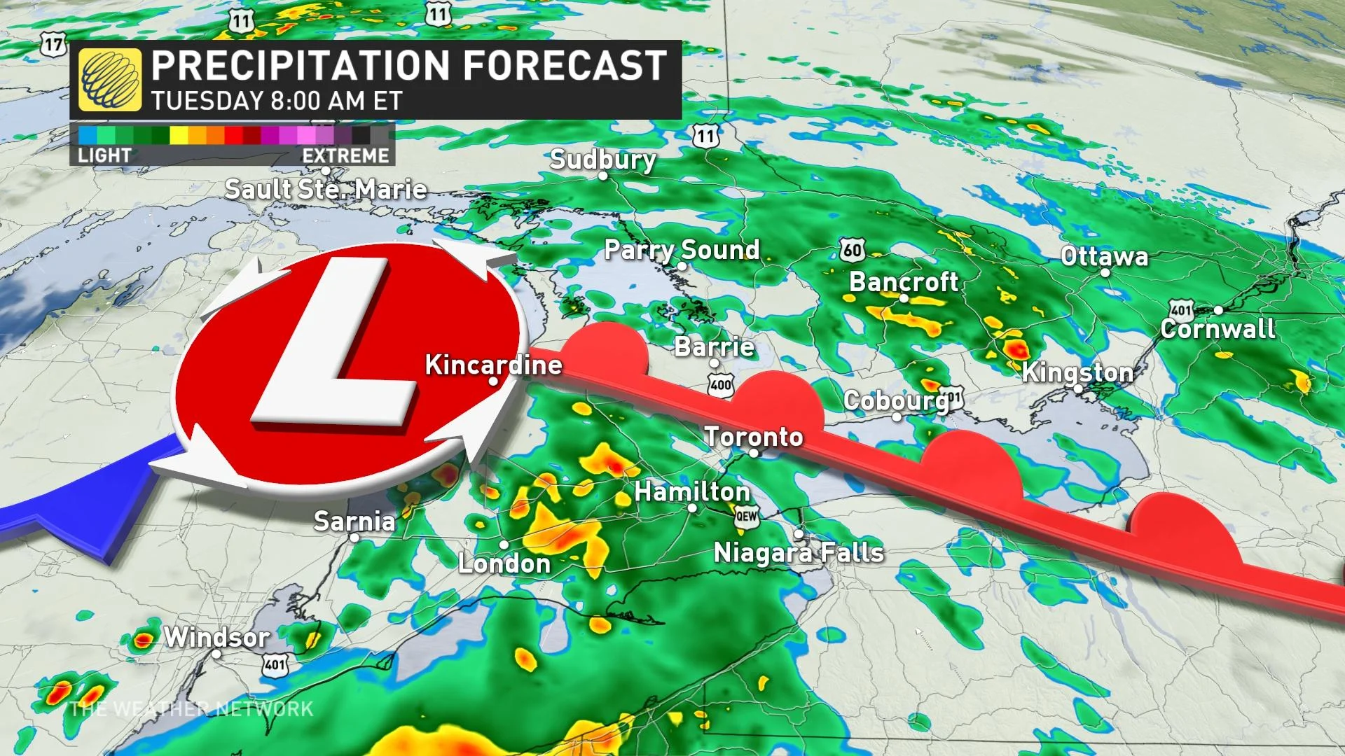
Rain will spread across the Greater Toronto Area (GTA) throughout the morning commute, with a swath of more persistent rain with occasional embedded rumbles of thunder tracking through eastern Ontario and the Ottawa Valley.
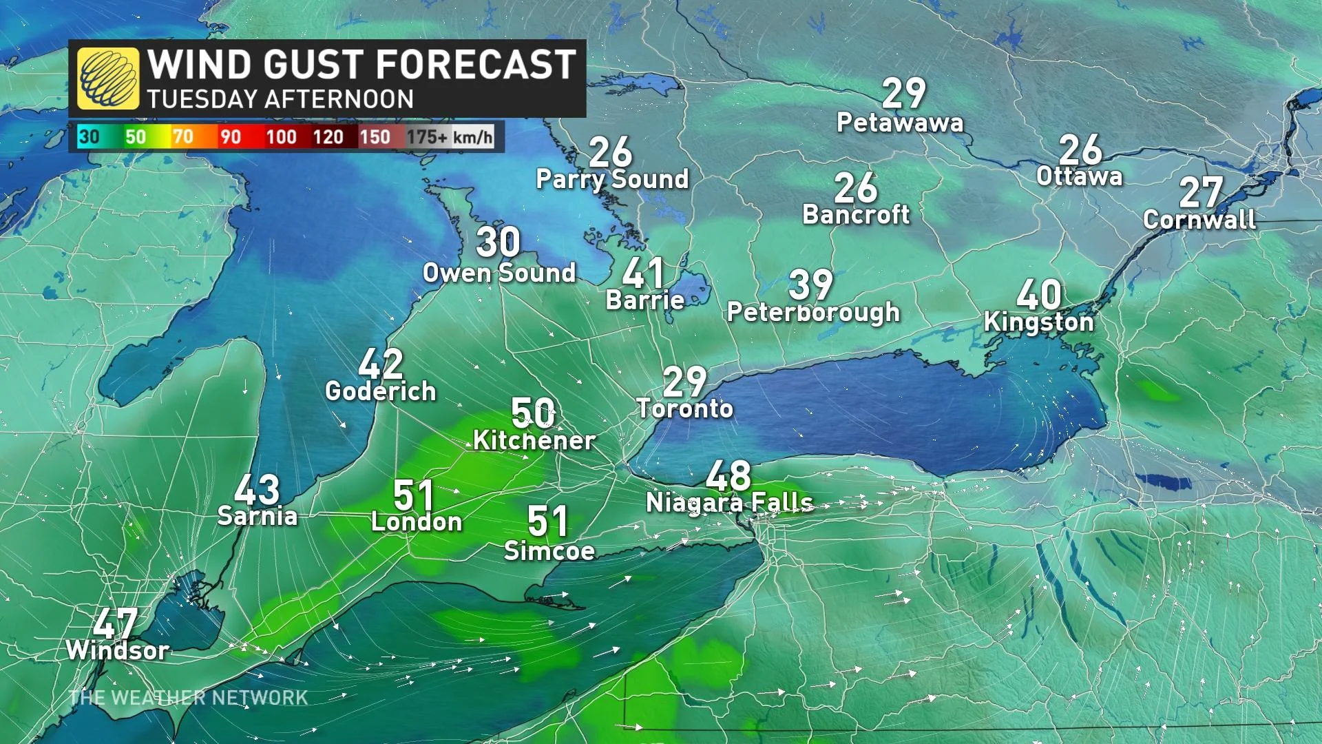
The system's rain and thunderstorms will be pushing out through the mid-day mark, though some gusty winds and chance for a light shower may linger into the afternoon hours as well.
READ MORE: Get your allergies under control with these 7 products
Tuesday will be humid across the region, with feels-like values in the low 40s in the Windsor areas and in the low and mid-30s through the GTA and points north. Eastern Ontario will be noticeably cooler, with daytime highs barely passed the 20-degree mark.
LOOK AHEAD: DRY STREAK RETURNS, RAINFALL DEFICITS CONTINUE TO GROW
It’s been quite the dry couple of weeks for the GTA as storms broke north and south, and it’s a pattern we could see repeat this week. Before Tuesday, Toronto had only recorded 7 mm of rain since June 12th, which is quite a bit below what we’d normally expect.
As we so often see during the summer months, rainfall totals will depend on where those thunderstorms track. One community could see more rain than its neighbours with this kind of setup.
The additional rainfall will be welcome in parts of southwestern Ontario as well, where dry conditions have become widespread throughout the early summer. An upcoming extended streak of drier weather however, means that deficits will likely continue to grow.
READ MORE: The best coolers for you and your drink this summer
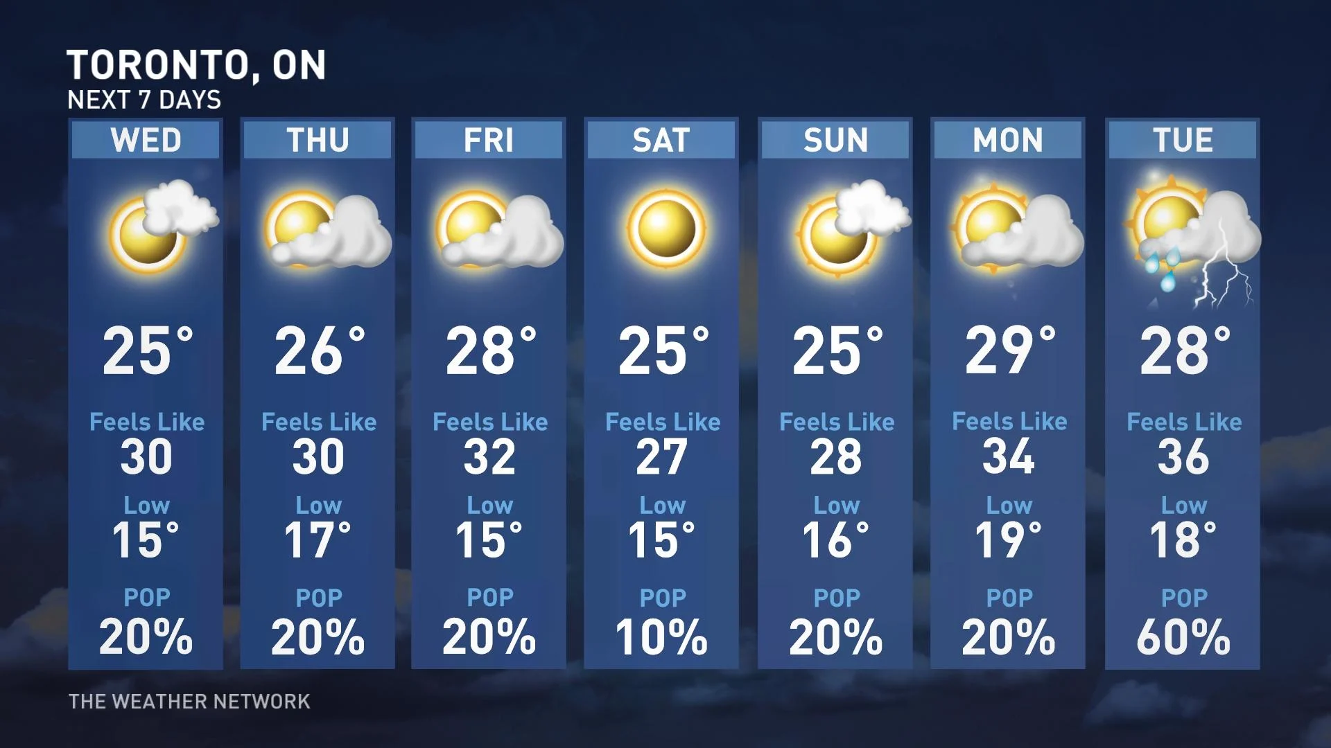
Temperatures this week will remain relatively consistent across southern Ontario, with daytime highs hovering within a few degrees of seasonal. No major temperature swings—nor any sustained heat—appears in the picture through the first half of July.
Stay tuned to The Weather Network for the latest forecast across Ontario.